
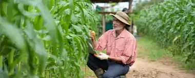
What is farm management? The definition may vary for a tiny camp farm living off a single field, and large agricultural companies that develop a system to add accuracy and precision into farming practices.
How can satellite imagery and EOSDA LandViewer tool help farmers on their way to more cost-effective, sustainable farm management? Let’s take a look at its most useful made-for-farmers solutions that can bring success to any farm, including yours.
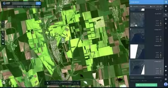
1. Keep An Eye On All Your Farms No Matter The Size Or Distance
Managing multiple fields within a region or even several countries isn’t that difficult with high-quality satellite imagery. A resolution of 10 meters per pixel allows to recognize even a small farm and check it at least every 5 days when Sentinel-2 satellite captures new scenes. It’ll be handy to mark your cropland plots on a map, and subscribe to receive alerts from EOSDA LandViewer when it’s time to view fresh images.
A resolution of 10 meters per pixel allows to recognize even a small farm and check it at least every 5 days when Sentinel-2 satellite captures new scenes.
Along with crop tracking, satellite data has proved its value in ranch management of all kinds: from monitoring of remote pastures around a dairy farm, poultry farm, or horse farm, to tracking harmful red tides for fish farm protection.
2. Track The Crop Growth Stage Throughout The Season
Timing is critical for farmers, who should stay in the know of whether crops are at an early growth stage or approaching maturity. With 24/7 access to regularly updated satellite imagery, you can observe the state of crops during all major menophases (sowing, germination, flowering, ripening, harvesting) in order to make timely decisions and take actions when it comes to fertilizer applications, harvesting, any field operations that are essential for the yield.
3. Find Stressed Crops Before You Can See Them
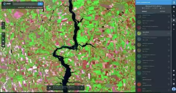
Did you know that a satellite image can be used to spot a dehydrated or stressed crop weeks before it can be seen? To check crop health for fungus, pests, waterlogging, saline or arid conditions, it’s suffice to create an NDVI map of a field in EOSDA LandViewer and interpret the colors you see. A healthy plant will appear green to dark green (depending on the crop type and its growth stage), while a range of colors from white to shades of brown will mean a stressed crop (or bare land).
4. Spend Less On ground-Truthing
Satellite image-based NDVI maps highlight the areas to be checked and acted upon; this makes scouting informed and efficient. Ground-truthing with such map at hand or on a tablet screen will take less time from small-scale farmers and cost less money to a large crop growing company, which outsources these services. All you need to do is go straight to the troubled area and fix the problem without causing much damage to crops with a “blind” search.
EOSDA LandViewer
Access historical satellite imagery with global coverage for free, analyze them on-the-fly and download.
5. Get To Know The Land Productivity Without Yield Maps
Whenever you need to assess a new plot for productivity, or compare different growing seasons to plan the next one — there’s an invaluable Time Series analysis feature in EOSDA LandViewer that will provide you with all necessary information.
Archives of historical satellite images allow to pull up yield data from the past seasons, up to 10 years back (thanks to Landsat satellites), and build an NDVI graph. All the events that ever happened to the field, whether a hailstorm or drought, early sowing or late harvesting, will be seen in spikes and drops of the curve. This gives powerful insights to farmers and agronomists, who can identify patterns of crop growth, track anomalies and farm their lands more efficiently.
Archives of historical satellite images allow to pull up yield data from the past seasons, up to 10 years back, and build an NDVI graph.
6. Manage Water Resources Sustainably
Maintaining the right amount of water is essential for best crop production and high yield. So is challenging. Floods, droughts, and ordinary equipment failures are additional stress factors in farm business management. To detect crop water stress (lack of water in plant) or excessive water, you can get a satellite image and calculate NDWI. An area with a broken sprinkler, insufficiently watered plants or waterlogged field plots — all these you can tell from an NDWI map of the field. Satellites will show you where to apply more and where less, so no water is wasted.
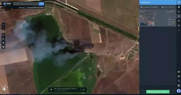
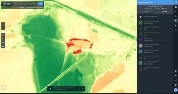
7. Estimate Crop Damages Remotely
All seasons are alike, but there’s hardly one without losses. Whether a small family farm or a huge field owned by a crop production company, all you need for precise crop damage assessment are “before”-“after” satellite images and EOSDA LandViewer.
Take a pair of Sentinel-1 scenes for a quick flood mapping and calculation of the damaged area in sq. kms or ha. For drought, it’s best to apply NDVI on a pair of Sentinel-2 or Landsat 8 scenes. And sometimes when stubble burning gets out of control, or heatwave sparks up a fire, the burned area can be assessed with NBR — a custom index that is not on the default list, but can be manually created and used in future.
Need a solution tailored to your business goals? Book a call with our team to see how we can help.
More news
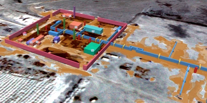
EOSDA tracks construction progress in the UAE PAD areas
Managing rapid industrial expansion in the UAE requires accurate data. See how our satellite-based solution helped a client verify construction milestones and reduce inspection costs.
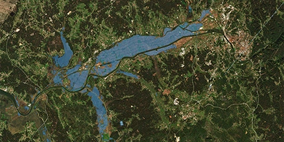
Validating satellite tech for flood analysis and damage mapping in Coimbra
Can satellites improve disaster response? We explored this in the Coimbra district, showing how integrated satellite intelligence can assess flood impacts and fill critical data gaps during a crisis.

EOSDA advances rice field mapping in Indonesia with SAR
EOSDA tested a radar-based approach to improve rice field detection in Indonesia. By integrating SAR and optical data, the team ensured stable monitoring even during peak monsoon months.