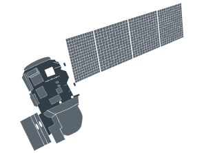
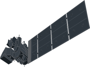
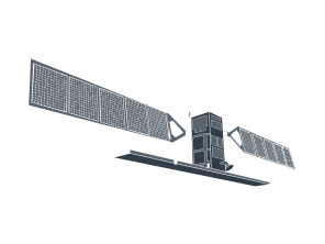
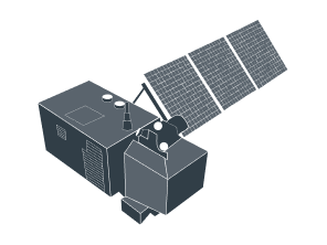
Landsat 7 images: Satellite data for historical analysis
Access medium-resolution, wide-swath, multispectral Landsat 7 satellite images on the EOSDA LandViewer platform:
-
Spatial resolution
15 m (panchromatic), 30 m (multispectral), 60 m (thermal, resampled to 30 m)
-
Scene size
~ 185 × 183 km
-
Revisit time
Every 16 days
-
Data archives
From 1999 to January 2024 (Scan Line Corrector failure since 2003)
-
Spectral bands
8 bands, including panchromatic, visible, NIR, SWIR, and thermal
-
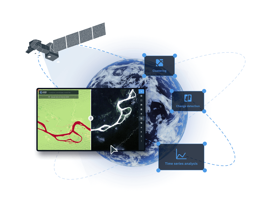
Analytical tools
Change detection, clusterization, time series analysis
How to access and download Landsat 7 data on EOSDA LandViewer
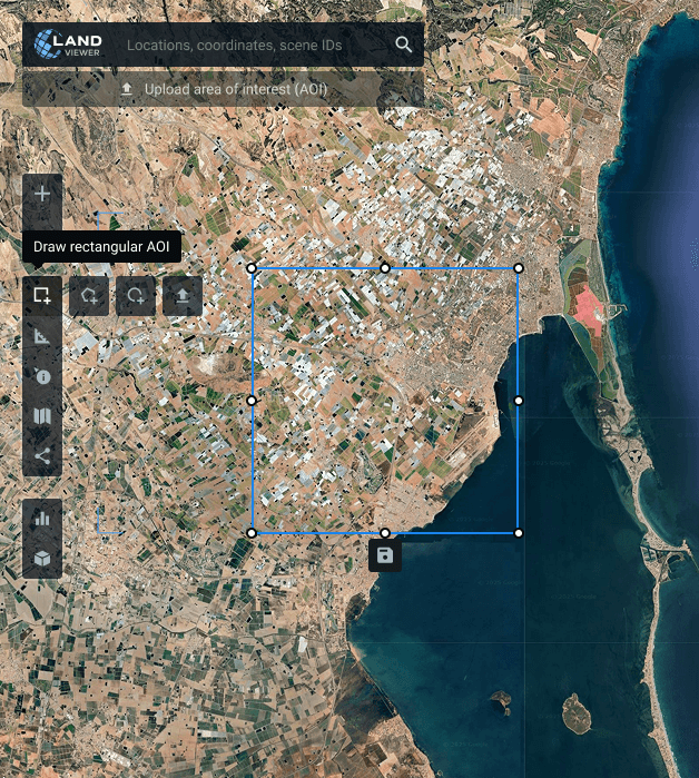
Define your AOI (area of interest)
Choose your area of interest (AOI) for monitoring by searching a location, sketching the region on the map, or uploading a boundary file from your device.
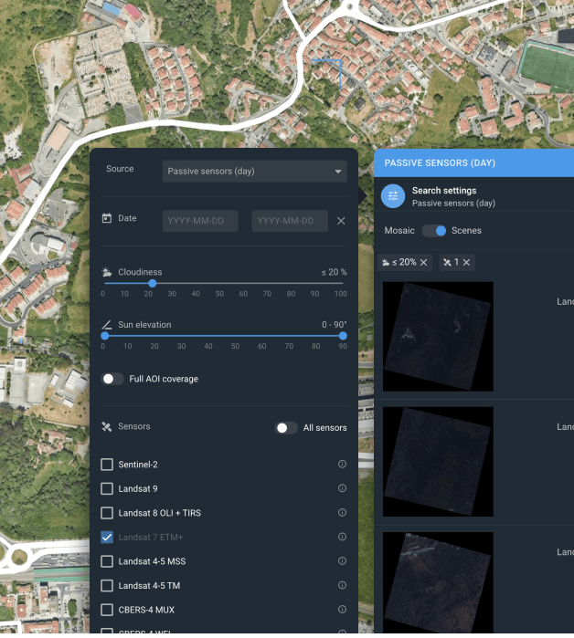
Filter your search
Apply filters like date, cloud coverage, sensor type, and AOI coverage to identify Landsat 7 images that best fit your needs.
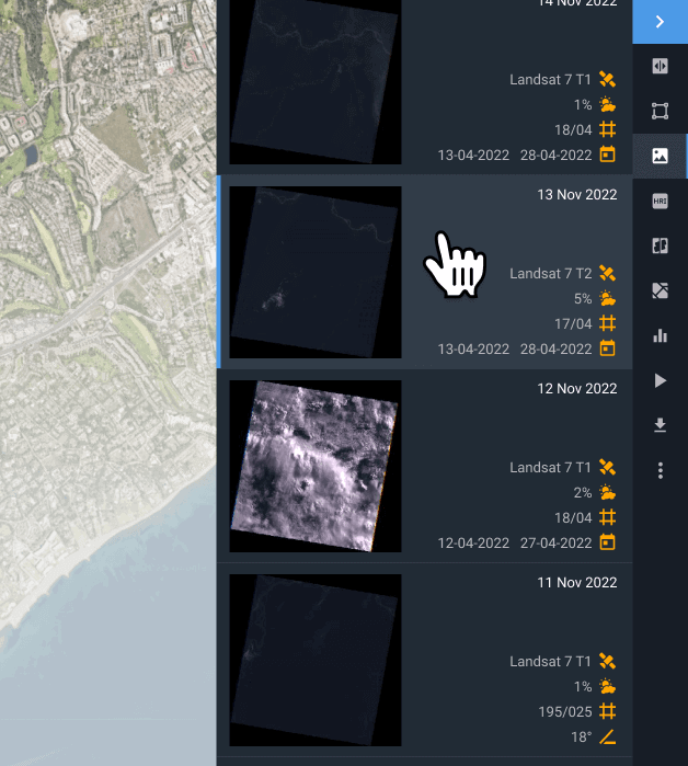
Select the scene that fits best
Review the filtered collection and choose the scene that most effectively supports your project's needs.
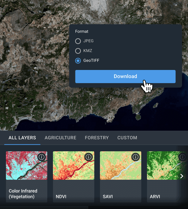
Analyze online or download for offline use
You can download the selected Landsat 7 image in GeoTIFF, KMZ, or JPEG formats for further processing in tools like QGIS or ArcGIS. If you prefer to work within the platform, EOSDA LandViewer offers powerful tools for analysis, including indices, band combinations, time series tracking, change detection, and clustering.
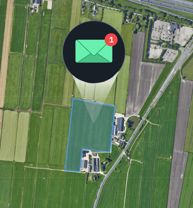
Stay updated with new image alerts
If the ideal Landsat 7 image isn’t available at the moment, activate notifications to get alerted as soon as fresh data is captured for your area of interest.
Analyze Landsat 7 satellite imagery on EOSDA LandViewer to extract meaningful data
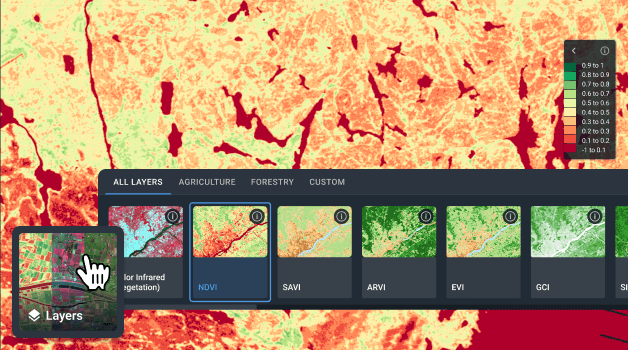
Indices and Band Combinations
EOSDA LandViewer makes analyzing Landsat 7 data faster and easier by offering over 20 ready-to-use indices and band combinations tailored for environmental monitoring. Whether you’re tracking vegetation dynamics, soil properties, or land changes, these presets provide clear and accurate insights. If the available options don’t fully match your project needs, you can easily create and apply custom indices for a more personalized analysis.
Change Detection
Track landscape changes over time by analyzing multiple Landsat 7 images taken on different dates. This supports continuous monitoring of urban growth, environmental variations, and disaster effects, empowering stakeholders with timely insights for risk assessment, strategic planning, and sustainable land management.
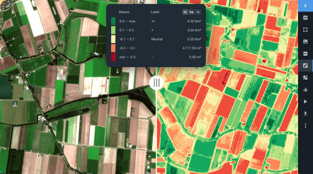
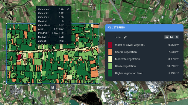
Clusterization
Get meaningful insights from Landsat 7 raster data by segmenting your AOI into zones with similar index values using clustering and vectorization. This automated process produces two new analytical layers that expose subtle variations in vegetation, land cover, and water quality, supporting informed decisions in agriculture, forestry, and environmental management.
Real-world applications of Landsat 7 imagery analytics
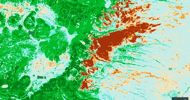
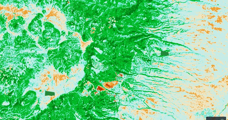
Wildfire impact
- Los Alamos, New Mexico, USA
- NBR index
- May 9, 2000 - Jun 17, 2000
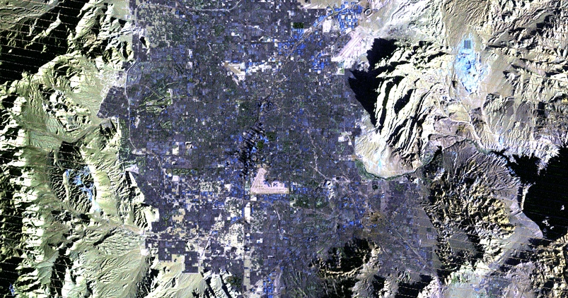
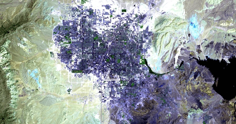
Urban expansion tracking
- Las Vegas, Nevada, USA
- False Color (Urban) band combination
- Jul 4, 1999 - Jan 18, 2024
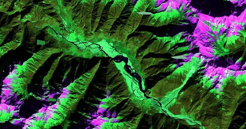
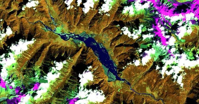
Water body monitoring
- Yigong Hu river, China
- Land/Water band comnibation
- Sep 23, 1999 - Dec 01, 2001

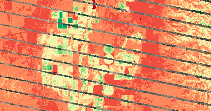
Crop health and irrigation efficiency monitoring
- Oneida County, New York State, USA
- NDVI index
- Jun 21, 2006 - Aug 24, 2006