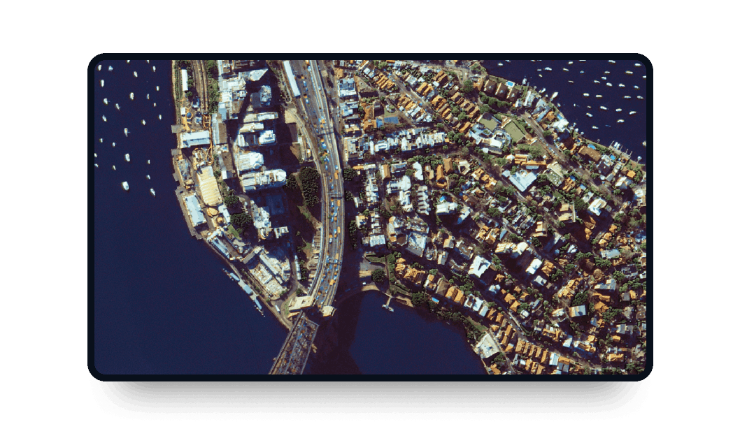
KOMPSAT-3A high-resolution images
Explore LandViewer and access KOMPSAT-3A satellite imagery with its high resolution and frequent updates.
-
Data type
Optical
-
Resolution
0.4 m
-
Revision
1.5 days
-
Spectral bands
Panchromatic, Red, Green, Blue, MWIR & NIR
-
Data archives
Archive since 2015
-
New Image Tasking
Available

How to access KOMPSAT-3A scenes on the LandViewer platform
Set your AOI (area of interest)
There are different ways to do it: searching for a location, drawing a polygon on the map, or uploading a file from your device containing the area's parameters.
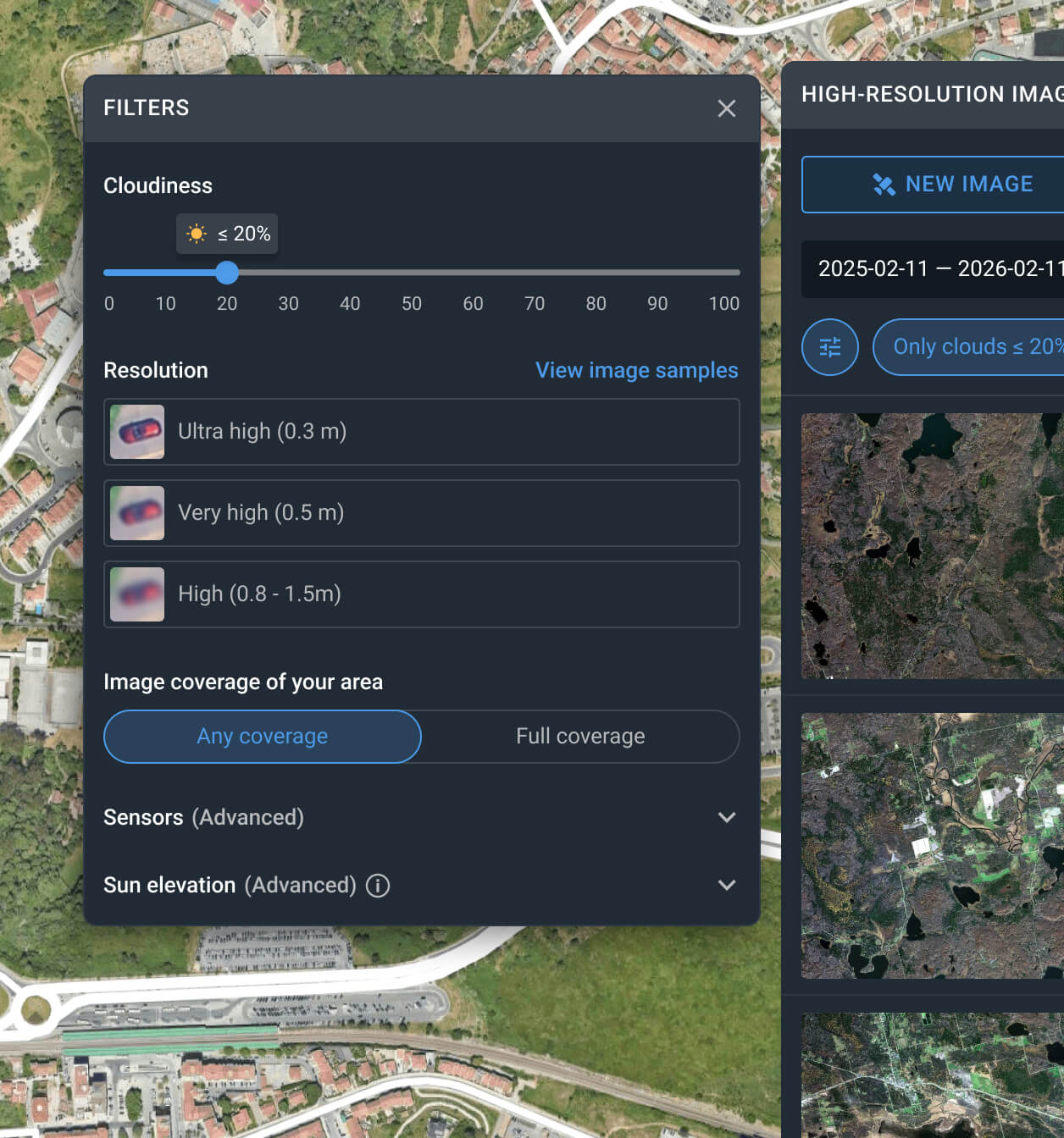
Use the filters to narrow down the search
Apply one or more filters, such as resolution, date, or cloud coverage, to find the KOMPSAT-3A satellite data that best matches your needs.
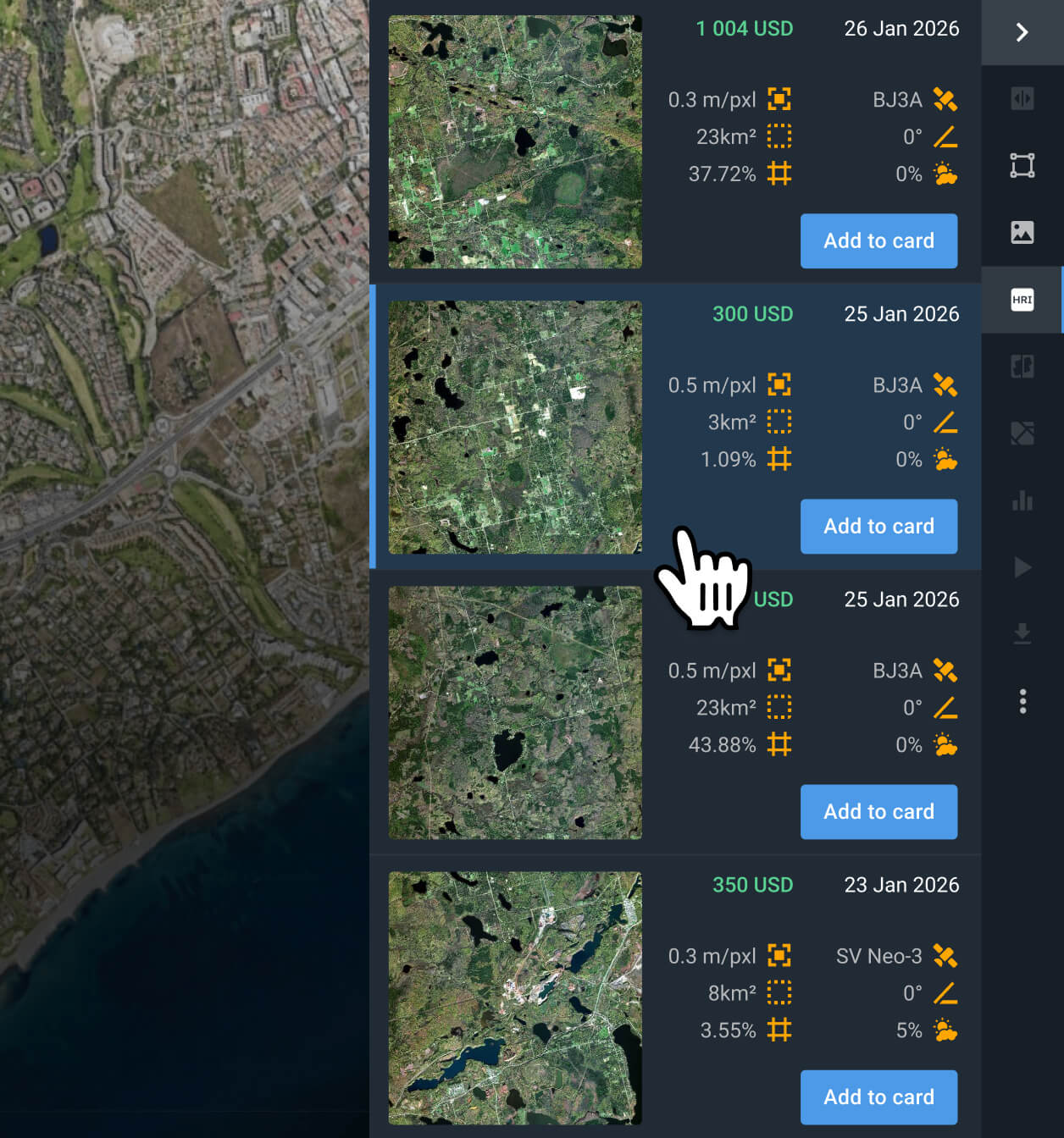
Choose the KOMPSAT-3A scenes that better fit your project
Examine the pricing details and other relevant information for the filtered results, and select the captures that work for your particular use case.
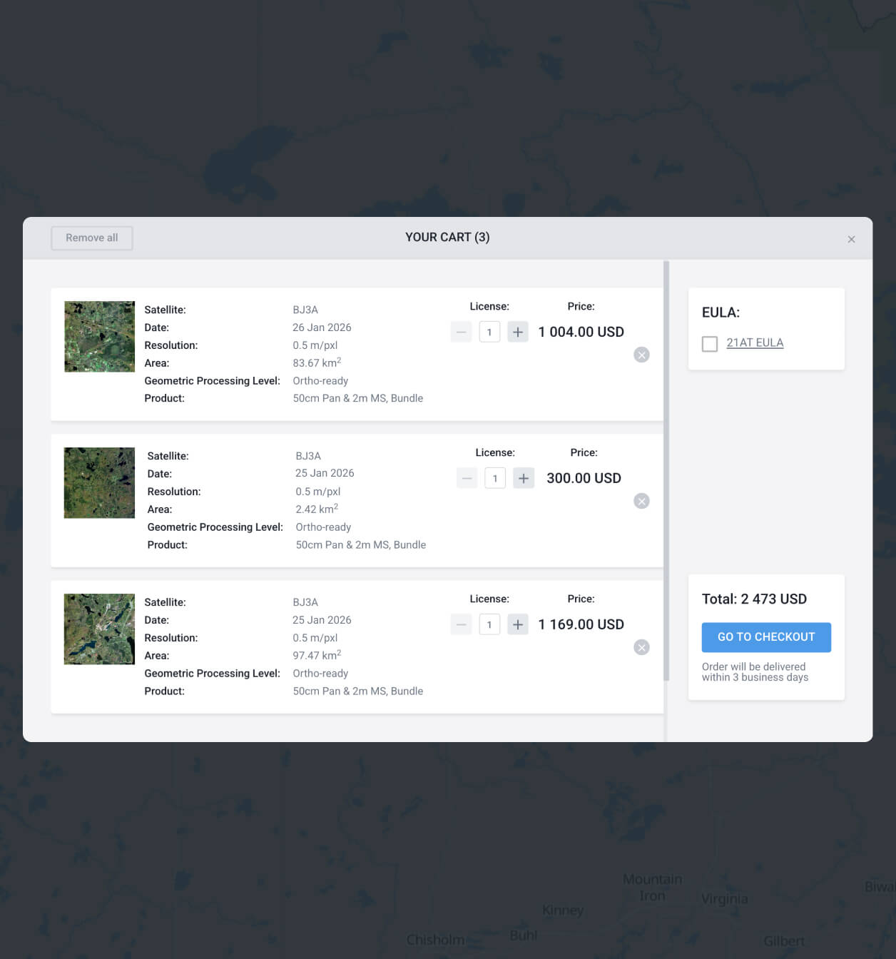
Add the KOMPSAT-3A satellite images you want to the cart and purchase
Once you find what you need, add it to the cart and submit your order. Purchase following the instructions, or contact our sales team to get your payment details.
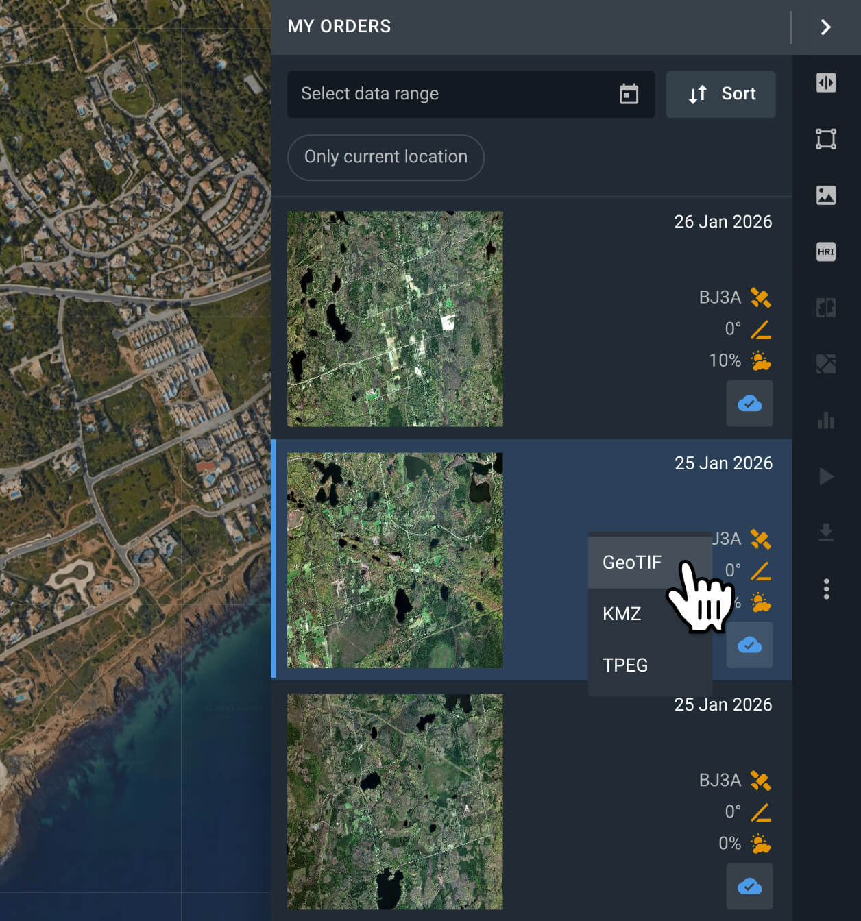
Conduct analysis on your recently purchased KOMPSAT-3A data or export it
Your scenes will be available on the LandViewer platform within 2 days. You can run analyses on the platform or export them in GeoTIFF, KMZ, or JPEG format.
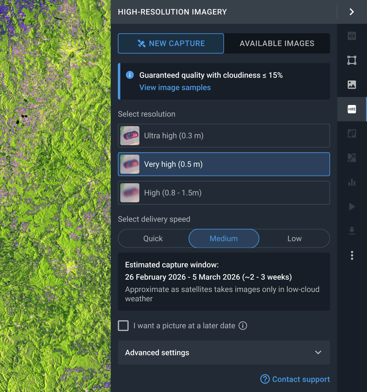
Task a satellite for new images
No archive match? Request a tasking service for the KOMPSAT-3A satellite to obtain a fresh scene that meets your needs.

FAQ
How much does a KOMPSAT-3A image cost?
Accessing archived KOMPSAT-3A data costs from $16.00 per square kilometer, with a minimum area of interest (AOI) of 25 sq km. If you need a new image (tasking), the price starts at $24.00 per square kilometer, with a minimum AOI of 100 sq km.
What are the most common use cases for KOMPSAT-3A images?
They are widely applied in environmental and agricultural monitoring, such as field boundary mapping, crop condition tracking, and land use change detection. Other uses include property condition assessment, urban development monitoring, and vehicle fleet visibility.
How does the KOMPSAT-3A tasking option work?
You have two options for requesting a fresh capture. One is to fill out the form on our website and wait for our sales team to reach out to you shortly after to assist you. The other one is logging in to the LandViewer platform, navigating to the High-resolution imagery section, and clicking the New Image option. There, you can select the resolution, delivery speed, and AOI for your tasking order.
What processing levels are available for KOMPSAT-3A data?
Every picture comes with georeferenced data, helping its export to third-party software. In most cases, we can provide advanced processing (i.e., orthorectification); please contact our support team if you need it.
Can I establish a long-term monitoring program for my AOI using KOMPSAT-3A?
Certainly. Please contact our sales team or complete the inquiry form on our website. Our specialists will reach out to you shortly to discuss your specific monitoring needs.
Is it possible to get a clear capture without clouds?
Yes. LandViewer has a cloud coverage filter that enables the user to set an acceptable threshold. Every KOMPSAT-3A image exceeding the threshold will be hidden, leaving only the results that match the user-selected criteria. Please note that the more restrictive the threshold, the fewer images will appear.
Which industries typically utilize KOMPSAT-3A data?
The ultra-high-resolution capabilities of KOMPSAT-3A make it indispensable for urban expansion tracking and infrastructure planning. It is widely adopted by the logistics sector for network and hub optimization, as well as by developers and government agencies for high-precision land suitability evaluations.
Is there a tasking service available when a new image is needed in very short advance?
Yes, there are 3 distinct tasking options (Standard, Priority, and Emergency), each tailored to different delivery timelines and budgets. You can select the plan that best fits your urgency through the LandViewer platform or contact our sales department for a detailed breakdown of each option.


