EOSDA Crop Monitoring solutions for developers
Years of experience and tons of technical expertise have made EOS Data Analytics one of the best providers of geospatial data and analytics out there. We specialize in creating products and custom solutions in Agriculture, Forestry, among other 20 industries.
For IT developers, we offer fast and easy API access to raw, processed, and analysis-ready satellite data from multiple sources, unparalleled White Label opportunities, and custom enterprise solutions tailored to specific real-world challenges in Agriculture. Our priority is to grow your business and ensure that you can meet fast-changing Agro market demands.
Satellite Monitoring Solutions for IT Market
Difficulty with processing and integrating large volumes of data
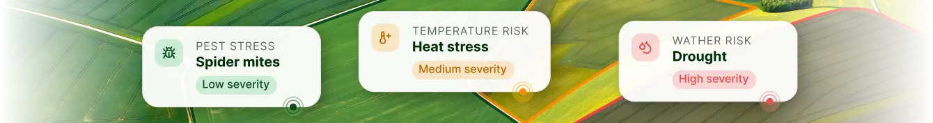
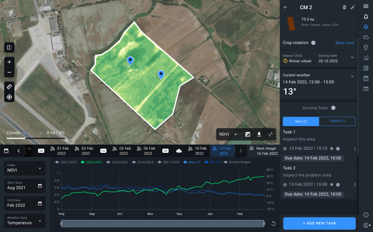
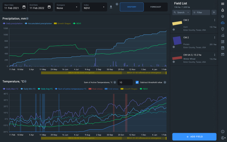
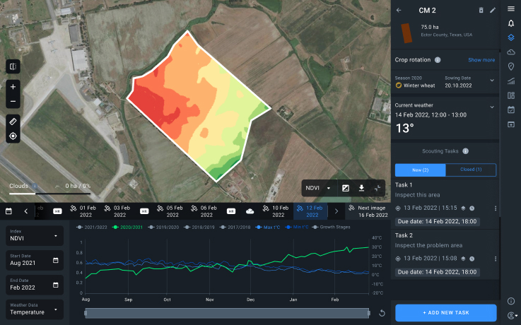
EOSDA Crop Monitoring platform provides fast and easy access to large volumes of data from multiple sources, including satellite imagery, weather stations, ground sensors, and more.
High cost of developing products and custom enterprise solutions from scratch
We have ready-made agro solutions that you can use either via API access or under your own brand as a White Label, thus reducing internal expenses and saving time on developing new products and adding features to the existing software.
It takes way too much time, money, and effort to grow business and expand into new markets
Our unique set of features provide additional value to existing products by allowing you to cover more industries, expand the client base, save time on market analysis, skip soft development, and avoid investment risks.
Explore EOSDA Crop Monitoring Capabilities for Developers
White Label Solution
We have developed an advanced agri platform for monitoring crops and managing field activities to save you time and money on starting from scratch.
Have it your way - domain, logo, color themes to serve core platform features plus branded mobile application and Partner Management System with an extensive potential for functional growth.
learn more
Custom Solutions
We have all the necessary components - in-house RnD & Data scientists team, latest AI-tech, and years of expertise - perfectly balanced on our platform to create a unique solution that suits your needs best. Just provide us with the data, set the task - and we will deliver.
From field boundaries detection through crop classification & yield forecasting to harvest monitoring - and more tailored solutions upon request.
learn more
API Access to Satellite Data
With our API access, you will get data from an extended number of satellites available on our platform. We’ll provide you with all the necessary guidelines so you can parse data to your existing products. For an additional price, you can also task us with implementing new data sources.
learn more
Transform your IT experience via
- Global coverage
- AI-powered satellite imagery analytics
- Detailed API documentation
- Easy integration of satellite and weather data from one source
- Multiple sources of satellite imagery
- Constant tech and product support
- Experienced team of RnD and Data Scientists
- Trusted regular & custom algorithms
- Latest aerospace technologies
- Wide range of remote sensing indexes
What our customers say
Case studies
EOSDA tracks construction progress in the UAE PAD areas
Managing rapid industrial expansion in the UAE requires accurate data. See how our satellite-based solution helped a client verify construction milestones and reduce inspection costs.

Validating satellite tech for flood analysis and damage mapping in Coimbra
Can satellites improve disaster response? We explored this in the Coimbra district, showing how integrated satellite intelligence can assess flood impacts and fill critical data gaps during a crisis.

EOSDA advances rice field mapping in Indonesia with SAR
EOSDA tested a radar-based approach to improve rice field detection in Indonesia. By integrating SAR and optical data, the team ensured stable monitoring even during peak monsoon months.
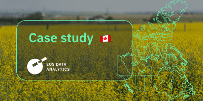
EOSDA Forecasts Yields For 2025 In Saskatchewan
EOSDA created RM-level crop yield forecasts for Saskatchewan to address limitations of official data. The project shows how satellite and weather inputs reveal local yield changes during the season.
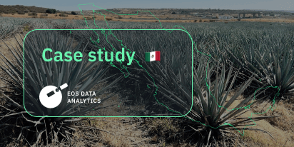
Digital Tools Improve Soil Health And Yields In Mexico
EOSDA and ITTA supported a Guanajuato farm with contour-line planning, monitoring tools, and practical guidance to reduce soil erosion and improve yields in the long run.