Satellite Monitoring Solutions for Agricultural Cooperatives
The world is changing at an alarming rate, and relying on traditional methods of agriculture, such as guesswork, conventional weather forecasts, and cumbersome records, is becoming a risky business. EOS Data Analytics, a leader in satellite-based EOSDA Crop Monitoring solutions, offers farming cooperatives a new, efficient way of managing food production.
With our digital precision ag platform - EOSDA Crop Monitoring - that relies on satellite imagery and constant streams of data collected from multiple sources, farming cooperatives can really thrive. We believe in the power of knowledge to make the world a better place.
Agricultural Solutions for Farming Cooperatives
Lack of analytical data to make informed decisions or provide recommendations for cooperative members
- Data on the current state of crops according to the vegetation indices
- Historical data on the field’s productivity
- Accumulated daily temperatures and precipitation for five years
- Hyperlocal 14-day weather forecast
- Scouting feature to speed up field check-ups
- Leaderboard of fields according to crop performance
Expensive agricultural inputs
- Productivity maps for precise planting
- Variable rate maps for precise fertilization
- Reliable weather forecast & historical data for timely harvesting
- Sending scouts directly to problem areas
Relying on several different types of software to coordinate efforts
Need to monitor multiple fields scattered over a vast area
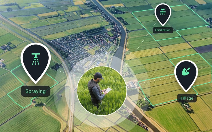
Satellite-based Сrop Monitoring Solutions
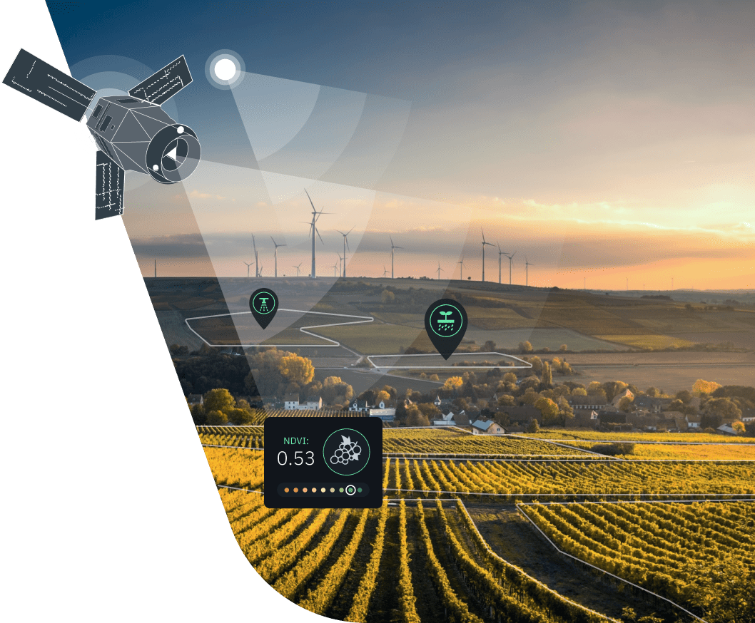
Satellite imagery & vegetation indices
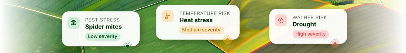
To provide farming cooperatives with data on the current state of crops, we rely on the latest satellite imagery and vegetation indices. Each vegetation index is a mathematical formula specifically derived to enhance particular surface features or parameters - from vegetation density to chlorophyll content.
These simple remote sensing tools can do wonders for agri coops, allowing for tracking changes in the state of crops in multiple fields at once and getting notified about the most critical developments.

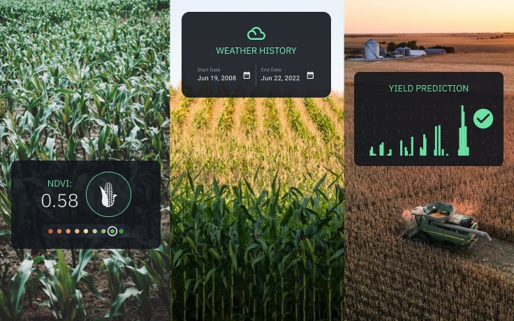
Weather analytics
Mitigation of weather risks is one of the priorities when it comes to keeping crops safe and sound. On EOSDA Crop Monitoring, members of farming cooperatives can access daily and accumulated temperatures and precipitation rates at the field’s location available for the past 5 years. You can also enhance field activities planning thanks to a hyperlocal 14-day weather forecast and trace the weather changes during the day hour by hour.

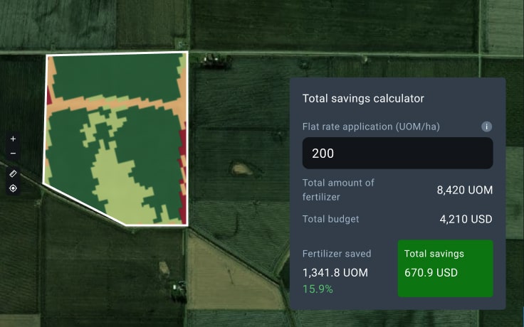
VRA maps
Here’s a truly valuable tool for agricultural cooperatives: maps for variable-rate application of seeds and fertilizers. Understand the real nourishment needs of your crops and identify which fields require a productivity boost. Calculate sowing maps, P&K and nitrogen fertilization maps, and multilayer maps. Download these maps and upload them into farming equipment terminals to enhance the precision of their performance.

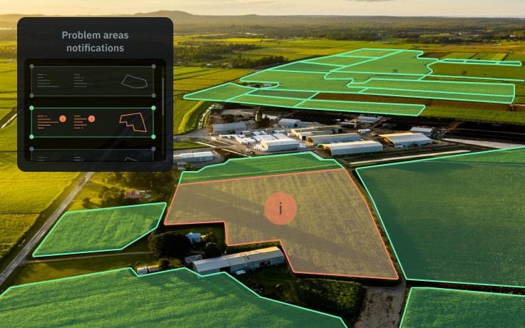
Field leaderboard
With a field leaderboard, members of farming cooperatives can always stay aware of abrupt changes in the state of crops in every field. This feature is especially useful if your fields are scattered across a large area. Get notified about the most alarming and most recent changes in the NDVI value - a crop health indicator.

Scouting
One of the top useful agricultural solutions for cooperatives, Scouting is the feature designed to significantly reduce the time and effort necessary for a check-up of a problem area in the field. With the mobile version of EOSDA Crop Monitoring, scouts can find the problem spot using GPS navigation even when they're offline. The app supports the instant report generation option - complete with snapshots and valuable details observed by the scout. As soon as the online report is generated, it can be accessed by everyone who shares the same Team account.

Special Business Solutions on Request


Success Stories
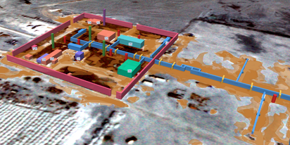
EOSDA tracks construction progress in the UAE PAD areas
Managing rapid industrial expansion in the UAE requires accurate data. See how our satellite-based solution helped a client verify construction milestones and reduce inspection costs.

Validating satellite tech for flood analysis and damage mapping in Coimbra
Can satellites improve disaster response? We explored this in the Coimbra district, showing how integrated satellite intelligence can assess flood impacts and fill critical data gaps during a crisis.

EOSDA advances rice field mapping in Indonesia with SAR
EOSDA tested a radar-based approach to improve rice field detection in Indonesia. By integrating SAR and optical data, the team ensured stable monitoring even during peak monsoon months.
EOSDA Forecasts Yields For 2025 In Saskatchewan
EOSDA created RM-level crop yield forecasts for Saskatchewan to address limitations of official data. The project shows how satellite and weather inputs reveal local yield changes during the season.
Digital Tools Improve Soil Health And Yields In Mexico
EOSDA and ITTA supported a Guanajuato farm with contour-line planning, monitoring tools, and practical guidance to reduce soil erosion and improve yields in the long run.
EOSDA Models Climate Change Impact On Sugarcane Yields
EOSDA modeled future temperature, rainfall, and other climate impacts on Veracruz sugarcane. The results help growers plan long-term adaptation strategies, including timing, varieties, and irrigation.
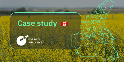
UK Farming Cooperative Uses SatTech To Optimize Harvest
EOSDA Crop Monitoring helped a UK farming cooperative accurately target harvesting areas with peas for either canning or freezing.