Our analytical solutions
Select a solution to learn more about its analytical capabilities and practical applications
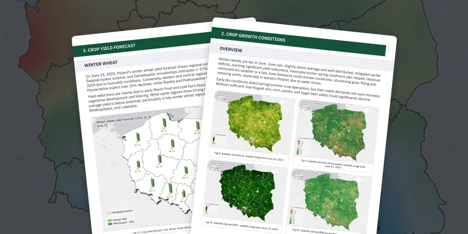
Agroclimatic reports
Region-level insights and forecasts based on satellite and climate data
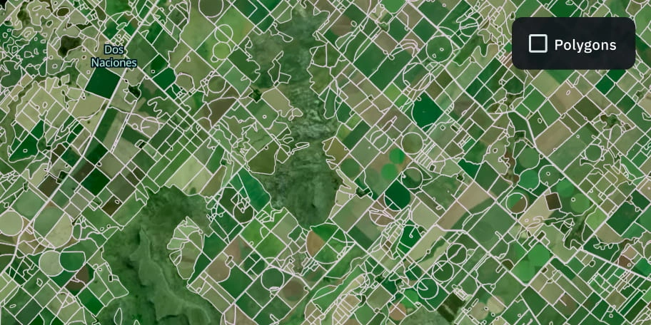
Boundaries detection
Precise field outlines for analytics, monitoring, and reporting
Border security
Monitoring borders for illegal crossings, smuggling, and infrastructure threats

Object classification and change detection
Classification of objects (by your request) and detecting changes with ML models
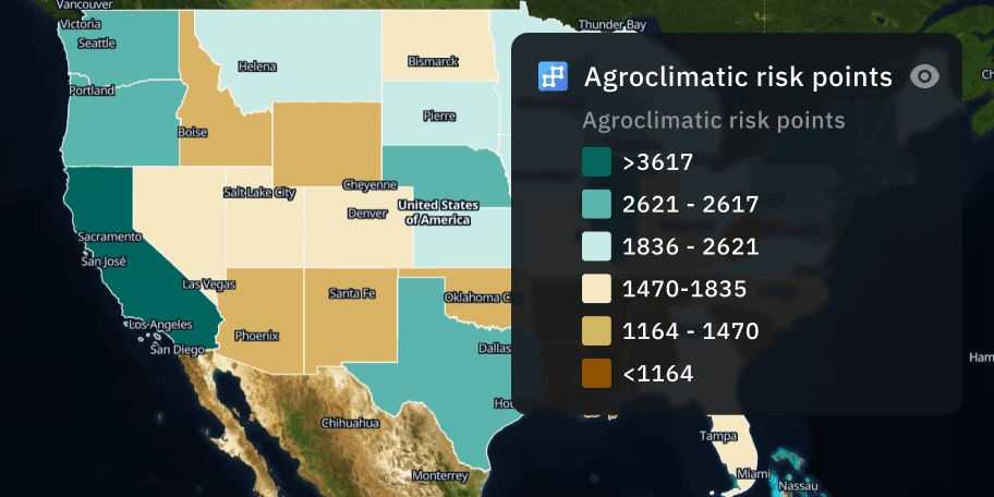
Climate risk analysis
Accurate risk assessment to support risk-aware strategies across sectors
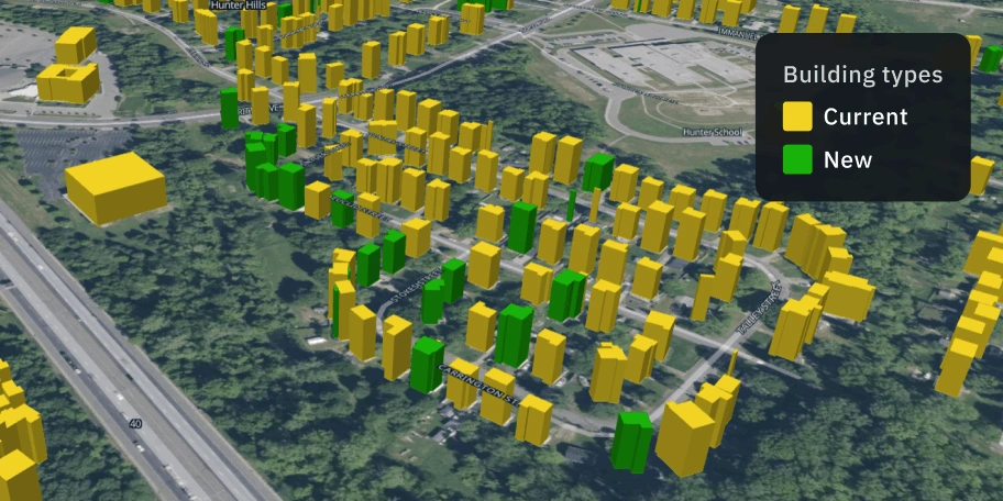
Construction progress assessment
Regular construction tracking for transparent reporting and risk control
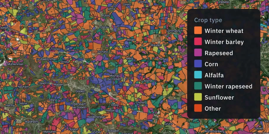
Crop classification
Reliable crop type intelligence across regions, seasons, and scales
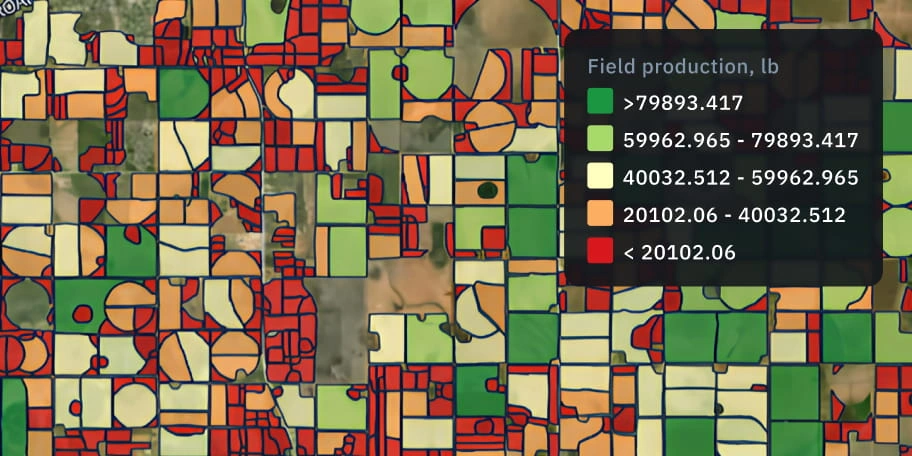
Yield prediction
Statistical and/or biophysical predictive modeling for the most accurate results
Damage mapping
Maping of affected zones and severity to support claims, repair, and reporting
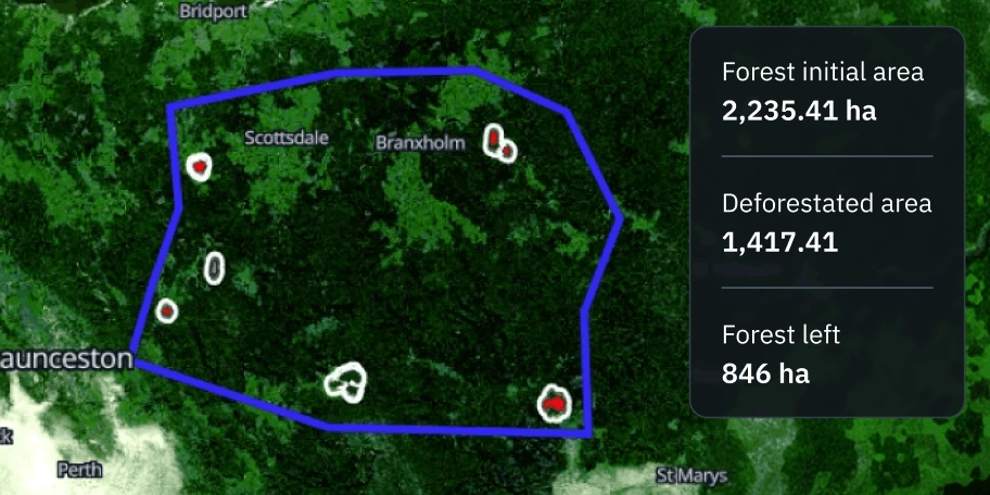
Deforestation and reforestation detection
The most accurate detection of changes in forest cover with multi-source images
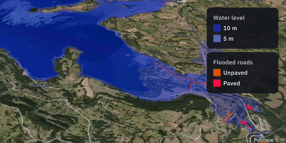
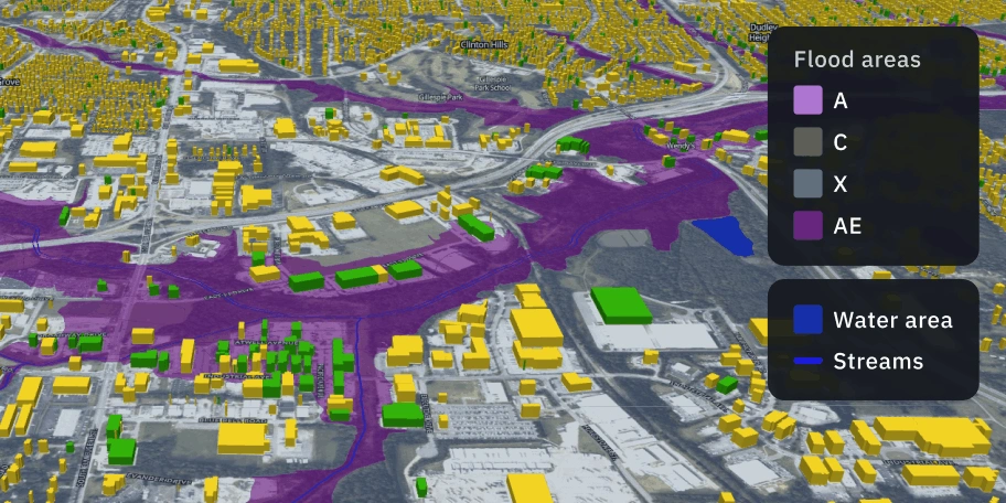
Flood risk and extent analysis
Analysis of inundated and flood-prone areas via multi-sensor satellite data

Forest cover detection
Detection of forest stands by analyzing the land's spectral characteristics and utilizing ML models
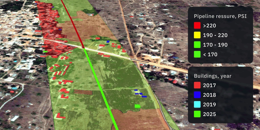
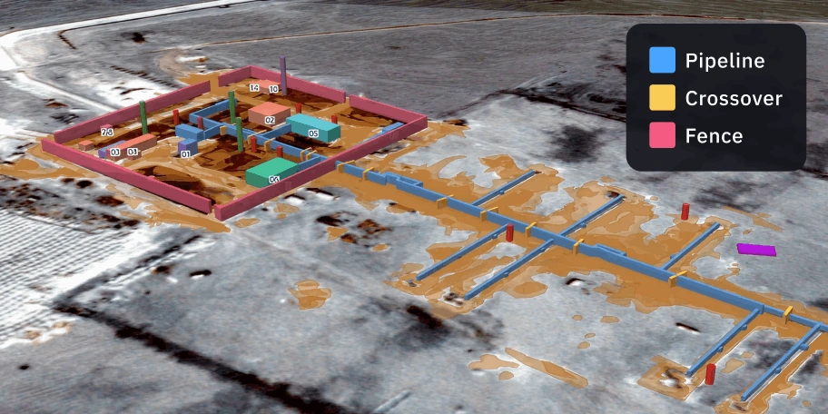
Fuel storage and pipeline monitoring
Monitoring fuel storage and pipelines using SAR and optical imagery
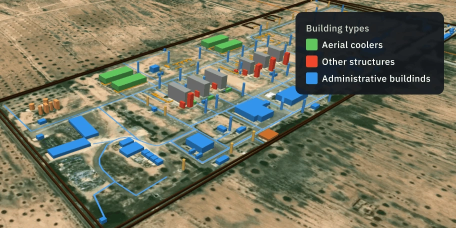
Infrastructure monitoring
Cost-effective monitoring of infrastructure based on multi-source satellite data
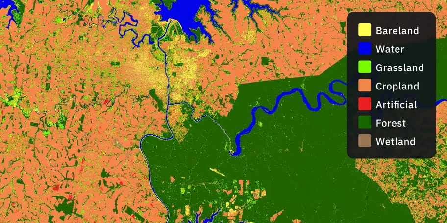
Land cover classification
Consistent and accurate land cover maps for planning and compliance
Maritime surveillance
Monitoring of vessel movements and illegal activities over vast ocean areas
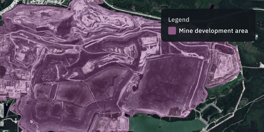
Mine expansion mapping
Monitoring surface mine growth via satellite change detection
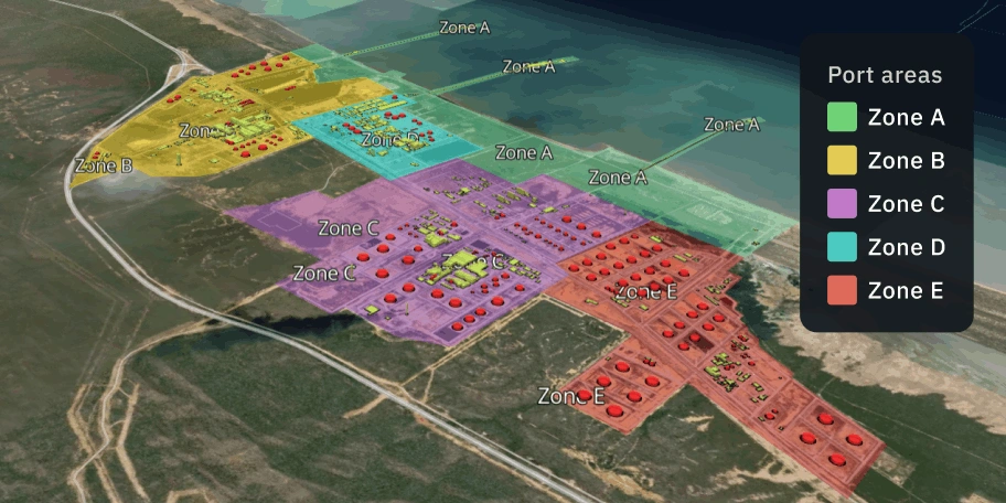
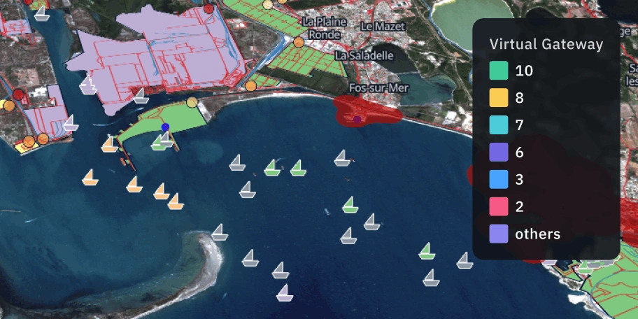
Ports operational status monitoring
Satellite intelligence for ports: vessel positions, congestion, operations
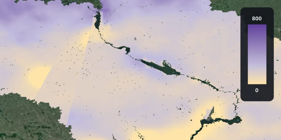
Soil moisture analysis
Satellite-powered surface moisture mapping tailored for different soil types
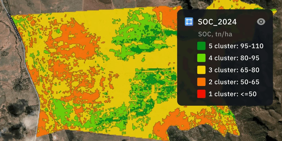
Soil carbon estimation
Accurate satellite-based SOC estimation that reduces follow-up soil samples
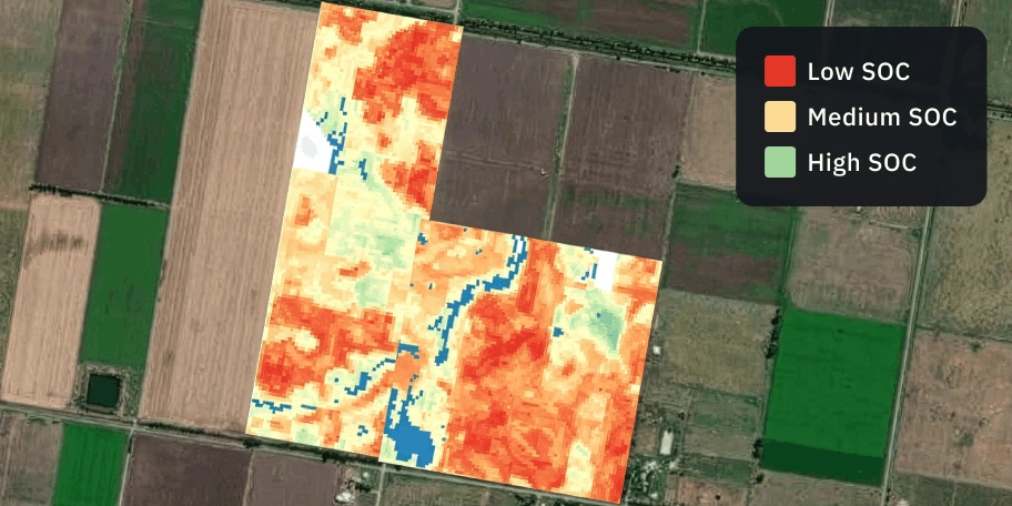
Soil organic carbon prediction
Monitor soil carbon changes and accurately plan regenerative practices
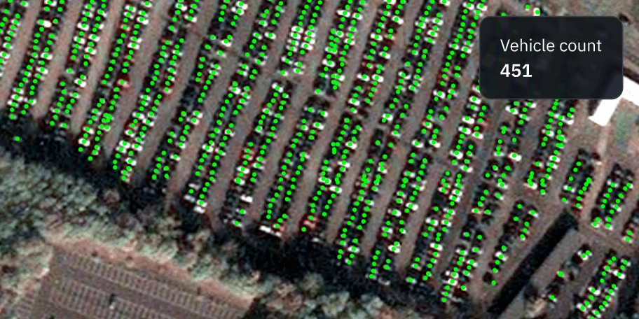
Vehicle and equipment detection
Large-area vehicle/equipment detection with satellite data and ML models
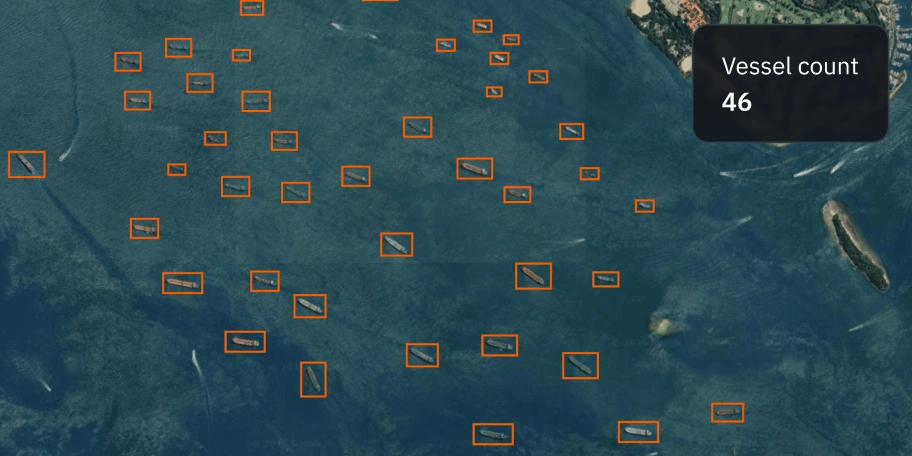
Vessel detection
Detection of ships at sea using remote sensing and ML models