Mid Kansas Coop (MKC)
Mid Kansas Coop is a full-service farmer-owned cooperative headquartered in Moundridge, Kansas. MKC provides a full line of agricultural inputs and related agronomy, management, grain, energy, and feed services and solutions to its members and non-member customers in 24 counties throughout the state.
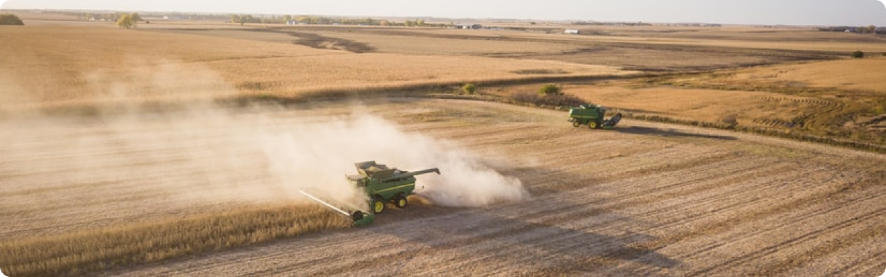
Mid Kansas Coop is committed to promoting and implementing precision ag technologies, so the co-op offers its Optimal Acre Program aimed to make precision agriculture more straightforward and affordable for everyone. The cost of the program is spread out over four years, which is only $5 per acre per year for four years for access to satellite imagery, customized soil fertility prescriptions, as well as the ability to do variable-rate nitrogen management, variable rate seeding, and more.
Overview
| Enterprise size: | 201-500 employees |
| Founded: | 1965 |
| Type: | Public Company |
| Industry: | Grain, Agronomy, Energy, Feed, Precision Agriculture |
| Revenue: | $201 million-$1 billion |
| States Served: | |
| Client base: | over 8,400 members |
| Website: | www.mkcoop.com |
| Headquarters: | Moundridge, KS |
| Contact phone: | 800-864-4428 |
| Address: | 307 W Cole St, Moundridge, KS 67107, US |
Area of Activity
Mid Kansas Cooperative is focused on providing agronomy services (with particular focus on precision ag solutions) and grain services, including grain merchandising, risk management services, logistics, accounting, and e-commerce.
Along with that, the cooperative partners with leading US brands of seed, crop protection and nutrition, animal feed, and fuels, being an active distributor and supplier of:
- Seed (CROPLAN, DeKalb, Asgrow, Mycogen, Monsanto, Dupont, and NK);
- Fungicides (Absolute Maxx, Topguard, Prosaro, and Stratego YLD);
- Fertilizer (SUPERU);
- Crop protection (Tordon 22K, 2, 4-D Amine, GrazonNext HL, and Escort XP);
- Feed (animal feed by Countryside Feed, Purina Animal Nutrition, including MKC’s own production, pet food by PMI Nutrition, Red Flannel, Infinia, Exclusive, feed for poultry by Purina, Home Grown, as well as MKC rations and supplements);
- Fuel and lubricants (Cenex oil, diesel, grease and gear lubricants, and packaged products sized from quarts to 220-gallon totes).
Products, Services And Solutions
Services, branches of activity, specializations of the Mid Kansas Coop:
-
Agronomy services
MKC’s six full-service agronomy centers and the fleet of applicators provide the customers with the latest products, programs, and services to meet various agronomy needs. From purchasing agricultural inputs to precision ag services Mid Kansas Co-op’s team can assist a farmer throughout the cultivation process.
-
Grain marketing
MKC operates 34 grain locations with a combined space of more than 30 million bushels. The grain team of the cooperative offers risk management options, merchandising, logistics, accounting, and e-commerce through Team Marketing Alliance LLC.
-
Energy Department
Mid Kansas Co-op provides propane, fuels, oil, grease, gear lubricants, as well as other products; including fuel storage tanks and accessories, bulk and packaged antifreeze, solvent, and DEF. Also, the MKC energy department offers automated fuel delivery.
-
Feed Division
MKC feed division provides quality feed nutrition products through the partnership with Countryside Feed and Purina, and operates its own feed mills in Manhattan and Onaga. Mid Kansas Co-op animal nutrition specialists assist the customer with choosing the right feed and mineral or medical products to meet the needs of a particular herd.
Partnership And Cooperation
Mid Kansas Co-op maintains partnerships both with other cooperatives and non-profit organizations in the served area:
- MKC Grain Division provides merchandising, logistics, accounting, and e-commerce through Team Marketing Alliance. Owned by MKC, Farmers Cooperative Elevator Company, Cooperative Grain & Supply, Central Prairie Cooperative, Mid-West Fertilizer, and Producer Ag LLC. TMA is aimed to assist producers in maximizing their revenue potential in today’s volatile markets.
- Through a partnership with Land O’Lakes, Inc., Mid Kansas Co-op offers the Land O’Lakes Cooperative Farmer Member Health Plan to its members in co-ops in Kansas.
- In a partnership with the Cooperative Finance Association (CFA), Mid Kansas farmers co-op association provides crop input financial programs for its members.
- Over the past five years, the cooperative has donated more than $300,000 to hunger relief programs, enhancing ag education, leadership, and community safety programs, including 4-H Leadership Development, Kansas-wide and local FFA chapters, Women in Agriculture, Community Food Banks, Farm Safety Camps, Emergency Services, among others.
EOSDA Crop Monitoring Solutions For Landmark Services Cooperative

- Providing crop yield predictions at the regional level by its main crops
- Automated monitoring of a large number of fields using satellite imagery
- Zoning tool which allows the building of a productivity map for differential fertilizing and drip irrigation
- Historical weather, 14-days weather forecast and weather risks alerts
- Assessment of current and historical vegetation as well as the development of crops based on NDVI, RECI, MSAVI, and NDRE. At each stage of crop growth, the most relevant index can be selected.
- Assessment of vegetation state using an improved cloud mask.