
Earth observation with satellites, thanks to extensive monitoring coverage and the opportunity to accurately define surface features indicating mineral deposits and tracking landscape changes related to mining, is getting sought-after in the industry.
In this interview, we met with Dr. Nataliia Borotkanych, Projects Coordinator at EOS Data Analytics, to find out how satellite remote sensing and analytics are used to support decision-making during the mine lifecycle, from exploration of mineral deposits to reclamation — environmental restoration of mined lands. Natallia also talked about the participation of EOSDA’s team in the HORIZON 2020 GoldenEye project that focuses on developing an analytics platform for the mining industry users.
How Is Remote Sensing Used In The Mining Industry?
Remote observation on the planet’s surface with satellites is applicable during all stages of the mine site lifecycle.
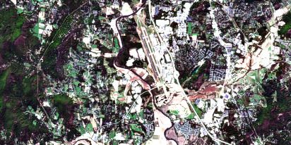
Satellite images are important means of supporting projects on prospecting mineral deposits. The spectrum of their application is quite wide. They provide geologists and field crews with information about the presence of roads, dirt tracks, fences, etc. In other words, satellite imagery is the base for making land cover maps. That’s essential for mapping potential access routes to explored areas and in consideration with the impact of a major project on the environment.
Satellite-based remote monitoring simplifies and speeds up geological exploration in hard-to-reach places. For instance, in Europe, high-quality mines are almost exhausted, so specialists are left to search for new deposits in remote areas.
Satellite maps are also useful for detecting outcropping and weathered rock layers and monitoring vegetation in exploration areas.
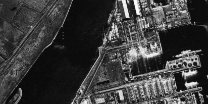
Monitoring open pits (located on the ground surface) during extraction is another use case for satellite data. For example, we analyze radar images from Sentinel 1 to track slope stability and monthly changes in the landscape parts where active mining takes place (i.e., defining sizing of stockpiles. The goal of such monitoring is to ensure worker safety by timely detecting potential issues and reporting them to the mine management to take measures before they lead to accidents.
Multispectral satellite images are used for the renaturation (restoration of post-mining lands to a state resembling nature) of mountainous areas as they allow monitoring the state of vegetation and the so-called acid drainage (the outflow of acidic water from iron ore and coal mines).
The obtained data make it possible to monitor the response of vegetation to stress factors with a high temporal and spatial resolution. Therefore, imagery data is the basis for improved renaturation management. Satellite remote sensing and imagery analytics are also useful, given the possibility of farming or other economic activities on lands after mining.
How Exactly Can Satellite Imagery Help Mapping Territories With Mineral Deposits?
There are more than 4,000 minerals on Earth. The amount of solar radiation that a particular mineral reflects, transmits, and scatters due to its chemical composition is unique. It resembles a human fingerprint and is called a spectral signature. A mineral’s spectral signature can be determined from space by measuring tiny fluctuations in the length of electromagnetic waves with the help of satellites.
These machines allow for shooting territories of interest from space and interpreting images taken in parts of the spectrum outside the visible range. For example, data in infrared and short-wave radiation are used to identify structural features of the Earth’s surface.
Thanks to spectral images and thematic mapping, researchers get information about soils’ absorption and reflection properties, the composition of rocks, and vegetation. Such data allows detecting deposits of clay and oxides and determining soil types on satellite images.
You Mentioned The Goldeneye Project. Please Tell Us Briefly About It
GoldenEye is a three-year H2020 project funded by the European Commission. The project aims to build an AI-based platform for monitoring and analyzing mine sites across the European Union to make the exploration of minerals more cost-effective and efficient while taking care of worker safety and lessening the extraction’s impact on the environment. VTT Technical Research Center of Finland coordinates the project.
The GoldenEye platform will leverage remote sensing and positioning technologies for data generation and collection (it uses satellites, drones, and in-situ sensors) and uses machine learning algorithms for its analysis. Satellite imagery for mining delivers actionable insights that support more efficient resource discovery and extraction while enabling continuous monitoring of mine sites and waste storage areas to minimize environmental risks.
The EOSDA project team consists of five people.
What Is EOS Data Analytics In Charge Of Within The Project?
Using imagery Sentinel and Landsat satellites, we conduct environmental monitoring of mine territories. The tasks include evaluating the integrity of tailing dams (storage) during post-closure phases by searching for leaks in the sides of tailings storage facilities.
Tailing is waste, a toxic mixture formed after the processing and enrichment of raw materials extracted in the mine. Tailing dam breaks lead to ecological disasters that often come with casualties. Over the last decade, at least two tragic events happened in South America. In 2015, the Mariana Dam collapse killed 19 people and destroyed the village of Bento Rodríguez in Brazil. As a result of the accident, 60 million cubic meters of iron ore beneficiation waste fell into the river and the Atlantic Ocean. The 2019 Brumadinho dam disaster took the lives of 270 people and caused severe environmental damage in the Brazilian state of Minas Gerais: 12 million cubic meters of waste polluted more than 300 km of rivers. The facility’s operator, Brazilian company Vale SA, had to announce the decommissioning of all tailings dams in the region at the cost of $1.1 billion.
So, the environmental monitoring we perform within this task is focused on solving the industry’s pressing problem: the disposal of production waste.
Also, we monitor recultivated lands around mines by making vegetation maps during a vegetation period based on NDVI and other indices to define how well plants are growing.
Recently The Goldeneye Project Team Had A Trip To Finland. What Did You Do There, And What Are The Results?
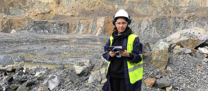
Olena Kavats, Senior Data Scientist and Scientist Kateryna Sergieiva conducted field trials at the Pyhäsalmi mine, particularly its active quarry and the sides of the tailing dump. The specialists measured soil moisture and soil temperature (on a five-centimeter depth) and the temperature of the near-surface layer of the atmosphere.
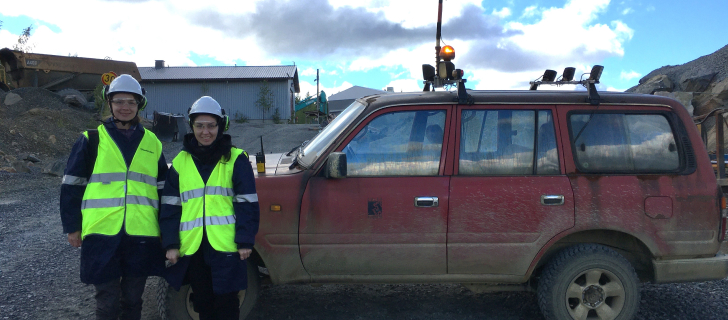
Olena and Kateryna used satellite data, for instance, Landsat 8 imagery, to get these three types of data. Landsat 8 has thermal bands that record the reflection of temperature indicators, and it’s possible to calculate soil temperature based on the imagery captured with thermal bands.
The team not only needed to take measurements but also validate them because the accuracy of temperature data from the satellite depends on the presence of clouds — its sensors may define the cloud temperature instead of Earth’s surface temperature.
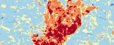
The specialists also used the Soil Moisture Index (SMI) over the Pyhasälmi trial site to reconstruct soil moisture dynamics over the tailing pond. SMI is based on the Normalized Difference Vegetation Index (NDVI) and Land Surface Temperature (LST) indices.
Data on soil temperature and moisture and the temperature of the atmosphere’s near-surface layer are necessary for making soil moisture maps. In turn, soil moisture maps are required for monitoring the integrity of tailing dams. So, indicators of increased moisture can point at places of tailing leakage.
Taking these measurements aligns with environmental monitoring for which the company is responsible within GoldenEye.
I’ve got to say that Finland is very sensitive to protecting the environment. The mine is near Lake Pyhäjärvi, which is a tourist destination. There is no air and water pollution. After working on the site, our shoes didn’t even get dusty, which surprised us pleasantly.
Ore exploration on this mine will take place until the end of September. It will function after that, but the exploration scale will be smaller than before. We will continue our environmental monitoring (making soil moisture and vegetation maps, etc.) until April 2023, when the project finishes.
Are There Upcoming Business Trips Scheduled For The Team?
Yes, we’ll meet with all the project teams at the General Assembly to discuss the latest progress on the project and present our findings. The event will take place in Romania on October 10.
About the author:
Natalia Borotkanych has a PhD in space history, Master’s Degree in Foreign Policy from the Diplomatic Academy of Ukraine, as well as Master’s Degree in Public Management and Administration from National Academy for Public Administration under the President of Ukraine. Natalia's experience includes working in business, science, education, and government projects for over 15 years.

Turn high-tech satellite data into actionable solutions for your business.
More news
SAR imagery: How synthetic aperture radar technology works
Want to monitor assets without weather delays? Learn how SAR imagery captures soil moisture, floods, and structural shifts through clouds and smoke for your monitoring projects.
Optical satellite imagery: Getting insights from space
Ground inspections can be slow and expensive. Discover how commercial optical satellite imagery simplifies remote site monitoring and supports daily operational decisions.
Natural Disasters 2024: Extreme Weather On The Rise
Take a closer look at the 2024 natural disasters that shook the planet to reveal their causes, spread, and the massive challenges they created we all need to solve.