Lidar and radar are two technologies that have become essential for various applications, from self-driving cars to weather monitoring. They share a common principle: the active remote sensing of the environment through sending signals and analyzing reflections. In recent years, lidar, using waves of light, and radar, using radio waves, have emerged as leading technologies for object detection and mapping.
This article will provide an in-depth comparison of lidar versus radar in terms of their operation, accuracy, range, sensitivity to weather, cost-effectiveness, and applications across different areas. We’ll also discuss key factors to help determine when lidar or radar is more suitable for specific use cases.
How Does Lidar Work?
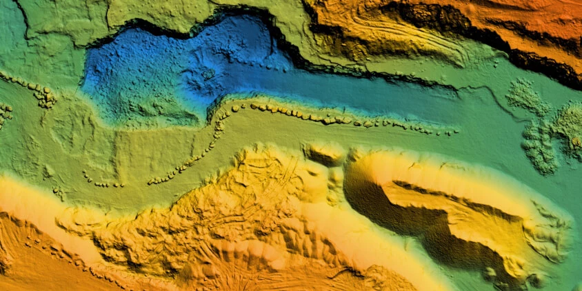
Lidar, short for “light detection and ranging”, is a geospatial technology that works by sending out a focused wave of light and measuring how long it takes for it to reflect off an obstacle. When the laser beam encounters an object like a tree or building, some of the light is reflected toward the sensor. By precisely timing how long it takes for each laser pulse to return, the system can calculate the distance to each reflective point. These calculations rely on the time-of-flight (ToF) approach, which assumes that the speed of light is constant.
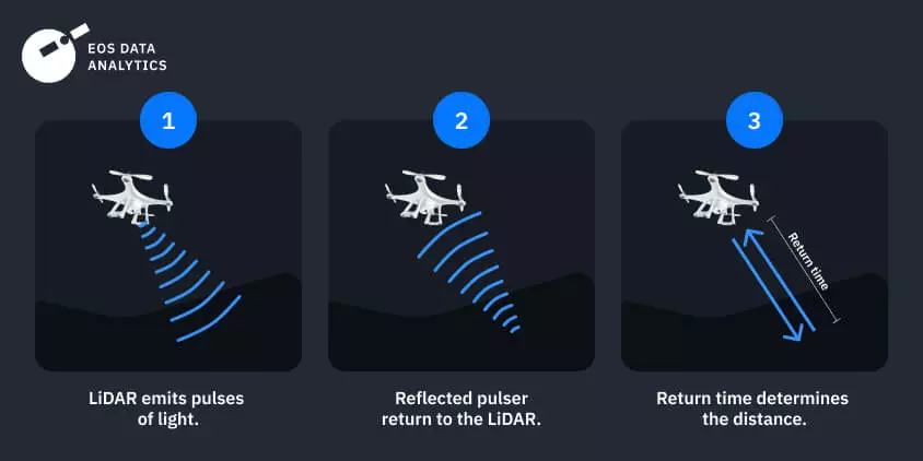
The three essential parts of a light detection and ranging system are the laser, the scanner, and the detector. The laser source generates light in intermittent pulses, rapidly scanning an area in multiple directions. After the light has made its way from the system to the object and back, it is collected by the scanner (typically a spinning mirror or MEMS — micro-electromechanical system) and sent to the detector for further calculations.
Airborne (drone) lidars and lidars with ground-penetrating radar (GPR) are both capable of penetrating the ground.
How Does Radar Work?
Radar, which stands for “radio detection and ranging,” is a sensing method that utilizes radio waves to determine the range, angle, or speed of objects. It works by actively transmitting electromagnetic waves in the radio frequency spectrum, detecting the waves that bounce off targets (echoes), and timing how long it takes for the radio signals to travel out and bounce back.
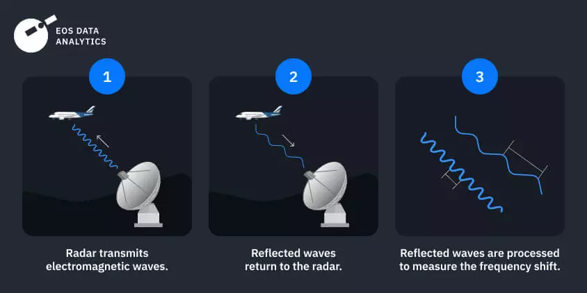
The three main parts of any radio detection and ranging system are the transmitter, the antenna, and the receiver. The antenna receives radio waves from the transmitter and broadcasts them into the surrounding area. When these waves hit an item, they bounce off and come back to the system, where the antenna picks them up and sends them to the receiver. The receiver can determine the object’s range, speed, and size by decoding the radio waves it picks up.
Lidar light waves, which typically range between 700 and 1550 nanometers, are shorter than radar radio waves, which range between 0.3 and 100 cm.
Differences And Similarities Between Radar And Lidar
There are advantages of lidar over radar, such as high-resolution data and precision. To compare, the advantages of radar over lidar are easier monitoring of large areas and all-weather operation. Radar is also superior in terms of price, making the light detection and ranging less widely used. Which technology to employ depends on the specific tasks at hand, the existing limitations, and the available resources.
Accuracy And Resolution
The effectiveness of lidar and radar tools depends on their precision and spatial resolution. As the light it uses has a shorter wavelength, lidar can detect and map smaller features. Radiolocation systems, accordingly, capture live satellite data at far longer wavelengths, resulting in somewhat lower resolution.
The precision of measuring distance by lidar and radar also differs a lot. Is lidar more accurate than radar? Given the swiftness of light and the accuracy of ToF computations, lidar sensors can pinpoint distances to within a few inches. Radiolocation systems may still provide accurate distance readings, but they might fall short when dealing with tiny objects or in congested environments, which is where light-based systems succeed.
However, the contest between lidar vs. radar accuracy is still ongoing. Modern radio-wave-based systems are more precise than ever thanks to advancements in technology that allow them to operate in a wider range of frequency bands and use complex signal processing methods. As the bandwidth of current receivers continues to grow, increasingly fine-grained radar images are now within reach .
Range And Coverage
When examining lidar vs. radar pros and cons, their range and coverage are to be considered. The energy of a light pulse, detector sensitivity, and environmental conditions primarily determine a light-based system’s range. Lidar devices mounted to drones or satellites have a range of several miles under ideal conditions. However, bad weather can significantly reduce the range and coverage of light detection and ranging systems.
The radar range represents the farthest distance at which a certain system can detect an object. Unlike lidar, radar equipment’s broad range and coverage hold true rain or shine. Large radio-wave-based systems commonly have ranges spanning several hundred miles, allowing for efficient monitoring of extensive areas.
Many variables affect how far and wide a radio detection and ranging system can see. These include the transmitter’s power, the electromagnetic waves used, the antenna’s size and field of vision, the system’s elevation, and the weather. Finding a happy medium between these factors is essential for choosing a radio-wave-based system that is optimal for its intended use.
Sensitivity To Environmental Conditions
The weakness of lidar, unlike radar, is high sensitivity to atmospheric interference. Rain, snow, and fog can all compromise the effectiveness of a laser system by scattering, absorbing, or reflecting its beams. Dense fog, for instance, can attenuate the laser light by up to 200 dB/km, greatly reducing the system’s effective range and accuracy.
In response, researchers have developed specific strategies for increasing light-wave-based systems’ performance in hazy environments. One possibility is to use laser light with a longer wavelength since it is less susceptible to being dispersed or absorbed by particles in the air. Equipping light-based systems with advanced signal processing and filtering technologies can also minimize the effects of atmospheric noise and interference.
Radar vs. lidar is more reliable in bad weather by default. Thanks to the longer wavelengths of radio waves, rain, snow, and fog have less of an effect on radio waves than they do on light. This means radio detection and ranging systems may keep operating properly even during severe weather, which results in more reliable and accurate data collection. This trait is especially useful for always-on applications like air traffic management and weather monitoring.
Cost-Effectiveness
The comparison between lidar and radar systems shows that laser-based ones are typically more sophisticated and costly. The necessity for high-precision lasers and sensors, as well as advanced computation powers, justifies the higher cost. That said, costs associated with managing and interpreting the massive amounts of high-resolution data collected by light-wave-based systems should also be considered.
Conversely, the components that make up a radar system are cheaper than lidar’s high-precision components. Radio-wave-based systems frequently boast reduced costs of operation and upkeep in comparison to their laser-based counterparts. In addition, radio detection and ranging systems produce data with a lower resolution, which translates into lower data administration and processing costs. This way, radio-wave-based systems, which are less expensive and simpler to operate, have become prevalent.
Combining the capabilities of radar and lidar in remote sensing can create synergy and provide more information for decision-making.
Practical Applications Of Lidar And Radar
When it comes to detecting objects and mapping, lidar and radar are key types of remote sensing technologies. Lidar is well-suited for precision mapping; radar is prized for its accuracy in spotting moving objects. While light-based technology is used in mapping, surveying, renewable energy, and robotics, radio-based technology is put to work in airplane navigation, traffic control, weather observation and forecasting, and environmental monitoring, to name a few.
Agricultural Applications
Lidar and radar both see regular use among agricultural technologies on today’s farms. Crop growth monitoring, disease and pest detection, and soil moisture mapping are all areas where radio-based systems have proven effective. They also finds applications in irrigation monitoring and evaluating yields. The accurate topographical data provided by laser-based systems is useful for better watershed and field management. They are also capable of measuring crop height, density, and canopy structure, providing a comprehensive assessment of agricultural landscapes.
Agricultural drones and satellites also employ radar and lidar technologies for crop monitoring. Farmers using EOSDA Crop Monitoring can access satellite data, including SAR radar images, allowing them to keep a close eye on their crops at all times. The information collected by lidar and radar systems helps farmers make sound decisions for improving their crop yields and agricultural efficiency.
Environmental Applications
Both lidar and radar systems can be used for ecological purposes. Radio detection and ranging may help monitor the weather, trace wildlife, and study Earth’s surface characteristics, such as moisture content. Comparatively, light detection and ranging systems can quantify pollutants in the air, map vegetation coverage, and locate hotspots for wildfire prevention. The data acquired by radar and lidar is vital to climate change studies, environmental conservation, and emergency response.
Urban Applications
Radar and lidar sensor data can be tremendously helpful for urban mapping and planning. Radio-wave-based systems serve various purposes, such as measuring building height and width, assessing plant density, capturing traffic statistics, and evaluating infrastructure conditions. This data proves invaluable for optimizing building densities and heights to ensure sufficient sunlight, building effective transportation networks, and pinpointing disaster-prone areas.
Lidar, as opposed to radar images, provides a highly accurate three-dimensional (3D) representation of urban landscapes, allowing city planners to view and examine features such as building placement, road systems, and vegetation coverage. By its nature, light detection and ranging technology works great for gathering information about a building’s geometry. Using this information as a starting point, researchers can incorporate data on energy use and other far-reaching issues in city planning and sustainability . This allows us to better understand urbanization trends, plan for future development, and enhance existing cities in a variety of ways.
How To Decide Between Lidar And Radar
Choosing radar or lidar technology hinges on your unique situation and goals. Autonomous cars and precision mapping are only two examples of applications that could greatly benefit from lidar-collected, high-resolution 3D imagery. Radio detection and ranging technology, instead, shines in applications where far-reaching sensing and reliability in any weather are essential, such as traffic control and meteorology. When deciding on lidar vs. radar for remote sensing, it’s important to take into account its cost, coverage, accuracy, and environmental constraints.
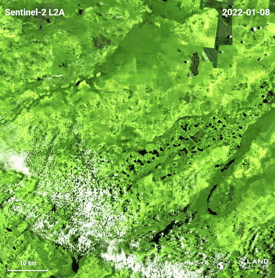
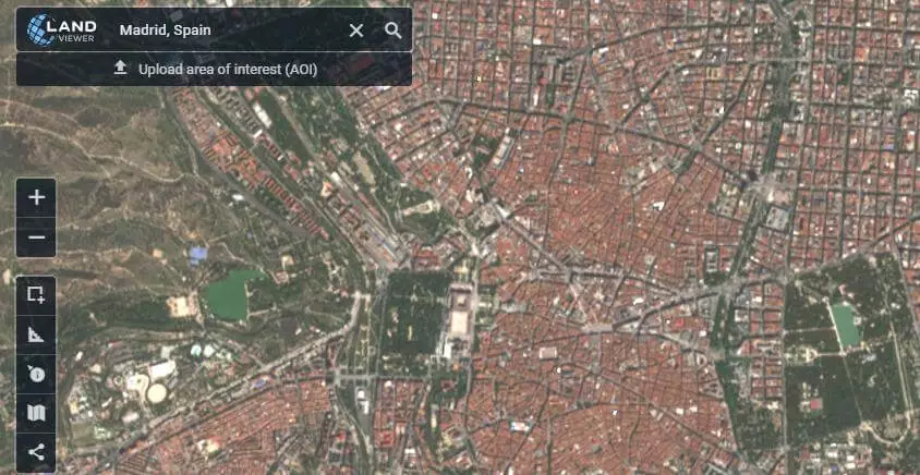
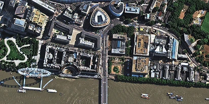
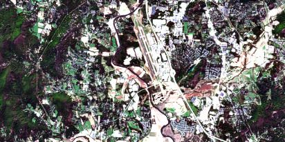
EOSDA Landviewer is the best choice if you need to find and process certain remote-sensing data. The platform’s users get access to up-to-date and historical satellite imagery from a variety of satellite types and spectral bands, providing comprehensive coverage. Multiple satellites, including the Sentinel-1 radar satellite, contribute to the rich imagery library provided. Part of the available data is free satellite imagery that is available for any chosen AOI.
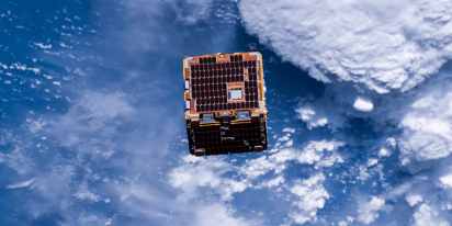
“The platform also incorporates high-resolution optical imagery from the EOS SAT-1, a multi-purpose satellite designed specifically to advance agriculture and forestry through cutting-edge Earth observation data.
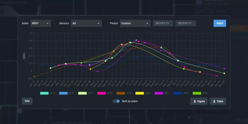
With the powerful capabilities to visualize diverse lidar and radar datasets across time, you can gain valuable insights, see the big picture in your field of study, and make well-informed, data-driven business decisions.”
About the author:
Petro Kogut has a PhD in Physics and Mathematics and is the author of multiple scientific publications. He is the Soros Associated Professor as well as the head of the department of differential equations in the Oles Honchar Dnipro National University and has received a number of grants, prizes, honorary decorations, medals, and other awards. Prof. Dr. Petro Kogut is a science advisor for EOSDA.
More news
Optical satellite imagery: Getting insights from space
Ground inspections can be slow and expensive. Discover how commercial optical satellite imagery simplifies remote site monitoring and supports daily operational decisions.
Natural Disasters 2024: Extreme Weather On The Rise
Take a closer look at the 2024 natural disasters that shook the planet to reveal their causes, spread, and the massive challenges they created we all need to solve.
Historical Satellite Images: Accessing The Old Data
Decades of space-based imagery are now at your fingertips. Historical satellite images reveal the past and can guide your next move — whether you’re a farmer, eco-activist, city planner, or scientist.