Normalized Difference Snow Index (NDSI)
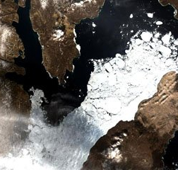
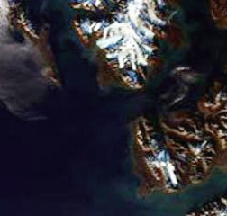
Snow is one of the common global climatological phenomenon well-known to be a serious constituent of the hydrological series and ecological hazard. In some parts of the world, snow is usually limited to the higher grounds and is regarded to be one of the most destructive natural hazards. Consequently, Identification of the snow cover is important to the hazard mitigation and catchment management. It is also significant for hydrological and weather forecasting. When identifying the snow presence, satellite tools includes the observations at 0.66 & 1.6mm. There is transparency in the atmosphere at the wavelengths, while snow is not reflective at 1.6mm and very reflective at 0.66 mm.
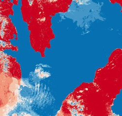
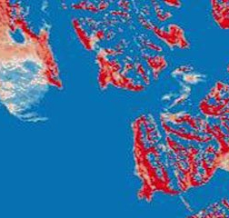
Snow cover is as bright as the clouds, and this makes it is difficult to differentiate it from the cloud cover. However, at 1.6 mm, snow cover absorbs sunlight, and for that reason, it appears darker than the clouds. This enables an effective distinction between clouds and snow cover. The image, therefore, demonstrates the ability to separate clouds from snow using observations at these wavelengths.
NDSI is a measure of the relative magnitude of the reflectance difference between visible (green) and shortwave infrared (SWIR). It controls variance of two bands (one in the near infrared or short-wave infrared and another one in the visible parts of the spectrum). This is useful for snow mapping. Snow is not only very reflective in the visible parts of the electromagnetic spectrum but also highly absorptive in the NIR or the short-wave infrared part of the spectrum, while the most cloud reflectance remains to be high in the same parts of the spectrum, this allows good separation of most clouds and snow.
NDSI Formula
To calculate the ratio of the two bands taken and composed in a satellite image in a specific time and location

Band 2: Visible Green, 0.53 – 0.61 micrometers
Band 5: Short Wave Infrared, 1.55 – 1.75 micrometers