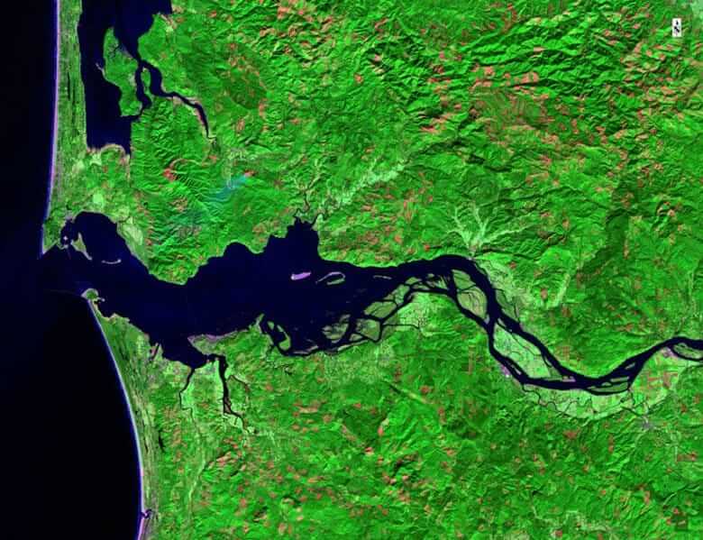
Atmospheric Penetration Band Combination
Atmospheric Penetration band combination (SWIR 2, SWIR 1, NIR) shows results similar to that of a traditional false color infrared photography but has an excellent clarity. It involves no visible bands while penetrating atmospheric particles, smoke and haze reducing the atmospheric influence in the image. Water attenuates the NIR and the short-wave infrared (SWIR) wavelengths, ice and snow giving well-defined shores, coastlines and highlighted sources of water within the image. Vegetation in the band combination appears blue, displaying details related to the vegetation vigor, the healthy vegetation is shown in light blue while the stressed, sparse or/and arid vegetation appears in dull blue. Urban features are white, gray, cyan or purple. The band combination can be used to find soils moisture, textural and characteristics each band in the combination plays a major in indicating different features giving them different characteristic in the appearance of the image.
SWIR2
This band (even though to some extent it is longer wavelength compared to wavelength 5) has a limitation in cloud penetration, but it provides a good contrast between different geologic rock formations and different types of vegetation as compare to bands 4 and 5. It is very useful in measuring the soil and vegetation moisture content and helps to distinguish between clouds and snow.
SWIR1
The short wavelength infrared (even redder than near infra-red) has a limited cloud penetration. It offers a good contrast among different vegetation types. It is also very useful in measuring the vegetation and soil moisture content and helps to differentiate snow, clouds, and ice.
NIR
The near infra-red (NIR, redder than red band, but invisible) is very useful in biomass content and shorelines mapping. It also helps in detection and analysis of vegetation.
This band combination is very useful in geological studies in finding the textural and moisture characteristics of soils.