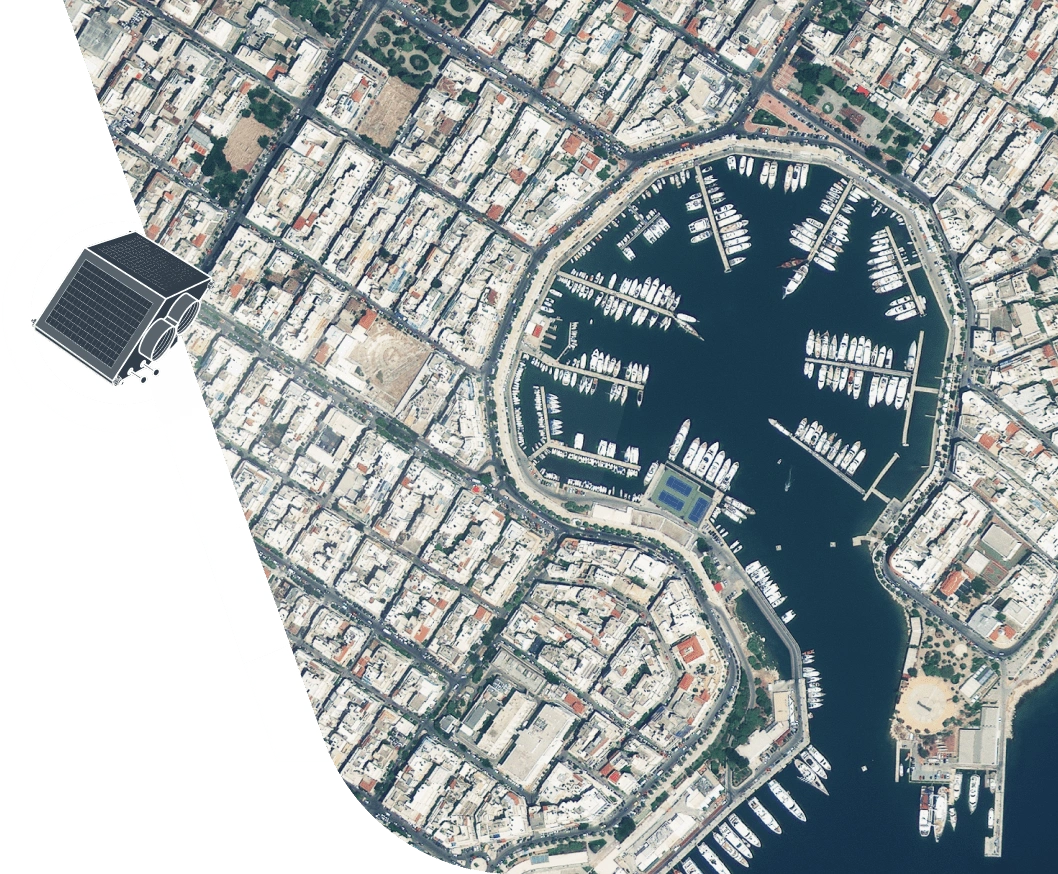
High-Resolution Satellite Imagery
High-resolution satellite sensors provide enhanced spatial resolution for the most accurate, reliable, and timely data. With EOSDA LandViewer, you can easily purchase imagery from the world’s leading high-resolution satellite imagery providers — all online, on one platform, in one click.
- Images with high resolution (up to 30 cm per pixel)
- Extensive archive for historical analysis
- Frequent high-resolution imagery updates
- Tasking satellites to acquire new images on demand
High-Resolution Imagery Options
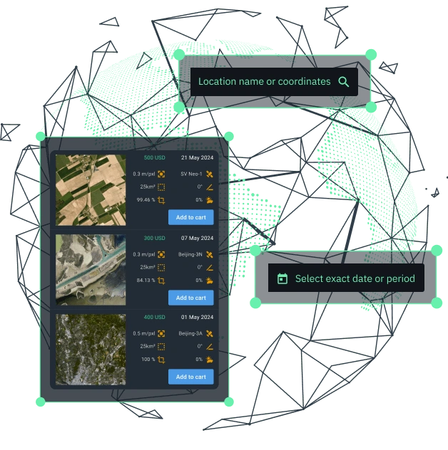
Available Images
Browse our rich archive and download high-resolution satellite images captured since 2006. This option is perfect when you need:
- Single-use, transactional applications (e.g., pictures of high quality for media)
- Visual recognition (e.g., location of specific objects)
- Creating a basemap (e.g., urban planning)
- Detecting historical changes (e.g., infrastructure development)
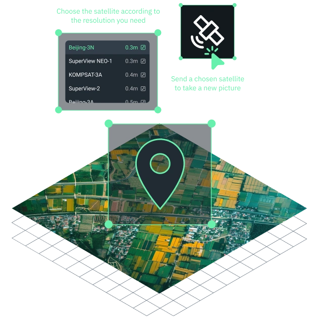
New Images
Request satellite tasking by selecting one of our satellites to capture new imagery of your area of interest. Tasking is the ideal solution when:
- Images for the required time period are not available in the archive data
- Better AOI coverage is required
- Archival imagery resolution is insufficient
- Regular monitoring and scheduled revisits of your AOI are required
- Specific image type is needed (e.g., panchromatic, multispectral, etc)
Pricing
Explore our price list for high-resolution satellite imagery and select spatial and temporal resolutions according to your needs.
Satellite imagery resolution
Revisit
Satellite imagery resolution
Revisit
Satellite imagery resolution
Revisit
Satellite imagery resolution
Revisit
Satellite imagery resolution
Revisit
Satellite imagery resolution
Revisit
Satellite imagery resolution
Revisit
Satellite imagery resolution
Revisit
How To Buy High-Resolution Satellite Images On EOSDA LandViewer
Set your AOI
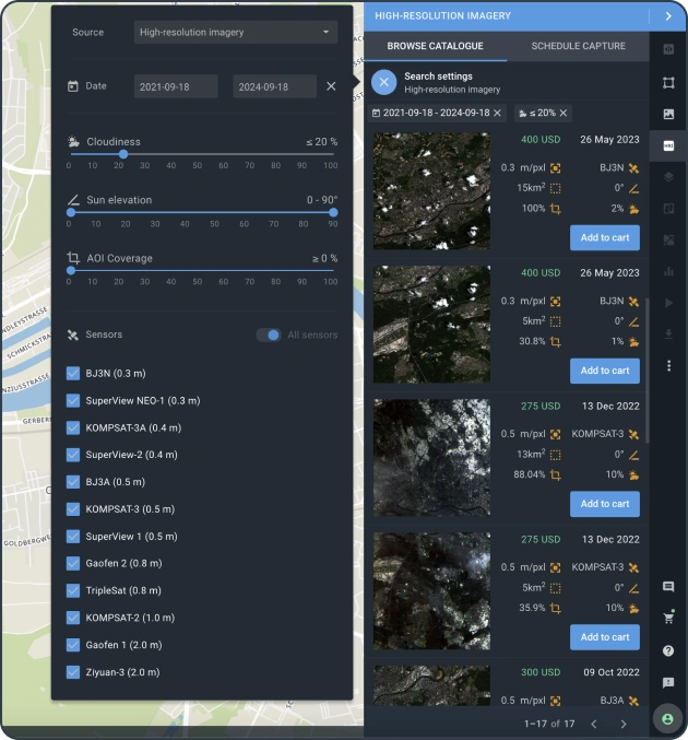
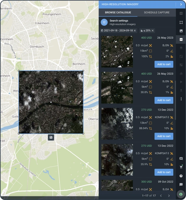
To purchase high-resolution satellite imagery, select your AOI, choose 'High-resolution images' as the data source, and apply the appropriate filters to view the list of available images with high resolution that match your query.
Check the area of intersection
Assess the coverage of your AOI by the high-resolution satellite image. Review the pricing and other relevant details to select the image that best meets your needs.
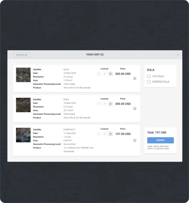
Add the image to your cart and purchase
Add the picture with high definition to your cart and submit the order. Make a payment with one click or contact our sales manager to agree on the purchase details.
Check out additional benefits
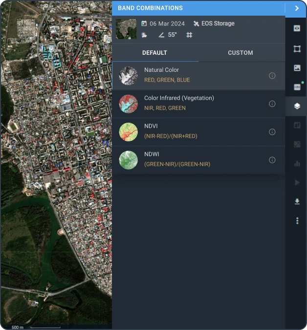
Access high-resolution imagery on the EOSDA LandViewer platform within 2 business days. Use vegetation indices to evaluate the changes for data-driven decision-making. You can crop and download the imagery in your preferred format. The image will be stored and accessible in your account.
Choose High-Resolution Satellite

- Resolution
- 0.3m/px
- Spectrum bands
- Panchromatic, Red, Green, Blue, NIR
- Revisit
- 5 days


- Resolution
- 0.3 m/px
- Spectrum bands
- Panchromatic, Blue, Green, Red, NIR
- Revisit
- Daily


- Resolution
- 0.4 m/px
- Spectrum bands
- Panchromatic, Red, Green, Blue, IR & NIR, Mid-Wave Infrared
- Revisit
- 1.5 days


- Resolution
- 0.4 m/px
- Spectrum bands
- Panchromatic, Blue, Green, Red, Red-edge, NIR1, NIR2
- Revisit
- 1.5 days


- Resolution
- 0.5 m/px
- Spectrum bands
- Panchromatic, Red, Green, Blue, NIR
- Revisit
- 4 day


- Resolution
- 0.5 m/px
- Spectrum bands
- Panchromatic, Red, Green, Blue, IR & NIR
- Revisit
- 1.5 days


- Resolution
- 0.5 m/px
- Spectrum bands
- Panchromatic, blue, green, red, NIR
- Revisit
- Daily


- Resolution
- 0.65 m/px
- Spectrum bands
- Panchromatic, Red, Green, Blue, NIR
- Revisit
- 5 days


- Resolution
- 0.8 m/px
- Spectrum bands
- Panchromatic, Red, Green, Blue, NIR
- Revisit
- 5 days


- Resolution
- 0.8 m/px
- Spectrum bands
- Panchromatic, Red, Green, Blue, NIR
- Revisit
- daily


- Resolution
- 1 m/px
- Spectrum bands
- Panchromatic, Red, Green, Blue, IR & NIR
- Revisit
- 5.5 days


- Resolution
- 2 m/px
- Spectrum bands
- Panchromatic, Red, Green, Blue, NIR
- Revisit
- 4 days


- Resolution
- 2 m/px
- Spectrum bands
- Panchromatic, Red, Green, Blue, NIR
- Revisit
- 4 days


- Resolution
- 2 m/px
- Spectrum bands
- Panchromatic, Red, Green, Blue, NIR
- Revisit
- 5 days

Applications Of High-Quality Satellite Images


