EOSDA Crop Monitoring released several new features and updates on the old ones. We would like to offer better data integration, enhanced user experience, and an improved UI to our users around the globe.
We have been working around the clock to make sure that agriculture field monitoring with our system is both highly efficient and easy-to-handle. For this purpose, EOSDA introduces Team accounts, Soil moisture management, enhanced Weather feature, Time Series Zoning, as well as other minor improvements.
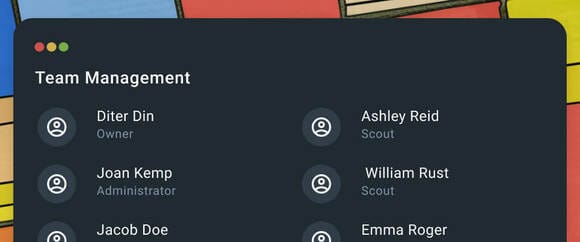
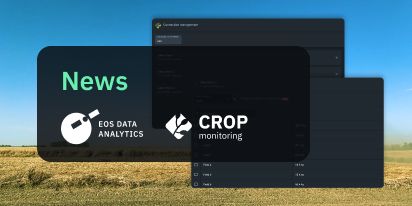
Team Accounts
The Team accounts feature will enable you to organize all your digital farming activities in one shared account. Collaboration has never been so easy: you can join as many Teams as you like and effortlessly switch between them. We have upgraded the Scouting feature as well. Now, thanks to the shared account, every task will be automatically synced with the mobile application account. You will stay in the know about any changes in the work of your Team thanks to the automatic alerts sent directly to your email account without delay. We have been working hard to make daily EOSDA Crop Monitoring as easy as possible for you.
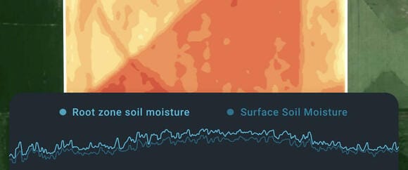
Soil Moisture
EOSDA has integrated the 250 m/px spatial resolution data available since 2015. Now, it’s time to give it another whirl and introduce an exclusive soil moisture monitoring feature. As far as the user-experience goes, nothing could be easier to handle. Two curves on one chart display the values for surface moisture and the rhizome zone moisture reserves respectively. No need for expensive facilities, just keep track of those two curves! That’s all that it takes to seriously improve yield predictions and upgrade farming decisions to a notably higher level of efficiency. With this feature, you will be able to create the most accurate irrigation plan possible. For now, this enhancement is an exclusive offer from EOSDA to its customers in the following countries:
- Ukraine
- the USA
- Brazil
- Australia
- Argentina
- Kazakhstan
- Russia
- Canada
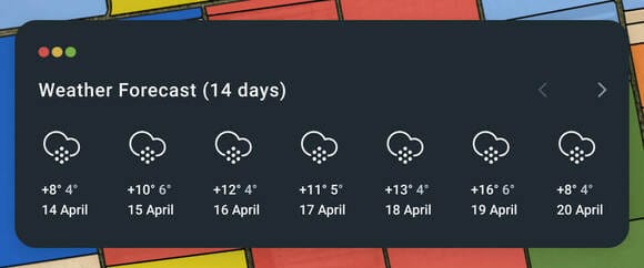
Weather +
EOSDA has teamed up with World Weather Online to provide users with constantly updated crucial weather data, including temperature, humidity, cloudiness, wind speed, and precipitation. All of this data is displayed conveniently in one menu. Farmers shouldn’t limit themselves to just current weather conditions, however. That’s why we have also equipped EOSDA Crop Monitoring with the historical data archive and a reliable 14-day forecast.
User-friendly experience does not end here: special charts combine weather data with the vegetation index curve and growth stages to create the most detailed portrait of crop development. Along with the accumulated precipitation and sum of active temperatures charts, we are giving you the key to the weather of the past, the present, and the future.
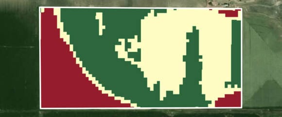
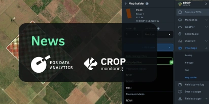
Zoning
EOSDA Crop Monitoring has been enhanced with the Zoning feature. The tool is based on the satellite imagery available for your fields and the spectral indices (NDVI, NDRE, MSAVI, NDMI, and ReCl) per pixel calculations. It is able to identify up to 7 zones with higher or lower vegetation, and to determine the size and proportion of vegetative zones. This allows you to create VRA maps (variable rate application maps) for your farm machinery for effective fertilizer application, thus saving you a lot of time and resources. As a result, it will help keep your crops growing evermore healthy and their yields increasing.
Minor Improvements
EOSDA is learning and improving continuously, aiming for nothing except perfection. We are working hard to bring amazing new features to our customers, fix every bug, and adjust the UI to the user needs. Our ultimate goal is to optimize the workflow and ensure a positive user experience. That’s why we have recently made some quality changes to the Legend and Cloud Mask on EOSDA Crop Monitoring, as well as optimized the overall speed of the product. We have also added more accuracy to the charts and made them easier to read. EOSDA believes that satellite monitoring is not just a useful agricultural tool but should be a fast and convenient experience for its users as well.
We are eager to see you try out these upgrades for yourself, so you can enjoy the benefits of satellite EOSDA Crop Monitoring directly from home: click here.
About the author:
Rim Elijah holds a double degree in business administration and political science from Stockholm University. As a VP of Sales at EOSDA, she oversees all aspects of business model development and implementation and the growth of the company’s global coverage. She has successfully established a number of strategic partnerships with an emphasis on sustainable solutions in Africa and Asia.
Detect crop risks earlier with AI-powered field alerts.

More news
Mask, Layer, And Indices: New In EOSDA Crop Monitoring
Explore the new features added to EOSDA Crop Monitoring in Q3 2024: cloud/shadow mask management, Planet data integration, new indices, activity recommendations, and mustard growth stages.
EOSDA Crop Monitoring Adds John Deere Data Integration
EOSDA Crop Monitoring users can add their John Deere data to the platform for automated data transfer and optimized VRA mapping capabilities.
EOSDA Crop Monitoring: Map Builder Feature Rolled Out
EOSDA Crop Monitoring users can now leverage their machinery’s yield data to optimize input use and crop performance with the VRA mapping capabilities of the Map Builder feature.