EOS Data Analytics (EOSDA), a global provider of AI-powered satellite imagery analytics, has announced the integration of John Deere data into its EOSDA Crop Monitoring platform.
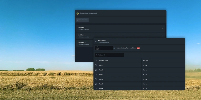
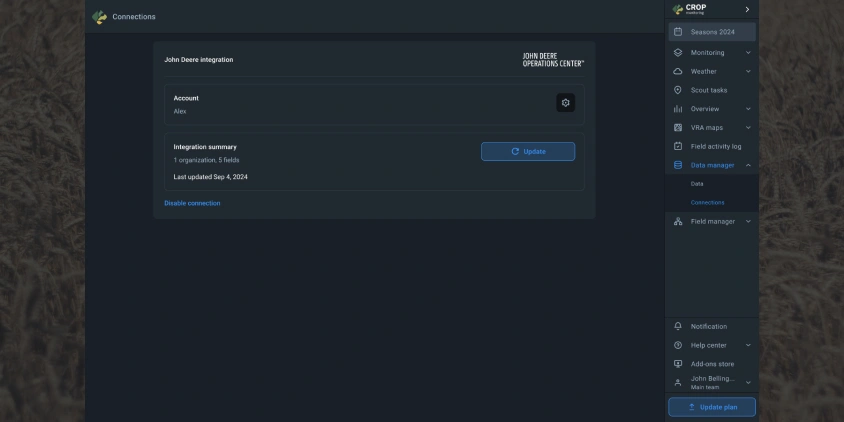
This new feature simplifies the process of managing fields and field operations data, allowing platform users to automatically synchronize information such as field boundaries, fertilizer application, seeding, spraying, and harvesting directly from their John Deere Operations Center.
For many farmers and agronomists, the manual process of transferring data between their John Deere equipment and digital platforms is both time-consuming and prone to errors. EOS Data Analytics has addressed this issue with a new feature that automates data transfer and allows the users of EOSDA Crop Monitoring, an online satellite-based precision agriculture platform for field monitoring, to visualize and store the data collected by John Deere machinery by operation type. This is particularly valuable for those who rely on accurate data for analyzing past seasons and planning future field activities.
With the support of John Deere machinery data, we’re making it easier for our users to manage their fields and field operations. This feature ensures that EOSDA Crop Monitoring users have access to reliable and timely information that is critical for optimizing their agricultural practices.
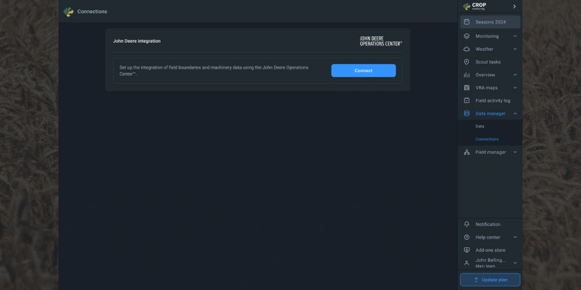
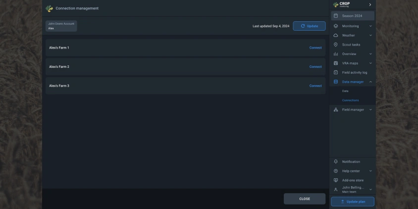
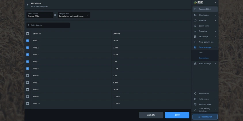
The data integration process is straightforward: the user only needs to connect their John Deere account to the EOSDA Crop Monitoring platform and select the fields of interest. Then, field boundaries and machinery data will be automatically synchronized and imported into the platform’s Data Manager. With it, the user gets the ability to manage field data across seasons, update field boundaries, and create detailed VRA maps using synchronized data.
The new feature offers significant benefits across different sectors. Farmers gain accurate insights into field operations to ensure compliance with technical norms and optimize input use. Input suppliers can conduct internal and external tests with precise data from machinery, which will come in handy in the development and refinement of technical standards. Insurance companies get access to reliable data for assessing compliance with operational standards before insuring crops. Finally, consultants can utilize accurate data from field operations to provide informed recommendations to farmers.
Unlike other platforms that may require additional subscriptions or complex workflows, EOS Data Analytics offers this feature as part of EOSDA Crop Monitoring, which makes it more accessible and user-friendly. Additionally, users can update field boundaries and data continuously without overwriting existing information.
The John Deere data integration is now available to all users of EOSDA Crop Monitoring, offering a powerful tool for enhancing precision farming practices and improving overall field management.
About the author:
Maksym Sushchuk is at the forefront of realizing EOSDA's vision to make space tech a global driver of sustainability on Earth. He has over 15 years of experience in journalism and content creation for prominent Ukrainian startups, charitable funds and ESG businesses. As Head and Co-founder of PR Army Maxim brings attention to the human and social tolls of the aggression against Ukraine.
Detect crop risks earlier with AI-powered field alerts.
More news
Updated VRA Maps And More: New In EOSDA Crop Monitoring
Explore the latest EOSDA Crop Monitoring features, including redesigned VRA maps, crop variety integration, global risk maps, free Davis station access, and more, all released in Q2 2024.
Free Access To EOSDA Crop Monitoring For Ukrainian Farmers
EOSDA, an expert on the local market, provides Ukrainian farmers, agrarians, and agribusinesses with 500 hectares of free access to EOSDA Crop Monitoring in 2024 for a period of 3 months.
Yield Estimation & More: New In EOSDA Crop Monitoring
EOSDA Crop Monitoring is constantly developing and answering clients’ demands for precision agriculture features. Discover January-March 2024 updates: Yield estimation, Typical growth index, and more.