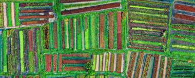
Soon Ukraine is about to lift the moratorium on the sale of farmlands. In this regard, EOSDA Crop Monitoring platform has launched an interactive satellite map showing the real state of the national agribank. The data allows to reevaluate the actual size of the fields which is why multiple regions have revealed to contain more farmland than the national registry.
The map allows to evaluate the field sizes effectively and find unregistered fields, anomalies in crop rotation and analyze the culture map by the regions. This will enable all the market players including insurers, national companies as well as investors to assess the state of the fields, historical data on individual fields, their accurate size, and many other things.
For example, you can see that the crop coverage of rapeseed in Kherson region is 117,8 thousand hectares. It’s 33% larger than in official records. When shifting our view towards the Dnipro region you can easily observe 136,4K hectares of fields within the unregistered farmland.
The new crop map by EOSDA Crop Monitoring leverages the results from a research done by EOS Data Analytics together with NASU Institute of space research as well as the State Space Agency of Ukraine within the “Supporting Transparent Land Governance in Ukraine” program by the World Bank. Currently the results are being used by the Ministry of economic development, trade and agriculture of Ukraine.
The main goal of the program is to support the transparency of land resources on part of the government as well as private landowners.
“This synergistic project between a private company, engineering teams, international donors and Ukrainian government creates a precedent of how the applied satellite monitoring is used by the market. The key representative criteria of our achievement is transparency. Processes that are invisible and often concealed intentionally can effectively be tracked from space. The monitoring technology of EOS is, above all, aimed at optimizing of all available resources and their rational expenditure. Not just for the sake of agriculture as it is, but also towards the resolution of global ecological issues. Today, the space is more open than it ever was, and we are already putting the know-how we’ve built into practice” – as commented by Max Polyakov, the managing partner and owner of EOSDA.
The map created by EOSDA Crop Monitoring is available via eos.com/cropmap/.
About EOS Data Analytics
EOS Data Analytics is an international company, providing and processing hi-res space imagery. It is partnering with the leading providers of space information, delivering data from Landsat, MODIS and Sentinel missions.
EOSDA Crop Monitoring is a public online solution with AI-based algorithms for satellite data processing to monitor and analyze the effectiveness of farmlands.
About the author:
Rim Elijah holds a double degree in business administration and political science from Stockholm University. As a VP of Sales at EOSDA, she oversees all aspects of business model development and implementation and the growth of the company’s global coverage. She has successfully established a number of strategic partnerships with an emphasis on sustainable solutions in Africa and Asia.
Detect crop risks earlier with AI-powered field alerts.

More news
Mask, Layer, And Indices: New In EOSDA Crop Monitoring
Explore the new features added to EOSDA Crop Monitoring in Q3 2024: cloud/shadow mask management, Planet data integration, new indices, activity recommendations, and mustard growth stages.
EOSDA Crop Monitoring Adds John Deere Data Integration
EOSDA Crop Monitoring users can add their John Deere data to the platform for automated data transfer and optimized VRA mapping capabilities.
EOSDA Crop Monitoring: Map Builder Feature Rolled Out
EOSDA Crop Monitoring users can now leverage their machinery’s yield data to optimize input use and crop performance with the VRA mapping capabilities of the Map Builder feature.