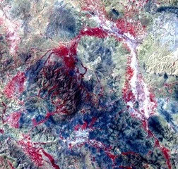
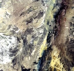
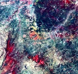
Landsat 4 (MSS) Satellite Images
The LANDSAT project commenced in 1972 with the launch of the Landsat 1 spacecraft. Initially, the system was operated by the National Aeronautics and Space Administration (NASA) of the United States, and in 1983 was transferred to the National Oceanic and Atmospheric Administration (NOAA).
Landsat 4 was launched on July 16, 1982. MSS sensors were identical to those on the previous Landsat satellites. The four spectral bands were numbered from 1 to 4, since RBVs were no longer used.
MSS sensors acquired images of the Earth from July 1972 to January 1999. The imagery collected during the first decade of these missions predates most other operational imaging efforts, providing a unique view of the Earth that was not available elsewhere. These early missions also provided the first digital remote sensing products to the scientific community.
Landsat 4 (MSS) Characteristics
| Characteristic | Description |
|---|---|
| Participants |
|
| Launch Date | July 16, 1982 |
| Vehicle | Delta 3920 |
| Site | Vandenberg Air Force Base, California |
| Spacecraft |
|
| Communications |
|
| Orbit |
|
| Sensors |
|
| Scene size | 170 km x 185 km (106 mi x 115 mi) |
| Design life | Minumum of 3 years |
Landsat 4 (MSS) Bands
| Sensor | Band number | Band name | Wavelength (μm) | Resolution (m) | Band Applications |
|---|---|---|---|---|---|
| MSS | 1 | Visible Green | 0.5 – 0.6 | 60 | Sediment-laden water, delineates areas of shallow water |
| MSS | 2 | Visible Red | 0.6 – 0.7 | 60 | Cultural features |
| MSS | 3 | NIR | 0.7 – 0.8 | 60 | Vegetation boundary between land and water, and landforms |
| MSS | 4 | NIR | 0.8 – 1.1 | 60 | Penetrates atmospheric haze best, emphasizes vegetation, boundary between land and water, and landforms |