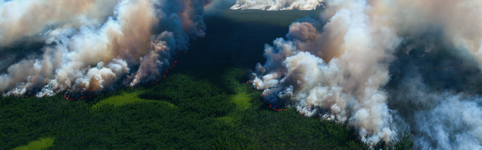
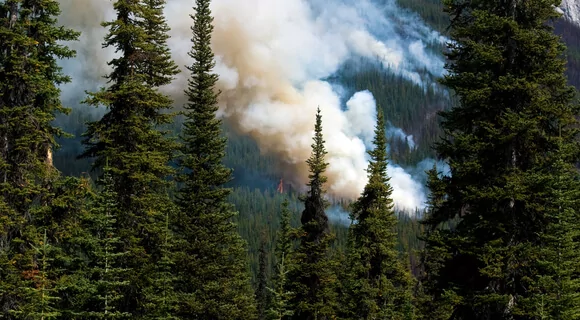
The importance of wildfire prevention is best illustrated with overwhelming statistics. According to the US Forest Service, nearly 7.5 million acres are lost to wildfires across the United States yearly, with a risk of damage to every state. Sadly, the anthropogenic factor is by far the main culprit of the catastrophic losses, which demands various wildfire prevention strategies.
Among the numerous strategies of how to prevent wildfires from spreading, the most effective one is never to let it happen. Forest fire prevention and control are possible with effective agricultural and forest management plans, alongside public awareness, responsibility, and concern.
Weather Conditions: Posed Danger & Wildfire Prevention
Certain weather causes forest fires by itself, but human activities aggravate the situation even more. For example, typical natural forces setting forests on fire are as follows:
- high temperatures raise the flammability of dry grass, leaves, trunks, or pine tar;
- strong winds speed up wildfire spreading;
- climate change and droughts intensify and prolong forest fire seasons, particularly, in the Amazon basin;
- lightning provokes ignition in dry forest trees.
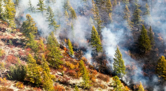
Therefore, in wildfire prevention, it is crucial to know wildfire hazards due to natural factors. When planning regular operations and thinking of how to prevent a wildfire from happening, foresters should consider current and upcoming weather conditions and their danger to forests.
When it is too hot or windy, sparkles from the working equipment or vehicles may ignite the dry grass or leaves and leap to large territories due to winds, causing wildfires. The problem with wildfires is that it is not always possible to spot them, understand the scope, and take actions otherwise than with remote sensing.
Being aware of the current and upcoming forest fire hazards or detecting smoke on time is always essential in preventing wildfires.
Preventing Wildfires Hazard From Vehicles
Driving off-road in nature, within the proximity of dry crop residue and forests, demands extreme caution in terms of wildfire prevention. Exhaust temperature is often high enough to set dry grass or straw on fire, with potential danger to nearby forests. In fact, exhausts can be as hot as 1200 degrees F . A mere sparkle from the overheated engine, poorly greased bearings, dragging safety chains, or worn-out tires can lead to wildfires, too. Thus, to prevent wildfires, it is essential to:
- undertake technical checkups regularly;
- have properly functioning spark arrestors;
- never park near dry grass, especially, close to forests;
- have a shovel and a fire-extinguisher;
- carry a bucket or anything suitable to fill with water;
- store a reservoir with water or sand;
Wildfire Danger From Equipment And Sparks & Prevention Tactics
Equipment and machinery may present a certain wildfire danger, too. First, working with spark-producing tools must be avoided near dry vegetation. Second, hot equipment may be a source of ignition. Third, refueling heated engines is never allowed since it leads to combustion. Taking these risks into consideration, it is necessary to develop wildfire prevention techniques. This will ensure safety when working with potentially dangerous tools.
How to prevent wildfires in this case? Simple yet vitally important measures will do a lot of good, which includes:
- cooling down the engine before refueling;
- clearing up the working place from any flammables 10 to 25 feet around;
- avoiding the use of heating and spark-producing equipment near dried-up vegetation;
- restraining from working with potentially dangerous equipment in dry and windy weather;
- providing fire-extinguishing equipment for wildfire prevention concerns.
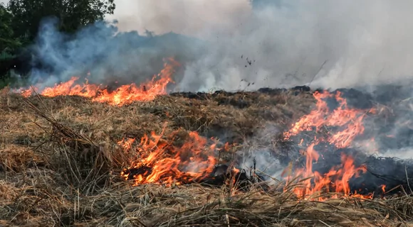
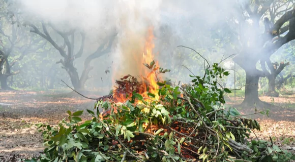
Preventing Wildfires Due To Agricultural Activities
Improperly planned agricultural operations also contribute to wildfires statistics if people ignore wildfire prevention tips, don’t take safety measures, and don’t consider the weather specifics. The main contributors are slash-and-burn practices, debris burning on the agricultural lands and households close to forests, and the use of flammable liquids.
Managing large burning territories is next to impossible, which leads to severe deforestation due to wildfires. Therefore, any prescribed burnings should always have thorough forest management plans to prevent fire.
Slash-And-Burn
Slash-and-burn practices are used for agricultural land expansion by cutting forests and burning dried vegetation. The ashes provide nutrients boosting soil fertility. However, this method has significant disadvantages regarding forest fire prevention, too. It not only deprives rare biodiversity species of their habitat but often goes out of control, setting even unintended territories on fire. Thus, it is essential to control a forest fire to prevent worse fires.
Under certain conditions, the wind may spread a wildfire to dozens of miles away from the source of ignition. That’s why if a field is far away from forest, it does not mean that the fire cannot reach. Unfavourable conditions may make the situation devastating.
Debris Burning
It is typical for some farms and especially households to burn leaves, crop residues, and other agricultural wastes. Such an approach is faster and more convenient than taking them away. Yet, in close proximity to forests, it presents certain wildfire risks and harms the environment, not to mention that it is illegal in many countries and the US states.
In this regard, for wildfire prevention reasons, it is ultimately important to obey the applicable laws and restrictions. People must never burn debris under dangerous weather conditions because the fire may spread to forests nearby, causing severe wildfires.
Besides, the ashes should be properly extinguished with water and stirring for forest fire prevention concerns as glowing remnants inside may result in fire even after several weeks. When burning wastes, it is prohibited to throw questionable materials into the fire (e.g., plastic, oil- or petrol-soaked fabrics, etc.) since they may lead to unexpected explosions and produce poisonous fumes.
Use Of Flammable Liquids
Solvents, fuel, degreasers, and other flammables are indispensable on any farm but put it at high risk of inflammation, also leading to wildfires. For this reason, it is vital to follow all storage and precaution guidelines. In particular, ways to prevent wildfires with flammable substances comprise:
- keeping out of the reach of children and ignition sources;
- storing in a designated place, away from living houses and separately from drinks and food;
- labeling fuel reservoirs and regular checking them for leaks and breaks;
- avoiding exposition to high temperatures and sun rays to prevent flashing;
- restraining from smoking when refueling, being in the storage areas, and otherwise handling flammable liquids;
- controlling electrical lines for short-circuit and other safety issues;
- following instructions for use.
Wildfire Prevention With EOSDA LandViewer
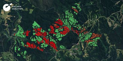
Effective wildfire prevention starts with one key ingredient: timely information. Whether it’s tracking vegetation stress, monitoring moisture levels, or identifying dry fuel build-up, staying ahead of wildfire risks requires up-to-date insights. EOSDA LandViewer, a powerful near-real time satellite imagery viewer, offers access to satellite-based tools that help transform raw data into concrete actions within a well-informed wildfire prevention plan.
Monitoring Vegetation Health to Predict Fire Risk (NDVI)
Vegetation that becomes stressed or overly dry is much more likely to catch fire. That’s where NDVI (Normalized Difference Vegetation Index) proves useful. It uses satellite data, including Landsat-8 and Sentinel-2 satellite imagery, to show which areas are thriving and which are under stress. High NDVI values indicate lush, healthy plants, while lower values signal areas that are vulnerable to drying and ignition.
On July 13, 2021, the Dixie Fire ignited near Cresta Dam in the Feather River Canyon, a rugged and heavily forested region characterized by steep slopes and dense vegetation. These natural features, combined with prolonged drought, extremely dry fuels, high temperatures, and low humidity, created the perfect conditions for a wildfire to spread rapidly and with devastating intensity. The fire quickly gained momentum, overwhelming firefighting efforts and forcing evacuations across multiple counties. By the time it was finally contained, it had scorched more than 963,000 acres, earning the grim distinction of being the largest single (non-complex) wildfire in California’s history.
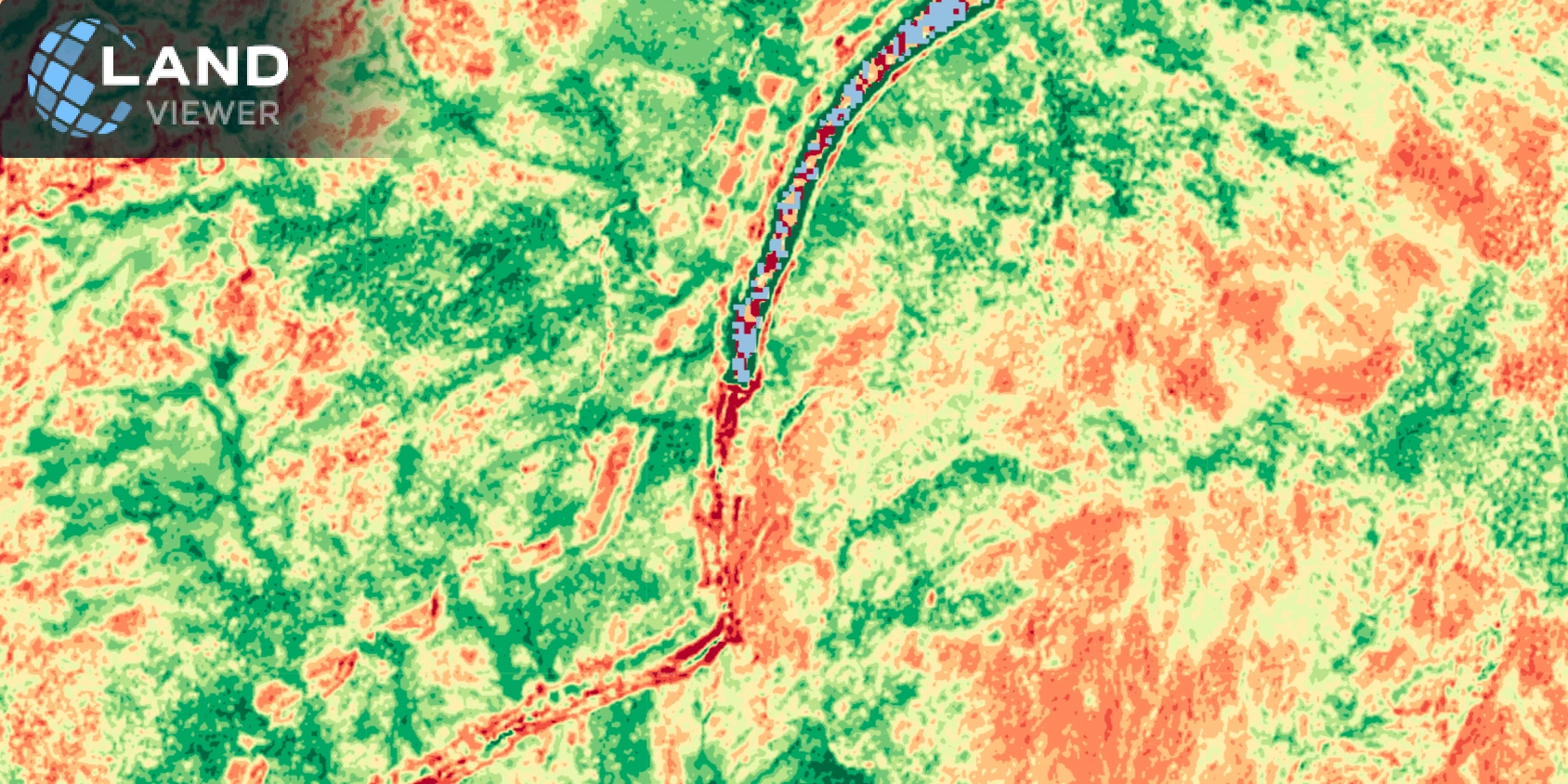
Tracking NDVI over time helps identify potential hotspots so that firebreaks, controlled burns, or surveillance efforts can be focused in the right areas. It’s a simple yet effective practice to prevent wildfire.
Spotting the Drying Process Early (NDMI)
NDMI (Normalized Difference Moisture Index) helps detect moisture loss in vegetation, making it a reliable tool for early identification of high-risk zones. As plants lose moisture, their vulnerability to fire increases.
EOSDA LandViewer enables users to monitor NDMI trends over time to spot areas drying out more quickly than others. These early warnings support faster, more strategic decisions, such as prioritizing regions for water retention or increased monitoring, as part of a larger wildfire prevention plan.
Tracking Live Fuel Moisture (NDWI)
NDWI (Normalized Difference Water Index) focuses specifically on how much water is present in live vegetation. It offers a closer look at fuel moisture, one of the most important indicators of wildfire susceptibility.
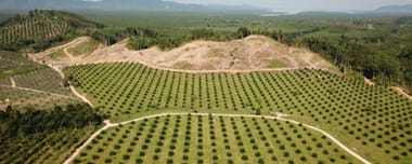
Low NDWI values point to drying leaves and plants, which can quickly become flammable. This is particularly relevant in forests already weakened by tree diseases or affected by environmental degradation such as palm oil deforestation. Monitoring NDWI allows users to anticipate areas of concern and implement targeted solutions to prevent wildfires before the threat escalates.
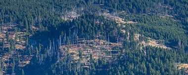
Understanding Where Fuel Loads Are Building Up (NBR)
NBR (Normalized Burn Ratio) is widely used after fires to assess damage, but it can also serve as a proactive measure. It reveals areas where dead vegetation or biomass is accumulating, which means pointing out conditions that can increase fire risk.
With EOSDA LandViewer, users can compare NBR values over different time periods to identify declining vegetation health and evaluate whether fuel has built up in particular zones. This insight is essential for targeting efforts like thinning or debris removal, helping forest managers apply a proactive practice to prevent wildfire, especially in ecosystems prone to recurring fires.
Improving Fire Risk Insights in Semi-Arid Regions (SAVI)
In areas with sparse vegetation or exposed soil, traditional indices like NDVI may not be fully accurate. SAVI (Soil-Adjusted Vegetation Index) addresses this by correcting for soil reflectance, giving a clearer picture of actual vegetation conditions.
Using SAVI through EOSDA LandViewer helps identify dry patches and track fuel continuity across open areas. These insights are especially valuable in Mediterranean regions, savannas, or transitional landscapes, where fires can spread quickly. SAVI supports more accurate planning and a better-informed wildfire prevention plan tailored to the local environment.
Prevent Forest Fires That Can Ignite From Tools And Vehicles!
What are forest fire prevention methods when dealing with tools and vehicles?
- Don’t refuel a car when the engine is hot.
- Don’t park near dry vegetation.
- Don’t operate sparkling tools near dry grass.
- Don’t use such equipment when the weather is windy and dry.
- Make sure exhaust spark arresters function properly.
- Always have a fire extinguisher ready.
Carelessness with fire in forests and nearby territories brings the trouble of wildfires. In fact, the US Forest Service estimated about 6.7 thousand fires with more than 1.6 million acres as the 5-year average in 2012-2016.
Fire prevention in forests is ultimately important as it greatly helps in the timely detection of hot spots, localization of ignition sources, and mitigating losses due to wildfires. In this regard, satellite forest monitoring and data analytics with EOSDA LandViewer software, prove useful as a forest fire prevention new tech.
About the author:
Natalia Ivanchuk holds a Master’s degree in Applied Mathematics from the National University of Water and Environmental Engineering. She is an author of 60+ scientific publications, monographs, and other scientific works.
Natalia's expertise and constant desire to learn and perfect her programming skills (C++, C#, JS, Python), has been most beneficial for EOS Data Analytics.
More news
How EUDR Compliance Drives Demand For Satellite Data
The European Deforestation Regulation (EUDR) has increased demand for satellite monitoring. Learn how businesses use satellite data to ensure compliance and gain a competitive edge.

How To Comply With New EUDR Using Satellite Solutions
The new EU Deforestation-free regulation EUDR is revolutionizing the way that commodities are imported to Europe. EOS Data Analytics experts share the main takeaways and recommendations on how to comply.
Forest Fragmentation: Far-Reaching Effects And Remedies
Forest fragmentation has a severe and far-reaching impact on the ecology. Communities and governments worldwide are now urged to seek lasting solutions to this pressing issue.