As accurate watering practices have a direct effect on harvest quantities, soil moisture sensors have become an indispensable tool in modern agriculture. While there are many types of soil moisture monitoring sensors, modern satellite sensors are in a class of their own because they can track ground moisture levels remotely without the need for actual installation. We can use the information gathered by soil moisture sensor systems to make better decisions in many areas of precision agriculture and related industries.
What Is A Soil Moisture Sensor?
A soil moisture sensor, as its name implies, is an appliance for monitoring the moisture levels in the soil. Integrating this tool in the irrigation system may allow for more precise watering scheduling than is possible with past information or weather forecasts.
Both conventional approaches have some drawbacks that farmers need to be aware of:
- relying on historical data limits adaptation to unexpected weather shifts;
- planning irrigation based on projected crop evapotranspiration, agriculturalists must perform some calculations (often complex) for each field’s unique conditions.
By contrast, modern soil moisture measurement sensors provide significantly more precise readings and display results in near real-time. These readings allow farmers to effortlessly reduce or increase watering for optimal crop development.
Types Of Soil Moisture Sensors
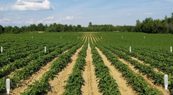
Soil moisture sensors are one of the cornerstone instruments of smart farming. They are continually evolving to become more user-friendly. In contrast to older, more cumbersome methods, today’s smart soil moisture sensors can transmit data wirelessly, be deployed at varying depths, and upload readings directly to a GIS database, eliminating the need for manual data collection.
Furthermore, sensors are not limited to being stationary; they can also be portable. Data may be collected from any area and depth with portable devices as opposed to stationary ones.
Based on the underlying technology, there are the following soil moisture sensor types:
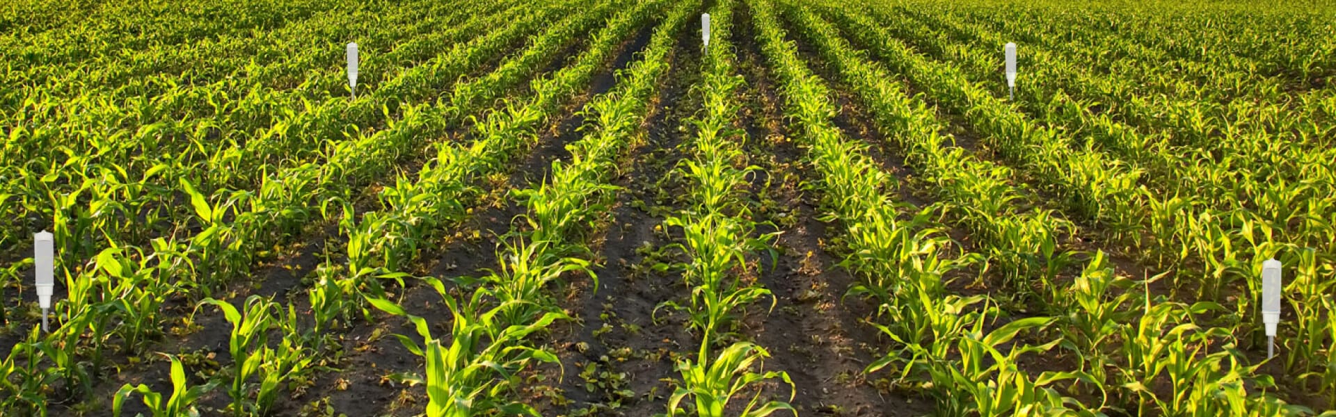
- ground — installed below the ground to monitor the root zone conditions;
- aerial — retrieving data with unmanned aerial vehicles (UAVs), which is an uncommon practice in soil moisture mapping;
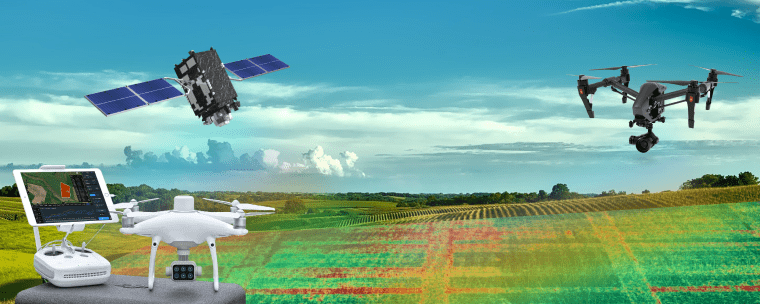
- satellite — estimating the situation from space. They do not interfere with activities in the field, help save costs, and don’t require labor-consuming installations.
To further categorize sensors, we might consider the indicators of ground moisture content that they measure. We’ll delve deeper into these categories below.
Volumetric Soil Moisture Sensor
Volumetric moisture sensors for soil determine the water-to-soil volume percentage. Two common varieties of volumetric sensors are neutron probes and electromagnetic sensors.
Neutron Probe
Neutron probes have been extensively used in American agriculture since the 1950s. When placed underground, this probe releases low radiation in the form of neutrons, and its sensor detects particles’ impacts with the hydrogen atoms in the water.
Despite their extreme precision, neutron probes are costly, need careful handling, and often require federal registration due to the radioactive elements employed to release neutrons.
Electromagnetic Sensors
Electromagnetic sensors have been alternatives to neutron probes since the late 1980s. Let’s consider the most typical examples of electromagnetic sensors:
- Capacitance or frequency-domain refractometry (FDR) sensors generate an electromagnetic signal and analyze the frequency shift between the outgoing and reflected waves.
- Time-domain reflectometry (TDR) soil moisture sensors use voltage on parallel rods to cause pulses, which are then reflected to the device for analysis.
- Transmissometry sensors in the time domain (TDT) share the same principle as TDRs but utilize a closed circuit with the rods connected in a loop. Similar to time-domain reflectometers, the speed of the returned pulse will be lower in damp ground than in dry ground.
Soil Water Tension Sensors
Soil water tension determines energy expenditure for plant roots to uptake water. With less groundwater available, the earth becomes more tense. Saturated ground has near-zero water tension.
However, depending on the type of soil, tension readings can be deceptive. Adjusting soil tension limits requires careful crop and land observation. You can avoid water scarcity by keeping tabs on soil stress levels and irrigating ahead of time if necessary.
Soil tension is measured via the following types of devices:
- Tensiometer soil moisture sensor. It features a porous ceramic tip hermetically sealed to the bottom of a plastic tube containing water and capped off with a detachable, airtight cover. The tension is read by a vacuum gauge in the tube.
- Electrical resistance sensor. By monitoring the change in electrical resistance between two wire grids implanted in a block of any material that keeps its water content balanced with neighboring ground, these sensors indirectly assess soil tension. A block’s internal electrical resistance is translated into a measure of tension using the manufacturer-provided calibration curve.
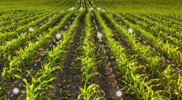
Satellite Soil Moisture Sensors
When it comes to gathering accurate and timely information, satellite remote soil moisture sensors never let you down because of their ability to analyze infrared (IR) emissions. Farmers can use this information in conjunction with satellite photography to monitor water content in the ground at all times and respond appropriately to any changes.
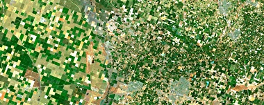
Ground moisture can be measured by satellite even in remote areas where physically installing sensors would be too time-consuming or difficult. Satellites may survey expansive regions, and specialized GIS software will then detail those regions into many distinct zones on field maps.
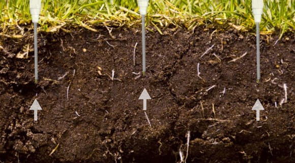
Sensor Installation And Calibration Routine
Having decided to utilize a soil moisture sensor system, you will need to install, calibrate, and adjust them constantly. Manufacturer-provided calibration functions are typically refined in controlled laboratory settings. However, factors like soil temperature, texture, bulk density, and soil salinization affect soil moisture sensor accuracy . This is the point at which designated specialists complete various operations, such as determining:
- device locations;
- distance from each other;
- their number;
- depth of installation;
- the way the sensors are placed;
- time of recalibration;
- data reading and interpretation.
Apart from this routine, employees have to fix devices that are out of service, validate the accuracy of data, and elaborate irrigation patterns. Sensor specialists have a tough job since there’s not one universally accepted way to test soil moisture sensors.
Among all types of sensors, satellite software is the one that really saves you trouble. Monitoring apps are user-friendly and available on many devices, including a PC, a laptop, a tablet, or even a smartphone. Thus, you are able to know what is happening in your field anywhere and anytime, provided you have internet access. Such apps enable farmers to detect the issue remotely and react in a timely manner.
Reading And Interpreting The Sensor Data
When the information is retrieved, you need to be able to interpret it correctly. Different types of sensors provide different kinds of data, requiring different approaches. Additionally, it may be hard to distinguish between a soil moisture sensor that is functioning properly and one that is providing useless data . Thus, the accuracy of interpretations directly depends on the skills of an employee. Yet, not every agricultural producer or landowner can afford to hire trained professionals, and, as we can see, they do not always have to.
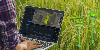
Online monitoring apps simplify the task. You get water content values for any date and any field you select. The curves on a graph promptly report on the situation and allow for managing the problem.
Precision Irrigation And Other Applications Of Soil Moisture Sensors In Precision Farming
Over the growing season, the land goes through a wide range of changes. Farmers used to scout fields and collect samples for soil testing, allowing them to learn about water and ground conditions. Then, it could take a few weeks for the laboratory to analyze these samples.
Luckily, modern sensors aid farmers in adapting to fluctuations in field conditions. Farmers and agritech companies can swiftly respond to these changes by using soil moisture sensors to keep an eye on specific areas of the field. When comparing irrigation scheduling strategies based on evapotranspiration loss and plant response to water stress, the soil-moisture-based approach emerges as the most straightforward . Soil moisture sensor data, weather information, and crop history can all be transformed into valuable insights for growers and landowners, who can then incorporate this into their precision agriculture practices.
There are a variety of applications of soil moisture sensors in agriculture, but one of the most crucial is tracking moisture levels near plant roots to cut down on wasteful water use. Increased crop yields, reduced water consumption, protection of local waters from depletion, and lower energy and fertilizer costs, all of which result in higher farmer profits, are just a few of the many upsides to using soil moisture sensors for irrigation.
In addition to being employed for managing irrigation, soil moisture sensors play a significant role in the following areas of precision agriculture:
- greenhouse monitoring and control;
- fertigation management;
- analyses of water balance;
- classification of watersheds;
- foreseeing the spread of crop diseases;
- plant (phyto) ecology;
- soil solarization;
- assessing soil health, and many more.
How EOSDA Crop Monitoring Helps For Precise Soil Moisture Estimation
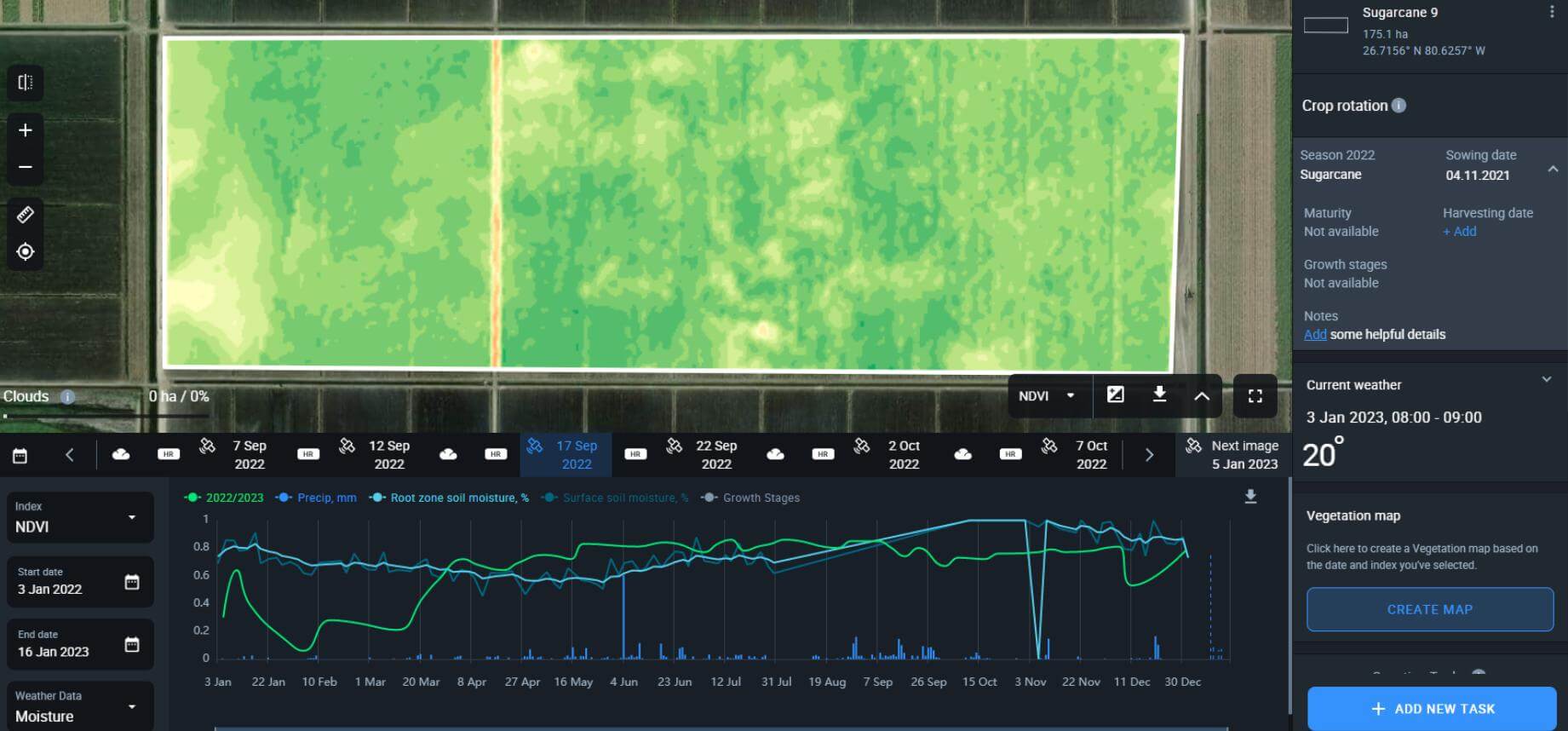
Farmers, agronomists, insurance agents, and traders can all benefit from using EOSDA Crop Monitoring, which contains a wide range of features. Functionality on the platform is regularly updated and enhanced. One of its relatively new features is the estimation of soil moisture based on the ratio (in %) between the water volume in the ground and the whole soil volume. For the purposes of pattern analysis and field irrigation scheduling, EOSDA also stores historical ground moisture data dating back to 2002.
EOSDA Crop Monitoring estimates moisture on two different levels, both of which are critical for the decision-making process:
- soil surface: 0–5 cm (0–2″);
- root zone/rhizome: up to 70 cm (27.5″).
The significant benefit of the platform is the insights it provides by mining satellite data for patterns and trends. Such details as crop yields, precipitation totals, and vegetation indices are all compiled into a single graph as per these parameters. This way, you can get the full analytic picture in one place. Our smart farm platform displays the curves in the following sequence: vegetation — root zone moisture — soil surface moisture.
Benefits Of EOSDA Crop Monitoring For Water Content Assessment
If you have access to a computer, laptop, or tablet with an internet connection, you can check the dynamics without ever going out to the field. Unlike ground-based sensing devices, satellite-based soil moisture sensor apps are less expensive and don’t require professionals to deploy and maintain them.
EOSDA Crop Monitoring provides additional data beneficial for various participants in the agricultural business. Information on water content, alongside a plethora of other parameters, enables farmers to create elaborate irrigation patterns and schedule precision irrigation events. As opposed to merely reporting on the data at a particular spot, the platform’s algorithm calculates an average for the entire field.
How Various Sectors Make Use Of EOSDA’s Moisture Tracking
With the aid of satellite monitoring, agricultural cooperatives can assess the ground moisture levels of all their fields at once, allowing them to better allocate their irrigation budgets and focus watering efforts only where they are truly necessary. Agricultural co-ops will also gain added value from the data collected because they will be better equipped to provide guidance to their farmer members on a wide range of issues, including fertigation, planting, and more.
Insurance agents can track and compare ground moisture readings from the past and present to determine coverage and premiums.
Similarly, API developers working on IT solutions for the agro-industrial sector can leverage soil moisture sensor API data to improve their products.
As of now, EOSDA’s soil moisture feature is available for the following countries:
- the USA;
- Canada;
- Brazil;
- Argentina;
- Ukraine;
- Russia;
- Kazakhstan;
- Australia;
- Indonesia.
The list is constantly updated as we plan to go global. In the meantime, we offer custom solutions worldwide, regardless of your country. To order a custom project, contact our sales department at sales@eosda.com.
Why Is Soil Moisture Monitoring Important?
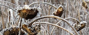
Sufficient water saturation is vital for plant development, and it is the farmer’s foremost task to maintain it. Lack of irrigation leads to fading since plants put all their efforts into absorbing scarce water with their roots, leaving no energy to ripen and yield good crops. Sufficient moisture, however, helps the plants survive regular stress events, staying healthy and achieving full development. Excessive watering, on the other hand, causes root rot and cuts off the oxygen supply, eventually destroying the plant.
As can be seen, without keeping water content levels stable, the situation can turn unfavorable either way. This is why soil moisture sensors for agriculture are indispensable farming tools, while online agricultural applications with soil moisture features are efficient, reliable, and relatively cheap.
Satellite remote sensors are a perfect bargain when it comes to comparing the amount of input or effort required to use them with the amount and quality of data they are capable of providing. Their integration into the daily farming routine helps improve plant growth by empowering farmers to more effectively manage water excess and deficiency risks.
About the author:
Vasyl Cherlinka is a Doctor of Biosciences specializing in pedology (soil science), with 30 years of experience in the field. He attended the engineering college in Ukraine and received his degree in agrochemistry, agronomy and soil science in the Chernivtsi National University. Since 2018, Dr. Cherlinka has been advising EOSDA on problems in soil science, agronomy, and agrochemistry.
Detect crop risks earlier with AI-powered field alerts.

More news
Big Data In Agriculture Backed By Satellites & Sensors
The days when big data in agriculture was only for tech-savvy large farms are over. Today, easy-to-use platforms make it accessible to any farmer ready to work more efficiently.
Top Ready-Made Agriculture Tools & Softwares for 2025
Agriculture softwares are silent partners in the field, working tirelessly behind the scenes to support farmers with insights and precision to cultivate sustainable agricultural ecosystems.
GIS In Agriculture: Best Practices For AgriTech Leaders
It's hard to overstate the role of GIS solutions for agriculture, particularly for global industry leaders. If you strive for productive and sustainable farming, look at GIS systems that can track a variety of factors over vast areas worldwide.