From raw satellite data to advanced AI-driven intelligence
Make strategic decisions with easy-to-read reports and clearly visualized satellite data.
Trusted by:


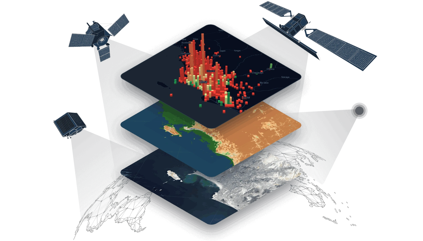
EOS Data Analytics is a global provider of satellite data and intelligence that bridges the gap between raw orbital data and the business decisions you need to make.
While operating the EOS SAT-1 satellite alongside 20+ partner constellations, we focus on what matters on the ground. Our proprietary AI algorithms transform vast amounts of imagery into clear visualizations and data-to-decision reports, ensuring you get the exact insights rather than raw pixels.

Our core platforms
EOS RayVision
Get tailored analytical reports that turn complex data into clear, visual stories for any industry.
LandViewer
Search, visualize, and analyze satellite imagery directly in your browser.
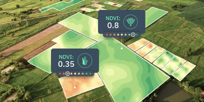
Crop Monitoring
Track crop health and field conditions with a precision agriculture tool through the entire growing season.
Solutions
-
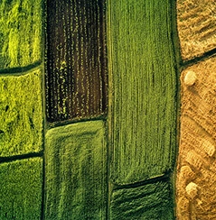
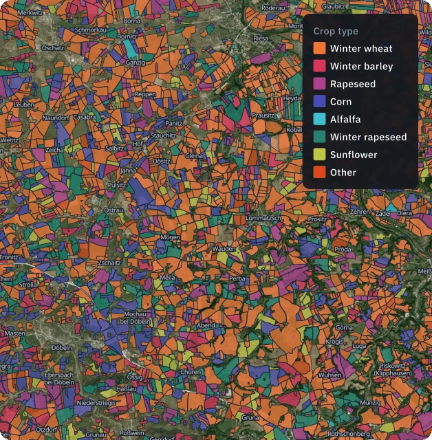
Crop classification
Identify crop types and field boundaries with high-accuracy ML models. Get reliable maps to optimize logistics and field management.

-
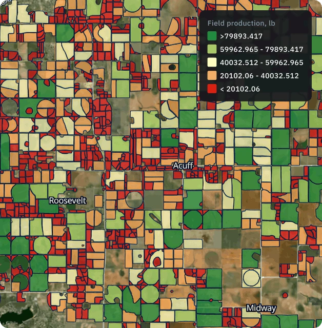
Yield prediction
Forecast crop production levels with confidence. We combine biophysical and ML models to deliver regional yield estimates across any season.
-
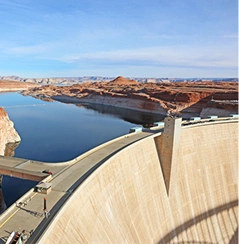
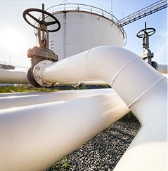
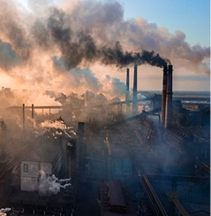
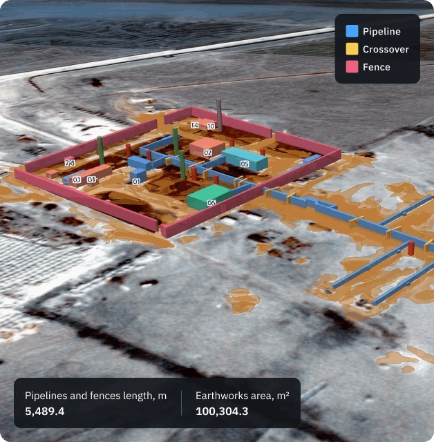
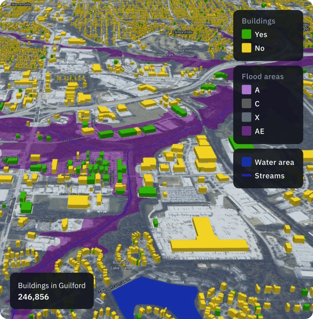
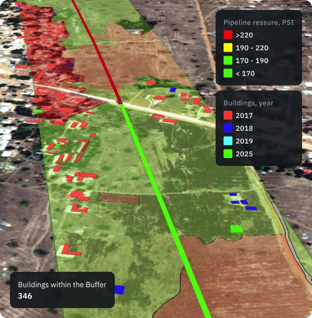
Infrastructure monitoring
Keep an eye on infrastructure assets. Monitor pipelines, dams, mines, and remote equipment activity for safer and efficent operations.
-
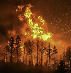
Damage mapping
Speed up recovery and prevent losses with rapid disaster analysis and contamination detection. Perfect for verifying insurance claims and coordinating emergency response.
-
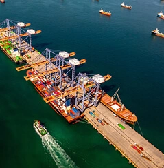
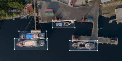
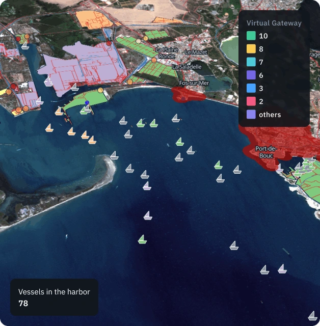
Maritime surveillance
Track vessel movement and port activity from space. Get the insights you need for security, compliance, and global logistics.
-
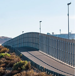
Border security
Secure border zones by identifying new trails, unusual activity, and terrain changes to help patrols prioritize their response.
-
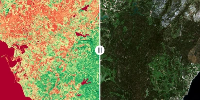
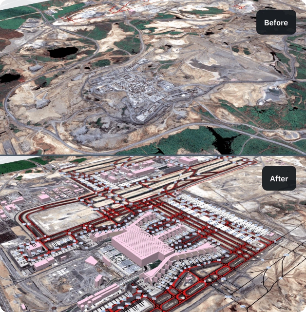
Change detection
Spot meaningful shifts on the ground using clear before and after satellite imagery by EOSDA. Receive alerts for new land use changes for faster investigation.
-
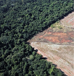
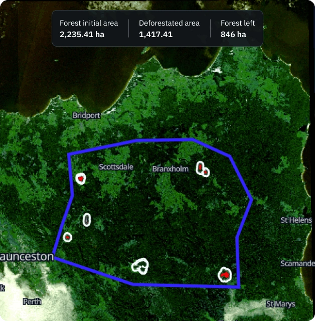
Deforestation detection
Protect natural resources with canopy-loss alerts. Track forest health and illegal clearing to support restoration and reporting.
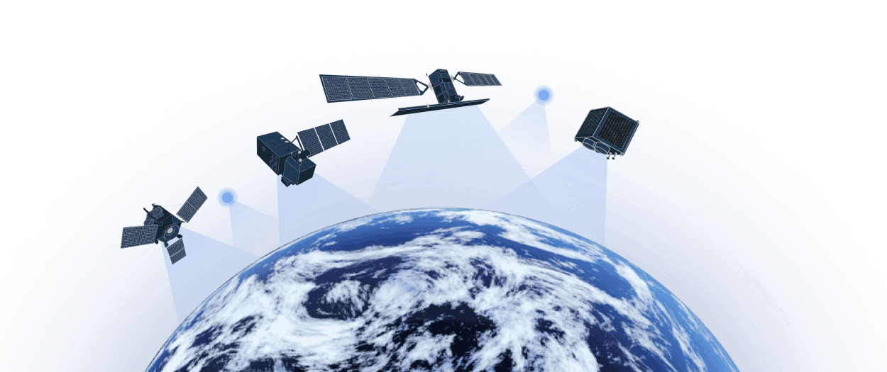
The satellite fleet behind your insights
EOSDA provides solutions for any corner of the globe by combining exclusive data stream from EOS SAT-1 with an additional extensive network of over 20 satellite constellations.
Due to the partnership with optical, SAR, and thermal data providers, we offer everything from high-resolution to ultra-high-resolution imagery and analytics on top of it.
Our partner ecosystem


Case studies & proven results

EOSDA Forecasts Yields For 2025 In Saskatchewan

Digital Tools Improve Soil Health And Yields In Mexico
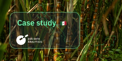
EOSDA Models Climate Change Impact On Sugarcane Yields
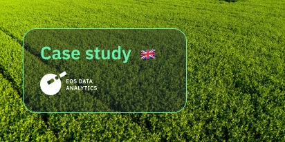
UK Farming Cooperative Uses SatTech To Optimize Harvest
EOSDA With Crosscheck Analyzes Soybean Fields For EUDR
Analyzing Seized Arable Land In Ukraine For PEJ
EOSDA Validates Sugarcane Mapping In São Paulo
Mapping Iowa: Smarter Crop ID And Field Boundaries
Boundaries And Crop Types: A Custom Project In Texas
Changing Sugarcane Yield Estimation In São Paulo
Testimonials
We found that automated EOS Data Analytics reporting saves time and increases accuracy. This adds value to the business by having accurate records for harvest monitoring and forward scheduling of crews. We are also able to obtain information on cloudy days which occur a lot in the winter months.

From nationwide field boundaries to yield prediction, EOSDA handles the heavy lifting. We’ve relied on them for years because they make complex data simple and usable for our team. They are fast, adaptable, and consistently accurate.

EOSDA's Crop Monitoring innovates our services and prevents our customers from wasting their money and resources. Crop Monitoring's innovations have a positive impact on the yield per hectare, customer profit, and overall environment.
Watch video review
The brightest moment of cooperation with EOSDA was the partnership management and communication. We are very happy that such a strong company is in our corner. We are looking forward to giving more farmers access to this system and promoting it and better training them to be more digitally friendly.
Watch video review
Our overall experience of LandViewer has been highly positive. It has given a greater oversight of international operations, and brought a different aspect of verification and planning to significant management decisions. LandViewer allows us to monitor our activities in the forestry sector. This includes: tracking weeding of young stands, spotting encroachment farming or illegal logging threats, assessing fire risk and damage, planning extraction routes, assessing stand quality and identifying potential areas for planting. It is an invaluable tool in our day to day operations.

LandViewer platform is very useful for our case. We have 18.000 ha of cattle ranch in South America and manage the farm with modern methods. We use the information from LandViewer for daily decision making on grass quality. For that, we systematically use NDVI data that is calculated based on Sentinel-2 data. I can only applaud your work and efforts as a grateful customer.