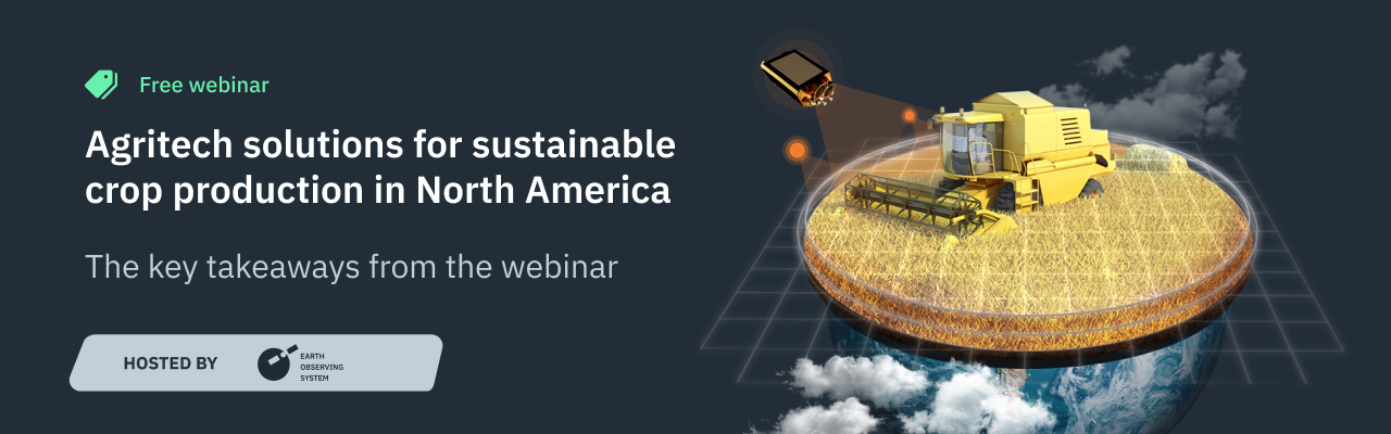
Agritech Solutions For Sustainable Crop Production In North America
On August 11, EOS Data Analytics, a global provider of AI-powered satellite imagery analytics, held an open-door webinar on leveraging satellite data analytics for streamlining operations.
The agenda included an overview of the North American agricultural market, its successes and challenges, and satellite monitoring solutions’ advantages for stakeholders. Attendees also learned about the purpose, implementation, and results of such agritech projects as сrop classification, field boundary detection, yield forecasting, harvest monitoring, and soil moisture.
Please follow the links to watch the webinar recording and view the presentation.
The webinar gathered food producers, farming cooperatives, agri lenders, consultancies, software developers, and telecom companies.
The presenter was the Director of Strategic Partnerships at EOS Data Analytics Brijesh Thoppil.
Mechanization, widespread use of crop protection chemicals, and following good farm management practices positively influenced the agriculture industry growth in North America. As a result, there is a rise in agri coops and a shift away from traditional farm ownership practices within the food production industry. Yet the constraints to transformation remain.
Food producers in the U.S. and Canada require access to data for monitoring crop health and development, predicting yields, or assessing optimal amounts of fertilizers, herbicides, and pesticides. A lot of time and cost goes into scouting fields; there is also a need for fast and easy sharing of work updates and coordinating activities. Satellite imagery analytics tools can help agribusinesses optimize farm operations further.
Satellite data enables remote monitoring of crop development and the state of soil and is used to answer questions about land use, crop rotation practices, or status of other field activities. By supporting farmers’ decision-making daily, satellite analytics allows for building and maintaining resilient food systems.
Satellite imagery analytics may bring value to agriculture market players besides food producers and agri coops. Banks can use information about potential customers’ fields for better risk assessment and justifying loan decisions. At the same time, consultancies can reduce time spent on scouting and use historical data and the latest insights into the state of fields to support recommendations. Software vendors get centralized access to multiple data sources and can integrate satellite analytics into existing solutions or introduce new ones. Telecom companies can use exclusive agricultural market data for tasks like crop classification or yield forecasting and get the opportunity to diversify and develop new streams of income.
The host explained the value of each agritech solution and overviewed some of the company’s projects.
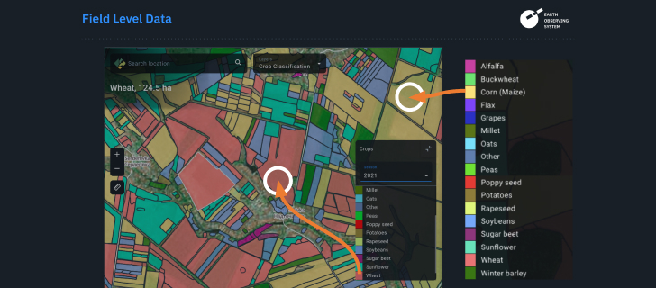
Crop classification means classifying land use in terms of crop types growing in an area of interest or identifying land cover classes, such as arable and non-arable land, on a regional and country level. Crop classification also allows for obtaining crop rotation historical data.
The project team needs satellite imagery and ground-truth data to perform the task.
Crop classification is usually combined with field boundary detection — identification of an exact field acreage. It’s possible to calculate a field area for current and past seasons.
This agritech solution can be performed using high-resolution imagery to increase the result’s accuracy and identify objects smaller than three hectares.
Harvest monitoring allows optimizing harvest-related activities and yield planning. The agritech solution includes regular reporting on harvest status for a field on a given date, the number of harvested fields, the area of harvested crops, estimated yield, and more.
Farmers can use harvest data from previous seasons to define optimal fertilizer amount per field or field plot, adapt tillage and seed rate, and manage fieldwork. They can also plan future crop production to maximize yields by knowing sowing dates for given seeds and detecting drops in vegetation growth and expected harvesting dates for selected fields.
Yield prediction permits farmers and stakeholders to estimate how much agricultural commodities will be harvested within a growing season. One can forecast yields on field, state (region), and country levels. Such data as agriculture calendar, soil moisture, soil type, weather, or historical yield statistics is required for the task. The accuracy of yield prediction surpasses 90%.
Soil moisture data is based on the ratio between water volume in the soil and the whole soil volume; it’s measured in percentage. Farmers and agronomists can use soil moisture data to manage irrigation, estimate water supply, or forecast the likelihood of drought in certain regions. Insurance agents can trace and compare historical and current soil moisture values to make grounded decisions regarding insurance payments.
While soil moisture analytics is available within the same-name feature in the EOSDA Crop Monitoring platform, data for the task is gathered for a particular region or area. The EOSDA team uses the geographic location of the area of interest and imagery from satellites like SMAP by NASA and AMSR-2/ASMR-E by the Japan Aerospace Exploration Agency equipped with microwave sensors (radiometers) that can measure the brightness and temperature of the land surface.
The company has already started providing customers with high-quality data from its own satellite.
In 2023, we launched the EOS SAT-1 — a multi-purpose satellite, focused on agriculture, forestry, natural disaster management, and urban monitoring. It will help us provide 90% of cropland coverage worldwide. Having our own data sources means controlling the full data cycle ourselves, obtaining data that works perfect for solving agricultural tasks, which is critical for their accuracy.