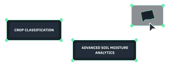
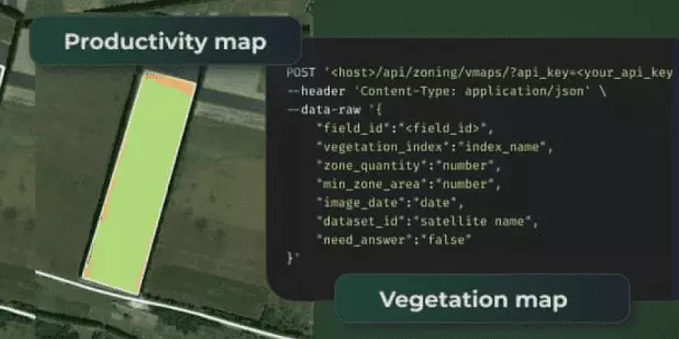
EOSDA
  • Products
    • EOSDA Crop Monitoring
      • Solutions
        • API
        • White Label
      • Business verticals
        • IT companies
        • Input Suppliers
        • Telecom Sector
        • Agricultural cooperatives
        • Agricultural Consultants
        • Banks and financial institutions
        • Insurance Companies
        • Food Production Companies
        • NGOs and Nonprofits
      • Features
        • Satellite Monitoring
        • Team Management
        • Scouting
        • Weather
        • VRA maps
        • Daily High Resolution Images
    • EOSDA LandViewer
    • High-resolution Satellite Imagery
    • EOSDA Forest Monitoring
    • Custom Projects
        • Yield Prediction
        • Remote Harvest Dynamics Monitoring
        • Crop Type Classification
        • Field Boundaries Detection
        • Advanced Soil Moisture Analytics
        • Soil Organic Carbon
  • Solutions
  • Company
    • Industries
        • Agriculture
        • Forestry
    • EOSDA Events
    • Space Infrastructure
    • Philosophy
    • Sustainability Commitment
    • Careers
    • Newsroom
    • Max Polyakov
  • Partnership
  • EOS SAT-1
  • Blog
    • Agricultural practices
    • Case Studies
    • Stories of impact
    • Company news
  • Contact Us
  • EN
    • EN
    • ES
    • PT
    • FR
    • UK
    • RU
    1. Home
  1. Solutions

Solutions

  • Agriculture
  • API
  • Forestry
  • API
Zoning API

Build vegetation and productivity maps for variable-rate application of inputs
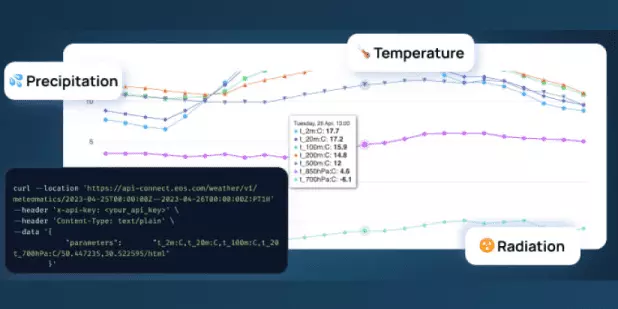
View Details
  • API
Weather API

Get access to comprehensive weather analytics for specific areas: historical, current, forecasted.

View Details
    • Products
      • EOSDA Crop Monitoring
      • EOSDA Crop Monitoring User Guide
      • Cooperatives
      • Crop management guide
      • Soil Organic Carbon
      • EOSDA LandViewer
      • EOSDA LandViewer User Guide
      • EOSDA Forest Monitoring
      • EOSDA Forest Monitoring User Guide
      • FAQ
    • Satellites
      • EOS SAT-1
      • Sentinel 2
      • Landsat 8
    • Gallery
      • Free satellite imagery sources
    • Sustainability
    • Analytical Methods
      • NDVI
      • NDMI
      • NDWI
      • MSAVI
      • NDRE
      • RECl
  • Terms of Use
  • Privacy Policy
  • Do Not Sell My Personal Information
© 2025 EOS Data Analytics,Inc. All rights reserved.
Contact Us

    Please add your goals, features that would best suit your needs, preferred contact date and time, and other useful information.

    Please share details below
    I represent

      Please share your business goals, project idea, preferred contact date and time so we know exactly how to help.

        Please share your business goals, project idea, preferred contact date and time so we know exactly how to help.

        Please share details below
        I represent

          Please share your business goals, project idea, preferred contact date and time so we know exactly how to help.

            Please share your business goals, project idea, preferred contact date and time so we know exactly how to help.