Mining Pits
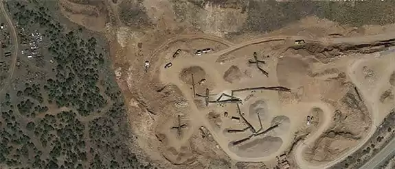
Problem Statement:
It is necessary to collect detailed information about the open pit mining market, such as climatic and environmental changes, and detection of illegal mining operations.
Unique Solutions:
We apply remote sensing imagery to locate, identify, and analyze open mining pits, using neural network land classification, change detection, and other types of processing to solve the problem.
Customer Benefit:
Customers receive regular, accurate analysis results with the help of hyperspectral, ultra-high-resolution satellite and aerial imagery. This enables frequent analysis of hard-to-reach mining pits with minimal cost.

All Minerals And Mining Case Studies: