Crop classification using satellite images and analytics
EOSDA’s crop classification solution offers accurate, scalable, and fully managed satellite imagery analytics powered by AI. It helps organizations make smart, data-driven decisions across the agricultural value chain.
- Up to 90% accuracy
- API integration
- Customizable reports
Approach and methodology of our AI-powered crop classification
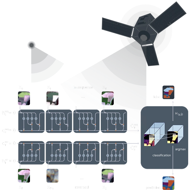
Model: EOSDA uses a multi-level Conv-LSTM architecture that integrates spatial (CNN) and temporal (LSTM) analysis. Using a full-season time series imagery analysis, the model captures crops' spectral changes across growth stages, significantly improving detection accuracy.
Satellite data: The model uses imagery from Sentinel-2 L2A satellite, which collects data 8 spectral bands (RGB, 2 Red edge, NIR, 2 SWIR).
Crops: The model was trained on data from over 20 crop types across various countries and can be adapted to any crop if ground truth data is provided.
Accuracy: up to 90%.
Limitations: Regions with high cloud cover and fields smaller than 2 ha.
Expected project outputs and formats
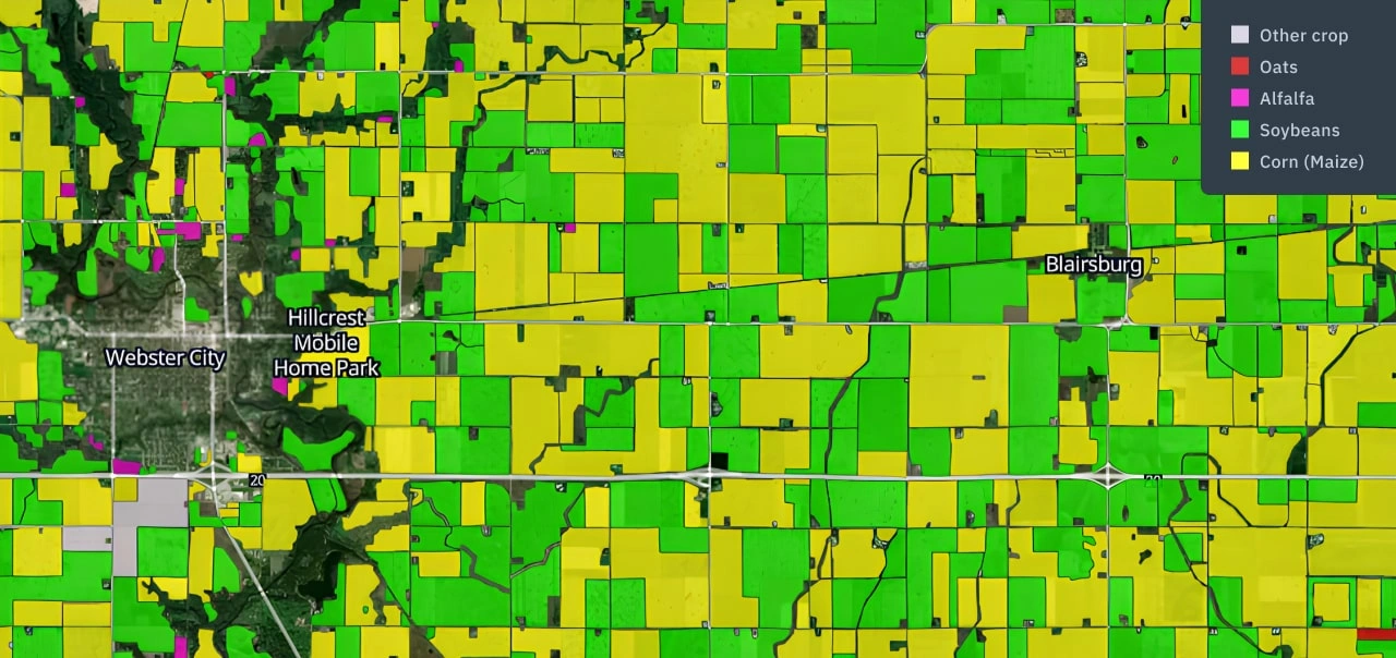
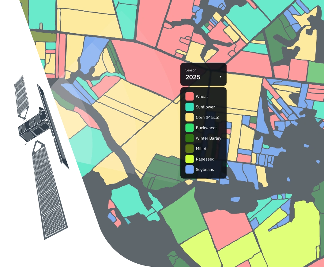
- Classification raster mask limited to the AOI in GeoTIFF format.
- Vector mask with field boundaries in ESRI shapefile, GeoJSON, KML, or GPKG.
- Aggregated statistics by admin boundaries of regions, districts, etc in xlsx, ot csv.
- Analytical report or results interpretation note, if required.
*Delivery in another format, including via API interface.
Required data for AI-powered crop classification
Input data provided by customer
- Area of interest in table (xlsx/ csv) or vector (KML, ESRI shapefile, GPKG, GeoJSON) format.
- List of the target crops.
- Crop сalendar, if available.
- Ground truth data (examples of the field with the target crops for model training), if available.
Data prepared by EOSDA
- Phenology data.
- Satellite imagery.
- Training datasets for general land cover classification (and target classes if not available).
- Validation datasets.
Standard project stages
Typical project duration: 3-6 weeks.
Investigation of vegetation features for AOI.
Ground data collection, verification, and filtering.
Search and download of required satellite data.
Model training and crop classification.
Result verification and final outputs preparation.
Benefits of crop clasfification solution by EOSDA
Short-term optimization
- Enhanced production and sourcing planning.
- Supply chain optimization.
- Improved field management & resource optimization.
- Easier agricultural loan/ insurance risk assessment & management.
- Easier monitoring of compliance with agricultural programs.
Long-term impact & resilience
- Smarter market analysis based on agricultural insights.
- Easy collection and storage of agricultural data.
- Ability to support food security policies and regulations.
- Smarter land use planning & sustainable resource management.
- Bioenergy feedstock assessment & monitoring.