Articles about EOSDA LandViewer features and uses
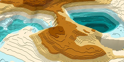
Digital elevation model (DEM): Guide to terrain mapping
Planning earthworks, drainage, or tower placement? See how digital elevation models reveal true ground contours and how to source site-specific DEM grids without overpaying.
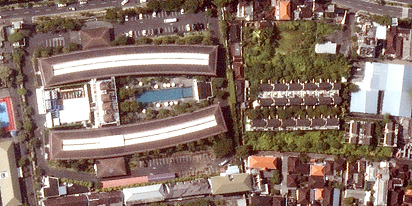
How to get a satellite view of my property?
Businesses need independent visual data to protect their investments. In LandViewer, you choose the date and source to get the satellite property photos for logging site damage or build readiness.
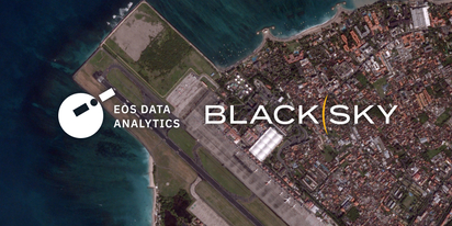
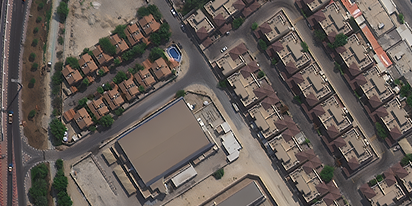
LandViewer welcomes BlackSky Gen-3 high-resolution imagery
LandViewer has expanded its high-resolution catalogue with BlackSky Gen-3, offering 0.3 m imagery, up to 15 daily revisits, and AI-powered analytics for detailed analysis and daily site monitoring.

LandViewer integrates Satellogic high-frequency imaging
LandViewer has expanded its high-resolution monitoring options by integrating Satellogic NewSat data. This update provides more frequent revisits and detailed imagery for tracking daily changes.
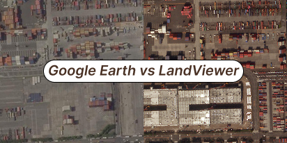
What’s better than Google Earth for professional use?
Is the resolution of free maps too low for your project? LandViewer offers a professional alternative to Google Earth with up to 0.3m imagery and daily revisits to ensure you never miss a detail.
Can I see a real-time live satellite view of my house?
Can you view live satellite images of your house? Discover how to find, preview, and buy high-resolution images of your property for planning or monitoring.

Analyze 2025 & Plan Your Best Year Yet: LandViewer Christmas Offer
It’s the most wonderful time of the year! The Christmas holidays are here, and so is your chance to analyze 2025 and plan a prosperous 2026 with more affordable Pro plans in LandViewer.

EOSDA LandViewer Black Friday Sale: Exclusive Offers & Giveaway
This Black Friday, LandViewer offers new users the chance to save on monthly plans, get extra months with yearly subscriptions, and participate in a free annual plan giveaway.

EOSDA LandViewer Adds SpaceWill And Improsat Sources
EOSDA LandViewer expands with new SpaceWill and Improsat satellite data sources. This means higher resolution and more frequent revisits for accurate monitoring.