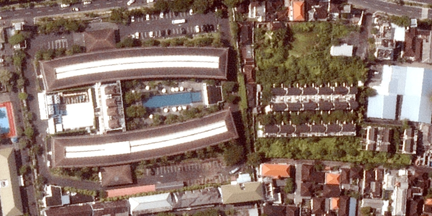
Can you completely trust a contractor’s progress report or a claimant’s damage estimate without an independent way to verify it? Of course, you can use free public maps, but they are usually too old and blurry to be of any real use. Upgrading to high-resolution satellite photos of your property lets you see what is happening on the ground at a specific moment. Suddenly, you can count the excavators on site, spot a caved-in warehouse roof after a storm, or check if a new fence crosses your boundary line. It takes a few clicks to filter out the clouds, choose your resolution, and get a satellite property view to run your project confidently.
Key takeaways
- Getting a clear, high-resolution satellite photo of your property helps verify construction progress, storm damage, or boundary lines without a site visit.
- LandViewer brings together recent property photos, historical archives, and satellite tasking in a single platform.
- Real estate companies use up-to-date satellite property images to check land parcels remotely, construction teams track equipment and progress without site visits, and insurers compare before-and-after photos to assess storm or flood damage.
- Resolution determines what’s visible in a satellite view of a property — from individual bushes at 0.3–0.4 m to building footprints at 1–1.5 m — so checking it ensures the image fits the project’s needs.
Why use high-resolution satellite photos for monitoring your property?
When inspecting real estate or monitoring a construction site, relying on generic map views often means missing critical details. LandViewer provides commercial sectors with a tool to view their assets with much greater precision, using property images from multiple satellite operators.
The platform focuses on features that meet these specific project needs:
- Higher resolution and recent photo updates to clearly see road access, construction progress, or structural changes as they look now.
- Access to multiple satellite providers in one place, giving you the best chance to find a clear, cloud-free photo of your location.
- An archive of past photos and satellite tasking, which lets you either study how the land evolved over the years or request a brand-new photo of your property.
This combination of tools helps companies monitor distant infrastructure and track ongoing projects based on accurate, recent photos rather than outdated public maps.
How to monitor your property using LandViewer
Finding clear, professional satellite photos for a specific property often requires jumping between multiple platforms and coordinate systems. LandViewer organizes high-resolution satellite imagery and basic analytics in one place so you can monitor your assets without the hassle. Here is how to do it:
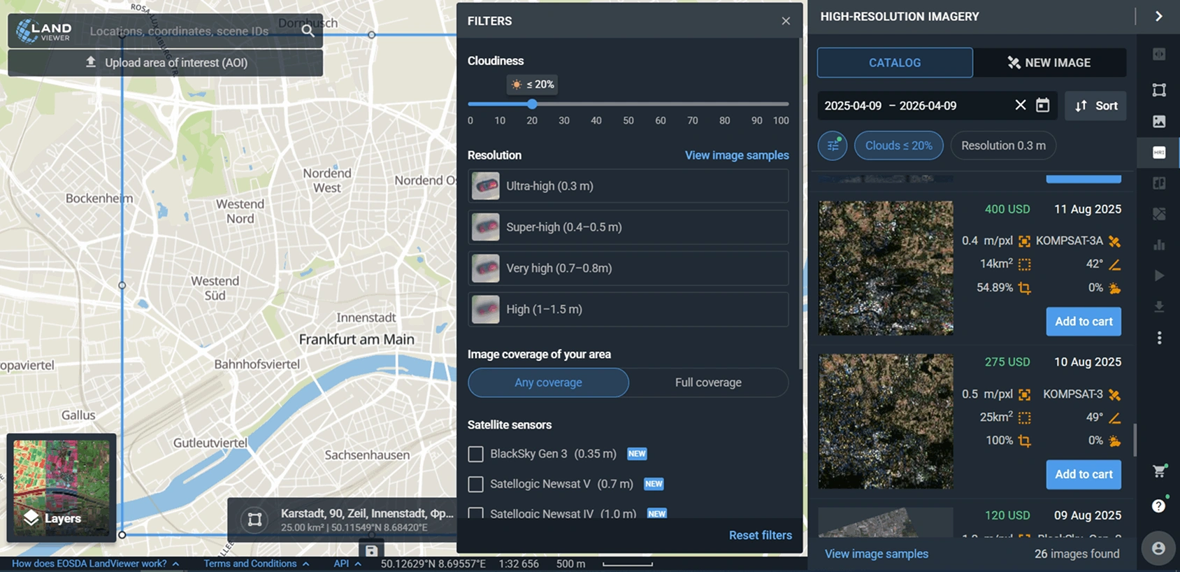
Step 1. Enter an address or precise coordinates in the search bar to find your property.
Filter the photo catalog by date, satellite provider, resolution, and cloud cover percentage to get a clear, unobstructed view. If your project is located in the US, you can pull up historical aerial photos from the NAIP archive to get a detailed view of the property in previous years. Once the criteria are set, look through the previews to select the best satellite view of the property.
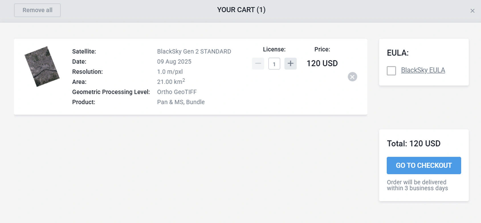
Step 2. Add the chosen satellite photo to the cart and finalize the checkout to download professional-grade visuals.
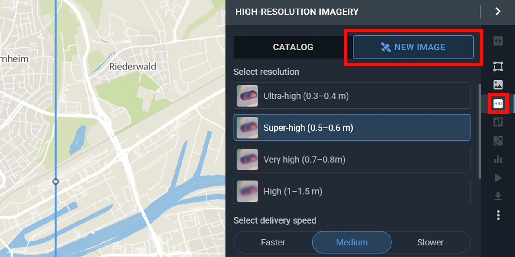
Step 3. If there’s no clear property photo in the archive for your required date, you can task a satellite for a new capture.
If you are new to the LandViewer, creating an account gives you 5 free medium-resolution images per month from satellites like Sentinel-2 and Landsat 8. This works well for broad territorial overviews, though high-resolution photos remain the standard for detailed property audits.
Let’s dive into a few practical examples of how businesses use these high-resolution satellite photos to manage their properties daily.
Real-world scenarios that require high-resolution property satellite photos
While the technology remains the same, a real estate broker, a site foreman, and an insurer look at the exact same plot of land through entirely different lenses. Each profession requires tracking different structural or environmental elements to do its job. Here is how that plays out in practice for each sector.
How real estate companies use real-time satellite views of property
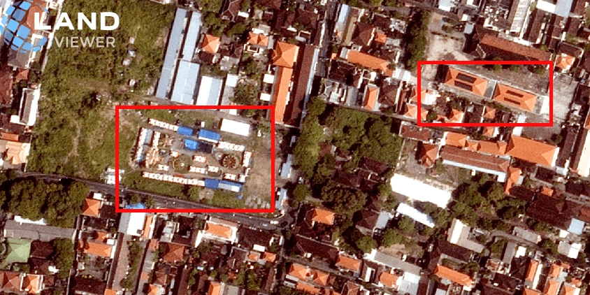
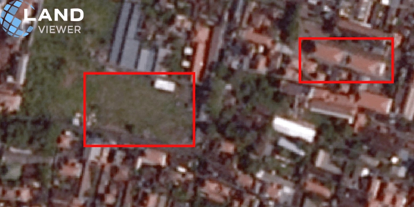
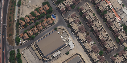
Evaluating large land parcels or distant commercial sites usually involves long drives just to check if the property matches the official records. LandViewer lets you run an initial check from your desk, showing you whether a plot has any road access issues, recent land clearing, structural changes, or new unauthorized builds nearby. If you are dealing with a fast-moving transaction and need an immediate photo that isn’t in the current catalog, you can use the tasking feature to capture a new high-resolution photo of the property. It keeps your due diligence moving forward without relying on outdated public records or expensive, repeated site visits.
A quick comparison shows how much data you can get without a site visit. The 2026 photo shows the current condition of the property, with new buildings and solar panels, while the 2025 photo serves as a baseline.
How construction teams benefit from satellite property management
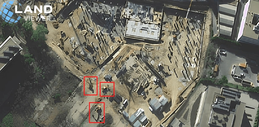
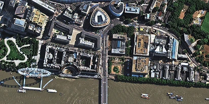
The biggest headache with managing several active builds is that you simply can’t be everywhere at once. High-resolution photos let project managers and investors check on excavation, see where heavy equipment is parked, and track contractor activity remotely. This keeps the field crew and the office team on the same page, so nobody has to guess the real status of the build. If you need a fresh update before the next regular satellite pass, you can order a new photo through tasking exactly when your reporting schedule requires it.
How insurance companies use historical satellite imagery
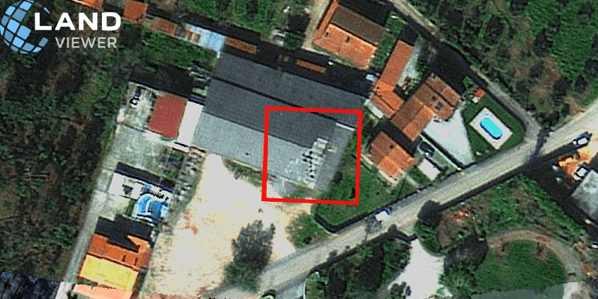
After a flood, fire, or severe storm, insurance teams are flooded with claims all at once, making manual site visits impossible to schedule quickly, especially in remote or cut-off areas. Сomparing older satellite photos of the property with the latest available allows you to immediately evaluate the impact on specific properties and spot fraudulent claims for damage that existed before the incident . It cuts down the investigation timeline from weeks to hours while keeping your data objective and unalterable. When a claim hinges on the exact current state of a property, satellite tasking lets you request a targeted high-resolution photo.
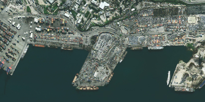
These examples only scratch the surface of how industries monitor assets remotely. Agricultural teams rely on property photos to analyze soil changes and irrigation patterns, while infrastructure operators use them to watch remote assets for safety risks . Ultimately, any sector, from urban planning to disaster recovery, can use high-resolution satellite photos to watch how a location changes over time.
How accurate are satellite photos of your property?
The level of detail you get depends entirely on the spatial resolution of the chosen satellite property images. Here is a quick breakdown of what you can actually see on the ground across different options:
- Ultra-high resolution (0.3–0.4 m). Clearly shows minor details like active construction work, small structures, or even individual bushes and vines.
- Super-high resolution (0.5–0.6 m). Captures infrastructure layouts, large machinery, and lets you count vehicles on site.
- Very high resolution (0.7–0.8 m). Identifies basic building shapes, surrounding environmental risks, and broad commercial activity.
- High resolution (1–1.5 m). Works well for outlining major building footprints, narrow roads, and forest boundaries.
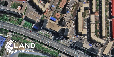
Beyond resolution of the photo, keep an eye on cloud cover. Since a single satellite photo might span miles, a high cloud cover percentage for the overall image doesn’t always mean your plot is hidden. Always check the free preview thumbnail before purchasing to make sure your asset is fully visible.
A quick look at resolution and cloud placement ensures that a chosen satellite property map perfectly fits your project needs. It is literally all it takes to handle your remote property checks with complete confidence.
About the author:
Petro Kogut has a PhD in Physics and Mathematics and is the author of multiple scientific publications. He is the Soros Associated Professor as well as the head of the department of differential equations in the Oles Honchar Dnipro National University and has received a number of grants, prizes, honorary decorations, medals, and other awards. Prof. Dr. Petro Kogut is a science advisor for EOSDA.
Choose up to 0.3 m high-resolution images from our catalog or request a satellite tasking.
More news
Satellite imagery tasking: How to order via the LandViewer platform
What if you could just order the satellite imagery you actually need? On-demand satellite tasking makes that possible — here's how it works and how to place your first order.
Digital surface model (DSM): How to map object heights
Need accurate elevation data for structures and land cover? See how digital surface models (DSMs) differ from bare-earth maps and learn how to get high-resolution stereo data for your area.
Digital elevation model (DEM): Guide to terrain mapping
Planning earthworks, drainage, or tower placement? See how digital elevation models reveal true ground contours and how to source site-specific DEM grids without overpaying.