Optical satellite imagery has become a default tool across so many industries for a simple reason: it shows the Earth the way we see it. So, it’s flexible enough to verify a property’s condition in one project and track a field through a growing season in another — optical imagery adapts to the question, as long as the coverage and resolution match what’s being asked. And with so much data now available through multi-source satellite platforms, finding the right fit for a specific project has never been simpler. Here’s a closer look at what optical satellite imagery is and where it makes the biggest difference.
Practical benefits of optical satellite imagery
Remember how complicated it used to be to collect data on physical assets? It required field teams, aerial surveys, or expensive on-site sensors. Today, optical satellite imaging replaces these complex logistics with a direct stream of Earth observation data covering any location. Because satellites orbit the Earth continuously, you can monitor remote assets and receive regular updates right at your desk. Plus, the commercial space market is booming, so optical imagery options are virtually limitless . This goes beyond simple visual inspection — advanced spectral bands allow you to instantly reveal environmental and structural shifts invisible to the human eye . A massive volume of commercial optical satellite imagery is now matched by how incredibly simple it is to access. You no longer need to navigate complex procurement processes or rely on technical gatekeepers to get reliable geospatial insights. Platforms like LandViewer bring everything into a single workspace, allowing you to discover imagery and order optical imagery, apply analytical indices, and task satellites for custom coverage in just a few clicks.
Optical imagery available in LandViewer
Instead of jumping between different data providers, you can find both free medium-resolution data and commercial high-resolution optical satellite imagery from BlackSky, TripleSAT, and NewSat constellations in one place. Having these options side by side means you can easily scale your data depth up or down depending on your project’s phase and particular needs.
High-resolution optical imagery
When your project requires high-resolution imagery, the choice of satellite should match the project’s scale and the specific insights you need to extract. To help you fine-tune this choice, LandViewer provides access to 20 high-resolution satellites with diverse temporal and spatial resolutions. Now, we’ll break down what features each resolution allows to distinguish, so that you pick the right level of precision without paying for unnecessary detail.
Ultra-high resolution (30–40cm)
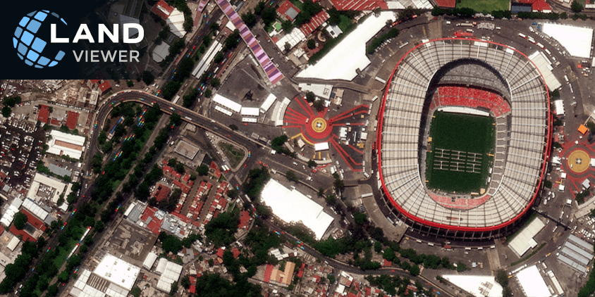
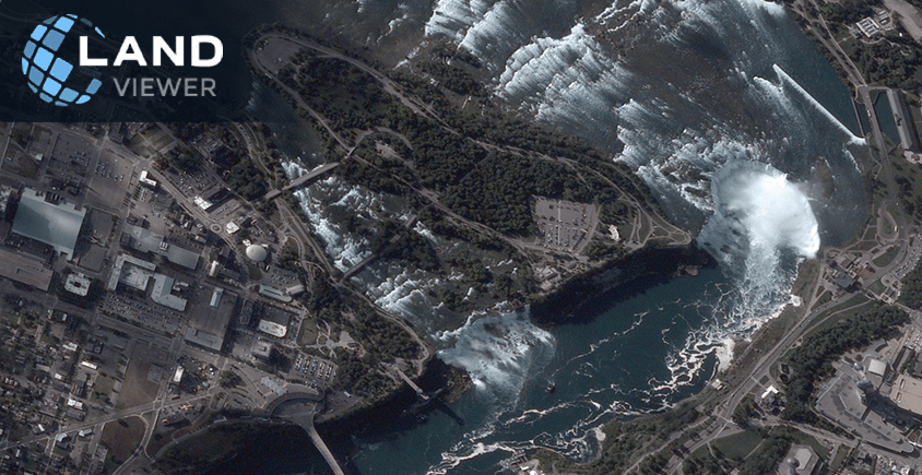
Ultra-high-resolution optical images provide the necessary clarity for identifying small, isolated assets. You can spot individual construction machinery, vehicles, and rooftops. This satellite imagery is also sharp enough to detect small tree canopies, bushes, and vineyard layouts. Best for active construction monitoring, structural property assessments, and precision specialty crop management.
Super-high resolution (50–60cm)
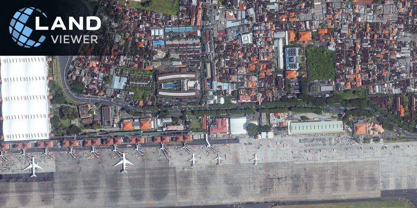
Super-high-resolution satellite imagery hits the sweet spot for everyday commercial use, balancing detail with practicality. Rather than chasing every small object on the ground, it shows how a site operates — equipment movement, footprint, and access points. Best for real estate due diligence, supply chain visibility, and facility-level oversight.
Very high resolution (70–80 cm)
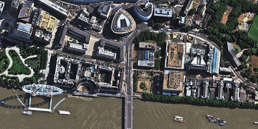
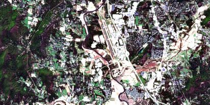
Very high-resolution optical satellite images make the big picture easier to read. You can quickly distinguish developed areas, road systems, agricultural fields, and key infrastructure features without getting distracted by smaller objects. This imagery helps reveal how land is divided, connected, and changing over time. Best for land use monitoring, site planning, and infrastructure assessments.
High resolution (1–1.5 m)
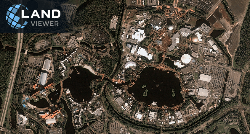
When the goal is to monitor an entire region rather than a specific site, high-resolution optical satellite imagery often provides all the detail you need. Major land cover types, transportation routes, forest boundaries, and large agricultural patterns remain easy to identify across extensive areas. Best for urban planning, environmental monitoring, infrastructure management, and site-level analysis.
Medium-resolution optical imagery
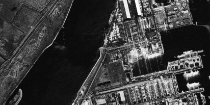
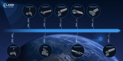
This imagery resolution prioritizes coverage over detail. LandViewer includes popular medium-resolution optical image sources such as Sentinel-2 (10 m resolution with a 3-day revisit rate) and Landsat 8 (30 m resolution with a 3-day revisit rate). Medium resolution is well-suited for tracking deforestation, water resources, field boundaries, and land cover changes across large areas. However, higher-resolution optical images are needed for analysis of individual assets and site-level activity.
Why go to LandViewer for optical imagery
Besides the data itself, businesses need an easy way to view and process it. No one wants to jump between vendor websites or manage multiple accounts. With LandViewer, archives and tasking from leading satellite operators live in one place — pick the optical imagery you need, purchase it, run your analysis, and skip the account-juggling entirely. Here’s what you get in our all-in-one satellite imagery platform:
- Resolution down to 30 cm. You can access sub-meter imagery from multiple leading commercial providers in the platform catalog. For tasks that demand extreme detail, LandViewer connects you to advanced satellite constellations like BlackSky Gen-3, BJ3N, and SuperView NEO-1. These images can show individual building structures, heavy machinery, and narrow asset boundaries.
- Daily revisits. High-frequency satellite fleets such as MODIS, NewSat, SuperView, BlackSky, and TripleSAT pass over the same coordinates every single day. Frequent satellite revisits ensure you can find recent optical imagery whenever you need a quick status update on an active project or emerging operational risks.
- Historical archives. You can look years back to assess property history, track long-term environmental trends, verify land use changes, or analyze mining site expansion.
- Scheduled satellite tasking. Command an optical imaging satellite to capture your specific area of interest. Just set a few desired parameters, choose the target resolution, and specify the area to get a fresh image tailored to your schedule.
- Cloud-cover filtering. With this filter, you can find a clear optical image even in tropical or mountainous regions. LandViewer includes a simple percentage slider that filters out overcast scenes instantly, so you only spend time evaluating clear, usable imagery.
- Change detection. Spotting land clearing or infrastructure expansion shouldn’t take hours. Our change detection feature highlights differences between two selected scenes, making regional monitoring straightforward and fast.
- Spectral index analysis. You can apply specialized indices like NDVI and NDWI directly to your high-resolution images to check plant health or map water lines. An extra 9 indices are available for Sentinel-2 and other medium-resolution satellite data.
Ultimately, LandViewer removes the friction between raw satellite constellations and practical business decisions. It gives your team the data depth required to audit assets and monitor territories efficiently, all from a single platform.
Where optical satellite imagery helps most
Not every site can be inspected as often as you’d like. It might be hundreds of miles away, span thousands of hectares, or simply change faster than anyone can visit it. But optical satellite imagery can always keep you up to date for:
- Checking a property before making a decision. Verify property conditions, watch development activity nearby, and track land-use changes. Historical satellite imagery is a quick way to double-check a property’s history before closing a deal.
- Ensuring that construction is moving as planned. Compare images from different dates to track progress, spot critical changes, and create a visual timeline of the project. It helps keep everyone on the same page without extra site visits.
- Keeping an eye on mining sites. Monitor excavation areas, haul roads, stockpiles, and site expansion without waiting for field reports. Optical satellite images also provide a reliable visual record to simplify compliance monitoring and environmental audits.
- Monitoring infrastructure across long distances. Roads, railways, pipelines, and power lines can stretch for hundreds of miles. Satellite imagery is an efficient way to monitor them as a single whole.
- Watching fields change throughout the season. Track crop development, compare growing conditions, and monitor agricultural operations from planting to harvest with optical imagery and specialized indices.
Optical satellite imagery won’t replace fieldwork, but it can make every site visit more purposeful. Instead of traveling to find out what’s happening, you can arrive already knowing where to look, what changed, and which areas deserve attention.
What is an optical satellite image?
When does optical satellite imagery work best?
What is the difference between optical and SAR imagery?
What is the difference between optical and infrared images?
About the author:
Kateryna Sergieieva has a Ph.D. in information technologies and 15 years of experience in remote sensing. She is a Senior Scientist at EOSDA responsible for developing technologies for satellite monitoring and surface feature change detection. Kateryna is an author of over 60 scientific publications.
More news
Historical Satellite Images: Accessing The Old Data
Decades of space-based imagery are now at your fingertips. Historical satellite images reveal the past and can guide your next move — whether you’re a farmer, eco-activist, city planner, or scientist.
EOSDA Reflects On Satellite Industry Trends For 2025
Small satellites, AI, hyperspectral imaging and more are next satellite industry trends. In this blog post, EOSDA experts discuss them to conclude a tech breakthrough is hardly possible in 2025.
Scientists’ Perspective On SatTech In Nature Recovery
Learn how EOSDA’s scientists view satellite monitoring’s role in nature recovery. Explore tools, examples, and a scientific approach to restoring ecosystems after disasters.