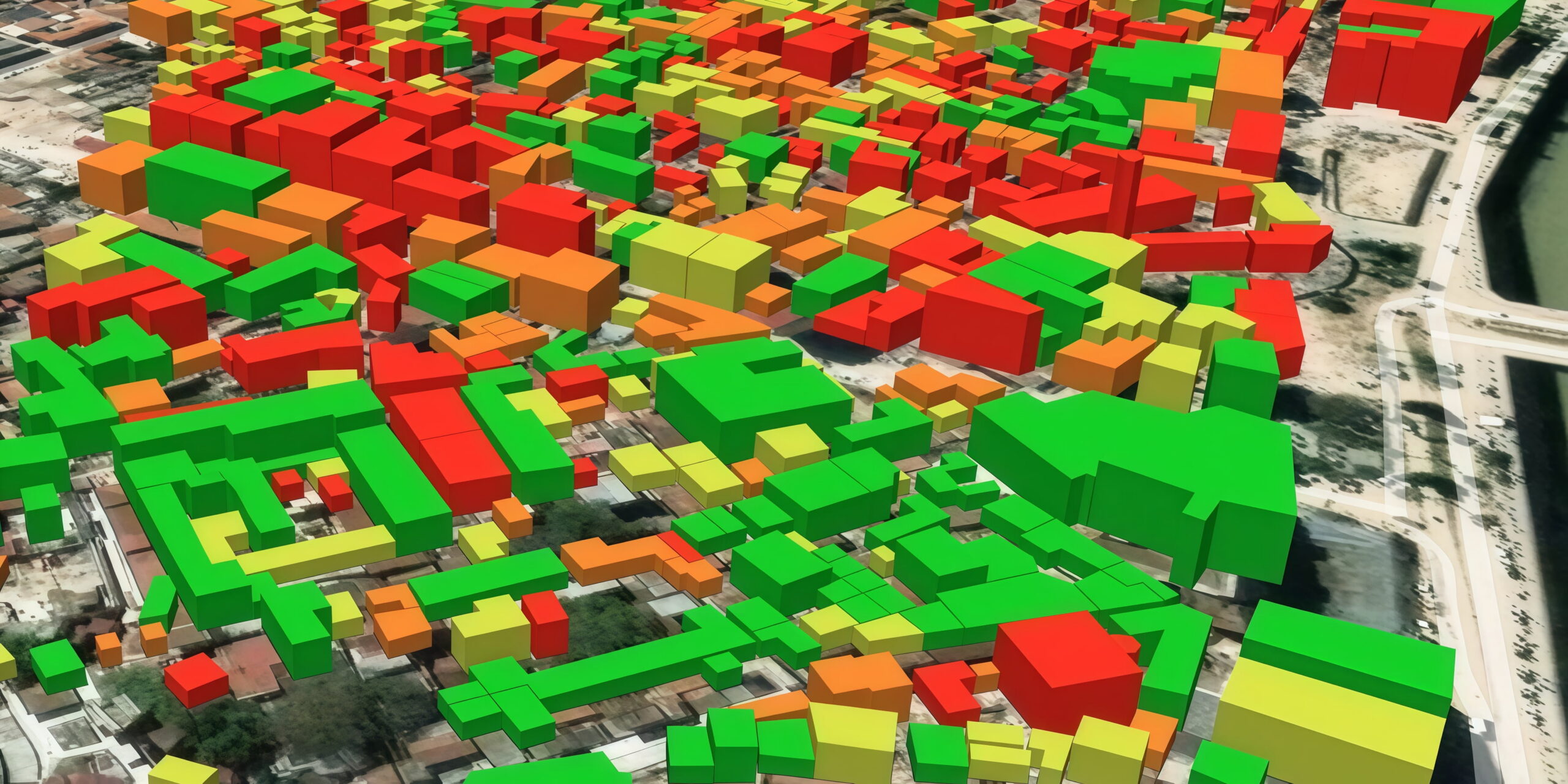
A digital surface model helps you see more than the footprint of a landscape by adding its vertical dimension. Instead of showing only where features are located, it measures the height of buildings, trees, roads, bridges, and other objects across the Earth’s surface. That’s why digital surface models are essential whenever physical structures affect planning, analysis, or monitoring. In this article, you’ll learn what a digital surface model is, how DSMs differ from other elevation products, how industries use them in practice, and how to obtain high-resolution digital models from satellite imagery.
Key takeaways
- A digital surface model (DSM) maps the height of everything on Earth’s surface, including buildings, tree canopies, and power lines.
- Unlike a digital terrain model, a digital surface model keeps all natural and artificial objects in place, making it useful for planning that depends on sightlines, obstacles, or shadows.
- DSMs can be created from satellite stereo imagery, LiDAR, drone photogrammetry, or airborne photography, with satellites offering the best balance of scale and cost for regional or city-wide projects.
- Higher-resolution imagery produces sharper, more accurate models.
- DSMs are used across different industries to evaluate physical obstacles and track environmental changes.
- LandViewer offers custom digital surface models with resolutions up to 30cm, built from archived stereo imagery or new satellite tasking depending on project timelines.
What is a digital surface model (DSM)?
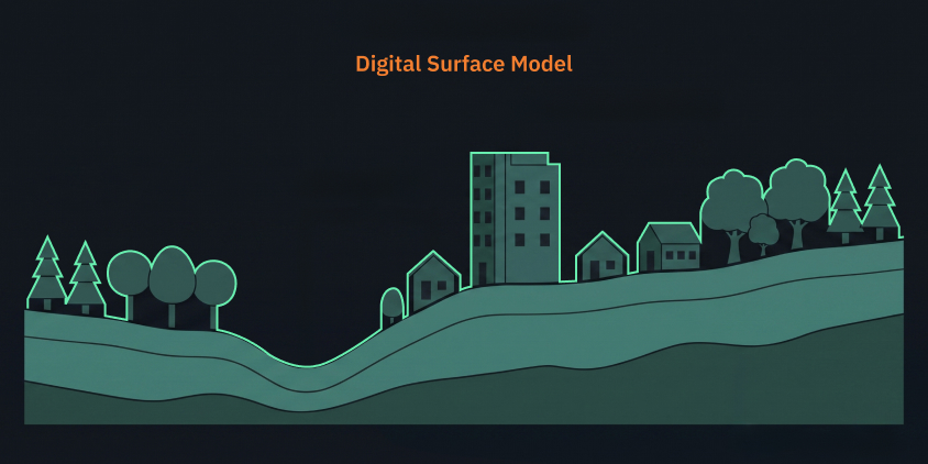
A digital surface model (DSM) is a map that measures the height of everything on the Earth’s surface. While bare-earth digital models remove artificial and natural objects, a DSM records the very top layer that a sensor sees from above. It measures the tops of buildings, forest canopies, power lines, bridges, and roads right alongside the ground beneath them.
Knowing the precise height of objects above the ground is critical for projects depending on clear sightlines, physical obstacles, or structural shadows. A DSM measures several key elements across a landscape:
- Building heights and roofs. Shows exact structural elevations in urban areas.
- Tree canopy tops. Tracks forest growth and vegetation overhangs.
- Overhead infrastructure. Pinpoints power lines, bridges, and raised highways.
Advantages of digital surface models
Because nothing gets filtered out, a digital surface model matches the real, current state of a place, not some idealized flat version of it. So DSMs offer:
- accurate heights for structures and vegetation;
- infrastructure planning based on solid ground truth;
- reliable mapping of shadows, view corridors, and signal blockages;
- clean input for 3D visualization;
- smooth integration into most GIS workflows.
In practice, digital surface models are a good bridge between raw elevation data and application-ready mapping.
Limitations of digital surface models
The same trait that makes a DSM useful, keeping every object in place, is also what limits it: once buildings and trees are baked into the elevation values, there’s no way to strip them back out.
Objects obscure the ground
DSMs do not represent bare-earth elevation, so they can overestimate height in urban areas and wooded regions, especially where the ground is completely hidden. For that reason, DSMs are not suitable for applications that require ground elevation only, such as flood modeling, drainage analysis, or erosion mapping.
Accuracy depends on the data source
DSM quality depends heavily on the data source and processing method used to create it. LiDAR-based digital surface models can precisely capture dense 3D structure, while satellite- or aerial-image-derived DSMs are more dependent on image resolution, viewing geometry, and object texture. Drone DSMs can be very detailed over small areas, but their accuracy still varies with flight height, overlap, camera quality, and ground control .
Why use high-resolution satellite images for creating DSMs
A DSM is only as good as the imagery behind it. Low-resolution imagery smudges building corners and turns forests into generic height blobs, ruining your measurements. Push the resolution higher, and buildings get sharper outlines, vegetation comes out more detailed, and changes are easier to spot. Sub-meter satellite data is widely available today, so this level of detail becomes accessible for most commercial DSM projects.
How digital surface models are created
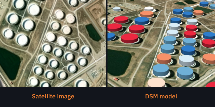
Digital surface models can be created from several data sources, but satellite stereo imagery is one of the most important methods for producing DSMs over large areas. The best choice depends on the required coverage, accuracy, cost, and level of detail.
Satellite stereo imagery
Satellites are the most effective option for regional, national, or city-wide DSM projects. Digital surface models use stereo (or tri-stereo) images captured from multiple angles.
Photogrammetry software then matches features across frames to reconstruct a 3D surface using parallax differences.
Satellites stand out for building DSMs because:
- one pass can cover an entire region;
- cost-effective for broad-area mapping;
- good for areas that are difficult or expensive to survey on the ground;
- frequent revisits, which support updates over time.
Satellite-based DSMs are especially attractive when you need a balance between scale and practicality. They may not always match LiDAR’s vertical precision, but they are often much easier to deploy over vast or inaccessible areas.
LiDAR
LiDAR shoots millions of laser pulses toward the ground to measure elevation down to the inch. It excels at penetrating dense tree canopies and creating digital surface models of complex urban infrastructure. However, LiDAR is expensive and operationally heavy, making it impractical for DSMs of large geographic regions.
Drone photogrammetry
For creating DSMs of small, defined areas, drones offer unmatched detail — enough to spot individual plants in a field or cracks in a foundation. That makes them a natural fit for construction site, mine, farm, and local infrastructure DSMs. They just don’t scale well: trying to cover a whole region with drones requires endless flights and massive field effort.
Airborne photography
Aircraft-mounted high-resolution cameras remain a common solution for municipal and regional DSMs, especially when a balance between coverage and detail is needed. They offer quite high resolution for building accurate digital surface models but still fall short of satellite efficiency over huge territories.
Where to use digital surface models
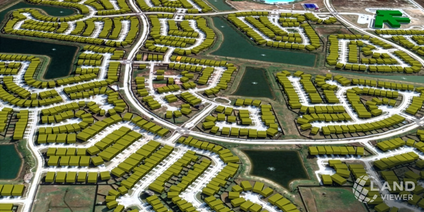
Digital surface models are useful whenever physical structures, such as buildings, trees, or power lines, affect a project. DSM data helps teams evaluate physical obstacles, plan infrastructure, and track environmental changes across various industries.
Urban planning and smart cities
What really shapes a city are its buildings and trees, not the hills and valleys. Digital surface models give planners a realistic 3D view of the city to watch how the skyline changes, map out shadows from buildings and trees, scope rooftops for solar panels, and judge how a new project will affect the blocks around it.
Telecommunications and network planning
Signals don’t travel through buildings and trees the way they travel through open air: they bounce, weaken, or stop entirely. Because a digital surface model keeps those obstacles in the data, engineers can run accurate line-of-sight checks, figure out the best spots for antennas, forecast how far cellular or microwave coverage will actually reach, and locate the dead zones caused by buildings or greenery.
Renewable energy and solar planning
Solar output hinges as much on a shadow from the building nearby as it does on roof angle. Digital surface model data makes it possible to check which rooftops get enough direct sun, track how shadows move across a property throughout the day, and choose installation spots that steer clear of obstructions. DSMs produce a far more realistic read on solar potential than a terrain-only model could give.
Forestry and vegetation analysis
Where a digital terrain model strips the trees away to reach the ground, a digital surface model leaves them in place. Thus, DSMs let foresters measure canopy height, follow forest growth across seasons, gauge storm or wildfire damage, and track vegetation spreading into areas near roads or power lines.
Mining and industrial site monitoring
Developers and operators can use digital surface models to estimate stockpile volumes, follow the construction of new infrastructure, watch for shifts in waste dumps or tailings storage, and follow how the site evolves. Because the digital model reads the surface of these features rather than the ground beneath them, it reflects an active mining environment with far more accuracy than bare-earth data alone.
Infrastructure and utility management
Roads, railways, pipelines, and power lines run through terrain cluttered with obstacles, any of which can become a source of hazard. Digital surface models let infrastructure operators watch for vegetation encroaching on transmission corridors, check clearance heights beneath bridges and overpasses, and spot obstacles too close to transport routes.
Flood risk and urban drainage
Digital terrain models remain the backbone of hydrological modeling, but digital surface models can add important context in built-up areas. Buildings and embankments can redirect or block floodwater, so including surface features can improve urban flood simulations and emergency planning . DSMs are critical in cities, where surface complexity strongly influences inundation patterns.
How to get high-resolution DSMs using LandViewer
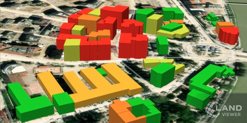
Not every mapping project is about the terrain itself. In many cases, the focus is on the features that stand above it — buildings, trees, transportation infrastructure, mining equipment, or other surface objects whose height and shape influence planning and decision-making. LandViewer provides custom digital surface models that capture this complete three-dimensional surface.
DSMs built from stereo and tri-stereo imagery with resolutions of up to 30 cm accurately represent densely built-up areas, rugged landscapes, and locations with tall vegetation. The imagery can be supplied by top-tier satellite operators, including 21AT, SpaceWill, and SIIS.
In LandViewer, you can choose between two acquisition workflows depending on your DSM project timeline:
- Archive. DSM processing of stereo imagery already available in the archive can be completed within a few business days.
- Tasking. You can task a satellite to collect new imagery for your AOI. The final delivery time depends on cloud cover, satellite revisits, and the size of the requested area.
Digital surface models can be complemented by optical or SAR imagery to provide deeper insights into the appearance, materials, and surrounding context of surface objects. Not sure which data fits your project? Our support specialists can guide your choice and help you source the exact DSM data you need.
About the author:
Kateryna Sergieieva has a Ph.D. in information technologies and 15 years of experience in remote sensing. She is a Senior Scientist at EOSDA responsible for developing technologies for satellite monitoring and surface feature change detection. Kateryna is an author of over 60 scientific publications.
Unlock accurate surface insights with custom DSMs for any location worldwide.
More news
Construction site monitoring: The guide to remote progress tracking with satellite images
From cameras and drones to satellites: a practical look at how construction site monitoring works, where each tool shines, and what a remote, orbital view actually adds.
SAR imagery: How synthetic aperture radar technology works
Want to monitor assets without weather delays? Learn how SAR imagery captures soil moisture, floods, and structural shifts through clouds and smoke for your monitoring projects.
Optical satellite imagery: Getting insights from space
Ground inspections can be slow and expensive. Discover how commercial optical satellite imagery simplifies remote site monitoring and supports daily operational decisions.