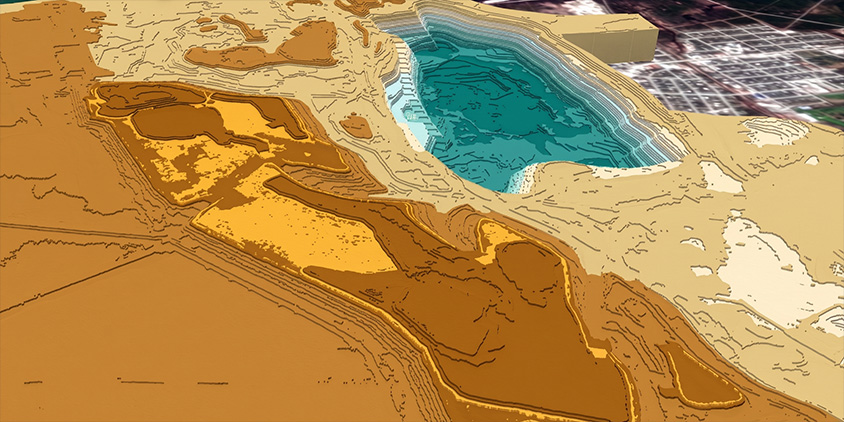
An optical satellite image shows you what a place looks like. It won’t tell you how steep the slope is, where water will collect after rain, or whether a hill blocks the signal path between two towers. However, a digital terrain model (DTM) will, with elevation data for bare ground where trees and buildings are filtered out.
Accessing an accurate DTM allows technical teams to evaluate slopes, trace drainage paths, and plan infrastructure directly against the physical landscape. Here is how digital terrain models support various field operations and how to get targeted elevation grids for your site.
Key takeaways
- A digital terrain model (DTM) in GIS is a dataset that captures bare-earth elevation by filtering away trees, buildings, and other above-ground features.
- Key digital terrain model application areas include slope evaluation, flood flow modeling, civil engineering, and infrastructure route planning.
- Optical satellite stereo imagery serves as a primary source of high-resolution digital terrain models for large or hard-to-reach areas.
- Creating custom DTMs through LandViewer allows technical teams to get up-to-date bare-ground data without funding ground surveys.
What is a digital terrain model (DTM)?
A digital terrain model (DTM) is a dataset that shows the elevation of the Earth’s bare ground. It excludes trees, buildings, and anything else on the surface, showing only the land’s shape.
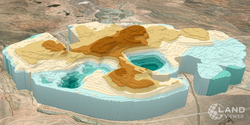
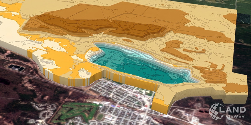
Most digital terrain models are stored as a grid of cells, where each cell holds one elevation value. This grid can be shown as a flat, color-coded map or built into a 3D digital model you can rotate and view from any angle. Hills, valleys, slopes, and ridges become easy to spot on DTMs when elevation is painted in different colors or marked with contour lines.
There are a few types of digital terrain models based on their sources: aerial surveys, LiDAR, radar, or stereo optical satellite imagery. Stereo imagery is built on two or more images of the same spot taken from different angles, with elevations calculated from how features shift between them. DTMs based on stereo satellite imagery can map vast, hard-to-reach regions without sending anyone out to survey the ground in person.
Where digital terrain models are used
Stripping away vegetation and man-made structures makes a digital terrain model the go-to elevation base for any project governed by gravity and geography. Below are some areas where the meaning of digital terrain models is most evident in practice.
Topographic mapping
A digital terrain model can be the structural wireframe with ground heights needed to pull standard 2D satellite maps into three dimensions. DTMs show valleys, ridges, plains, and plateaus that optical cameras miss, especially in heavily overgrown areas.
Drape high-resolution satellite imagery over that wireframe, and you get sub-meter detail on top of the elevation values, enough to tell a gravel road from a paved one, or a cleared field from scrub. That makes it much easier to run spatial measurements, map out watershed paths, or render solid visual assets.
Engineering and construction
Before ground breaks on a project, engineers use DTMs to map the bare Earth and see how the existing land works against a proposed design. DTMs are particularly useful because they allow engineers to test multiple design alternatives digitally. Digital terrain models are used in highway planning, site development, earthwork estimation, drainage, dams, and other civil-engineering projects. Ultimately, running these spatial checks early on reduces expensive site surveys and lets teams catch costly design flaws.
Hydrology and flood analysis
In hydrology, a digital terrain model is the essential input for tracking how rainwater collects and moves across the landscape. A key characteristic of a digital terrain model is its ability to remove trees and rooftops that would otherwise artificially block water flow in a simulation.
Hydrologists use these DTM height grids to map stream networks, outline entire river catchments, and pinpoint low-lying areas. This lets planners run flood simulations to see which roads, homes, or farmland are at risk of flooding.
Road and railway planning
When planning a new road or railway, engineers use a DTM to check the ground shape along different potential routes. The digital terrain model shows steep hills and deep valleys, so teams can pick paths that avoid heavy digging and keep slopes gentle. DTMs also reveal natural low points where bridges, tunnels, or drainage pipes should go. Testing these routes with digital terrain modeling first saves significant time and money.
Mining and quarrying
Digital terrain models can be used to measure the site, plan extraction, and monitor mine expansion. With DTMs, a mining company can survey a quarry at regular intervals and estimate how much rock was removed, how much material remains in stockpiles, and whether excavation follows the approved design. DTMs are especially valuable because they offer a safer, faster alternative to measuring steep quarry walls and active excavation zones.
Telecommunications and line-of-sight analysis
A digital terrain model helps predict how terrain affects wireless-signal coverage and line of sight. For example, a microwave link between two towers may appear close enough geographically, but a ridge between them can block the signal. A DTM reveals this obstruction before you install the equipment.
How to create a digital terrain model
When you need a digital terrain model that spans an entire region, satellite stereo imagery is often the most practical solution. Instead of relying on expensive ground crews or aircraft, satellites capture the patch of Earth from multiple angles in a single pass. Software then compares the visual shift between those images (a process called photogrammetry) to calculate ground heights and build a complete 3D terrain map.
Satellite-derived digital terrain models are so effective because:
- a single satellite pass can capture hundreds of square kilometers at once, making it ideal for regional or national DTM projectsprojects ;
- satellites deliver accurate elevation data for dense jungles, high mountain ranges, or restricted areas where physical surveys are impossible;
- mapping vast areas via satellite costs significantly less per square kilometer than deploying airborne LiDAR or manual ground teams;
- frequent orbital revisits simplify monitoring terrain changes and keeping regional DTMs up to date.
While high-density LiDAR still holds the edge for fine-grain vertical precision on small construction sites, satellite-based DTMs deliver the best balance of scale, speed, and real-world utility for large-scale mapping.
Building custom DTMs with LandViewer
Relying on generic elevation databases can compromise the accuracy of critical engineering and mapping projects. When they lack the detail or recency you need, ordering a custom digital terrain model built from stereo satellite imagery gives the project a more reliable basis for planning and decision-making.
LandViewer manages the entire workflow from raw imagery to final DTM. The process is straightforward and built around your project’s specific demands:
- you define your Area of Interest (AOI) and share the DTM accuracy levels your application requires;
- our team pulls high-resolution optical stereo and tri-stereo imagery from leading satellite networks, including 21AT, SpaceWill, and SIIS;
- finally, we turn raw satellite data into accurate, custom-built digital terrain models ready for download.
This custom workflow allows infrastructure planners, environmental scientists, and survey teams to get up-to-date digital terrain models for any location on Earth, even remote or restricted sites, without waiting for standard map updates or funding costly ground surveys.
About the author:
Kateryna Sergieieva has a Ph.D. in information technologies and 15 years of experience in remote sensing. She is a Senior Scientist at EOSDA responsible for developing technologies for satellite monitoring and surface feature change detection. Kateryna is an author of over 60 scientific publications.
Find satellite imagery in the largest online catalog, analyze it, and download instantly.
More news

LandViewer integrates Satellogic high-frequency imaging
LandViewer has expanded its high-resolution monitoring options by integrating Satellogic NewSat data. This update provides more frequent revisits and detailed imagery for tracking daily changes.
What’s better than Google Earth for professional use?
Is the resolution of free maps too low for your project? LandViewer offers a professional alternative to Google Earth with up to 0.3m imagery and daily revisits to ensure you never miss a detail.

Analyze 2025 & Plan Your Best Year Yet: LandViewer Christmas Offer
It’s the most wonderful time of the year! The Christmas holidays are here, and so is your chance to analyze 2025 and plan a prosperous 2026 with more affordable Pro plans in LandViewer.