EOSDA Provides Data Access For Nebraskan Forest Service
Nebraskan forest management involves complicated activities, as the territories are vast. For organizations like the Nebraska Forest Service (NFS), monitoring forest health efficiently and using fewer resources is essential. Unfortunately, manual checks and traditional monitoring practices are too time-consuming and labor-intensive. They are also error-prone and require more precision. Thus, NFS is looking at the skies to receive that information.
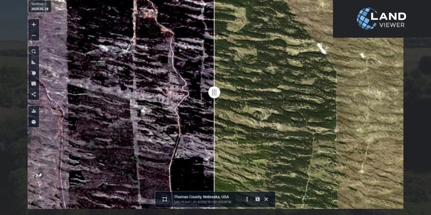
Kun-Yuan Lee, a former Conservation Forester GIS specialist at NFS, decided to take the matter into his own hands. He got access to EOSDA LandViewer, a high-resolution satellite imagery platform by EOS Data Analytics, a global provider of AI-powered satellite imagery analytics, that allowed him to retrieve forest images, process them automatically, and apply vegetation analysis. Read on to learn more about this case.
| Challenge | Nebraska Forest Service required an effective and easy-to-use tool to monitor forest health remotely. The satellite imagery analytics method overweighted the usual manual searches. |
| Solution | Kun-Yuan Lee, a former Conservation Forester GIS specialist at NFS, used EOSDA LandViewer and NAIP images with NDVI and EVI indices to monitor the required area. |
| Outcome | The team has saved approximately 30% of their time using EOSDA’s automated reporting features and improved their data accuracy by 40%. |
Local Context: Extensive Monitoring Area Of NFS
The forestry industry faces challenges such as climate change, pest infestations, and wildfires, significantly impacting woodland health and sustainability. These challenges require efficient and accurate monitoring and data analysis to manage and mitigate their effects. Thus, various forest services and conservation organizations aim to monitor forests efficiently and without too much manual labor. Automating the processes is a current trend in forest management worldwide .
Nebraska Forest Service is an affiliate of the University of Nebraska. It is dedicated to the sustainable management and protection of Nebraska’s tree and forest resources. NFS’ services include forest health monitoring, rural fire protection and control, urban and community forestry, and rural forestry assistance. The organization utilizes advanced GIS technologies to support its mission and enhance operational efficiency.
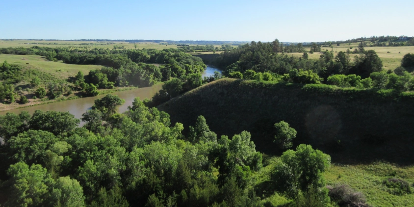
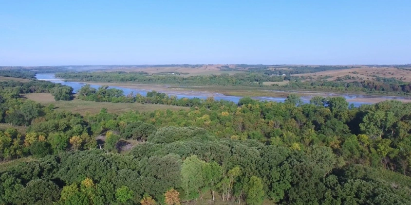
According to the US Forest Service, Nebraskan woodlands and grasslands account for 1.1 million acres . NFS faced a significant challenge in monitoring and managing the health of such extensive forested areas. In the initial stages of the woodland health monitoring projects, NFS specialists relied on ground-based surveys and low-resolution aerial imagery, which provided limited coverage and insufficient details. This made detecting early signs of pest infestations, disease outbreaks, and other threats to forest health difficult. The only tool that could provide the required coverage was satellite monitoring. Still, the availability of high-resolution satellite imagery was limited due to the high costs of the services, further complicating the efforts to obtain timely and accurate data.
Focus: Precision In Monitoring Forest Health
For NFS, traditional methods of forest health assessment were time-consuming and labor-intensive and often required more precision for effective forest management. As a result, there was a pressing need for a solution to assess canopy coverage and forest health. One of the main challenges was processing and assessing large volumes of spatial data quickly. NFS needed a tool that could streamline and improve accuracy.
This ineffectiveness of NFS’ monitoring capabilities prompted the use of satellite-based imagery analytics tools. Kun-Yuan Lee, a former Conservation Forester GIS specialist at NFS, started to research different opportunities and stumbled across EOSDA LandViewer. He started utilizing it in his work in September–October 2023. Armed with remote sensing and GIS analysis tools, Kun-Yuan and his colleagues aimed to overcome these challenges to monitor forest health more effectively.
Research: About Kun-Yuan Lee’s Study
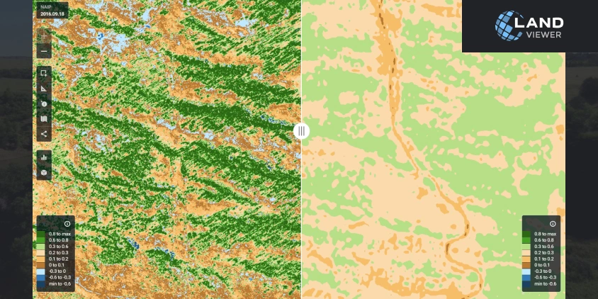
To enhance its canopy studies, NFS started processing high-resolution satellite imagery extracted from EOSDA LandViewer using remote sensing and GIS tools. Kun-Yuan utilized the platform’s automated data processing and advanced vegetation assessment features. These tools helped him quickly capture canopy cover maps and identify areas of potential negative impact like fires or pests, streamlining the forest health assessment workflow.
Our use of EOSDA products is particularly vital for our forest health monitoring and conservation planning efforts, allowing us to conduct detailed canopy studies and assess forest conditions accurately.
The image of the area of interest was downloaded from the platform and processed locally. The automated data processing features significantly reduced the time required for data analysis, while the advanced vegetation analysis tools provided more accurate than manual assessments of canopy coverage. These workflow enhancements allowed them to deliver faster and more reliable results to their stakeholders. Those stakeholders include farmers, landowners, community councils, Nebraska Statewide Arboretum, Lincoln Electric System, and the Rural Volunteer Fire Department. They are also working on federal grants that assist communities and counties with prescribed burns and help coordinate with local and neighboring state fire departments.
Kun-Yuan noticed that some of the NAIP images on EOSDA LandViewer at specific locations were outdated, representing information from 2016. However, the official NAIP website had the 2020 imagery. Other satellite images remained up to date. He used the NAIP website to download the pictures for processing while using EOSDA LandViewer data to fill in some remote areas.
Thus, EOSDA LandViewer became a bridge between the high-resolution imagery obtained from various satellites and the analysis results that Kun-Yuan Lee and his team calculated to assess the forest health.
Before the EOSDA platform, our data processing times were significantly longer, and our accuracy in assessing canopy coverage was limited. Post-implementation, we have seen a reduction in processing time and an improvement in data accuracy, leading to more reliable assessments and faster project turnaround. The integration of EOSDA solutions has improved our operational efficiency and strengthened our ability to manage and monitor Nebraska’s forests.
These results have been observed over a quarter. The team has saved approximately 30% of their time using EOSDA’s automated reporting features and improved their data accuracy by 40%.
Perspectives: Enhanced Conservation And Sustainable Forest Management
The NFS GIS team has now reached its short-term goals, which included improving its forest health monitoring capabilities and expanding its GIS applications for better data analysis and reporting. In the long term, NFS aims to enhance its conservation efforts, promote sustainable forest management practices, and increase public awareness and engagement in forest conservation.
Tools like EOSDA LandViewer can help reach those goals, as was clearly seen in this case. High-resolution imagery analytics allows scientists and researchers to provide evidence-based reports to their stakeholders and wider audiences, and this, in turn, allows for more sustainable actions from the public.
Implementing EOSDA LandViewer significantly enhanced our project outcomes. Specifically, we were able to detect early signs of pest infestations, disease outbreaks, and other threats to forest health more effectively. As a real example, we wouldn’t have known the information if the NAIP image had been available only in 2020 but not in 2021. Essentially, LandViewer fills these gaps and allows us to have better assessments. For NAIP images, especially in Nebraska, we do not get updates every year.
EOSDA aims to help scientists like Kun-Yuan Lee strengthen their research and boost their institution’s work. We are welcoming students, independent researchers, non-profit organizations, universities, and scientists to use our tools and take all the possible benefits from them.
About the author:
Kseniia Kunakh has over 6 years of writing experience, working in various domains, including business, educational, and media-directed texts. Kseniia’s previous experiences as a development manager in a Ukrainian eco-NGO and as a talent matcher in an IT company make her a perfect combination of someone who is passionate about eco-tech innovations and can communicate about them with ease.
Recent articles

EOSDA Forecasts Yields For 2025 In Saskatchewan
EOSDA created RM-level crop yield forecasts for Saskatchewan to address limitations of official data. The project shows how satellite and weather inputs reveal local yield changes during the season.

Digital Tools Improve Soil Health And Yields In Mexico
EOSDA and ITTA supported a Guanajuato farm with contour-line planning, monitoring tools, and practical guidance to reduce soil erosion and improve yields in the long run.

Analyze 2025 & Plan Your Best Year Yet: LandViewer Christmas Offer
It’s the most wonderful time of the year! The Christmas holidays are here, and so is your chance to analyze 2025 and plan a prosperous 2026 with more affordable Pro plans in LandViewer.