Satellite Images Of Los Angeles Wildfires
- Location
- Los Angeles (LA), USA
- Coordinates
- 34.07328° N, 118.37837° W
- Satellite
- Sentinel-2
- Tags
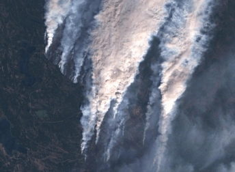
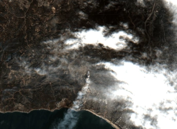
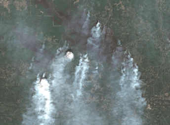
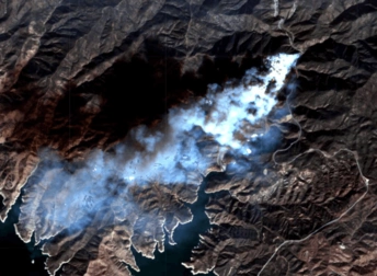
Wildfires in Los Angeles are not uncommon, but few are as destructive as the combined 14 wildfires affecting the LA metropolitan area in early 2025, with two major blazes causing most of the damage: the Palisades fire and the Eaton fire. The satellite images of LA fires helped emergency teams track wildfire’s direction and speed, enabling them to extinguish. Although it is not entirely possible to prevent these disasters, it shows the importance of continuously monitoring weather conditions and conducting regular pruning work.
Key Facts About The LA Fires
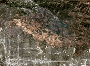
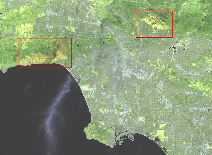
In early January 2025, the accumulation of combustible vegetal material and the lack of rain in the previous months set the ideal conditions, with Santa Ana winds contributing to the spread. The fires raged for a bit less than a month, until their final containment on January 31st. In the meantime, they engulfed large populated areas, including the iconic coastal community of Malibu and entire neighborhoods in the Altadena-Pasadena region. The satellite images of the LA wildfires revealed a terrific aftermath, with thousands of acres scorched, hundreds of structures destroyed and a large number of displaced people.
Interpretation Of Satellite Imagery Of LA Fires
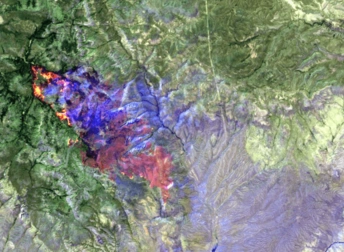
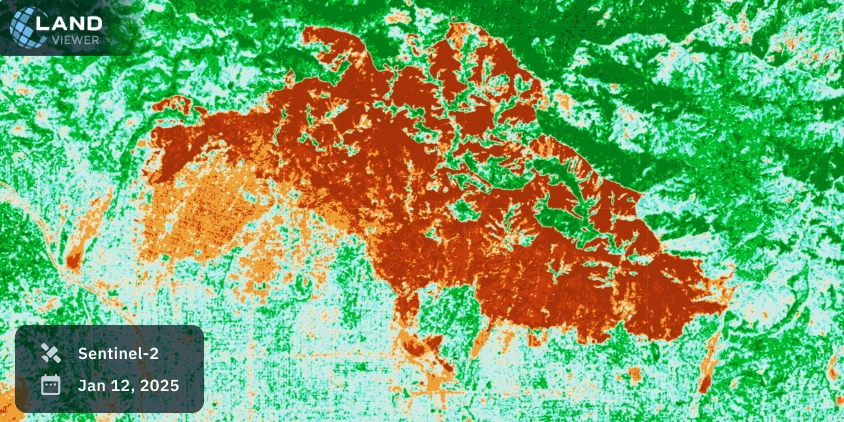
The following satellite view of the LA wildfires provided by Sentinel-2 uncovers the extensive destruction caused. Applying the NBR index to satellite images, it is possible to identify what areas have been burned during the wildfires and also assess the burn severity.
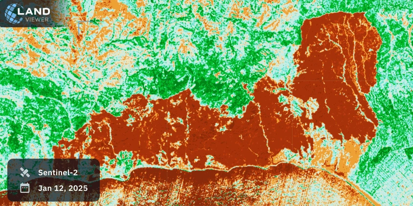
The NBR index relies on both NIR and SWIR wavelengths. Healthy vegetation exhibits high reflectance in the near-infrared (NIR) spectrum, whereas the areas recently burned reflect strongly in the shortwave infrared (SWIR) spectrum. Any satellite view of the Los Angeles fire can be easily interpreted thanks to the color composition: green areas are intact, orange indicates moderate severity, and red areas have recently burned (high severity).
Historical Background
California is an area historically prone to wildfires, with several devastating ones since the beginning of the century. Climate change is one of the factors that have intensified conditions favorable to fires: the soil moisture has decreased, droughts last longer and are followed by heavy rain, resulting in abundant dry vegetation as fuel. Urban expansion and land use have also contributed to this problem.
These catastrophic events highlight the need for long-term satellite monitoring to track climate patterns. By comparing past and present events with remote sensing, it’s possible to reveal changes over time in the surface and identify immediate danger.
Explore more satellite images of Los Angeles fires further on EOSDA LandViewer to analyze real-time and historical satellite data.