Satellite images of Palisades fire
- Location
- Pacific Palisades, USA
- Coordinates
- 34.07870°N, 118.54584°W
- Satellite
- Sentinel-2
- Tags
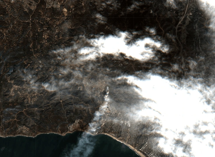
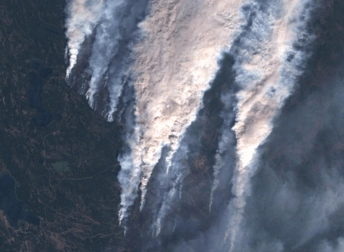
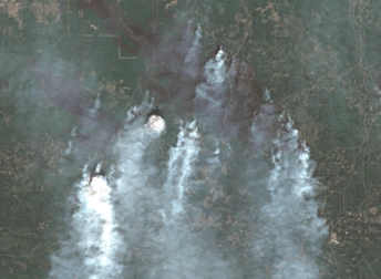
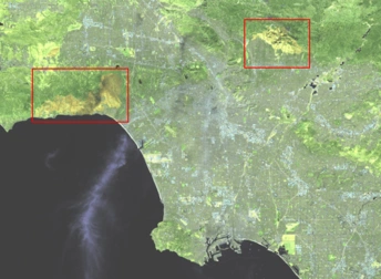
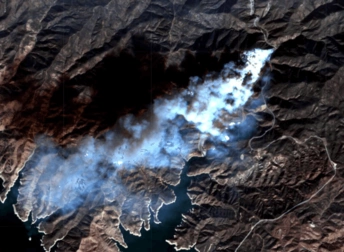
On January 7, 2025, the Palisades fire spread across the coastal hills of southern California. Although strong winds prevented aircraft from flying and monitoring the situation, optical and radar satellite views captured everything. For example, the Pacific Palisades fire satellite image above shows a thick smoke drifting southwest over the ocean. In the center of the image, the wildfire front can be viewed burning through dry vegetation and leaving dark patches on the hillsides, in contrast to green and brown untouched areas.
Key Facts About Pacific Palisades Fire
The wildfire broke out on January 7, 2025, in Los Angeles County and raged for 24 days before being contained. It scorched about 24,000 acres (9,700 ha), destroyed nearly 6,800 buildings, and forced thousands of inhabitants to evacuate.
Severe drought and fierce Santa Ana winds fueled the wildfire spread. Since agencies couldn’t fly because of the continuous high winds, smoke, and the fact that the flames were also burning at night, Palisades fire satellite views were crucial in gathering information about the situation and organizing rescue operations.
Interpretation Of Palisades Fire Satellite Images
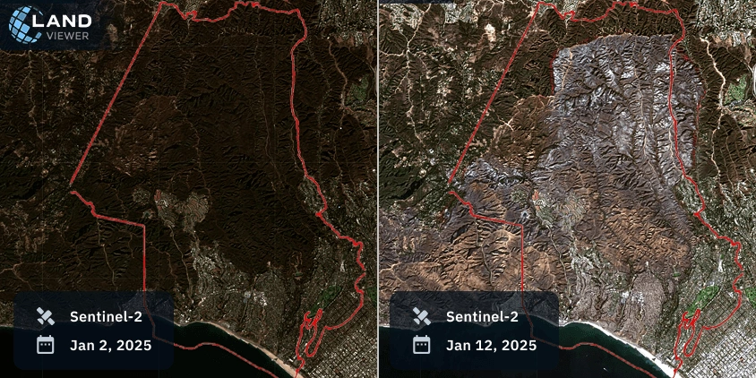
Our comparison of 2 Sentinel-2 images captured before and after the wildfire shows how quickly and drastically the landscape changed:
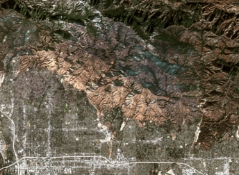
- On January 2, 2025 (image on the left), the slopes are covered in dense green shrubland, with dark green and brown tones marking healthy coastal vegetation.
- Ten days later, on January 12 (image on the right), a wide burn scar stretches across the central and northern parts of the neighborhood. Gray and light brown tones on this view replace what was once green. Coastal urban areas remain largely intact, sharply contrasting with the view of surrounding damage.
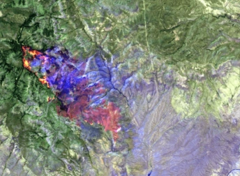
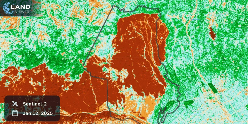
The Normalized Burn Ratio (NBR) was applied to the Pacific Palisades fire satellite view to highlight the burn severity. In this view, red marks severely burned land with exposed soil, green marks healthy vegetation, and light cyan/blue marks sparse growth or urban surfaces. This spectral analysis emphasizes the wildfire’s uneven impact and provides valuable information for damage assessment and recovery efforts.
The Wildfire Historical Background
Wildfires in Los Angeles County happen regularly and have been part of its life for decades. Since the 1950s, the region has often dealt with blazes caused by heat, drought, and strong Santa Ana winds. The 2025 wildfire was the most devastating, but the reasons behind it are familiar: rising temperatures, dry weather, and fast-growing plants after short rainy periods. As more homes are built near natural areas, the risk keeps growing.
Satellites have helped us view this pattern over time. Landsat images from the 1980s show early burn scars, while Sentinel-2 images now track active perimeters in near real time. Comparison of recent satellite images of the Pacific Palisades fire highlights that the 2025 catastrophe overlapped with earlier burn zones. Continuous satellite views help us see how the land recovers and spot places that might be in danger again.
Explore the Palisades fire further on EOSDA LandViewer to analyze both real-time and historical space imagery.