Satellite images of Arizona wildfires
- Location
- Arizona (AZ), USA
- Coordinates
- 33.82733° N, 110.93398° W
- Satellite
- Sentinel-2
- Tags
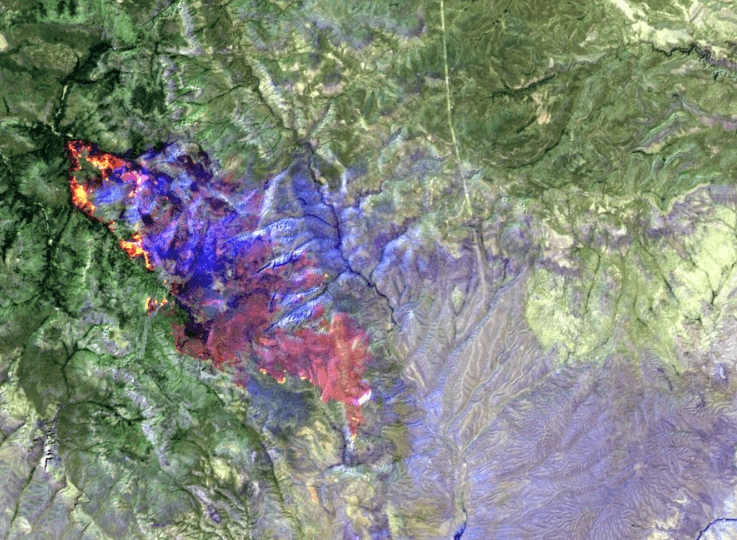
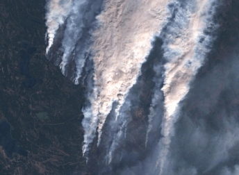
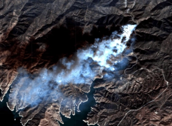
Wildfires are a recurring threat in Arizona, where hot, dry conditions allow flames to spread rapidly across forests and grasslands. The view above shows the Billy Fire, one of the most damaging blazes of the season. Such events highlight the importance of monitoring through satellite images of Arizona wildfires, which provide valuable insights into fire progression, the scale of destruction, and risks to nearby communities. These images also help compare current events with past seasons, offering a clearer view of long-term environmental change.
Key Facts about Arizona Fires
In summer 2025, the state was once again gripped by devastating wildfires, with blazes spreading rapidly in several counties. The largest, already mentioned Billy Fire, broke out on July 9, scorching thousands of acres of forest and threatening nearby communities. These wildfires, fueled by extreme heat, drought, and strong winds, underscore the growing threat climate change poses to the Southwest.
Interpretation of Satellite Image of Arizona Fires
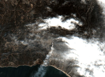
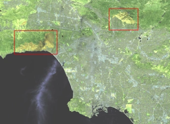
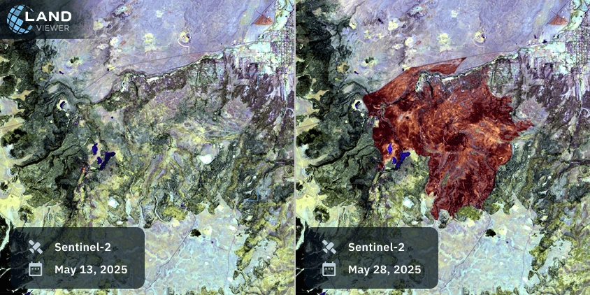
The Sentinel-2 satellite view provides a clear picture of how fires spread and the damage they leave behind. The comparison of the Greer Fire shows two stages: on May 13, 2025, just as the fire began, there are no visible burn scars; by May 26, the affected area is clearly marked, with the flames having come dangerously close to the town of Eagar, shown in turquoise in the upper right corner.
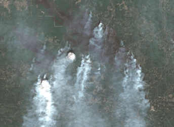
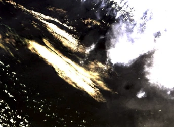
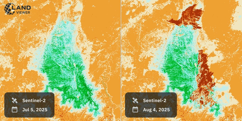
Another example can be seen in the Dragon Bravo Fire, where satellite indices reveal the full scale of forest loss. The Dragon Bravo Fire pictures, taken on July 5 and August 2, 2025, use the Normalized Burn Ratio (NBR) index to highlight burn severity. In these Arizona wildfire satellite views, red indicates burned areas while green marks forests that remained intact. Mosaic technology combines the imagery, showing how the flames expanded over time and how much forest cover was lost.
Historical Background
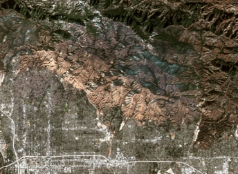
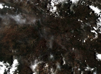
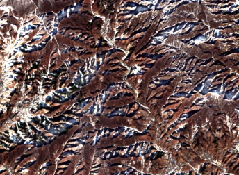
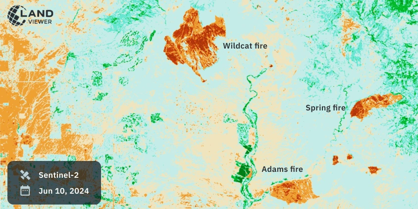
As we see in the image below, wildfires are not new to the area, but satellite views show they are becoming more frequent and intense. Recurring blazes have scorched vast areas, leaving lasting ecological impacts. Long-term satellite monitoring allows scientists to track patterns, evaluate forest recovery, and study how climate factors like rising temperatures and prolonged drought contribute to these events. Comparing current data with past seasons provides crucial insights for planning prevention strategies and highlights the value of observing Arizona’s landscapes from space. Monitoring their scale and progression through satellite images of Arizona wildfires helps responders and scientists understand both immediate damage and long-term consequences for ecosystems and people.
Explore Arizona wildfire via satellite view further in EOSDA LandViewer to analyze real-time and historical satellite data.