Satellite views of California wildfires
- Location
- California (CA), USA
- Coordinates
- 34.569127° N, 118.559727° W
- Satellite
- Sentinel-2
- Tags
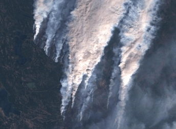
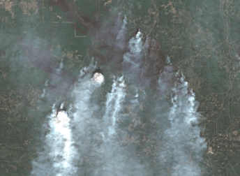
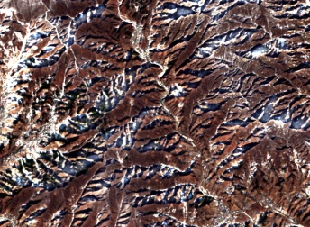
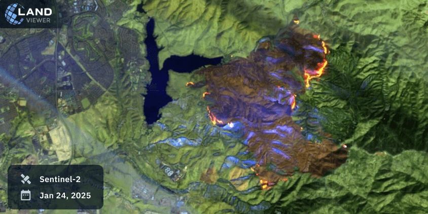
The pictures of devastating California fires from space reveal the true scale of destruction across the state. Recent satellite images of those captured by Sentinel-2 highlight how quickly flames spread through forests, threatening nearby communities. A satellite image above shows clear smoke plumes, burn scars, and active hotspots. This helps scientists and the public monitor the disaster’s extent and plan recovery.
Key Facts About California Wildfires
In January 2025, a series of major wildfires, including the Palisades and Eaton Fires, swept through Los Angeles County, fueled by intense Santa Ana winds and prolonged dry conditions. By January 21, these blazes had charred almost 38,794 acres, destroyed over 12,000 structures, and placed around 88,000 residents under evacuation orders. California wildfires fires satellite view records used for tracking fire perimeters, heat signatures, and smoke plumes were critical for guiding emergency response and managing public safety.
Interpretation of Satellite Image of California Wildfires
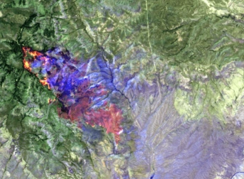
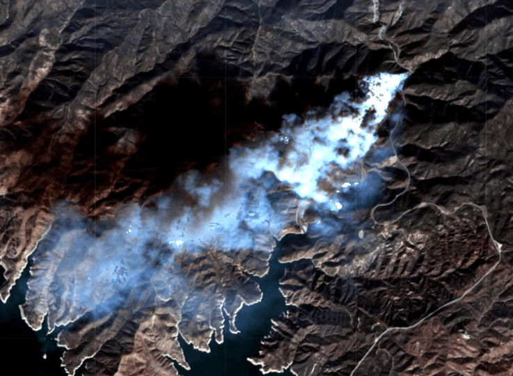
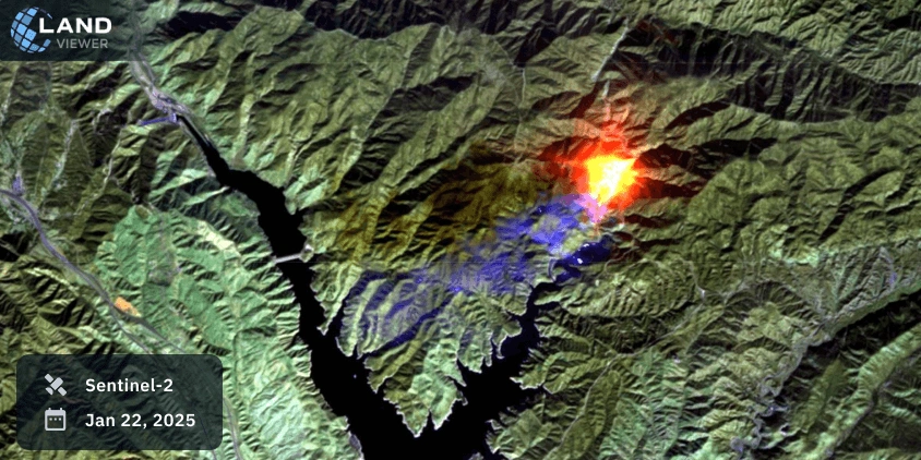
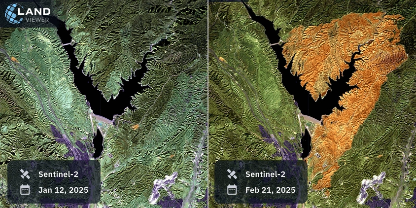
A detailed satellite imagery of California fires reveals several elements. In false color, dense forests appear dark green, while burned zones turn brown or orange. Blue-tinted smoke drifts from the epicenter near Castaic Lake, covering Lake Hughes Road. Shades of red and yellow highlight areas where the fire remains active, moving dangerously close to infrastructure.
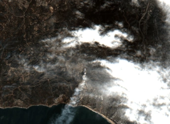
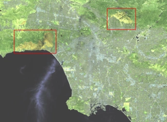
Another satellite view shows flames approaching Lower Otay Lake and nearby houses. Smoke trails extend toward residential areas, while NBR analysis confirms vegetation loss and identifies risks of further spread. Such satellite map readings help track changes over time and pinpoint hotspots still burning.
Historical Background
These wildfires are part of a recurring pattern. Similar disasters in 2020 and 2023 were also recorded from space, showing how climate change and land use drive more frequent events. Long-term space view of California fires provides policymakers and scientists with crucial insights for prevention and adaptation.
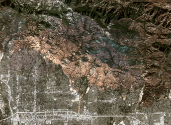
From Castaic Lake to Otay Mountain, the latest California fire space image series highlights the growing scale of wildfires and their impact on communities. By comparing past and present events, satellites reveal both immediate dangers and long-term changes. Access to accurate historical and current satellite images of California fires ensures better preparedness, faster response, and more effective recovery.
Explore California wildfires further on EOSDA LandViewer to analyze real-time and historical space data.