Satellite Images of Alberta Wildfires
- Location
- Alberta, Canada
- Coordinates
- 54.87917° N, 116.03523° W
- Satellite
- Sentinel-2
- Tags
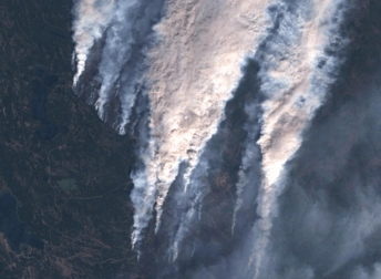
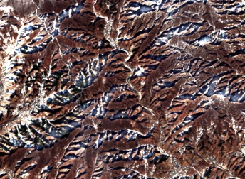
Unfortunately, the trend of wildfires in 2025 in the province of Alberta, Canada remains similar to previous years. Numerous fires starting from April have raged the region in different locations even before the boreal summer had even begun. Climate change, through higher temperatures and drier conditions, has led into a longer fire season with fires now more frequent and severe than decades ago. The satellite map of the Alberta fires shows a gritty aftermath, with thousands of hectares burned, a landscape that will take years to recover, and hundreds of Albertans evacuated every year.
Key Facts About The Alberta Wildfires
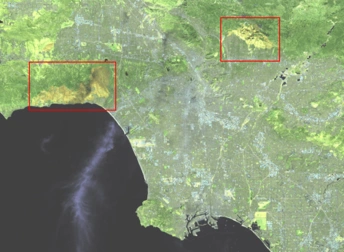
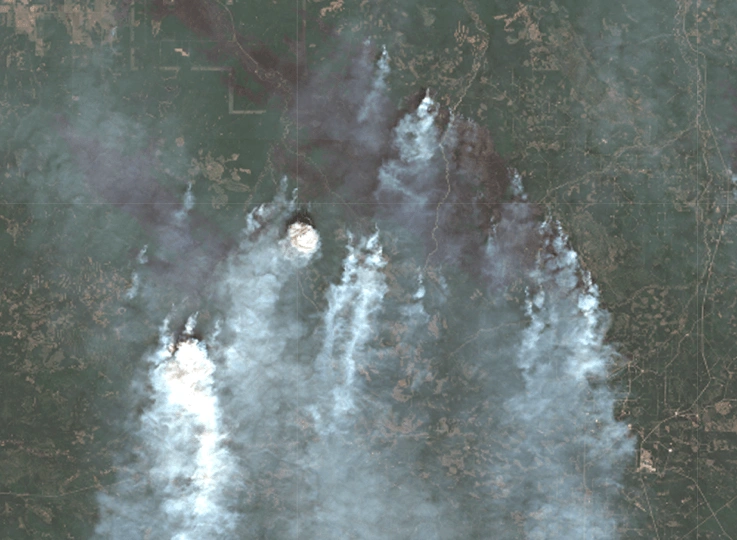
The intense fire activity in the province is a mix of dry conditions aided by a low level of snow during the winter, hot temperatures and occasional high wind. The Edith Lake fire broke out on May 25th, about 7 km north of the town of Swan Hills, forcing the residents to temporarily evacuate shortly after, as it ran out of control and the flames drew closer. Another fire in the county of Grande Prairie forced an evacuation of people and livestock. In total, more than 600,000 hectares have burned in the first 8 months of the year.
Interpretation Of The Satellite Images Of The Alberta Forest Fires
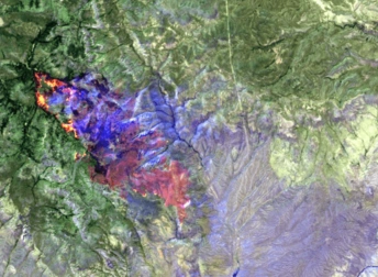
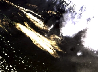
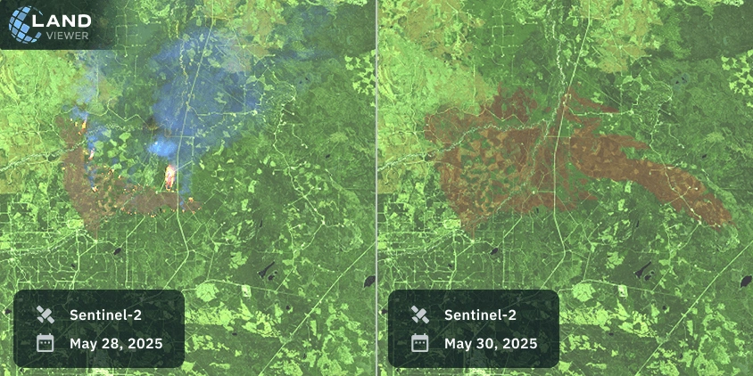
A glance at the Alberta wildfires from the space reveals the severity of these events over the years. The fire in Edith Lake in May 2025 was held in just a few days, yet it burned a vast area of land, as seen in the following images.
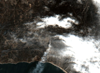
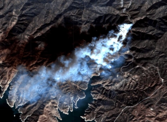
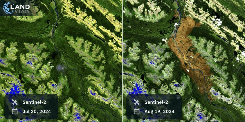
In 2024, the wildfire of the Jasper National Park had its origin on July 22nd due to several lightning strikes. The fires started from north and south and ended up engulfing the entire resort town of Jasper shortly after.
Historical Background
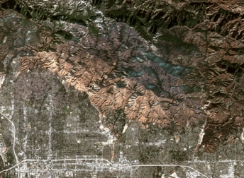
Despite Alberta forests mainly consisting of deciduous trees, considered low-flammability, climate change has sharply increased their vulnerability. Fire springs ignite when the trees have not yet grown their leaves, where they store moisture. Another critical factor is the combination of a lower snow level during winter, which creates a dry environment, and the increasing average temperature every year, making wildfires more likely to occur.
Local organizations have begun developing new strategies to address this growing issue. Satellite monitoring has become one of the main tools to track climate patterns, understand the conditions of Alberta forests, and create a map that reflects potential vulnerabilities. Thanks to this satellite-based map, all parties involved have access to critical data no matter where they are or what their job is.
Explore more satellite images of the Alberta fires on EOSDA LandViewer to analyze real-time and historical satellite data and create your own map.