LandViewer to solve agricultural challenges in a smart way
Stop walking every acre. Get a clear view of crop health and risks with precise satellite data for agriculture.
- Spot issues early — crop stress, pests, or weak growth.
- Plan smarter — track growth and optimize inputs.
- React faster — visualize flood, fire, or drought impact.

Overcome every field challenge with LandViewer
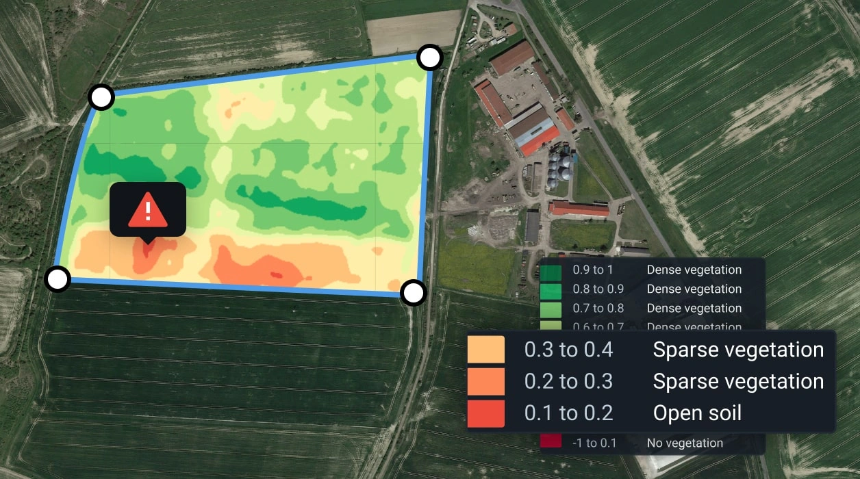
Find yield-killing issues with satellite crop monitoring
- Regular overview of field conditions: track crop stages and catch early warning signs without walking every hectare.
- Stop pests in their tracks: see unusual stress patterns that often signal infestation via crop satellite imagery.
- React faster to drought: identify water-stressed zones before they overtake the field.
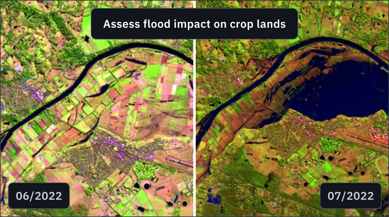
Speed up insurance claims with undeniable proof
- Assess impact instantly: map flood or wildfire damage and share unbiased satellite images of agriculture lands as proof.
- Skip the field walk: get a precise damage overview to resolve disputes and speed up your compensation.
- Prioritize recovery: know exactly where to replant immediately and which areas are too damaged to save.
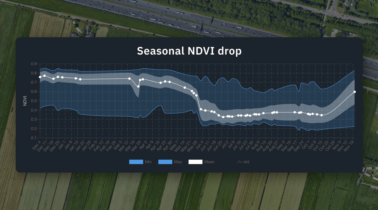
Use historical data to guide this season's plan
- See long-term field trends: find the zones that always struggle and the ones that thrive year after year.
- Predict risks early: use historical patterns to anticipate drought stress, poor growth, or nutrient issues.
- Optimize inputs: make smarter calls on planting, irrigation, and fertilizer based on field history, not memory.
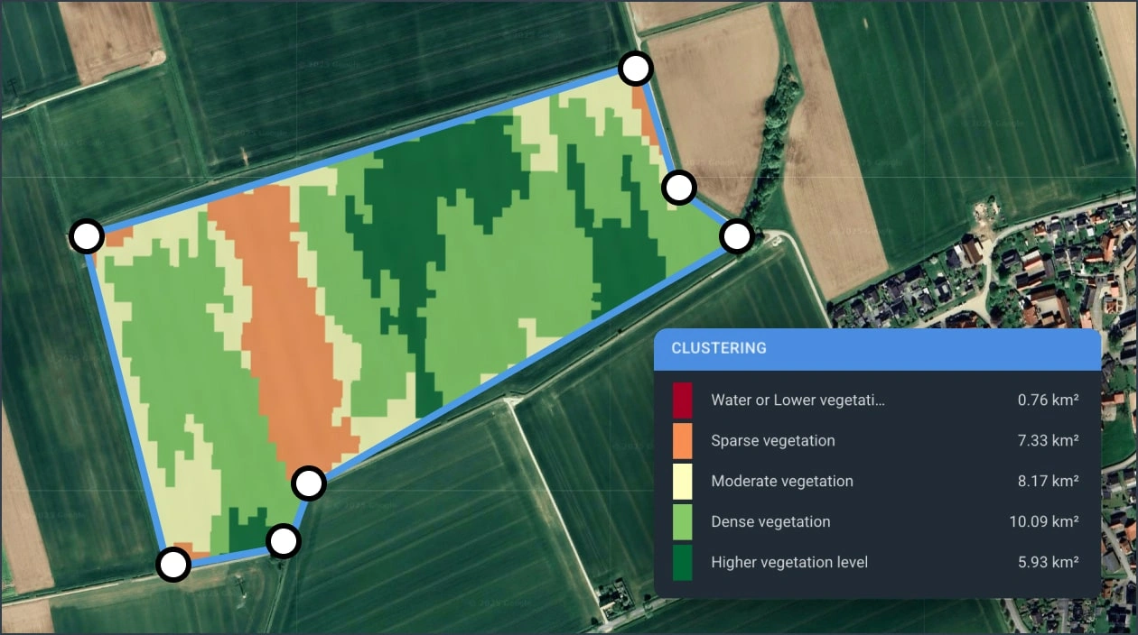
Keep your livestock well-fed with better grazing
- See actual feed level: get a full view of available grass density with NDVI satellite imagery.
- Identify grazing issues: clearly see bare patches, weak vegetation, and overgrazed zones on the map.
- Improve rotation planning: rest stressed paddocks and direct herds to strong zones to keep forage stable.
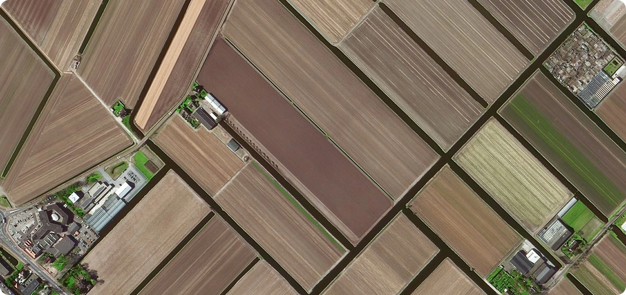
High-resolution satellite imagery for better agricultural precision
See your fields in stunning detail, even the smallest plots with a rich archive since 2006 or request satellite tasking.
- Catch issues others miss: detect crop stress, pests, or soil problems on small or dense fields.
- Support accurate claims: verify damage after droughts, floods, or storms with detailed imagery.
- Monitor growth with confidence: track individual field sections or even single crops with NDVI images.