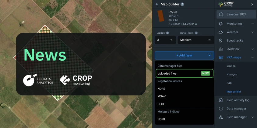
EOS Data Analytics, a global provider of AI-powered satellite imagery analytics, has enhanced EOSDA Crop Monitoring, an online satellite-based precision agriculture platform for field monitoring, by introducing the VRA Map Builder feature.
This update allows farmers and agronomists who use smart machinery to create detailed Variable Rate Application (VRA) maps by integrating data from various sources, including satellite imagery and machinery files. The feature is now available to users using EOSDA Crop Monitoring on a Professional plan.
Farmers who practice precision agriculture often face the challenge of creating accurate VRA maps based on yield data. Traditionally, this process involves using complex software tools, which require a high level of expertise. With the new Map Builder feature, EOS Data Analytics addresses these challenges by offering a more accessible and streamlined solution.
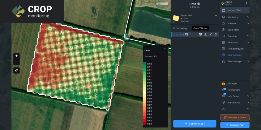
The VRA Map Builder allows users to upload yield data files from their machinery into the EOSDA Crop Monitoring platform. Once uploaded, this data can be used to generate VRA maps that optimize the application of inputs like seeds and fertilizers. By adjusting the input levels according to the actual productivity of different field zones, farmers can improve their crop yields, reduce costs, and minimize environmental impact.
Many farmers trust the data collected directly from their equipment over other sources. By integrating this data seamlessly into our platform, we’re simplifying their workflow and enhancing the accuracy and reliability of their decision-making process.
The primary expected audience for the Map Builder feature includes farmers and agricultural enterprises with access to smart machinery capable of collecting yield data and performing VRA. This tool will also be particularly valuable for users who plan to start using differential seeding and fertilization practices.
Our crop monitoring system for an agricultural field suggests three ways to create a VRA map using the new Map Builder feature.
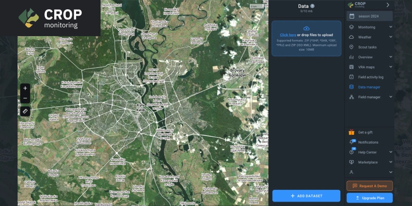
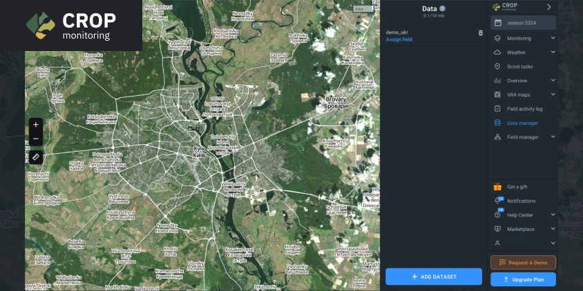
The first one involves using Data Manager. The user can open it and upload yield data from the machinery. After that, they will need to select the relevant field (or create a new one) and assign it to the uploaded data. Then, when hovering over the uploaded file, users will be able to press Create VRA Map and, if necessary, adjust the new map’s settings before using it.
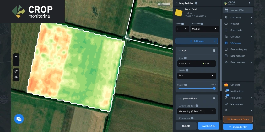
The second way is to use the VRA Maps option in the side menu and click Map Builder. There, the user can create a new field map and supplement it with machinery data by clicking Add Layer and then Upload New File. Then, an existing field must be assigned to the uploaded file. This will allow adding the data from the uploaded file as a layer in the VRA map of the field.
Finally, if the user has already uploaded the file from their machinery, they can proceed to VRA Maps and Map Builder to select a field, press Create map, and create a VRA map with data from the uploaded file as one of its layers via the Add layer button and Uploaded files option in the dropdown menu.
The result is a highly customized VRA map tailored to the specific conditions of a selected field.
The new feature is now available as part of the Professional plan for EOSDA Crop Monitoring, providing users with the necessary features to enhance their precision farming efforts.
About the author:
Maksym Sushchuk is at the forefront of realizing EOSDA's vision to make space tech a global driver of sustainability on Earth. He has over 15 years of experience in journalism and content creation for prominent Ukrainian startups, charitable funds and ESG businesses. As Head and Co-founder of PR Army Maxim brings attention to the human and social tolls of the aggression against Ukraine.
Detect crop risks earlier with AI-powered field alerts.

More news
Mask, Layer, And Indices: New In EOSDA Crop Monitoring
Explore the new features added to EOSDA Crop Monitoring in Q3 2024: cloud/shadow mask management, Planet data integration, new indices, activity recommendations, and mustard growth stages.
Free Access To EOSDA Crop Monitoring For Ukrainian Farmers
EOSDA, an expert on the local market, provides Ukrainian farmers, agrarians, and agribusinesses with 500 hectares of free access to EOSDA Crop Monitoring in 2024 for a period of 3 months.
Yield Estimation & More: New In EOSDA Crop Monitoring
EOSDA Crop Monitoring is constantly developing and answering clients’ demands for precision agriculture features. Discover January-March 2024 updates: Yield estimation, Typical growth index, and more.