Crop Damage Assessment
Farmers strongly rely on high yields while crop damage puts the agricultural business at risk. The common types of crop damage occur due to weather extremities, pest or pathogen attacks, wildlife grazing, misuse of chemicals, and poor irrigation.
While stresses are often inevitable, crop damage assessment is an effective way to mitigate losses. Once the problem is detected, farmers can find out the cause and help plants recover. If the damage is irreparable, the existing stand can be replanted. Software to assess crop damage allows understanding of how to act and considering the pros and cons of any scenario.
Crop Hail Damage
Hailstorms are a typical threat to agriculture worldwide. In particular, corn, soybeans, cotton, barley, tobacco, or wheat crop damage by heavy hail is a big concern to the US farmers in Texas, Oklahoma, Kansas, and Nebraska.
Specifics Of Crop Damage Due To Hail
The immediate consequences of hail strikes are broken stems, shredded or ripped off leaves, beaten or fallen fruits. Additionally, pathogens easily find their way through fresh wounds.
Yield losses can be pretty severe if:
- hailstones are big (they can exceed 6 inches (15 cm) in diameter);
- hailstorms last long;
- hailfall swaths are dense;
- heavy hailstones hit ripening fruits;
- plants are too weak to withstand the stress.
Plant vulnerability differs in each crop type and depends on the injured part and growth stage. For example, hailfall essentially threatens corn at tasselling, while cotton is highly sensitive at the bud stage.
Remote Sensing Of Crop Hail Damage
If you suspect that your crops have suffered from recent hailfall, you can estimate crop damage from hail using remote sensing. Generate vegetation indices on EOSDA Crop Monitoring to compare and assess vegetation state before and after the hail events. If there are significant discrepancies between the before and after charts, use the scouting feature and set a task to scouts to check the issue visually. When you know the real state of things, you can run two scenarios: try to recover your crops or replant them. In the case of replanting, it is important to consider current hail crop damage cost estimates versus the risks of yield loss in the late season due to early frosts.

Crop Wind Damage
Strong winds are major environmental stressors that can hinder plant growth and essentially reduce yields. However, farmers can mitigate their losses by analyzing historical weather patterns as well as choosing the most suitable species and planting time.
Strong Winds As A Crop-Damaging Factor
Winds can make quite a big mess on the field through green snap or root lodging. Green snap hits leaves and stalks while root lodging implies rooting plants out. Outraging winds kill most plants, breaking them just above the ground or rooting them out with no chance to re-establish.
Each plant type suffers from wind outrage differently, having its own ability to recover. For example, corn can produce new (yet weaker) ears when green snap breaks the node just below the existing ear. Also, younger plants are likely to return to the upward position after root lodging while yield drops are inevitable at the stage of pollination and tasselling.
Crop Wind Damage Assessment On EOSDA Crop Monitoring
To find out if your crops have suffered from strong wind, you can use one of the available vegetation indices like NDVI, MSAVI, NDRE. This vegetation index can facilitate in assessment of:
- the fact of damage occurrence;
- damage severity;
- affected field zones;
- necessity of recovery measures.
Wind Damage Prevention With EOSDA Crop Monitoring
With the weather feature on the platform, you can analyze wind speed in your area using historical data since 2006 and weather forecasts for 14 days. This data will help you understand climatic patterns for your fields and find out if wind storms are common in the growing season. If so, you can choose wind-resistant species that will suffer least from wind gusts.

EOSDA Crop Monitoring contains historical data dating back to 2006 that can be downloaded for your convenience.
Crop Damage Due To Flooding
Floods put plants at high risk and may lead to complete yield losses, depending on unfavorable conditions.
Flood Crop Damage As An Agricultural Threat
Loss probability depends on several factors that make a stronger impact in combination:
- event duration – the shorter, the better for crop survival;
- individual plant tolerance, e.g., cereals endure waterlogging better than canola or most grain legumes;
- soil type – high water infiltration mitigates risks;
- water level – fully submerged plants cannot breathe and suffer from root rots;
- mud/residue cover prevents photosynthesis but can be removed with sprinkle irrigation or upcoming rain;
- temperature (hot weather increases losses, e.g., corn before producing its sixth leaf will die within 24 hours at 77°F (25°C) and higher).
Assessment Of Crop Damage From Flooding
Despite the high probability of damage, plants can be saved by fast drainage and residue removal. Remote sensing and EOSDA Crop Monitoring will help quickly identify the problem without driving to the field and react correspondingly. Check NDMI in this case. Its high values (0.6-1.0) are likely to signal waterlogging.

You can also use NDVI and MSAVI to detect the damage and track vegetation recovery. The suitability of these vegetation indices depends on the plant’s phenological stage.
Prevention Of Flood Damage With EOSDA Crop Monitoring
Historical precipitation data and weather forecasts allow you to get ready for extremities and save your yields. By comparing historical weather charts, you will also know if the situation worsens or improves year by year to prepare the field correspondingly. Additionally, weather forecasts on EOSDA Crop Monitoring will report on upcoming rainfalls that can potentially cause floods. Empowered with this information, farmers will be able to take timely preventive measures.
Also, EOSDA Crop Monitoring provides data on evapotranspiration informing on water evaporated from the soil and used by the plants. Thus, you will be able to schedule irrigation just to accurately support plant needs, avoiding overwatering and saving resources.
Temperature Crop Damage
Field vegetation can be completely ruined by frosts or abnormal heat, yet, the damage extent is proportional to the event duration and temperature deviations.
Crop Frost Damage
When the temperature drops below 32°F (0°С), plants suffer from freezing stress. They can recover from 1-2-hour moderate frost in the morning but are likely to die from 24-hour milder frost. Damage severity also depends on the plant type (e.g., strawberries, tomatoes, cucumbers, peppers are very tender, while alfalfa is half-hardy). However, even alfalfa can be lost under frost heaving.
Most plants are greatly sensitive to early frosts at flowering, budding, podding, and fruiting. Also, freezing stress can be lethal at early growth stages, causing late freeze crop damage.
Some of the methods to mitigate frost crop damage include:
- planting early-maturing species,
- covering,
- smoking,
- heating,
- sprinkling,
- use of wind machines, etc.
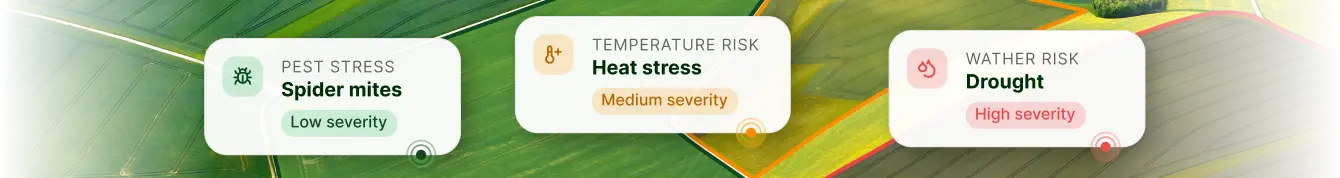
Crop Heat Damage
High temperatures beyond tolerant thresholds kill plants by destroying their tissues (115°F/46°С), slowing down photosynthesis (94°F/34°С), and causing water loss. Signs of heat damage in plants include wilted or scorched leaves, sun-burnt parts, defoliation, among others.
Farmers help their crops cope with heat by shade cloth netting, mulching, and correlating evapotranspiration needs with irrigation. In particular, temperature-reducing irrigation methods are spraying, sprinkling, and misting. Mulching suggests covering plants with straw or agricultural fabrics.
Assessment And Prevention Of Temperature Damage With EOSDA Crop Monitoring
By comparing vegetation indices before and after frost or heat, users can assess temperature crop damage after the extremities. As an additional tool of assessment, the Elevation map helps to understand why some field zones are covered with snow longer. This is because snow thaws slower in lower areas, and low areas are more subjected to frost. It is critical under repeated thawing and freezing, which is lethal to plants. The Elevation map can help in this case by outlining lower zones to remove the snow.
Additionally, field flatting in the future will prevent the risk.

Thermal trends in historical weather on EOSDA Crop Monitoring allow estimating the probability of extremely high or low temperatures during the season and assessing their impact on vegetation.
The EOSDA software also sends out alerts, warning farmers about upcoming extremities. You can modify your settings, specifying what temperatures are too cold or too hot to get alerts about the threat. It will empower you to take preventive measures on time.
Weather on EOSDA Crop Monitoring provides data on precipitation, air humidity, solar radiation, air temperature, and soil moisture.

Other Causes Of Crop Damage
Apart from the above-mentioned unfavorable conditions, farmers lose their yields due to other factors, which include:
- Crop damage from cattle or wildlife, particularly by wild boar, snow goose, moose/elk rabbits, raccoons, groundhogs, etc.
- Crop damage by insects, e.g., weevils, caterpillars, locusts.
- Crop damage due to poor irrigation, pesticide/herbicide/fertilizer burns, and other improper agricultural activities.
- Crop damage from road dust and natural disasters like wildfires.
EOSDA Crop Monitoring will help you detect the damage from miscellaneous factors and identify the cause with the Scouting feature. Once you see drops in vegetation indices, set a task to scouts. Inspecting the field, they will report on the exact cause and damage severity. Additionally, use the variable rate application maps to avoid causing fertilizer or herbicide crop damage due to unjustified chemical applications.
Remote Sensing And EOSDA Crop Monitoring For Field Damage Assessment
Irrespective of the cause, accurate AI-powered analytics of Sentinel-1 and Sentinel-2 imagery by EOSDA can facilitate timely damage detection and preliminary loss estimation. Knowledgeable decisions based on accurate weather data on the platform can increase revenues by 10% per hectare. Get familiar with other useful features on EOSDA Crop Monitoring and avail them for remote and highly efficient management of your fields.