KOMPSAT-2 high-resolution images
Access the LandViewer platform to get KOMPSAT-2 high-definition imagery in just a few clicks.
-
Data type
Optical
-
Resolution
1 m
-
Revision
5.5 days
-
Spectral bands
Panchromatic, Red, Green, Blue, NIR
-
Data archives
Archive since 2006
-
New Image Tasking
Not available

How to obtain KOMPSAT-2 satellite data on LandViewer
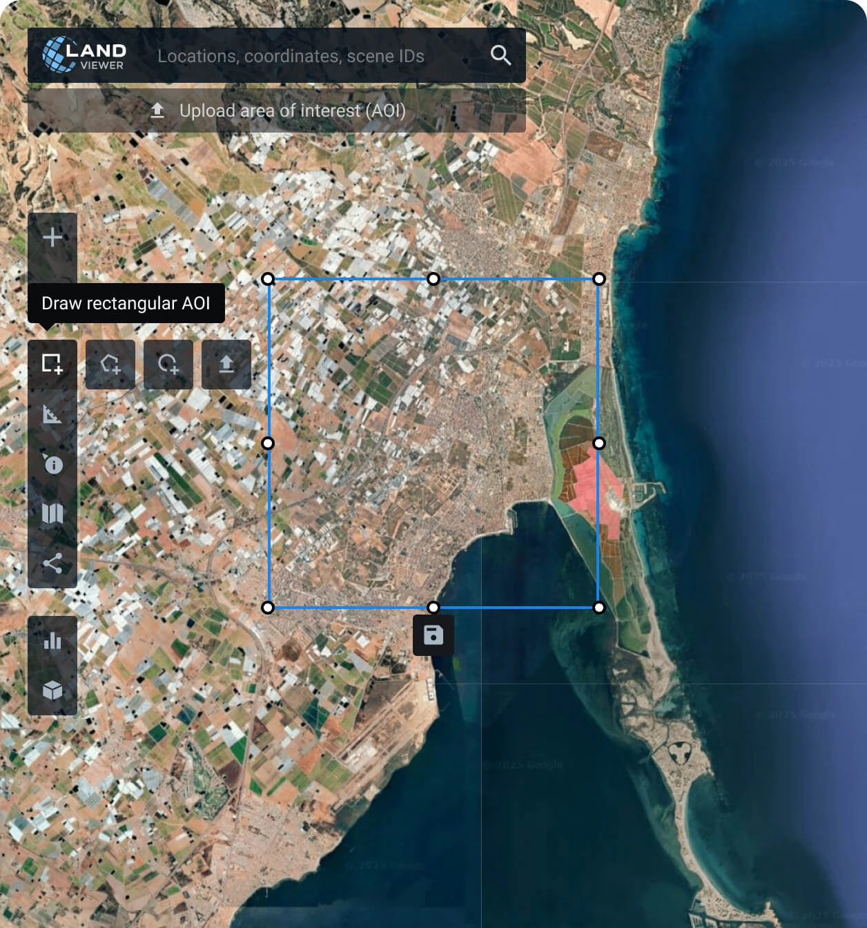
Set your area of interest (AOI)
Establishing an AOI is simple and can be done in several ways: searching for a location, drawing a polygon on the map, or uploading a file with the parameters needed.
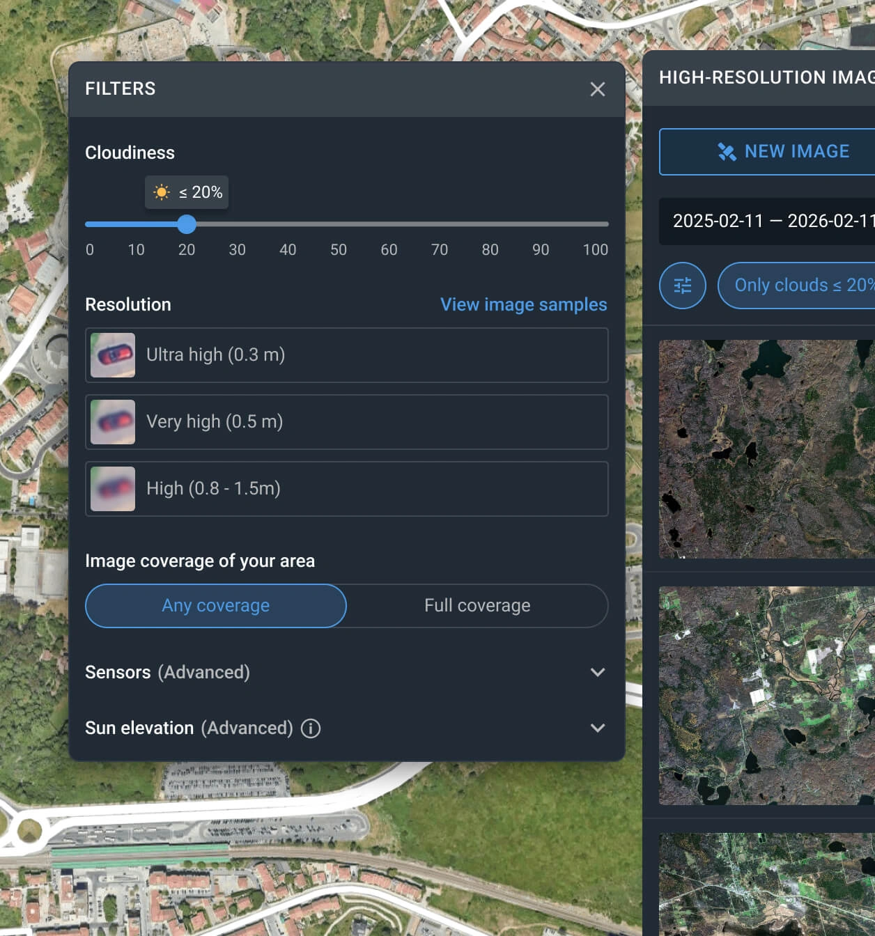
Use the filters to narrow down the search
Apply one or more filters, such as resolution, date, or cloud coverage, to find the KOMPSAT-2 scene that best matches your needs.
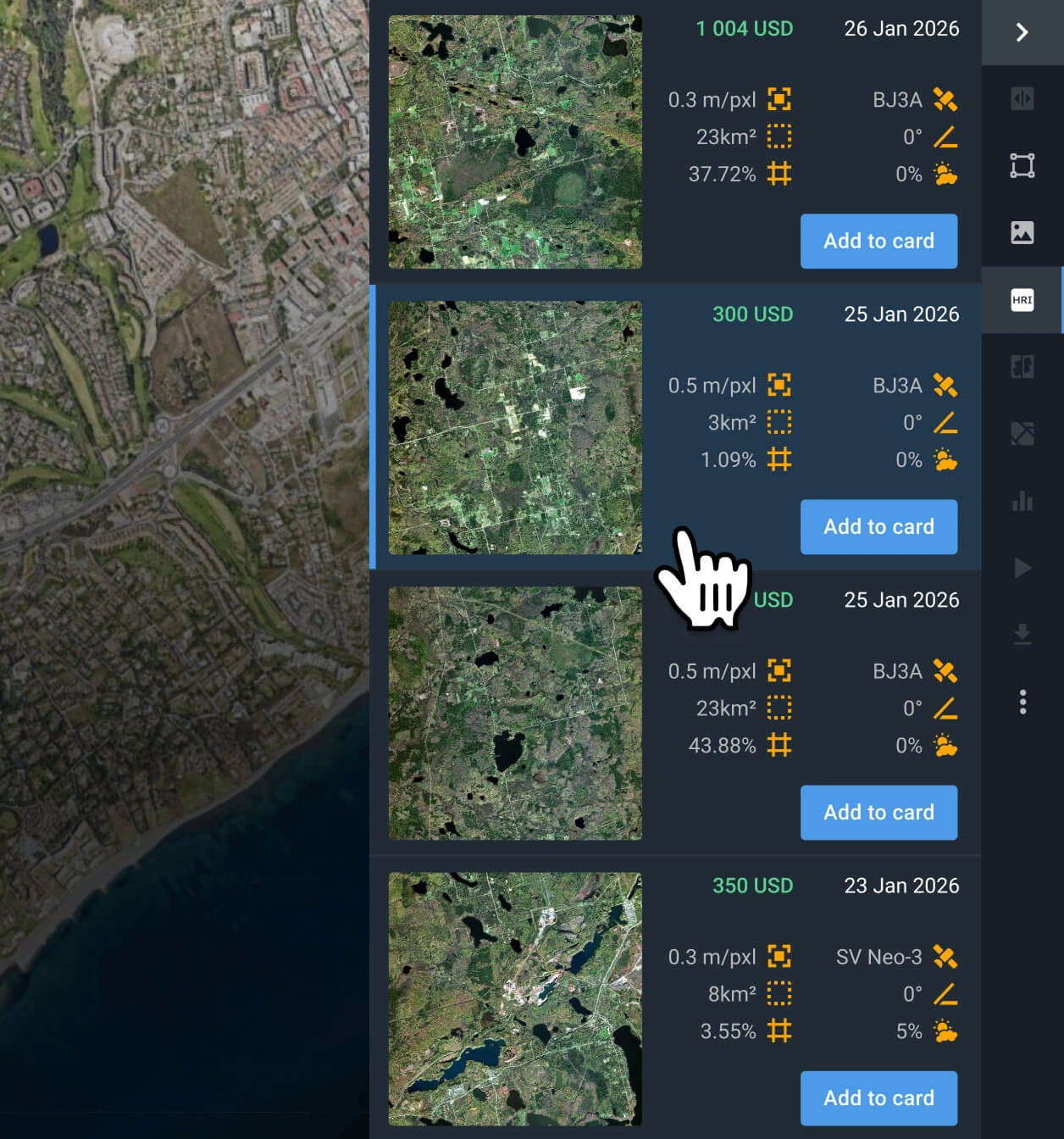
Select relevant KOMPSAT-2 images
Browse the available search results, check pricing details, and select the specific KOMPSAT-2 captures that best fit your project goals.
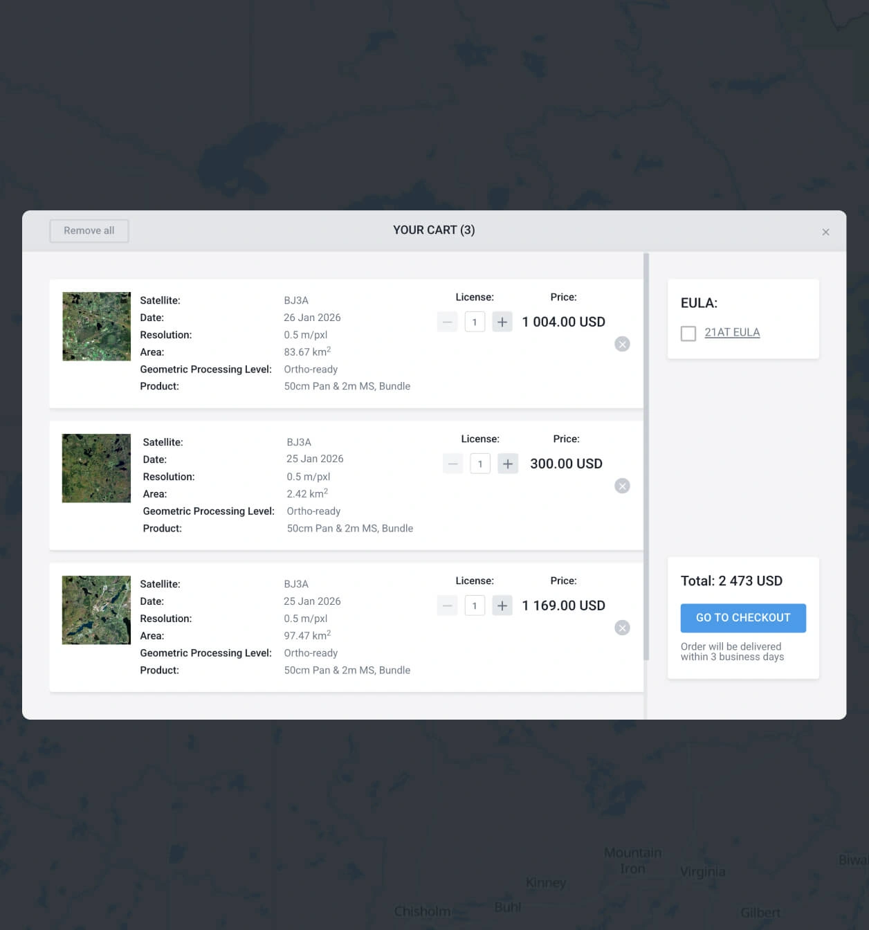
Add what you need to the cart and make your order
Add as many images of KOMPSAT-2 as you need to the cart, and submit your order. You can purchase them yourself or reach our sales team to obtain your payment details.
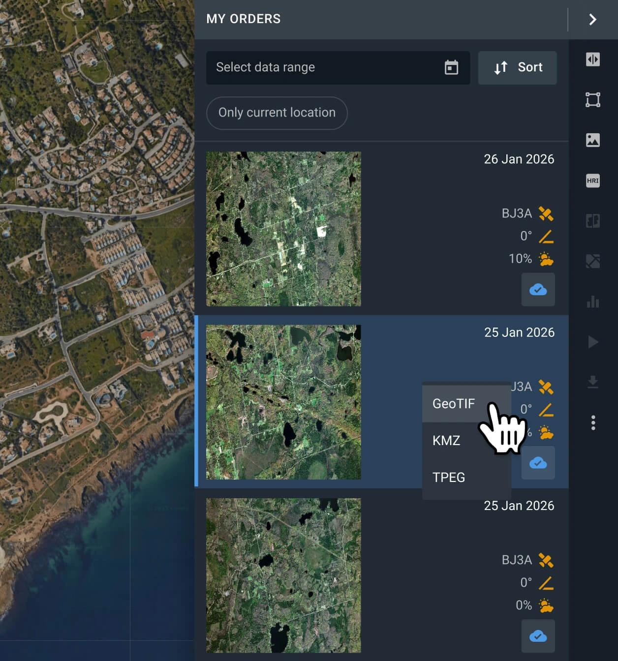
Start with your analysis or export the data
Your KOMPSAT-2 data will be available within 2 business days. Conduct analysis with the built-in options, or export the data in GeoTIFF, KMZ, or JPEG format.
FAQ
How much does a KOMPSAT-2 image cost?
KOMPSAT-2 archive scenes are available from $6.00 per sq km, and the area must be at least 25 sq km.
What are the most common use cases for KOMPSAT-2 imagery?
This imagery is most commonly used for land planning, urban development, field and forest boundary detection, and planning infrastructure corridors. It also excels in GIS mapping and cartography.
Why is tasking unavailable for KOMPSAT-2 satellite imagery?
The KOMPSAT-2 mission ended in September 2022. While archive data remains available, new tasking requests can be directed to the KOMPSAT-3 and KOMPSAT-3A constellations. For those requiring even higher precision, LandViewer also supports tasking for alternatives like SuperView NEO-1, Beijing-3N (BJ3N), and BlackSky Gen 3.
What levels of data processing are available?
All KOMPSAT-2 images are delivered georeferenced for seamless integration into GIS software like QGIS or ArcGIS. Should your project require advanced processing, such as orthorectification, please contact our support team; we can accommodate these requests in most instances.
Can I set a recurring or long-term monitoring for my AOI with KOMPSAT-2?
Yes, this service is available. Please reach out to our sales team or complete the inquiry form on our website. Our specialists will contact you shortly after to discuss the details of a customized monitoring schedule.
Is it possible to receive additional analysis alongside the raw KOMPSAT-2 image data?
Certainly. For all purchased data, we provide additional analytical layers, including NDVI and NDWI indices. Our dedicated R&D department is also available to create custom, advanced analytical solutions tailored to your specific needs.
What quality level can I expect from KOMPSAT-2 imagery?
With the 1m resolution provided by KOMPSAT-2, you can easily distinguish large-scale features such as building footprints or forest edges.
How can I ensure my KOMPSAT-2 images are cloud-free?
LandViewer includes a cloud-cover filter that lets you specify a maximum atmospheric interference threshold. Scenes from KOMPSAT-2 that exceed your chosen percentage will be automatically filtered out, ensuring you only review the clearest available results. Please note that the more restrictive the threshold, the fewer captures will appear.


