Change detection and objects сlassification
Detect meaningful land and asset changes quickly and turn them into clear signals your team can act on with confidence.
How change detection by EOS RayVision helps your business
Spot changes early
Core benefit:
Detect new activity and shifts anywhere early without scanning images manually.
Cut through noise
Core benefit:
Focus on high-impact changes using smart filters and confidence levels.
Improve risk control
Core benefit:
Monitor sensitive areas and flag violations with clear, traceable evidence.
Track real progress
Core benefit:
Monitor project execution or remediation with regular before/after comparisons.
Change detection data delivered in formats you need

Original data layers
Receive GEOJSON / KML / SHP datasets and upload them wherever you want.

Decision-ready PDF report
Actionable report summarizing key findings for rapid response and easy sharing.

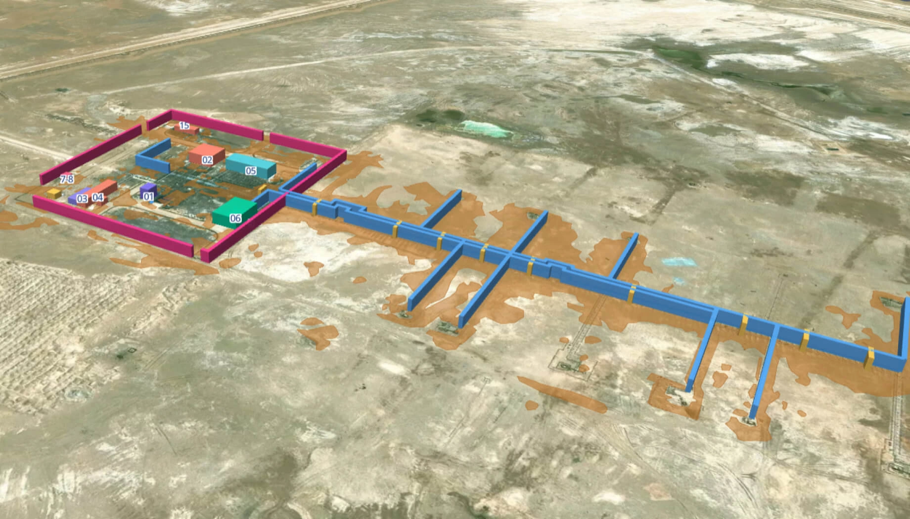
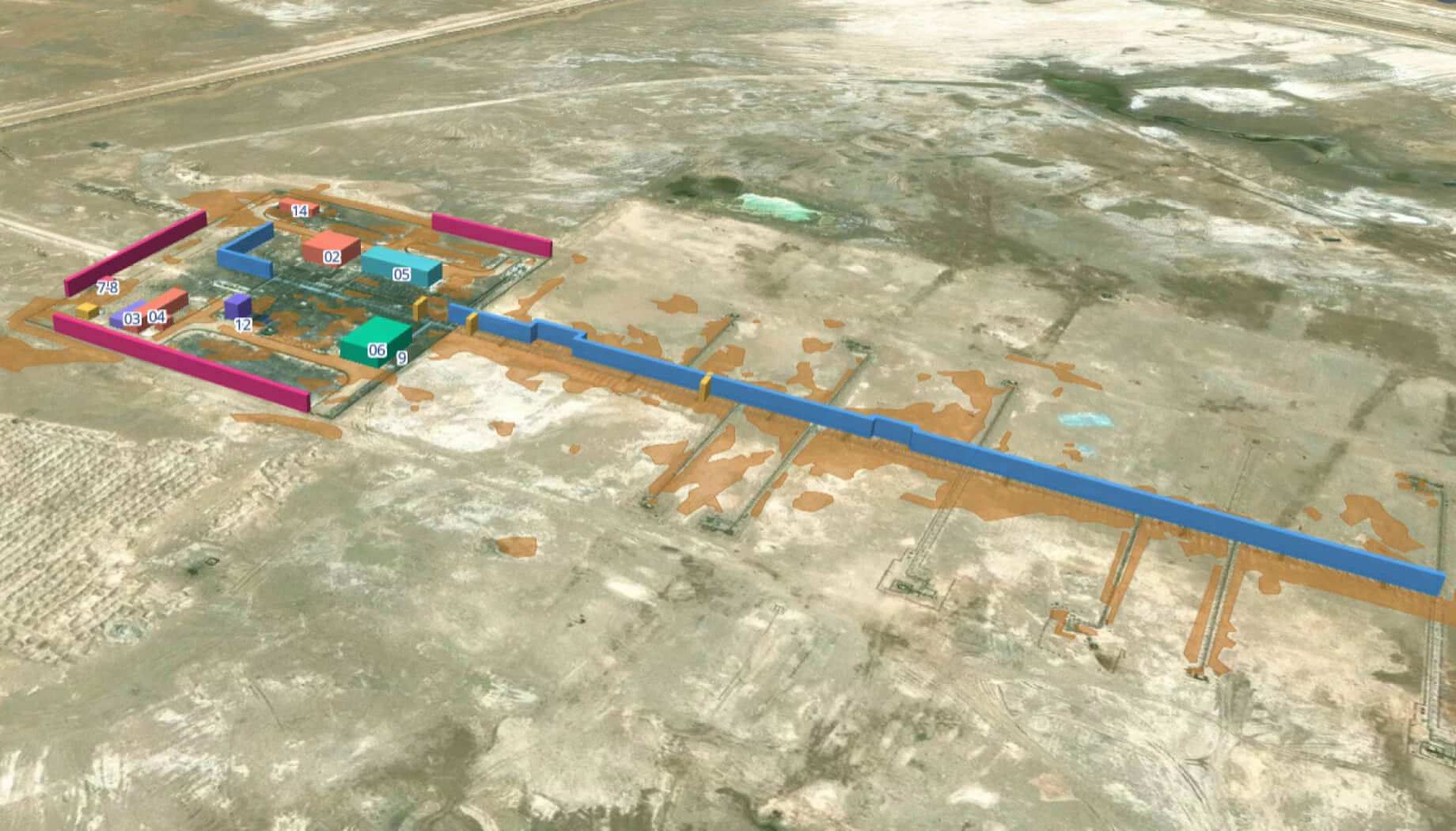
Interactive smart map
Cloud-based interactive map with 3D view for clear visualization and spatial analysis.
Typical project stages
Defining AOI, requirements, and KPIs
Selecting optimal imagery (optical, SAR, or hybrid)
Running baseline mapping and ML change detection
Validating, enriching, and prioritizing insights
Delivering data layers, a report, and a smart map on schedule
Featured case study

Forest cover change detection in Tasmania
What sets the EOS RayVision approach apart
Intelligence, not raw data
Get ready-to-use insights, not just raw layers, to make decisions on the fly.
Multi-sensor monitoring
Never miss critical changes thanks to smart optical and SAR coverage of 20+ constellations.
Global scale, fast rollout
Deploy quickly across regions to standardize monitoring and save time.
Flexible delivery and visualization
Access data in the way that fits your workflow: GIS layers, PDF reports, or 3D interactive maps.
Reusable ML/AI models
Get consistent, accurate detection across assets through proven ML/AI models.
End-to-end expert implementation
In-house science and GIS teams handle the full process for reliable results every time.
FAQ
What kinds of changes can you detect?
We detect a wide range of land and asset changes, including new structures, earthworks, road cuts, vegetation loss, water extent shifts, site expansion, damage signatures, and more, depending on terrain and sensors used.
Can you detect small changes?
Yes, within the limits of satellite sensors. We match resolution and revisit frequency to your AOI and minimum detectable change size relevant to your use case.
Does change detection work with clouds or smoke?
Sure, monitoring continues through clouds or smoke with SAR or hybrid data acquisition.
Can you define "authorized" vs. "unauthorized" changes?
Yes, can apply rules by zone, asset list, and thresholds to flag changes that fall outside your approved plans or boundaries.
How often can you check for changes?
We can check from daily to monthly or quarterly, depending on AOI size, sensor availability, and time sensitivity.
Can a change detection solution be combined with object detection?
Yes, change detection can trigger targeted object classification, such as vehicles, buildings, or stockpiles, for deeper insight.