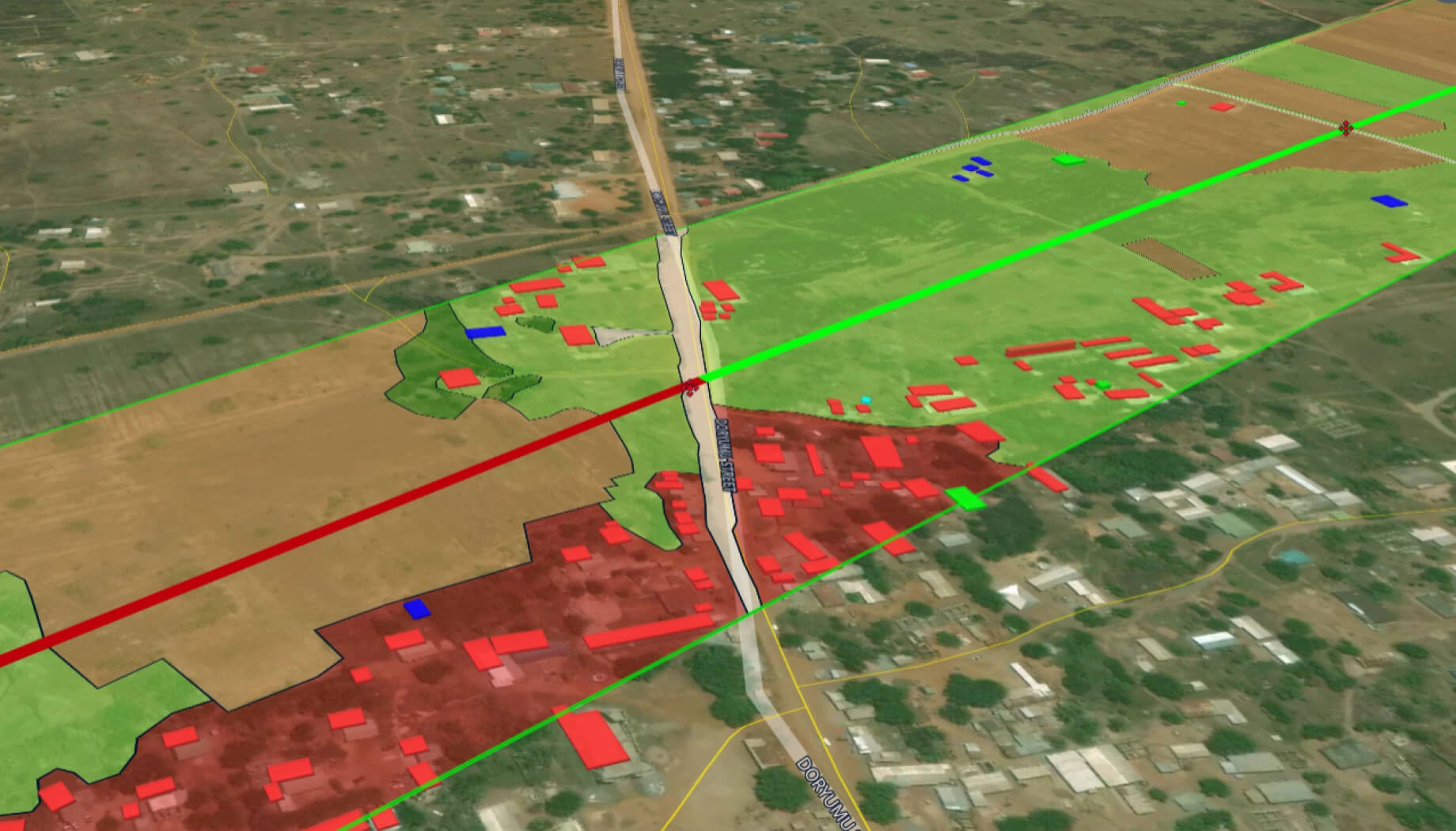
Border security
Secure your borders with satellite intelligence – detect unusual activity, emerging routes, and terrain changes at scale.
Driving your business and strategic goals with EOS RayVision
Detect new routes
Core benefit:
Spot repeated crossings and fresh trails to reveal shifting movement patterns.
Flag activity risks
Core benefit:
Spot encampments, vehicle traces, staging areas, etc. for faster prioritization.
Optimize patrols
Core benefit:
Boost patrol effectiveness by prioritizing actual satellite-detected threats.
View in all weathers
Core benefit:
Monitor borders reliably through clouds and darkness with SAR/hybrid imagery.
Border security data tailored to your workflow

Original data layers
Receive GEOJSON / KML / SHP datasets and upload them wherever you want.

Decision-ready PDF report
Actionable report summarizing key findings for rapid response and easy sharing.

Interactive smart map
Cloud-based interactive map with 3D view for clear visualization and spatial analysis.
Typical project stages
Defining AOI, requirements, and KPIs
Selecting optimal imagery (optical, SAR, or hybrid)
Running baseline mapping and ML change detection
Validating, enriching, and prioritizing insights
Delivering data layers, a report, and a smart map on schedule
What sets the EOS RayVision approach apart
Intelligence, not raw data
Get ready-to-use insights, not just raw layers, to make decisions on the fly.
Multi-sensor monitoring
Never miss critical changes thanks to smart optical and SAR coverage of 20+ constellations.
Global scale, fast rollout
Deploy quickly across regions to standardize monitoring and save time.
Flexible delivery and visualization
Access data in the way that fits your workflow: GIS layers, PDF reports, or 3D interactive maps.
Reusable ML/AI models
Get consistent, accurate detection across assets through proven ML/AI models.
End-to-end expert implementation
In-house science and GIS teams handle the full process for reliable results every time.
FAQ
What kinds of activity and changes can you detect in border zones?
We can identify new tracks and routes, encampments, vehicle activity indicators, earthworks, and infrastructure changes, depending on imagery resolution and terrain.
Can your border security solution work at night or in cloudy weather?
Sure, SAR ensures monitoring continues in darkness, haze, or cloudy conditions without gaps.
How fast can you deliver alerts?
Alerts are delivered from near-real-time to scheduled reports, depending on AOI size, sensor mix, and operational urgency.
Can we focus only on specific segments or risk zones?
Yes, our solution allows target monitoring of corridors, buffer zones, known crossing points, or dynamic hotspots.
What's included in each border security report?
We deliver full details in each report: location, change type, confidence level, timestamp, and evidence snapshots so teams can verify quickly.
Is this solution suitable for long borders?
Yes, we scale border monitoring using wide-area screening combined with targeted high-resolution focus on hotspots.