SAR imagery in near real-time
Monitor any area day and night with trusted sub-meter radar data
Free inquiry — no purchase commitment
Access SAR data from multiple trusted providers in one place
Global coverage
Seamless monitoring of your assets anywhere in the world
High resolution
Maximum accuracy with details down to 0.25 m
Daily revisit
Fresh views every 24 hours for near-real-time tracking
Archive and tasking
Historical imagery since 2020 and on-demand capture
Optical vs. SAR satellite imagery
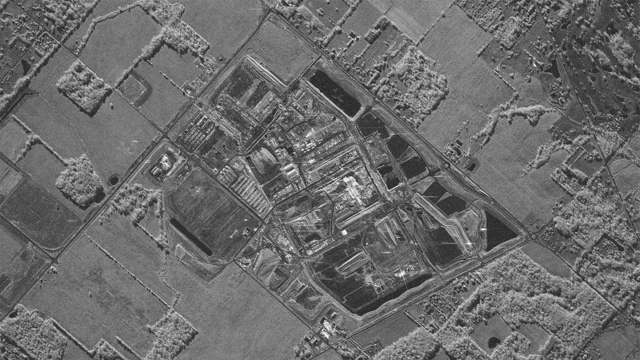
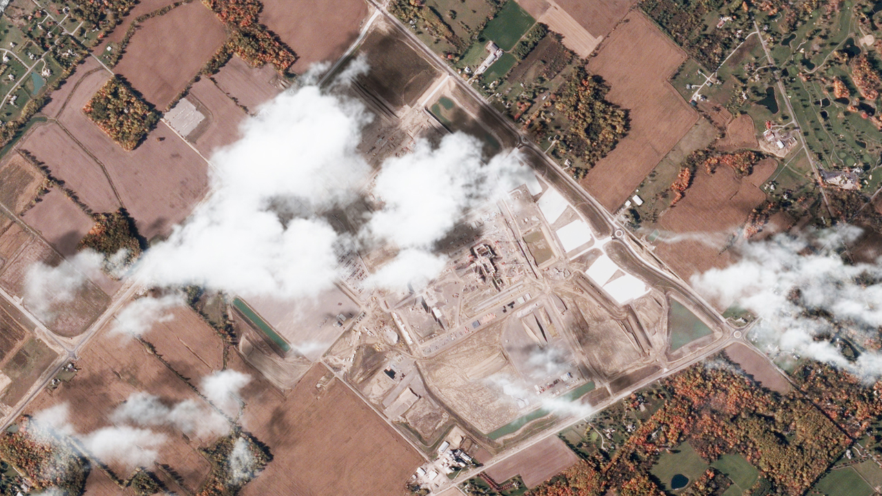
Intel Ohio One construction monitoring. Passing clouds partially obstruct the optical imagery (on the left), whereas SAR radar (on the right) penetrates the cover to map exact structural geometry, metallic foundations, and material density.
How different industries use SAR satellite images
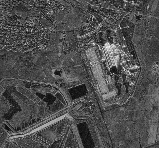
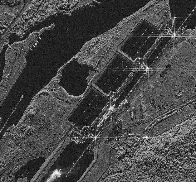
Infrastructure and energy
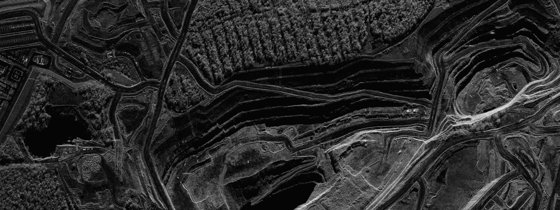
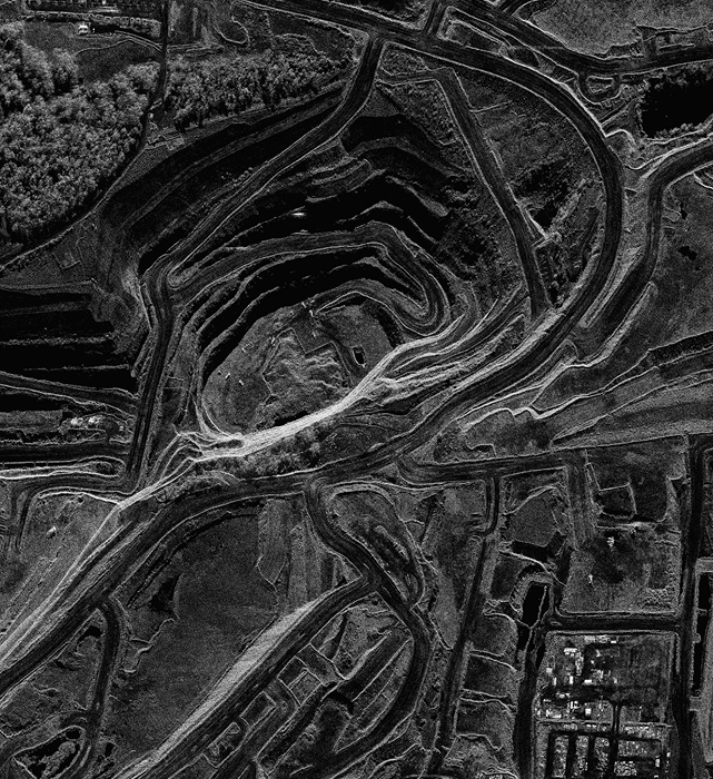
Detect ground movement and structural changes around pipelines, dams, open-pit mines, and construction sites.
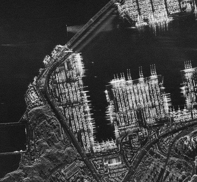
Maritime and ports
Monitor vessel activity, port traffic, and signs of potential oil spills under any weather conditions.
Finance and commodities
Analyze global supply chains, port congestion, and oil storage tank levels in near real-time.
Disaster response
Track active wildfires and floods even through smoke or clouds to minimize damage.

Trusted by industry leaders worldwide


We deliver space-derived imagery through LandViewer, a satellite observation platform by EOS Data Analytics (EOSDA) trusted by thousands of professionals worldwide. This means your SAR images arrive quickly and via a secure, scalable, and field-tested infrastructure.
FAQ
Can you capture imagery through clouds, smoke, or during bad weather?
Sure, SAR imaging isn't affected by atmospheric conditions. It penetrates 100% of cloud cover or dense smoke, so you get a clear, high-quality view regardless of the weather or time of day.
How fast can I get the imagery delivered after submitting a request?
Purchased commercial SAR imagery in LandViewer's archive can be delivered almost instantly once approved. For new satellite tasking (on-demand capture), the turnaround time depends on orbit schedules and chosen priority level. To get your order delivered faster for time-critical projects, you can choose emergency or urgent tasking.
What is the minimum Area of Interest (AOI) size for an order?
Our ordering sizes are flexible enough for both small test plots and large-scale regional monitoring. Share your coordinates or target region in the contact form, and we will check the feasibility for your project.
In what formats do you deliver the purchased imagery?
LandViewer delivers it in industry-standard GIS formats, primarily as Analysis-Ready Data (ARD) in GeoTIFF, NITF, SICD, HDF5, NetCDF, SAFE, or CEOS. So, you can integrate it directly into standard software like ArcGIS, QGIS, or your custom cloud pipelines without complex pre-processing.
Do you provide analytics or only raw imagery?
We offer both. If you don't have a team to process and analyze SAR images, our experts can handle it for you. We can track specific objects, map changes over time, and deliver tailored reports with direct answers instead of just raw files. Simply fill out the form and let us know what insights you are looking for.
What details can SAR imaging detect beyond basic visual shapes?
Thanks to radar's high material sensitivity, SAR imagery lets you spot details that optical sensors miss: detect sub-centimeter micro-movements, analyze surface roughness, and accurately identify specific metallic structures.