Observe crops with more precision to get better profits from every hectare
- Find problem spots in time
- Record field observations on-the-go
- Schedule corrective actions
Detect issues that affect yield at an early stage
Detecting issues at a later stage increases a risk of crop failure and yield losses
See how it works at a glance
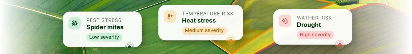
Hone in on vegetation deviations
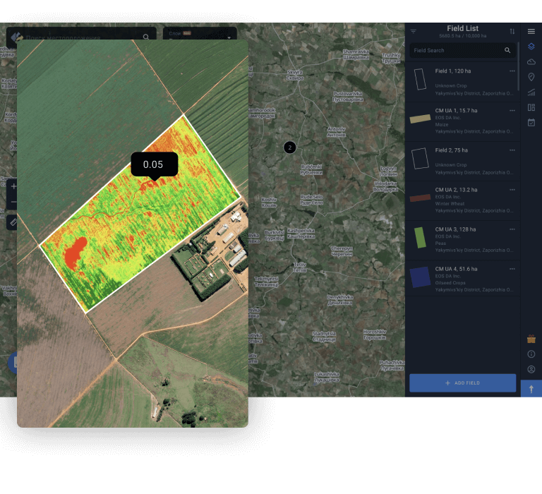
Eliminate guesswork from crop scouting - identify problem areas within your fields with up-to-date satellite imagery and vegetation data
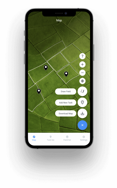
Pinpoint areas which get scouted first and assign scouts easily
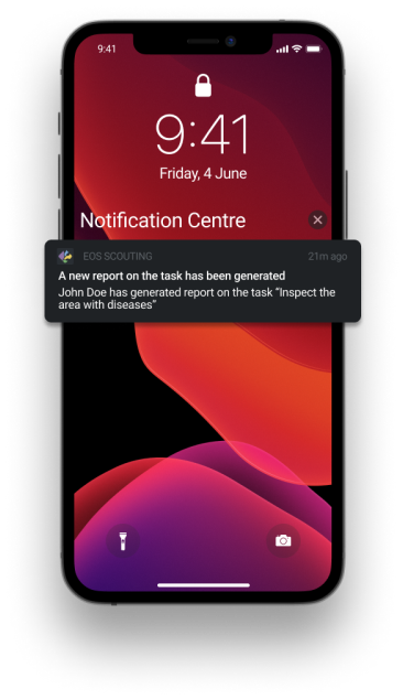
Simply place the pin on the problem area, assign a scout, and the notification about a new task will be delivered instantly
FREE SCOUTING APP FOR PRECISION AGRICULTURE
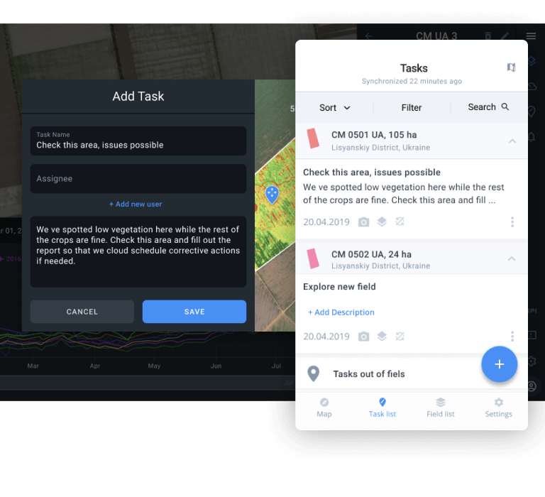
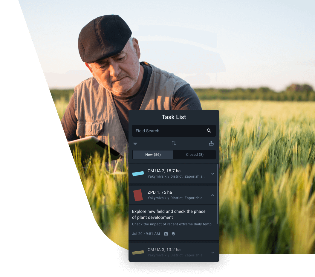
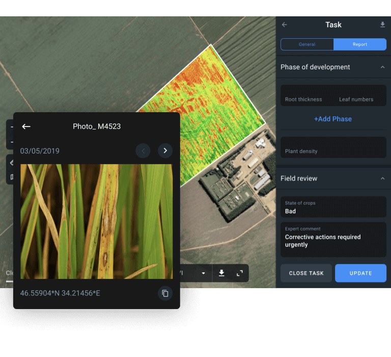
Collect reports containing spanshots directly from the fields
Collect all the data you need: growth stages, plant density, soil moisture, and more
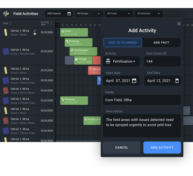
Schedule an effective action plan
Increase profit with timely decisions, strategy and willingness
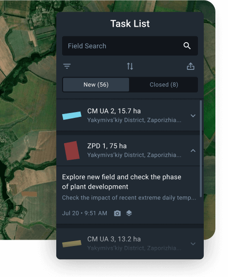
Monitor scouting operations anywhere anytime
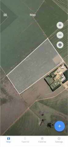
All the data collected by the scouts in the field is immediately available in the web version online
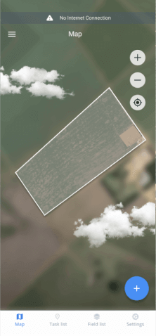
To do their job, scouts do not need to be online all the time. Recorded data will be available as soon as the internet connection is back

Stay updated on all the field-related events with scouting reports, weather forecasts, and more
Scouting reveals what's holding you back from getting the most out of your crops. Increase profit with better-informed agronomic decisions
Minimize your effort while maximizing profit
Improve planning strategies and make better-informed decisions in the next season thanks to a more efficient scouting
Suits everyone
Farmers
Save time and cut costs by sending scouts directly to problem spots, and maintain better crop health overall as a result