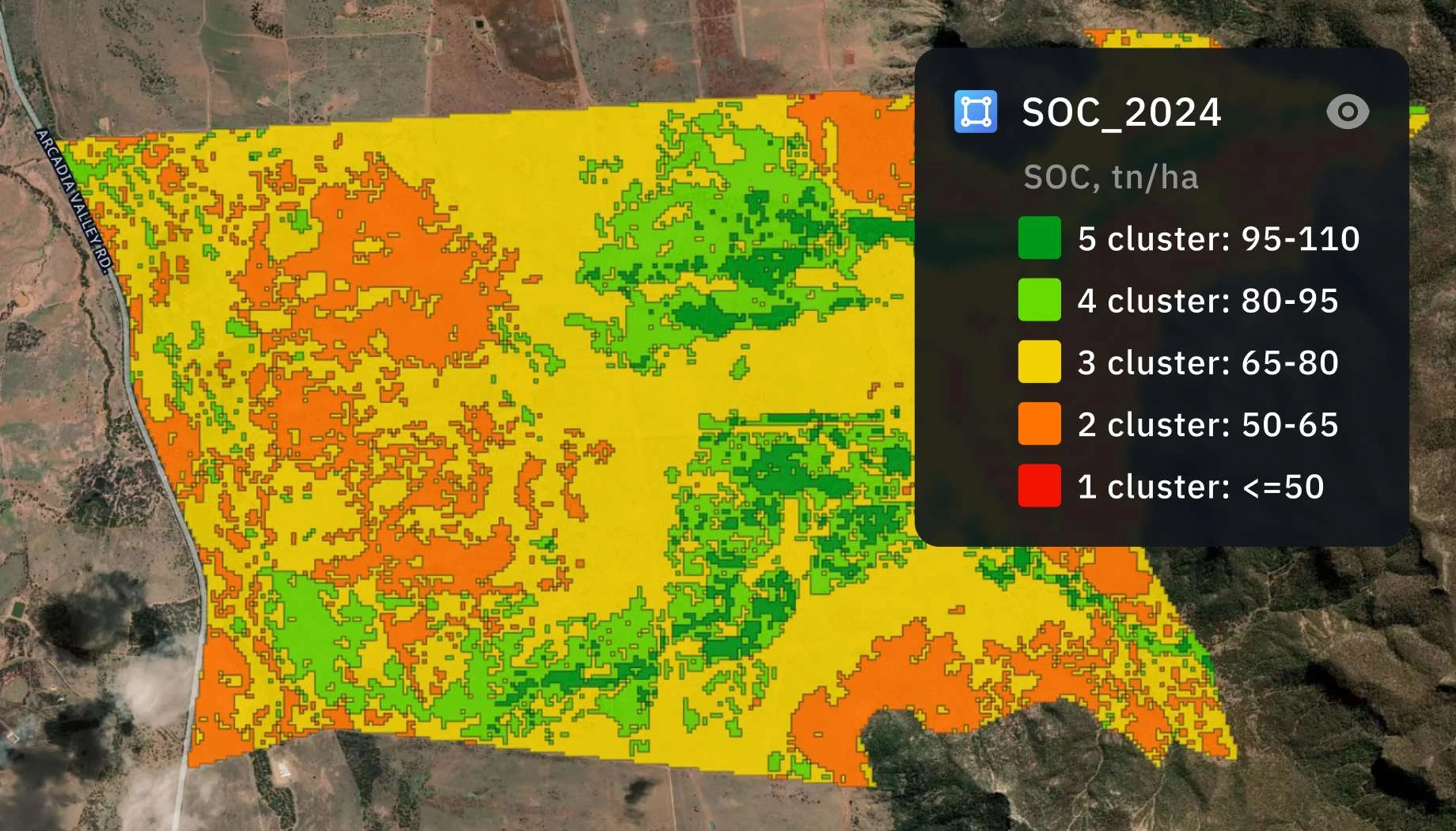
Soil organic carbon estimation
Establish verifiable soil organic carbon (SOC) baselines with 90%+ accuracy while cutting your follow-up soil sampling costs by nearly half.
How SOC estimation by EOS RayVision supports your projects
SOC baseline mapping with digital MRV
Core benefit:
Accelerate project registration with precise baselines based on 140+ predictors.
Smart soil stratification
Core benefit:
Enable standard-ready projects through satellite-driven land stratification.
Verified sequestration reporting
Core benefit:
Support audits with evidence-backed reports for stakeholders and VVBs.
Supply chain Scope 3 assessment
Core benefit:
Measure soil health and carbon stocks across large-scale agri supply chains.
SOC estimation outputs delivered in formats you need
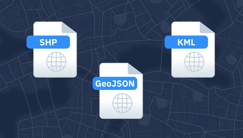
Original data layers
Receive GEOJSON / KML / SHP datasets and upload them wherever you want.
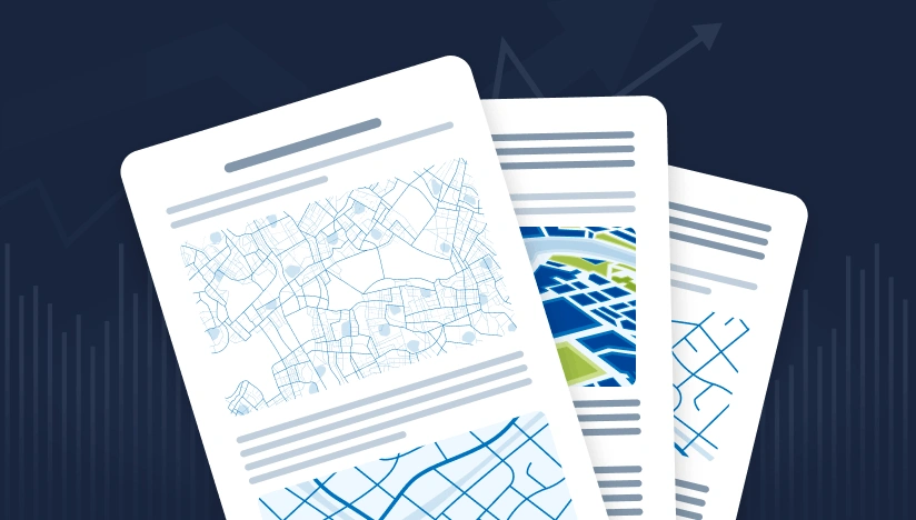
Decision-ready PDF report
Actionable report summarizing key findings for rapid response and easy sharing.
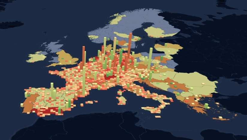
Interactive smart map
Cloud-based interactive map with 3D view for clear visualization and spatial analysis.
Typical project stages
Defining AOI, requirements, and KPIs
Selecting optimal imagery (optical, SAR, or hybrid)
Running baseline mapping and ML change detection
Validating, enriching, and prioritizing insights
Delivering data layers, a report, and a smart map on schedule
Why global leaders choose EOS RayVision
Intelligence, not raw data
Get ready-to-use insights, not just raw layers, to make decisions on the fly.
Multi-sensor monitoring
Never miss critical changes thanks to smart optical and SAR coverage of 20+ constellations.
Global scale, fast rollout
Deploy quickly across regions to standardize monitoring and save time.
Flexible delivery and visualization
Access data in the way that fits your workflow: GIS layers, PDF reports, or 3D interactive maps.
Reusable ML/AI models
Get consistent, accurate detection across assets through proven ML/AI models.
End-to-end expert implementation
In-house science and GIS teams handle the full process for reliable results every time.
FAQ
What level of accuracy can I expect from satellite-based SOC estimation?
You can expect 85–93% estimation accuracy when satellite data is combined with ground measurements. Our integrated modeling approach requires significantly fewer soil samples than traditional ground-only sampling while maintaining reliable results.
How much can I save on traditional soil sampling costs?
You can reduce the number of required physical soil samples by up to 90% for follow-up sampling cycles by applying EOS RayVision's satellite-based soil stratification.
Are your estimation reports accepted by carbon credit registries?
Are your estimation reports accepted by carbon credit registries?
Do you provide the physical soil sampling services?
We provide digital modeling and analytics rather than physical sampling services. However, we can connect you with trusted laboratory and soil sampling partners.
How long does it take to generate a baseline SOC report?
A comprehensive baseline SOC report by EOS RayVision is typically delivered within one month, significantly faster than with traditional assessment approaches.
What data do I need to provide to start the SOC estimation?
We require your Area of Interest (AOI) and field management information you can provide, such as crop rotations, fertilizer use, and farming activities.
Can you estimate SOC at different soil depths?
Yes, our models support SOC estimation for both topsoil (0–30 cm) and deeper soil layers (30–100 cm) based on your project needs.