Mine expansion mapping
Track mining operations, pit expansions, and resource extraction activities.
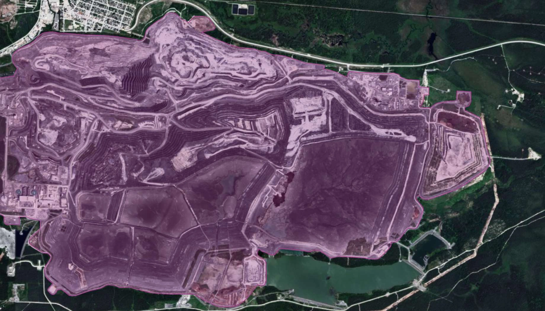
How EOS RayVision supports mine expansion mapping and analysis
Expansion tracking
Core benefit:
Monitor open pit growth, new extraction zones, and mining footprint changes over time.
Compliance verification
Core benefit:
Verify mining operations stay within permitted boundaries and authorized areas .
Stockpile analysis
Core benefit:
Analyze ore and waste pile areas, track inventory changes, and assess production changes.
Environmental impact assessment
Core benefit:
Assess land disturbance, track rehab, vegetation recovery and reclamation progress.
Outputs EOS RayVision delivers for your mining project

Original data layers
Details of that data format.

Decision-ready PDF report
Insights and clear conclusions, packaged for fast decisions and easy sharing.

Interactive smart map
Cloud-based interactive smart maps with 3D visualization.
Typical project stages
Defining AOI, requirements, and KPIs
Selecting optimal imagery (optical, SAR, or hybrid)
Running baseline mapping and ML change detection
Validating, enriching, and prioritizing insights
Delivering data layers, a report, and a smart map on schedule
Why global leaders trust EOS RayVision
Intelligence, not raw data
Get ready-to-use insights, not just raw layers, to make decisions on the fly.
Multi-sensor monitoring
Never miss critical changes with the smart optical and SAR coverage of 20+ constellations.
Global scale, fast rollout
Deploy quickly across regions to standardize monitoring and save time.
Flexible delivery and visualization
Access data in the way: GIS layers, PDF reports, or 3D interactive maps.
Reusable ML/AI models
Get consistent, accurate detection across assets through proven ML/AI models.
End-to-end expert implementation
In-house science and GIS teams handle the full process for reliable results every time.
FAQ
What types of mines can be monitored?
We monitor surface activity (open pit mines, waste piles, access roads, surface subsidence).
Can you detect illegal mining?
Yes, EOS RayVision can identify new mining activity, artisanal operations, and encroachment into protected areas.
How do you ensure accuracy?
EOS RayVision uses baseline calibration, automated QA rules, cross-sensor verification, and expert review for high-impact alerts.
How do you handle cloud coverage?
SAR imagery provides cloud-free monitoring. We also use optical composites or wait for clear conditions.