Satellite images of the Eaton fire
- Location
- Eaton Canyon, CA, USA
- Coordinates
- 34.20012° N, 118.04673° W
- Satellite
- Sentinel-2
- Tags
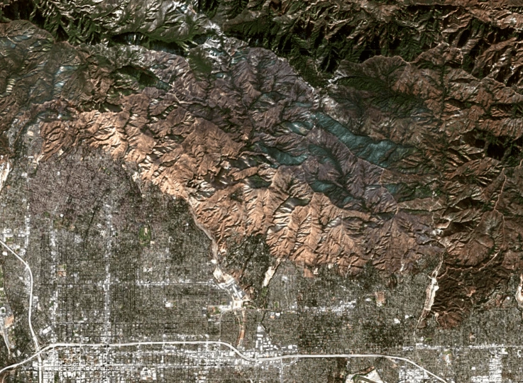
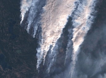
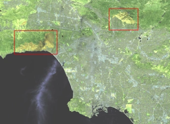
January 2025 will be sadly remembered in California due to the series of fires that affected San Diego County and even the Los Angeles metropolitan area. One of the most destructive ones was the Eaton fire, a wildfire that began in the canyon with the same name in the San Gabriel Mountains. Nineteen people died and thousands of buildings were destroyed, making it among the most severe in the region’s history. The satellite view of the Eaton fire reveals a significantly damaged landscape, including numerous landmarks and public structures devastated across an area of more than 5,500 hectares. Red and brown tones indicate the area burned, combined with grey, typically indicating ash or charred ground. Small dark green areas can be seen in the upper side of the image, where dense vegetation was not affected by the fire.
Key facts about the Eaton fire
The Eaton fire started on January 7th and took 24 days to contain fully. It was caused by high-voltage power lines overdue for repair. It spread rapidly, driven by strong Santa Ana winds and a lack of measurable rainfall over several months. Altadena, a community near the canyon, was severely impacted with numerous residential houses, and public and commercial buildings burned to their total destruction. Thanks to satellite images, the Eaton fire was closely monitored by the emergency teams, helping them to work effectively and prevent other nearby populations from being directly affected by the blazes.
Interpretation of satellite imagery of the Eaton fire
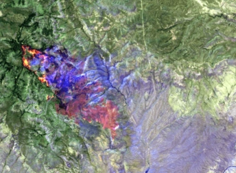
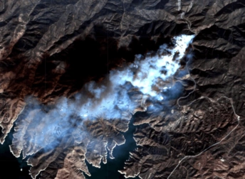
A quick view at a satellite image of the Eaton fire can give a visual idea of the impact. The mountains, full of vegetation, have an intense green color before the catastrophe, as seen in the image on the left. Those same mountains present yellow, orange and red tones in the right image, when the firefighters were starting to contain it. The charred urban grid is also easy to distinguish.
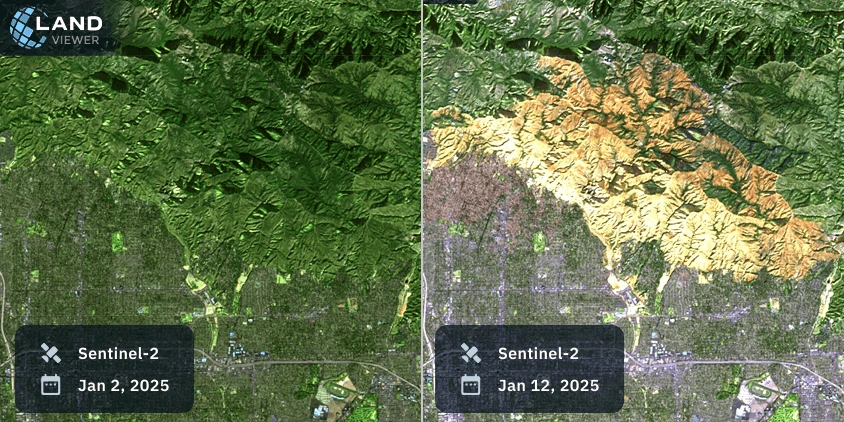
The images, presented in false color, enhance the difference between healthy vegetation and unchanged urban areas, and their burned counterparts. The use of satellite images is also helpful for experts to assess various questions related to this tragedy, such as soil erosion, fire severity and other environmental changes.
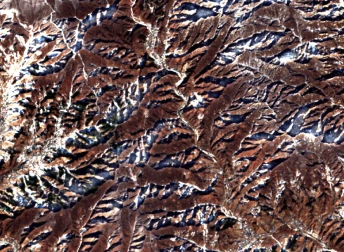
Historical background
In 1993, the same area was affected by the Kinneloa Fire, which damaged buildings and infrastructure in several populated areas. The area is prone to wildfires thanks to a combination of high temperatures exacerbated by climate change, irregular rainfall, and strong wind gusts.
Satellite monitoring has become more critical than ever to have a constant, up-to-date view of this area. The comparison between this updated information and historic data can help experts and decision-makers to identify anomalous situations, create new weather models, and develop robust prevention and response activities.
Explore more satellite images of the Eaton fire further on EOSDA LandViewer to analyze real-time and historical satellite data.