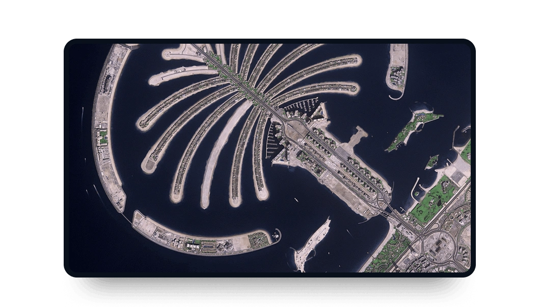
Ziyuan-3 high-resolution images
Access medium-resolution multispectral data from the Ziyuan-3 satellite in LandViewer, perfect for large-scale historical terrain analysis:
-
Data type
Optical
-
Resolution
2 m
-
Revision
5 days
-
Spectral bands
Panchromatic, Red, Green, Blue, NIR
-
Data archives
Archive since 2012
-
New Image Tasking
Not available

How to access Ziyuan-3 satellite imagery on LandViewer
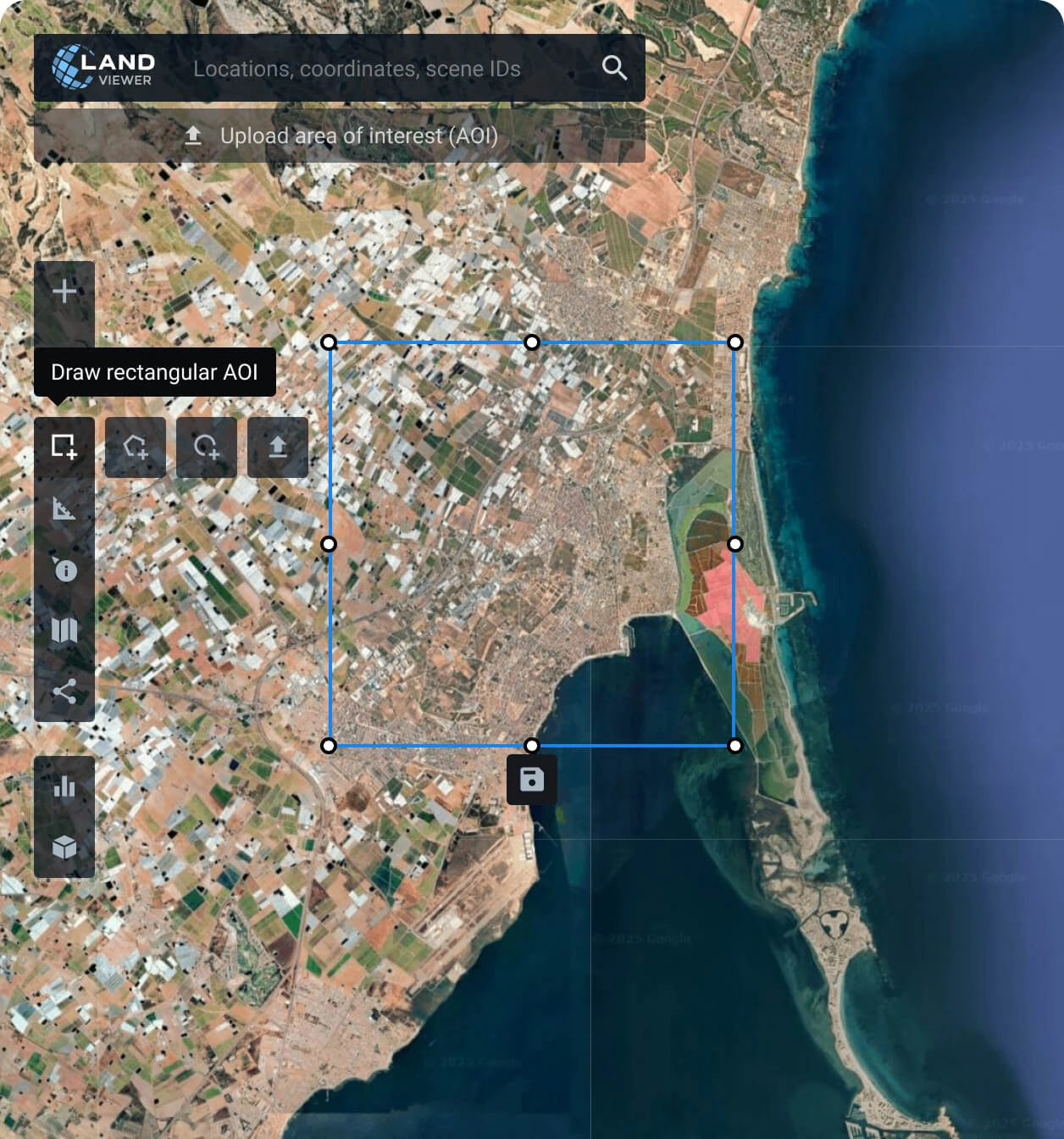
Define your exact target area (AOI)
Set your observation zone: manually draw a boundary, upload spatial files, or search coordinates for your Ziyuan-3 analysis.
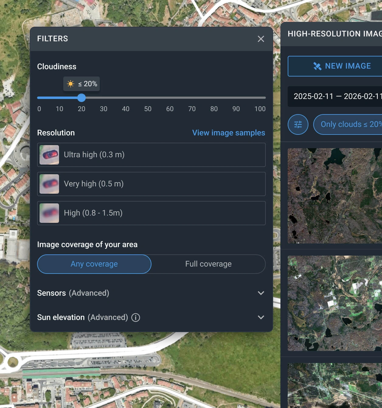
Apply precise search filters
Adjust the catalog by selecting date ranges, cloud cover limits, and resolution to locate the right Ziyuan-3 scene.
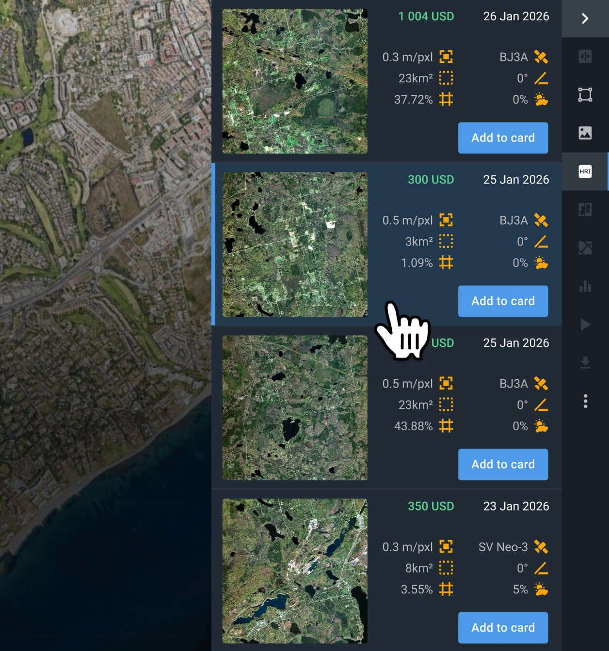
Select the best matching scene
Review the filtered results, check technical specifications, and pick the capture that fits your exact project needs.
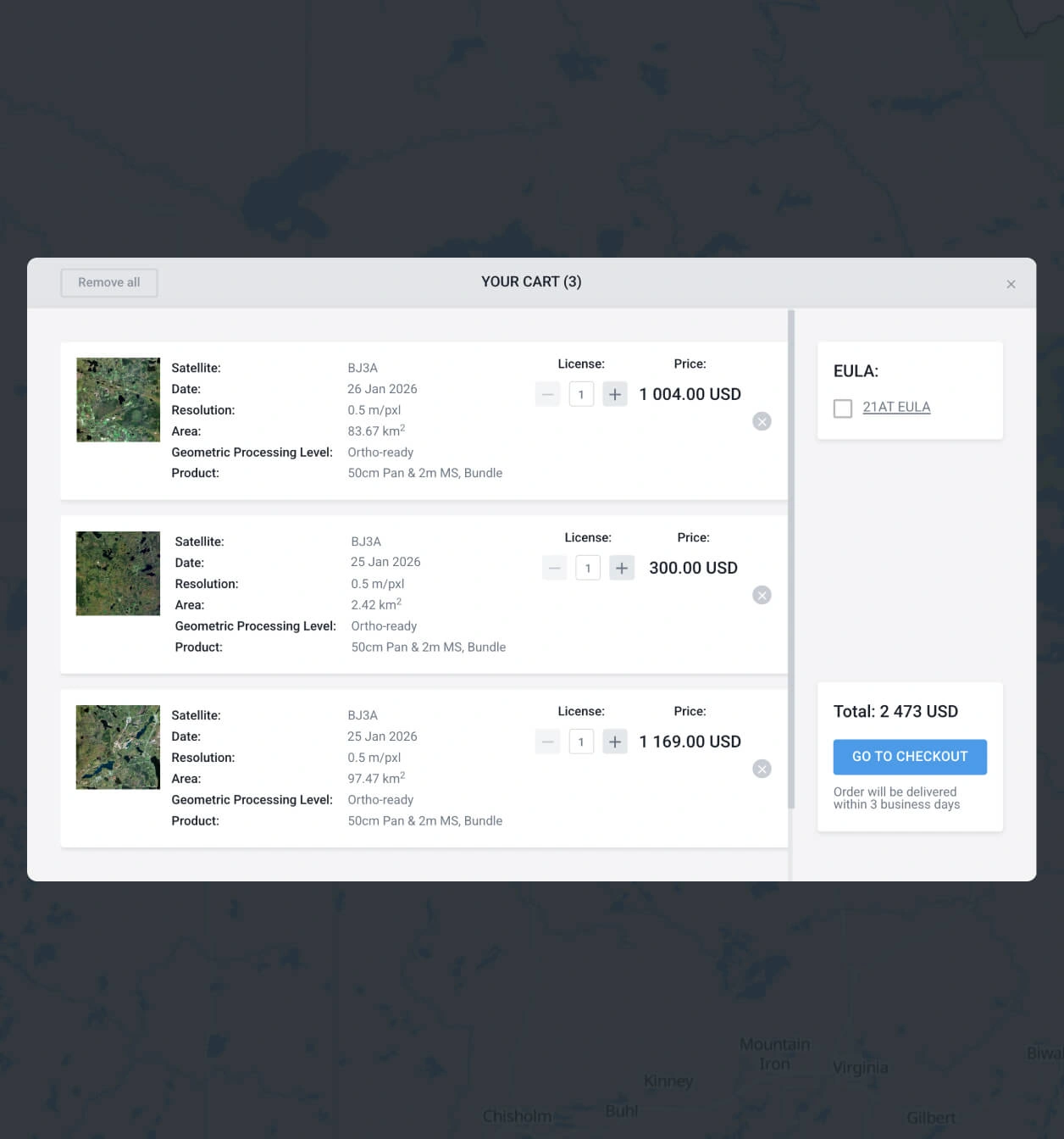
Add to cart and complete purchase
Place the chosen scene in your cart for a quick checkout, or contact sales to finalize your order.
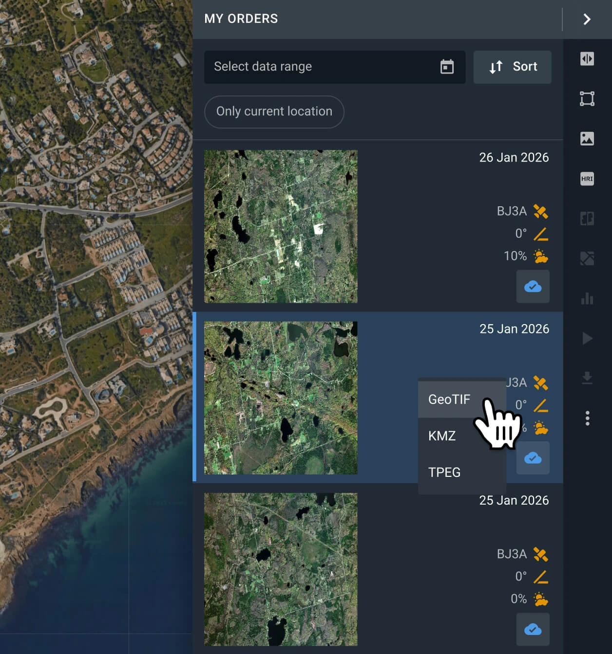
Download data or analyze on-platform
Get needed imagery in 2 days and export in GeoTIF/KMZ/JPEG for third-party GIS software. You can also use LandViewer analytics with built-in indices and bands.
FAQ
What are the costs for historical Ziyuan-3 data?
Accessing the Ziyuan-3 archive is cost-effective, starting at just $2.10 per square kilometer. Please note that all orders require a minimum coverage area (AOI) of 500 sq km.
Why can't I request a new capture from Ziyuan-3?
Custom tasking on our platform is reserved for the newest satellites with superior resolution and faster revisit rates. If your specific project demands fresh captures, please request new scene from BlackSky Gen 3, BJ3N, or SuperView NEO-1 providers.
Are these satellite images pre-processed for GIS workflows?
Yes. Every scene arrives fully georeferenced for immediate integration into tools like ArcGIS and QGIS. If your spatial analysis requires orthorectification, please contact our support team and we will fulfill these processing requests.
Can I establish ongoing observation of my target zone?
Absolutely. Regular site tracking is supported across our platform. Just fill out the contact form below or speak directly with our sales department, and our experts will promptly assist you.
What if the Ziyuan-3 archive lacks coverage for my specific location?
LandViewer hosts optical data from more than 15 Earth observation providers beyond the Ziyuan-3. Adjust your search filters and uncover suitable historical captures from other satellites.
How do I access sharper resolution than the 2m standard?
If your mapping requires extreme details, we recommend exploring the archives for Beijing-3B, SuperView NEO-1, or BlackSky Gen 3.
Are value-added analytical layers included with the optical data?
Yes. Every purchased image automatically includes analytical indices like NDVI, NDWI, and Color Infrared. Furthermore, our dedicated in-house R&D team of developers and data scientists is available to collaborate on crafting customized, advanced analytical solutions for your needs.
What are the most common use cases for Ziyuan-3 images?
Imagery captured by this satellite typically supports land resource investigation, urban planning, environmental monitoring, and change detection in agriculture and forestry.


