TripleSAT high-resolution images
Access to high-definition and high-frequency data from the TripleSAT constellation through the LandViewer platform.
-
Data type
Optical
-
Resolution
0.8 m
-
Revision
daily
-
Spectral bands
Panchromatic, Red, Green, Blue, NIR
-
Data archives
Archive since 2018
-
New Image Tasking
Not available

How to order TripleSAT images on LandViewer
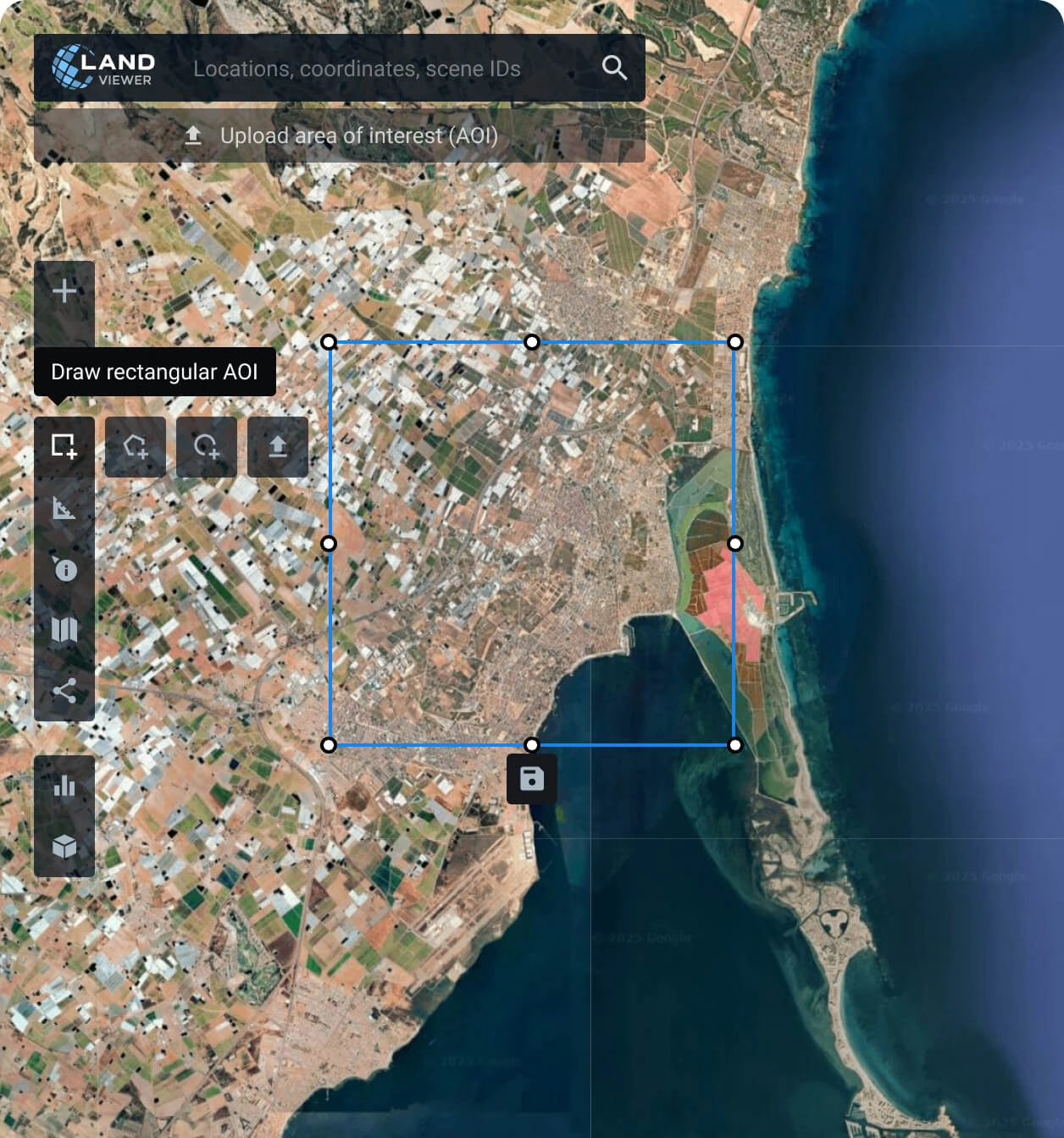
Set your AOI (area of interest)
There are different ways to do it: searching for a location, drawing a polygon on the map, or uploading a file from your device containing the area's parameters.
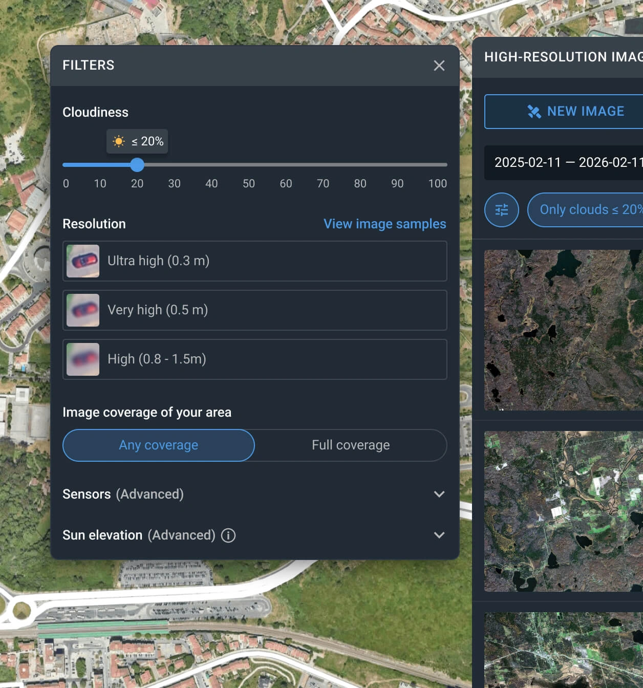
Use the filters to narrow down the search
Apply one or more filters, such as resolution, date, or cloud coverage, to find the TripleSAT imagery that best matches your needs.
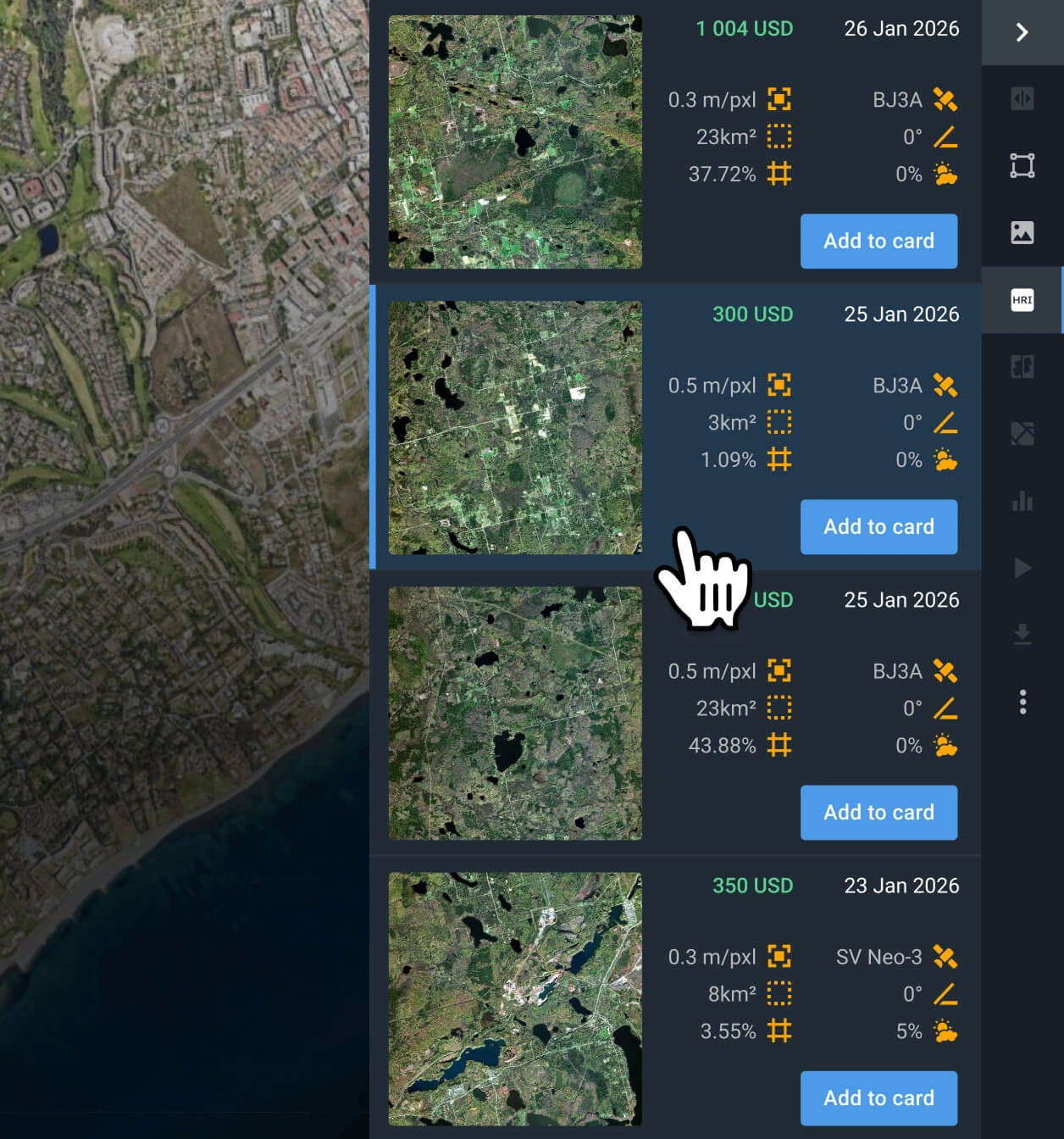
Select the most relevant TripleSAT images
Examine the pricing details and other relevant information for the filtered results, and select the scene(s) that fit your particular use case.
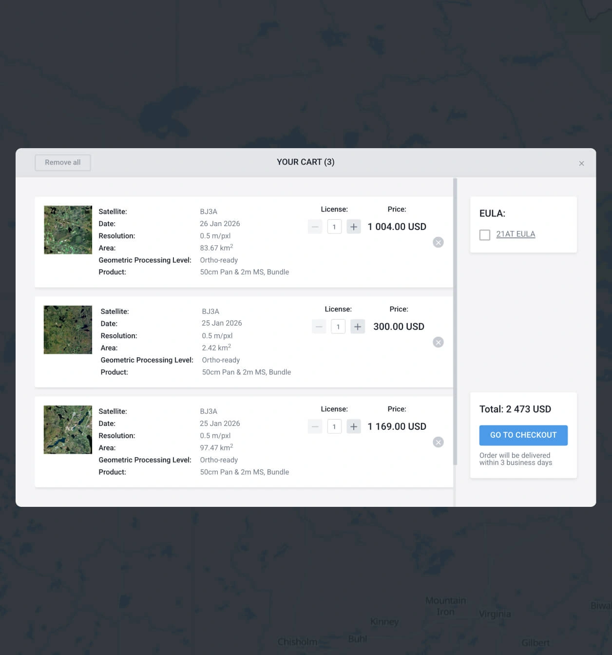
Add to the cart and buy the TripleSAT imagery selected
Add as many as you need to the cart and submit your order for TripleSAT images. You can purchase them yourself or reach our sales team to obtain your payment details.
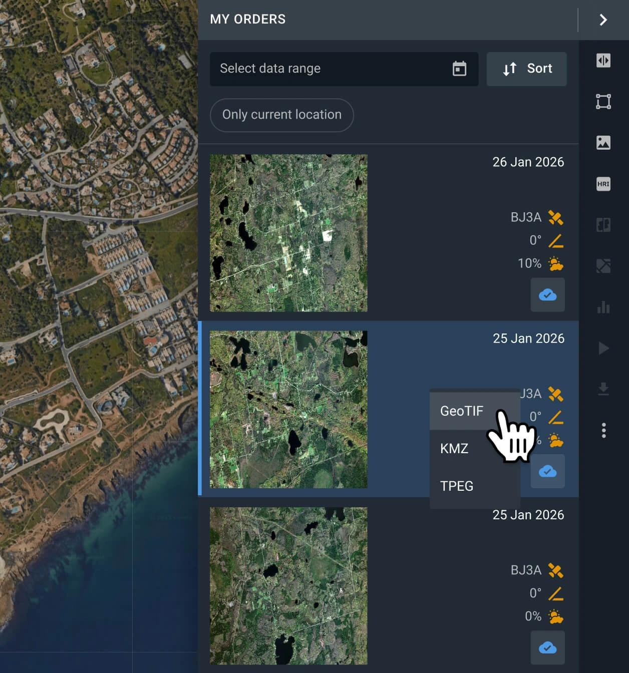
Analyze your data on the platform or export it
Your order of TripleSAT imagery will be processed within 2 days. Analyze the data on the platform, or export it in multiple formats (GeoTIFF, KMZ, or JPEG).
FAQ
How much does it cost to buy TripleSAT images on LandViewer?
TripleSAT archive scene prices start at $6.00 per square kilometer. The area of interest (AOI) must cover at least 15 sq km.
What are the most common use cases for TripleSAT images?
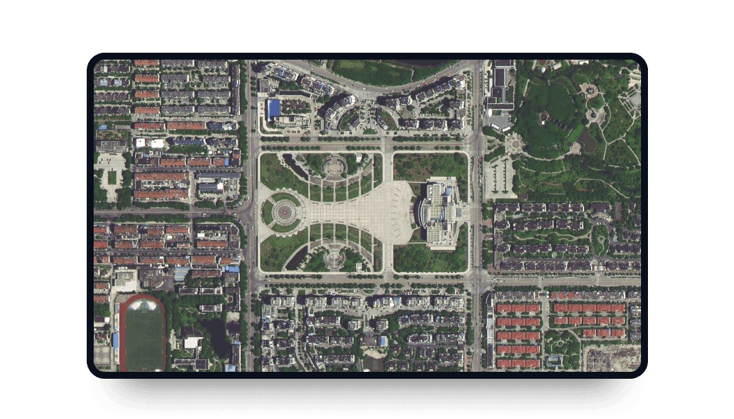
The most common use cases for TripleSAT images include agriculture monitoring, land mapping, urban change detection, suburban growth tracking, green zone assessment, and land cover change analysis. Thanks to its 0.8m resolution, the satellite is particularly suitable for detailed mapping and precise monitoring of small-scale land and infrastructure changes.
Is the TripleSAT constellation appropriate for wide-scale monitoring?
With a minimum width of 23.4 km, TripleSAT offers one of the widest high-resolution satellite data sources in the market. This extensive coverage reduces the total number of scenes required for large-scale monitoring.
Why is tasking unavailable when I want to buy TripleSAT images?
The tasking option in LandViewer is only available for newest satellites with better resolution, and shorter revisit times. If you want to request a new high-resolution capture, access our platform and select a different source, such as BlackSky Gen 3, Beijing-3N (BJ3N), or SuperView NEO-1.
What level of processing is provided when customers buy TripleSAT satellite scenes?
Every scene includes georeferenced data, which makes it easier to use in third-party software. If you need advanced processing (i.e., orthorectification), please contact our support team, as we can provide it in most cases.
Does TripleSAT support a scheduled long-term monitoring of an AOI?
Yes, long-term monitoring on a regular basis is possible. To do that, please contact our sales team or fill out the form on the page, and our specialists will help you set it up.
Is it possible to obtain a digital elevation map?
Yes, we accept custom orders for digital elevation maps generated from stereo images (of the same location, taken from different angles). You can contact our sales representatives or fill out the form on the page to obtain more information.


