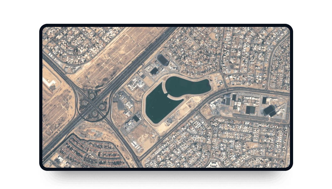
SuperView NEO-3 high-resolution images
Explore LandViewer and take advantage of the SuperView NEO-3 spectral bands coverage and high-resolution imagery.
-
Data type
Optical
-
Resolution
0.5 m
-
Revision
1-3 days
-
Spectral bands
Panchromatic, Red, Green, Blue, NIR1, NIR2, Coastal Blue, Yellow, Red Edge
-
Data archives
Archive since 2025
-
New Image Tasking
Available

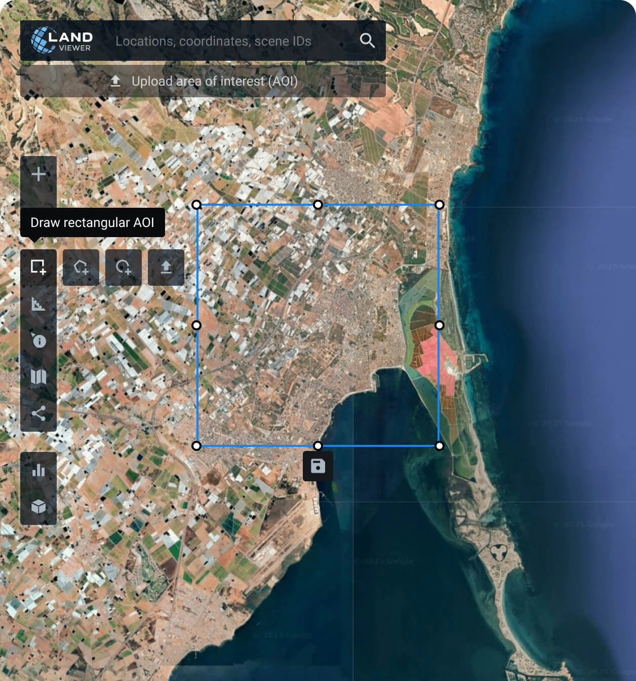
How to order SuperView NEO-3 imagery on LandViewer
Set your area of interest (AOI)
Establishing an AOI is simple and can be done in several ways: searching for a location, drawing a polygon on the map, or uploading a file with the parameters needed.
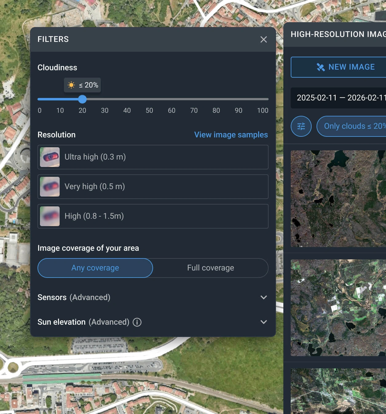
Apply the filters to reduce the number of satellite scenes
The filter can be used with one or more conditions, such as date, resolution, sensor, cloud coverage, and AOI coverage.
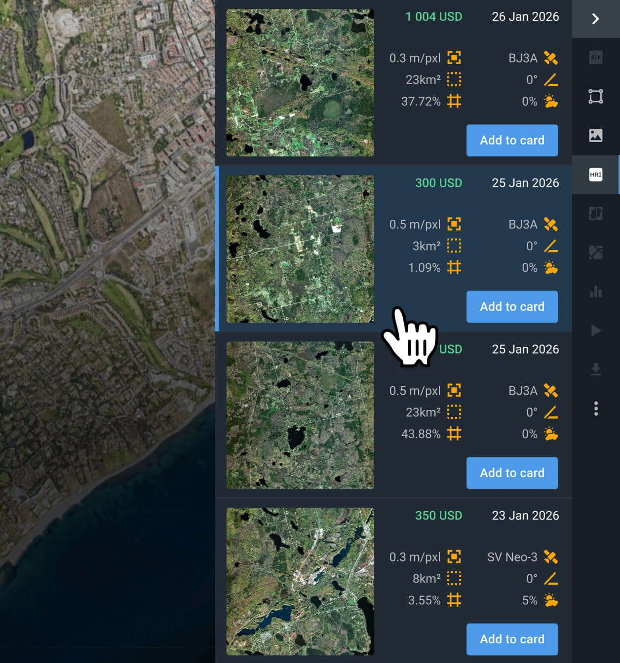
Choose the SuperView NEO-3 scenes that better fit your project
Examine the pricing details and other relevant information for the filtered results, and select the image(s) that best suit your use case.
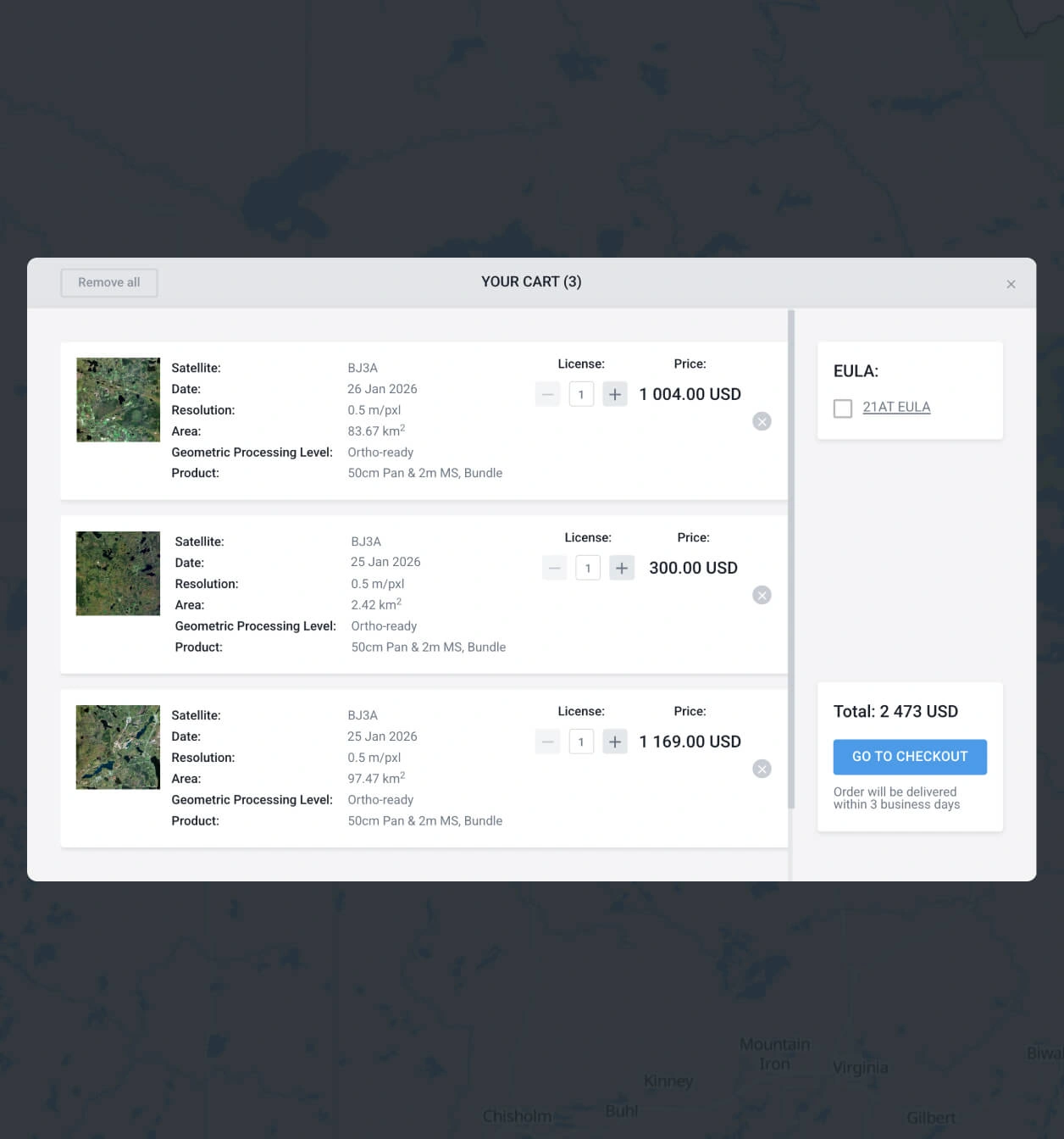
Add to the cart and make your order of SuperView NEO-3 images
Add satellite captures to the cart, then submit your order. You can purchase them yourself or reach our sales team to obtain your payment details.
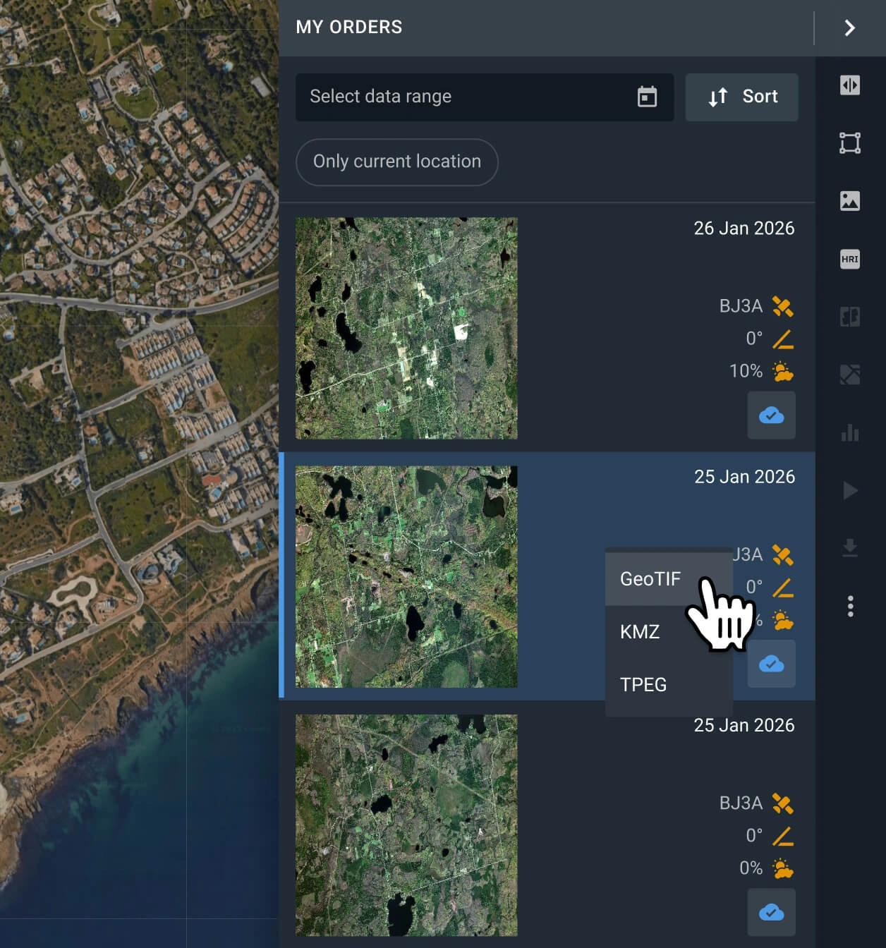
Start with your analysis or export the data
Your SuperView NEO-3 data will be available within 2 business days. Conduct analysis with the built-in options, or export the data in GeoTIFF, KMZ, or JPEG format.
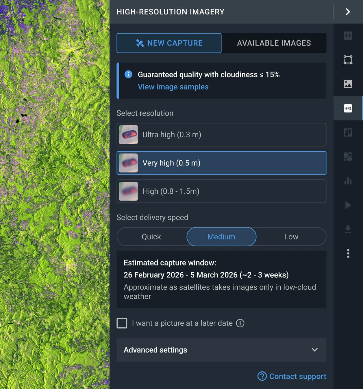
Request a new image with the tasking option
If the available images do not meet your requirements, you can use the Tasking option to request a fresh image from SuperView NEO-3 that does.
FAQ
How much does a SuperView NEO-3 scene cost?
Archived SuperView NEO-3 scenes cost from $14 per sq km, with a minimum area of 25 square kilometers. New pictures requested via the tasking option cost from $19 per sq km, with a minimum area of 100 square kilometers.
What are the most common use cases for SuperView NEO-3 imagery?
It is widely used for site suitability analysis, land resources surveys, infrastructure monitoring, fleet oversight, and urban growth assessment. Precision agriculture and forestry also benefit from the satellite's advanced spectral bands for vegetation health analysis.
How does the satellite tasking option work?
You have two options for requesting a new capture. One is to fill out the form on our website and wait for our sales team to reach out to you shortly after to assist you. The other one is logging in to the LandViewer platform, navigating to the High-resolution imagery section, and clicking the New Image option. There, you can select the resolution, delivery speed, and AOI for your tasking order.
What is the level of processing of SuperView NEO-3?
Every SuperView NEO-3 scene includes georeferenced data, which makes it easier to use in third-party software. like QGIS or ArcGIS. Should your project require advanced processing, such as orthorectification, please contact our support team; we can accommodate these requests in most instances.
Can I set a regular monitoring program for my AOI using SuperView NEO-3?
Yes, you can. Get in touch with our sales representatives or fill out the inquiry form on our website. Our specialists will contact you to discuss your specific needs.
What is the level of precision of SuperView NEO-3 data?
The very high resolution provided by the satellite allows for the identification of small objects, such as small trees and bushes, parked cars, road signs, and fencing.
What are my options if I require even higher resolution?
For maximum clarity, we recommend exploring datasets from the following satellites: Beijing-3N (BJ3N), SuperView NEO-1, and BlackSky Gen 3. These sensors currently offer the highest resolution available on our platform.
Is it possible to obtain a digital elevation map?
Yes, we accept custom orders for digital elevation maps generated with stereo images (captures of the same location taken from different angles). You can contact our sales representatives or fill out the form on the website to obtain more information.


