SuperView NEO-1 high-resolution images
Access the very-high resolution data and daily revisit of the SuperView NEO-1 satellite via the LandViewer platform.
-
Data type
Optical
-
Resolution
0.3 m
-
Revision
daily
-
Spectral bands
Panchromatic, Red, Green, Blue, NIR
-
Data archives
Archive since 2022
-
New Image Tasking
Available

How to get the most out of SuperView NEO-1 and spectral bands with LandViewer
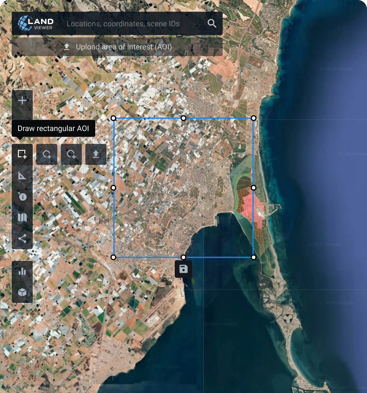
Set your AOI (area of interest)
Identify your area of interest by searching for a location on the map, drawing the region manually, or uploading a predefined AOI file from your device.
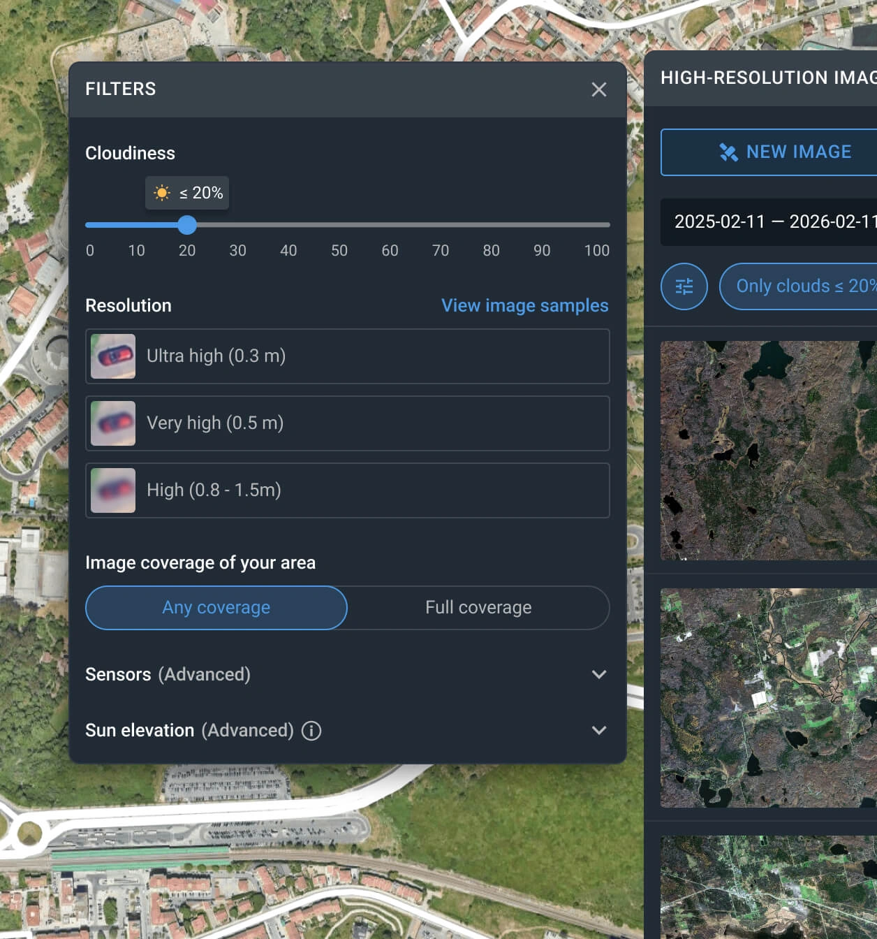
Apply filters to narrow down the search
Customize your search using filters like date range, resolution, sensor type, AOI coverage, and cloud level to quickly locate the most relevant SuperView NEO-1 data.
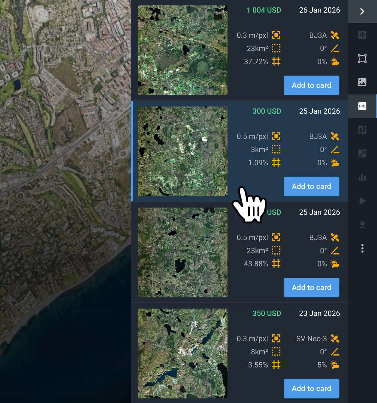
Choose the SuperView NEO-1 image(s) that better fit your project
Examine the pricing details and other relevant information for the filtered results, and select the scenes that work for your particular use case.
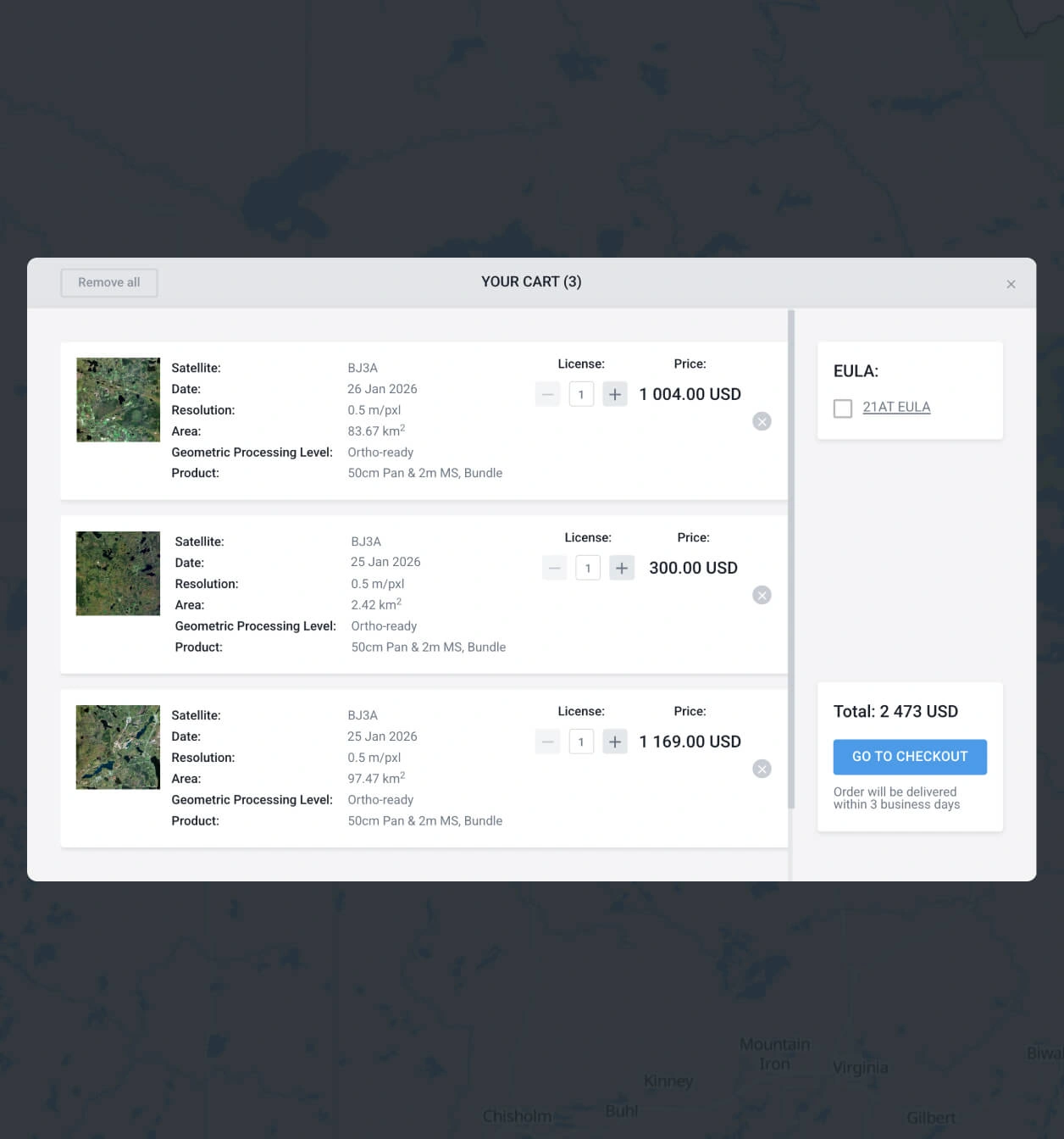
Add what you need to the cart and make your order
Add as many images of SuperView NEO-1 as you need, and submit your order. You can purchase them yourself or reach our sales team to obtain your payment details.
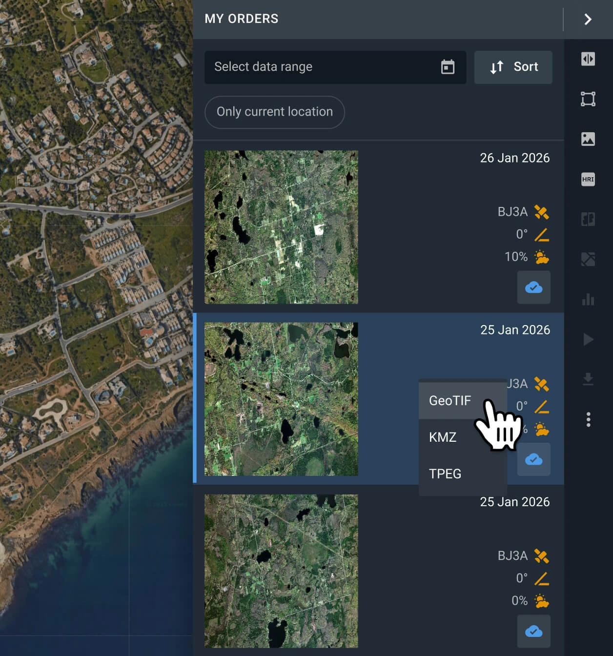
Start analyzing or exporting the data
Your order with SuperView NEO-1 data will be processed within 2 days. Analyze the data on the platform, or export it in multiple formats (GeoTIFF, KMZ, or JPEG).
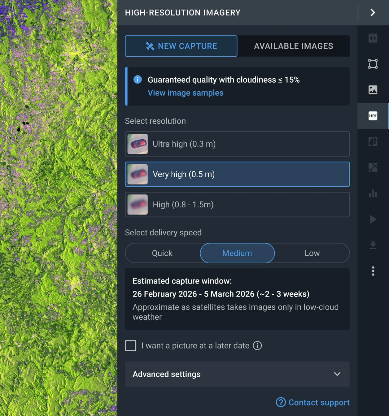
Request a new image with the tasking option
If the available scenes do not meet your requirements, you can use the Tasking option to request a fresh capture from SuperView NEO-1 that does.
FAQ
What is the cost of a SuperView NEO-1 image?
Archived SuperView NEO-1 captures start at $20 per sq km, with a minimum area of 25 square kilometers. New images requested via the tasking option cost from $25 per sq km, with a minimum area of 100 square kilometers.
What are the most common use cases for SuperView NEO-1 imagery?
SuperView NEO‑1 imagery is most commonly used for very‑detailed urban mapping, infrastructure monitoring, and construction progress. It is also widely applied in defense and security, critical infrastructure inspection, and precision change detection, where both fine spatial detail and daily revisit are crucial.
How does the SuperView NEO-1 tasking option work?
You have two options for requesting a fresh scene. One is to fill out the form on our website and wait for our sales team to reach out to you shortly after to assist you. The other one is logging in to the LandViewer platform, navigating to the High-resolution imagery section, and clicking the New Image option. There, you can select the resolution, delivery speed, and AOI for your tasking order.
What is the level of processing of SuperView NEO-1?
Every SuperView NEO-1 capture includes georeferenced data, which makes it easier to use in third-party software. If you need advanced processing (i.e., orthorectification), please contact our support team, as we can provide it in most cases.
Does SuperView NEO-1 support a scheduled regular monitoring of my AOI?
Yes, regular, long-term monitoring is possible once it's set up. To do it, please contact our sales department or fill out the contact form on our website, and our specialists will contact you.
Is it possible to get a clear capture without clouds?
Yes. LandViewer has a cloud coverage filter that enables the user to set an acceptable threshold. Every image exceeding the threshold will be hidden, leaving only the results that match the user-selected criteria. Please note that the more restrictive the threshold, the fewer images will appear.
Is it possible to receive additional analysis alongside the raw SuperView NEO-1 data?
Yes. For all purchased data, you will receive integrated analytics, including NDVI and NDWI indices. Furthermore, our dedicated R&D department is available to collaborate on bespoke projects and engineer advanced analytical solutions tailored to your specific requirements.
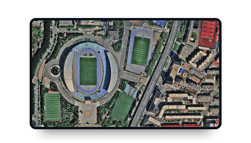
What level of clarity can I anticipate from these images?
Utilizing the resolution provided by SuperView NEO-1, you can achieve very high-precision identification. This data allows you to clearly distinguish individual shrubs, small trees, parked vehicles, road markings, and boundary fencing.


