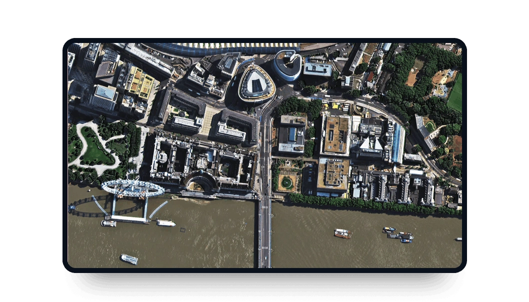
Superview-2 high-resolution images
Gain access to exceptional 0.4m-resolution optical data from the SuperView-2 multispectral satellite directly on the LandViewer platform:
-
Data type
Optical
-
Resolution
0.4 m
-
Revision
2 days
-
Spectral bands
Panchromatic, Red, Green, Blue, NIR1, NIR2, Red-Edge
-
Data archives
Archive since 2016
-
New Image Tasking
Available

How to get SuperView-2 satellite images on LandViewer
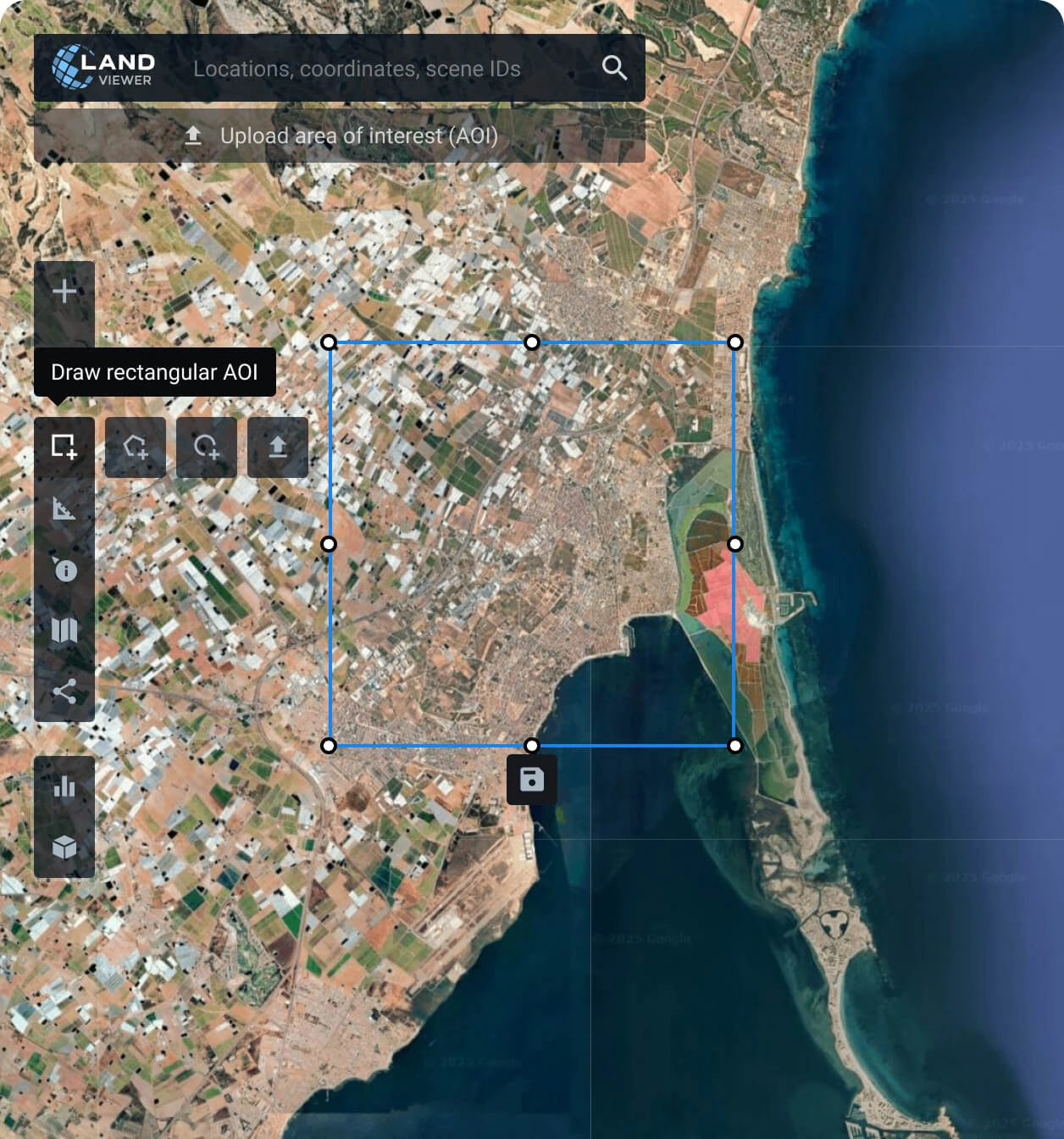
Set your area of interest (AOI)
Input location coordinates, sketch a custom area, or upload boundary files to pinpoint the exact zone for your SuperView-2 data.
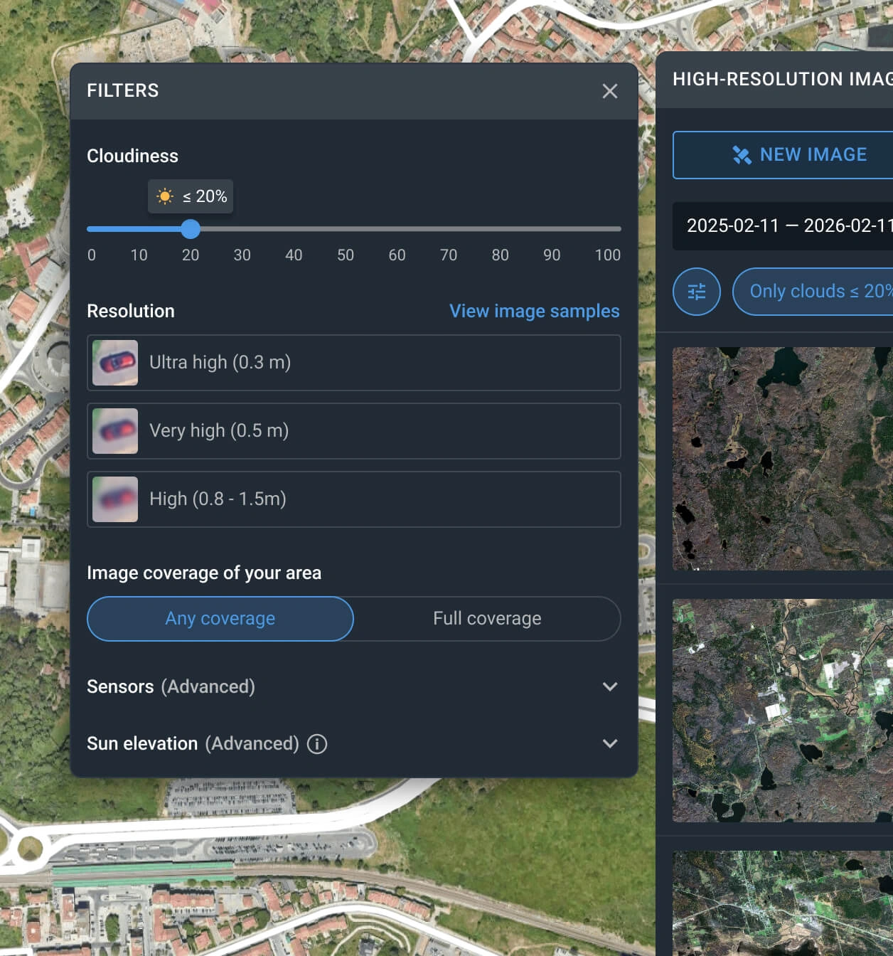
Apply specific search filters
Narrow down the catalog by adjusting parameters for the SuperView-2 resolution, desired date range, sensor, and maximum cloud cover.
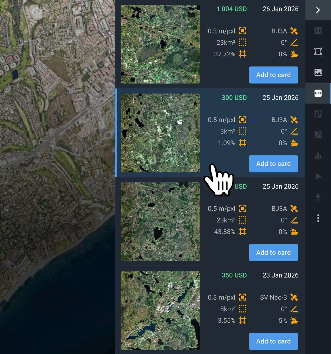
Select the ideal satellite scene
Review the filtered results, compare pricing and technical specs, and choose the SuperView-2 capture that best fits your project.
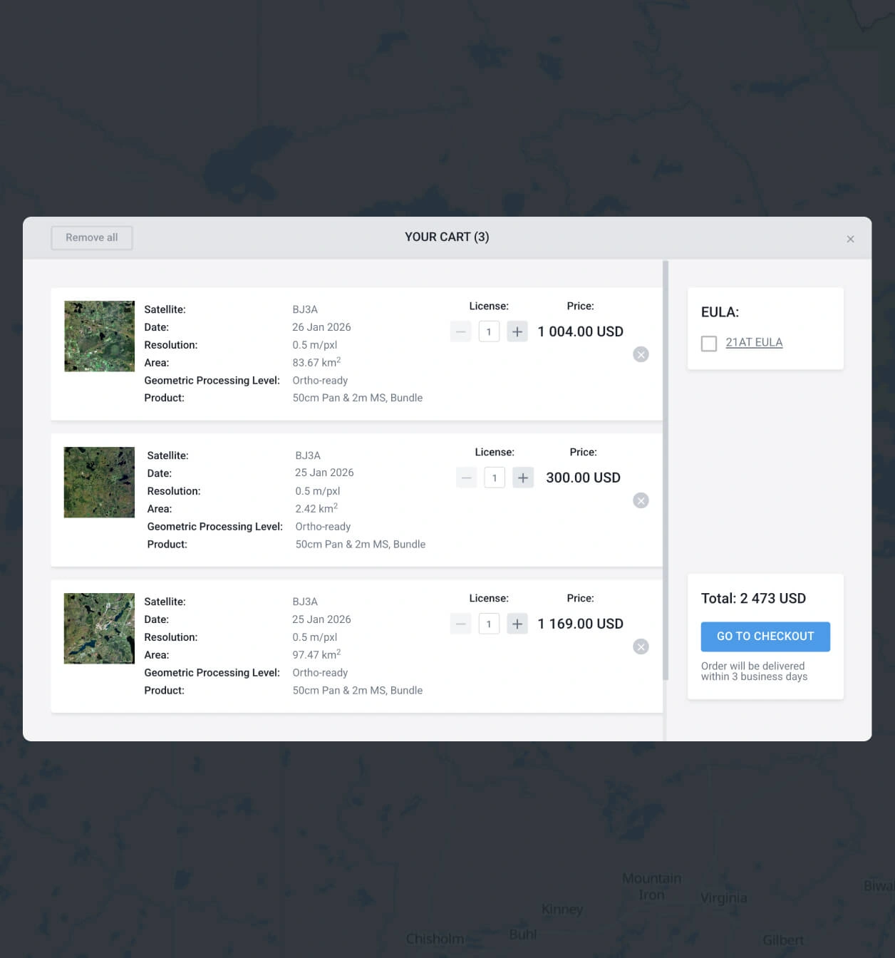
Proceed to cart and finalize purchase
Place the chosen SuperView-2 scene into your cart for immediate checkout, or reach out to our sales experts to process your order.
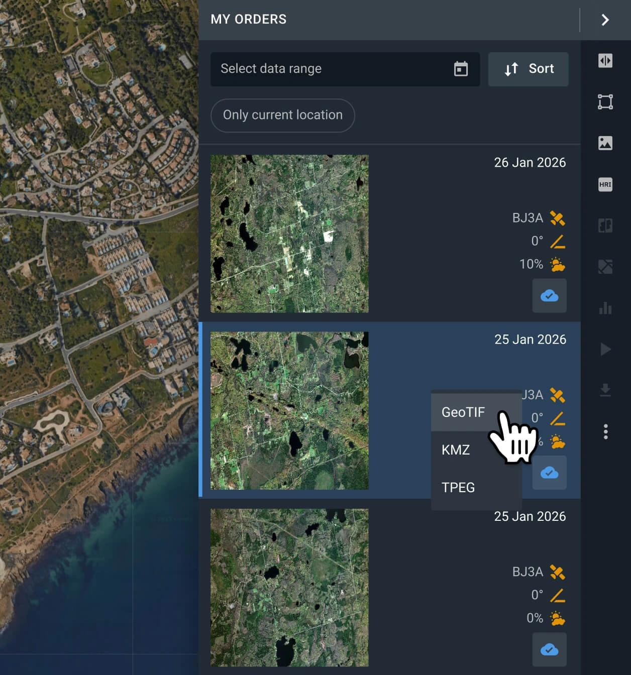
Download data or analyze it in-platform
Receive your SuperView-2 imagery within 48 hours. Export in standard GIS formats (GeoTIFF, KMZ, JPEG) for QGIS or ArcGIS, or perform analysis on LandViewer.
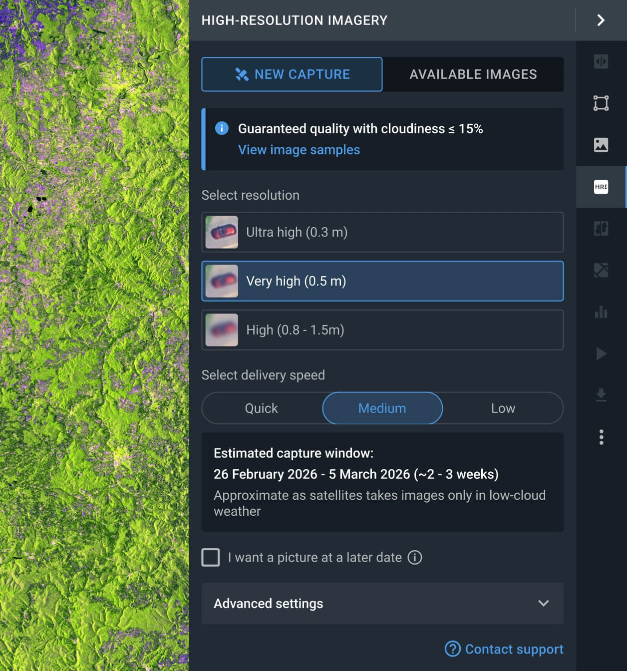
Task a satellite for a new capture
Can't find the right archive image? Order custom tasking to request a new SuperView-2 snapshot that will suit your needs.
FAQ
What is the pricing for SuperView-2 data?
Purchasing existing captures from the SuperView-2 library costs from $18.00 per sq km (starting at a 25 sq km minimum). If you need a brand-new satellite pass (tasking), the rate starts at $20.00 per sq km (with a 100 sq km minimum threshold).
What are the most common use cases for SuperView-2 images?
Their common uses, stemming from high resolution and frequent revisits, include logistics hub planning, construction progress monitoring, resource management, precision agriculture, illegal logging detection, and ecosystem health tracking.
How do I command a new SuperView-2 capture for my region?
Leave your details in our contact form for personalized help from our sales experts. Prefer to do it yourself? Log into LandViewer, open the High-resolution tool, click the "New Image" tab, choose your urgency and resolution, and finalize your AOI order.
What data processing standards are included?
Every file is delivered georeferenced, making it instantly compatible with GIS platforms like QGIS or ArcGIS. If your project needs higher-tier geometric corrections like orthorectification, reach out to our support team and we will handle these upgrades.
Is continuous or prolonged AOI tracking available?
Definitely. Routine observation is fully supported. Reach out to our sales team or drop your details into the on-page form, and our specialists will help you set up a custom monitoring timeline.
Are there extra analytical tools beyond the standard imagery?
Yes. Every purchased scene comes with complimentary indices, including NDWI, NDVI, and Color Infrared. Furthermore, our dedicated R&D department is ready to collaborate with you to build advanced, highly customized spatial solutions tailored to your specific operational needs.
What exact ground features will a 0.4m resolution reveal?
The exceptional 0.4m clarity allows you to spot compact cars, individual shipping crates, precise roof outlines, and doorways. This delivers an upgrade in visual sharpness compared to earlier 0.5m systems.


